
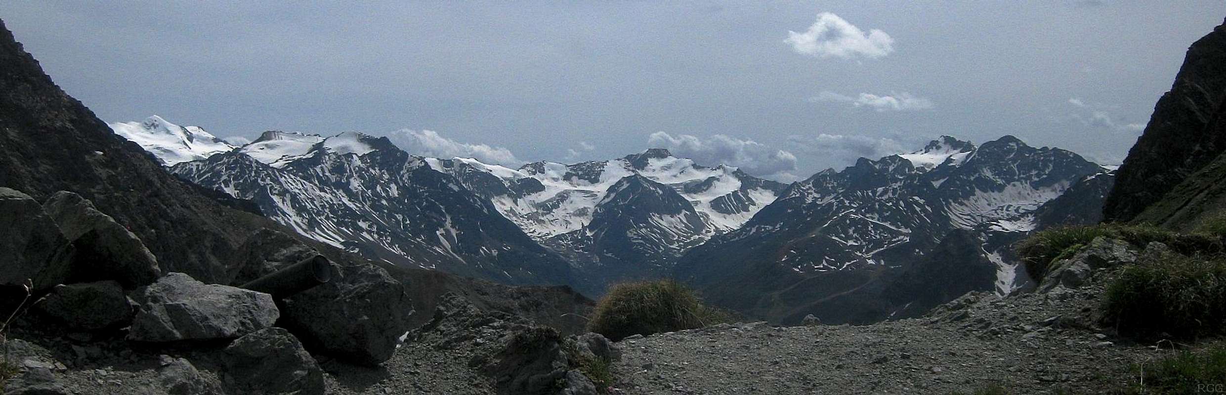
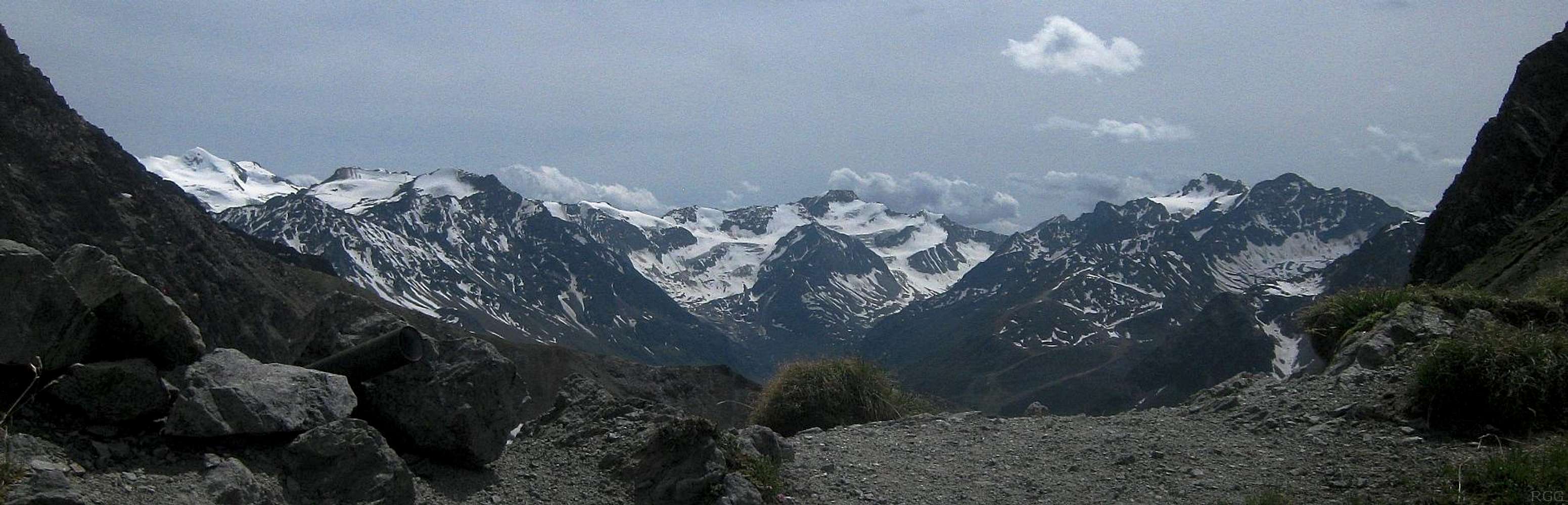
Zooming in on the glaciers of the southern Ötztal
The southwestern part, to be precise. The whole southern area is vast, and the only way to capture that in one photo would be from high up in the sky - or from the satellite view.
This photo is taken from the Kapuzinerjoch.
The bright white mountain on the far left, just over 14 km to the south, is the Wildspitze (3768m), the highest one in the Ötztal and second highest in Austria. It's heavily glaciated, and the north face is a popular route.
In the center, at a distance of just over 16 km, is the Hochvernagtspitze (3535m).
And finally, on the right, are Bliggspitze (3453m) and Eiskastenspitze (3371m), just over 13 and 12 km to the southwest, respectively.
At a distance of 11 km, the broad one between Wildspitze and Hochvernagtspizte is the Brunnenkogel. It's at the edge of a developed ski area and there is a (new) cable car to the summit on the left, the Hinter Brunnenkogel (3438m). The one on the right is the Vorder Brunnenkogel (3396m).
The development of the ski area has been the subject of heated discussion for years. On the one side there are the commercial interests and winter tourists that want to be assured of snow, which means the development of high areas. On the other hand are environmentalists and summer tourists, that prefer to keep the area pristine. There is no easy answer, but I hope that the long time plans to build a cable car to the Wildspitze never come true.
28 June 2012.


