Day five and the big walk
After finishing off the Knob (San Rafael Knob),
Andy and I drove back to the town of
Green River (I-70) and grabbed some dinner (Subway) and gas for our last mountain which we were to do the next day. We met
Kadee at the pre-determined location where we all camped for the evening. Kadee had some knowledge of what we were going to be dealing with the next day and she shared that with us
so we were aware of what we were looking forward too. She also amazed me with her Verizon phone's ability to get a signal at where we camped, that was impressive in and of itself.
Early the next morning, we all piled into my truck and drove the last mile or so from the spot where we camped to where the road was blocked. We left the truck and walked around the obstruction and headed for our first objective,
the Price river. Initially the first mile or two was pretty much a downhill trek that eventually took us to the river and we made the crossing, with the Price river running cold and higher than I thought it'd be. Fortunately I'd brought some river sandals to aid in the crossing and that helped a lot on the rocky bottom. All of us made it across with no problems but we also realized that the river would be running a bit higher when we hit it again later in the day.
The road picked up on the other side and with Kadee leading the way, we starting plodding back uphill, regaining all the elevation we had lost on our descent to the river.
![The trailhead....]() Trailhead Trailhead | ![Hiking the road]() From TH to River From TH to River | ![Price River canyon]() In the canyon In the canyon |
A long road
![Just about across]() Fording the river
Fording the riverThe road we were following was in great condition and as we hiked along it, we were trying to figure out why it was even there. Our speculation was that it might have led to a mine at one time. Still, that road is the one breach in the otherwise protective ramparts that make Mt. Elliot a tough place to get to. After leaving the river, the road works its way back to the top of the river canyon before flattening out for a bit and then dropped back down, creating elevation loss that we would have to regain. We could see the road working its way up the landscape in the distance and knew that we'd be regaining the elevation we were going to lose both ways. Overall, I came to realize that with the ups and downs of the hike, we'd probably be somewhere around an elevation gain close to 4000 feet on this hike, even though the actual difference between trailhead and summit is in the neighborhood of 2600 feet. Mostly, this old road is in pretty decent shape and although there were a few sections where the road had seen better days due to rockfall and landslides (which would've stopped most vehicles)it was obvious that this road had been abandoned and was no longer of any value except to hikers like ourselves. I thought a lot of it would be great for mountain biking and might consider a mountain bike if I were to ever do this one again.
Kadee had been to within a mile and a half of the summit on a previous visit but she had been smart enough to call it quits when she knew that the extra three miles she would have to hike just wasn't in her that day. Still, she had put in 18 miles which is a big effort and was now back to get this blemish off of her hiking record. It was fun to hike along with her and have her point out things that she had noticed previously or point out rocks and spots where she and Greg had stopped to rest or grab a snack. Andy of course is a hiking machine and his long stride makes covering ground almost seem effortless on his part.
![The canyon]() Price River canyon
Price River canyon
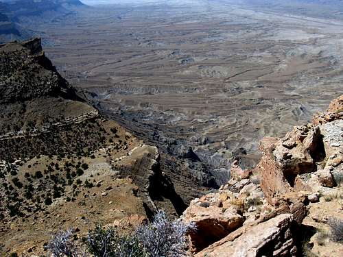
The miles melted away as we generally spent most of the time chatting or observing the country we were hiking through. I wish my pictures or even my comments here could convey the feel of this area, it is big, expansive and
isolated. If the road hadn't of been there, I would've felt that I was on the far side of the moon at times. Occasionally we'd see an old can or water bottle tossed by some thoughtless individual who had passed through this area in times past but for the most part, we didn't see much of anything else that smacked of man's civilization.
Fortunately the day we had chosen to hike this one wasn't a real hot one. There is no water after leaving the river and you WANT to have plenty of water with you. I would not want to do this one again on a hot day. No thanks. This area can get brutally hot in the summertime so either spring or fall is what I think would be the best time to hike it. However, we were to find out later that the week before our visit, the Price river had been running a foot and a half higher. That would've been a stopper for me so timing is important.
![Some of the road]() Looking at the road ahead Looking at the road ahead | ![Mount Elliot appears]() Mt. Elliot view Mt. Elliot view | ![Andy hits the saddle]() Final slope to Mt. Elliot Final slope to Mt. Elliot |
We see it - the summit
![Hey....]() Saddle view Saddle view | ![Summit route]() The route The route | ![The notch]() to the notch to the notch |
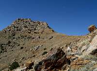
I'd say we really didn't see Mount Elliot until we were about three miles away from it. At first it appeared to be a fang like projection but as we got closer, it began to look even more interesting and even somewhat formidable.
At the 9 mile mark, the point where Kadee had turned around on her previous visit, it was actually somewhat nasty looking. I was beginning to wonder if it had some class 4 stuff that we'd have to deal with but those fears began to dissolve as we continued to get closer. Soon we could see the line that we would take to reach the summit notch. Finally we reached a point where the road dropped down as it went around the east side of Mount Elliot and we dropped down the road as well until we had lost a couple hundred feet of elevation after which we left the road and headed up cross country toward a saddle on the north side.
![The last bit to the summit]() To the notch To the notch | ![The last scramble bit]() Scramble bit to top Scramble bit to top | ![Summit shot]() summit posing summit posing |
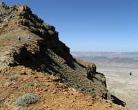
Kadee and I chose a different line up to the saddle than Andy but as it turned out, his line was the better of the two and he reached the saddle before we did and after gawking at the west side views we had from the saddle, we started towards the last 500 feet that led to the summit. With Andy in the lead, we worked our way over to the notch on the southern part of the mountain as that was the key to reaching the summit area. Andy as usual, picked a good route and Kadee and I just followed his lead. There were a couple interesting places but nothing difficult or technical. The last twenty feet to the notch was easy class 3 and once you hit the top of the notch, you had an easy walk over to the summit.
What was interesting was that the summit area was pretty much a small flat plateau like area. A bouldery area served as the highest point but as you can see in the pictures posted of it, it was nothing special.
We looked for a benchmark and a register but found neither one so Andy created a register for those who might be hitting the summit at some future time. After a leisurely lunch and picture taking, it was time to head back down and retrace our steps. We knew we had 10.5 miles left in the day and
some great sandwiches waiting at the vehicles. Kadee makes a great sandwich, with avocados and tomatoes and that was the lure that made the miles melt away on our return hike.
![On top of the goal]() Top area Top area | ![Humble register page]() Register page Register page | ![The view south]() Looking south Looking south |
![Looking down]() Looking down
Looking down
![The view east]() Looking east Looking east | ![The Price River]() Price River Price River | ![Desolate country]() Desolate country Desolate country |
The river crossing went fine although it was a bit higher and seemed stronger than when we had gone across in the morning. There must still be a fair amount of snow melting somewhere in the headwaters of the Price River.
We hadn't seen any animal life at all during the first 19 miles of the hike and that was resolved when we came across several rocky mountain sheep who seemed as curious about us as we were about them. Beautiful and wonderful animals, they were the frosting on the cake of what had been a wonderful
and fitting conclusion to five days in southern Utah for me. Even after 21 miles, I felt great and appreciated the companionship of Andy and Kadee
on our visit to Mount Elliot.
Andy went on to do Mt. Pennell in the Henry Mountains and by doing so he completed the five major prominence peaks that that range offers. He went home to Tucson AZ with a smile on his face.
Five days of wonderfulness
That's what hiking is to me: wonderfulness (probably not a word)
In the five days I was able to finish off the peaks with two thousand feet of prominence in the Henry mountain range, re-visit another one (Lands End) and pick up Mount Elliot. Also included was the San Rafael Knob, a peak with close to 2000 feet of prominence so all in all, it was a great week. Finishing it off with a 21 miler made it just about perfect. I had a great companion in Andy Martin and then Kadee joined us for the big hike so it was indeed, a week full of wonderfulness.
FIVE DAYS OF HIKING
Day one -
Mt. Hillers
Day two -
Mt. Holmes
Day three -
Mt. Ellsworth as well as
Land's End
Day four -
San Rafael Knob
Day five -Mt. Elliot
Extra section for my Rocky Mtn sheep pics
![Where s Waldo?]() Where's Waldo? Where's Waldo? | ![Can you see him?]() Can you see him? Can you see him? | ![New friends]() Three posers Three posers |
![Bighorn Sheep]() Checking us out
Checking us outThoughts about this hike
Should I ever think about doing a repeat of this one, I'd give serious consideration to using a mountain bike. Also, the timing of that hike would
take into consideration of the volume of water flowing down the Price River as
I wouldn't want to ford it if it was higher than my thighs. Autumn might be
a great time to do it as the river would be lower and it'd be easier to carry a mountain bike across.
Greg went back for a second time but he used the distance to test his running skills. As I understand it, he ran most of the way and even though he is a really fast hiker, he must be even that much faster now since he has taken up running.
![Mount Elliot]() Nearing sunset shot
Nearing sunset shotFlower of the day
This was about the only type of flowering plant that we saw on this hike.
Anyone know the name?
![Lonely flower]() Color in the desert
Color in the desert


Comments
Post a Comment