Elliott Highlights - May 19th, 2013
And yet another trip report with a grouping of peaks which have little in common with each except a proximity in time and space as they pertain to when I visited, and posted here at this point only through the same OCD behavior that drives me towards chasing these peaks in the first place. Though I usually do these in chronological order (cue the OCD) I figure I midas whale display the highlight of the group first, even though it was the last peak done timewise, lest the unfortunate reader’s eyes glaze over in boredom before they get to this gem.
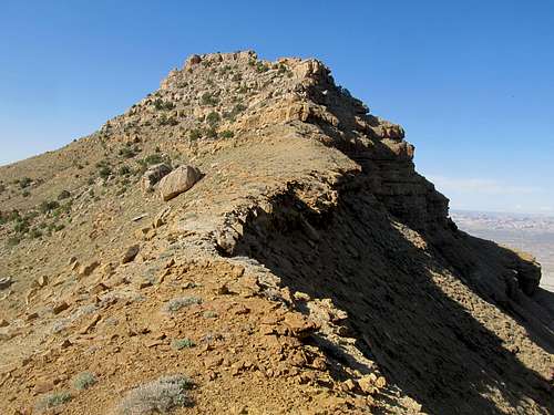
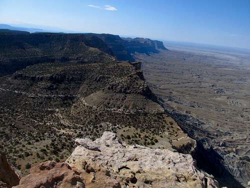
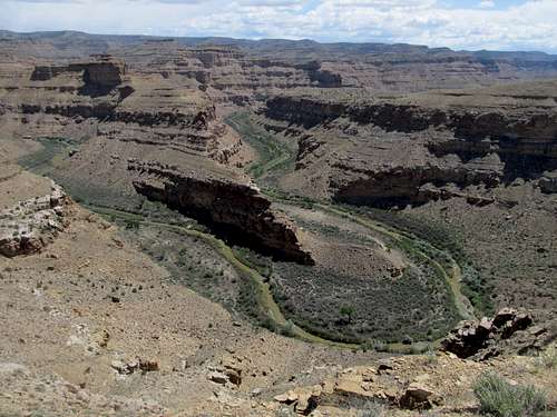
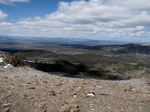
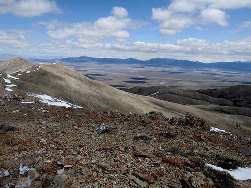
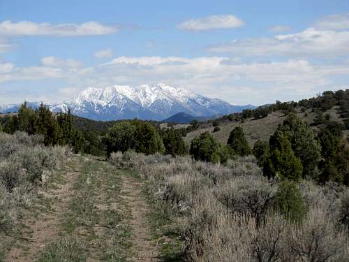
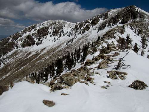
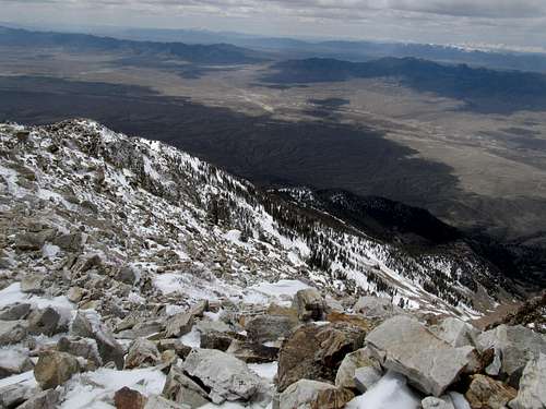
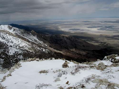
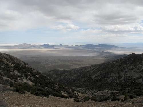
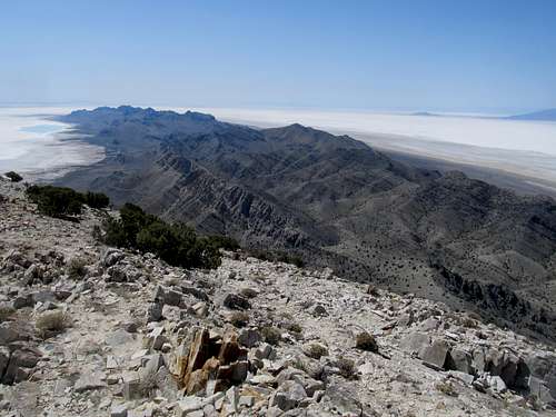
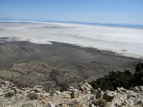
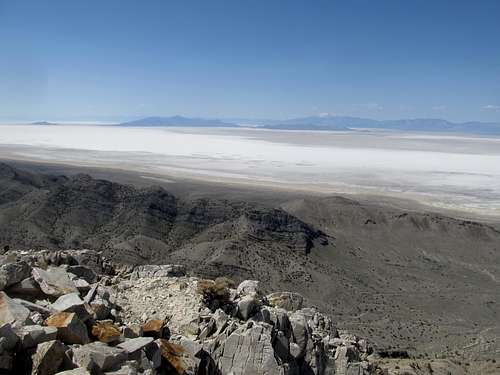
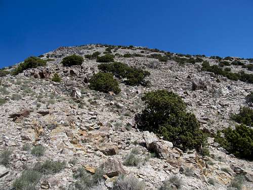
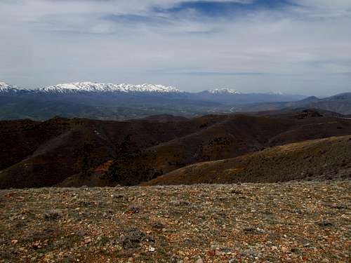
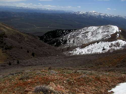
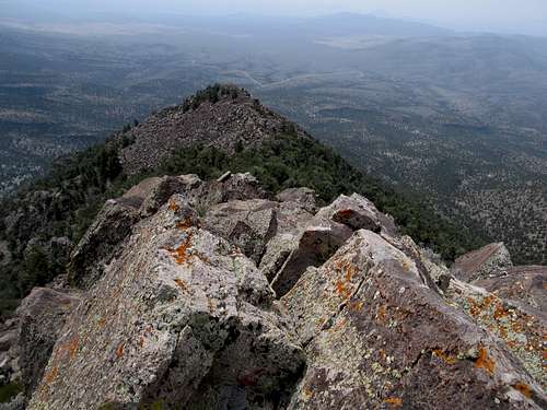
And if any mountain in Utah merits special consideration, Mt. Elliott ought to be in the running. As one can tell from Greg’s excellent page for it on SP, the spectacular and sheer knife edge cliff feels its western aspect viewed by hundreds of thousands driving along US-6, travelers oftentimes bound to and from Moab, I-70, and points further. Indeed, this western sentinel of the Roan/Book Cliffs, stretching well into Colorado, are graced with just the momentary concentration of intrigue from the casual driver before their attention diverts onto the next vista down the road. Some, such as myself, have seen these cliffs years before and wondered at the vast wilderness complex contained within, but even then I glossed past them on the way to national parks or even the San Rafael Swell further ahead.
It is only the (crazed) attention from the prominence peak addicts that have differentiate this spot cliff from the rest of its Roan Cliff brethren, a high point along this vast ridgeline that rests just a little higher than the rest, and gifted by the geography of the Price Rivers and the Green Rivers to separate it from the higher summits of the Roan/Book Cliffs and delineate it as a P2K and thus, a homing beacon for those deranged prominence peakers such as myself. And it was on a glorious mid-May Sunday when I decided to throw caution, and a ten mile one way approach, to the wind, and try and bang this peak out before the Bruins played the Rangers in the Divisional Round of the NHL playoffs later that afternoon.
Because of the mid-afternoon puck drop I did my best to get up as early as possible and try to hit the peak at the crack of dawn. I was a little late, but not by much, though I did have a few costly minutes from trying to find the right trailhead; the correct road for the final mile branches left, very roughly, up the side of the cliff while the right branch seems like a better road at first, but quickly disappears well before it reaches the Price River. I wasn’t sure if the rougher alternative was the correct one, but after circling around a few times, realized I had no other option, and thus followed it as it went through a few sheer areas until I reached a small plateau overlooking the river down below. I could see what looked like a boulder a little further ahead, so I assumed this was the trailhead, and parked accordingly. In hindsight I was probably very close to the TH described in the SP page, though not necessarily exact, mainly because the boulders mentioned that block the road have been removed (and it looks like the BLM even graded some parts of the road), so technically you could drive a truck to within a mile of Elliott’s summit. I would highly recommend against it though, for two reasons: first, you miss out on the incredible journey and workout and secondly, the first mile past where I parked, though unhindered by boulders, have two extremely narrow and steep spots where the road angles down into the canyon, and one slip of the wheel means a tumble in your jeep of a few hundred feet. Just walk it bro.
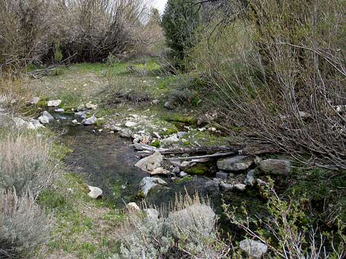
I hustled the first few easy miles to the river crossing, which made for a cold affair in the early morning shade, but uncomfortable rocks on bare feet aside the crossing wasn’t too much of a challenge; more pressing was wasting time to don the boots off and back on and waiting for the feet to dry, all while the puck drop countdown clock tik tok’d the seconds away. The steepest ascent of the route starts right after the river, as you follow the road switching back up and around almost impossible as it weaves a path through the steep canyon walls to a vantage point that allows you to gaze down at the narrow Price River canyon you were walking in just minutes before.
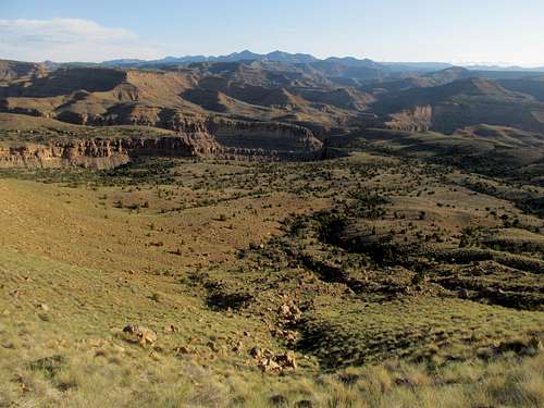
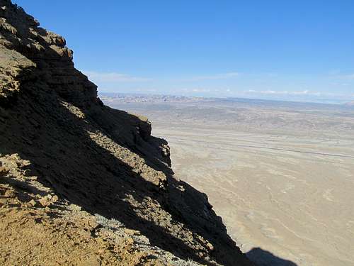
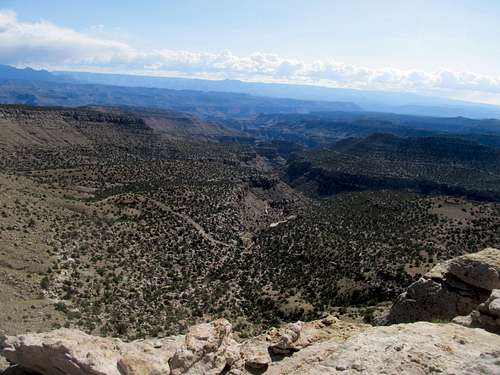
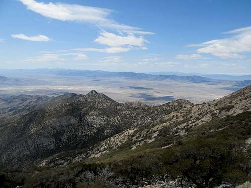
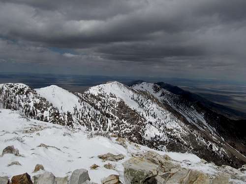
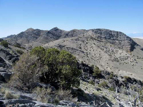
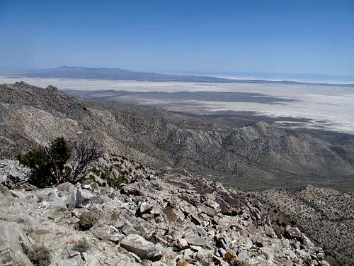
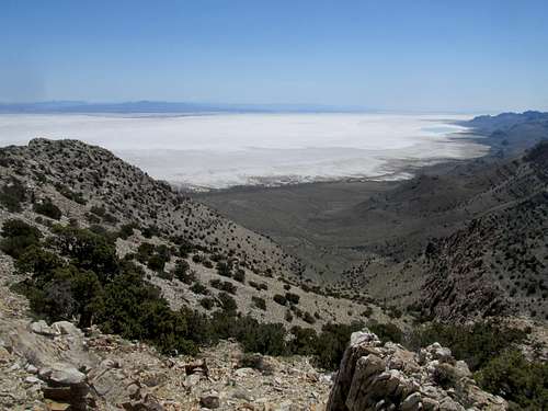
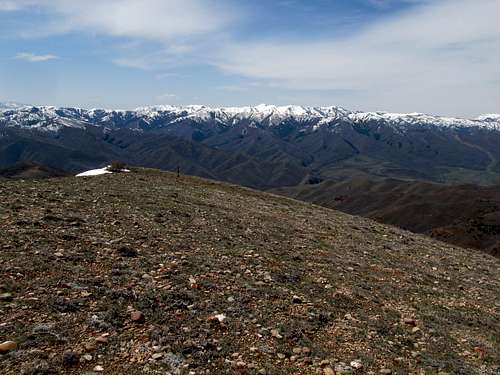
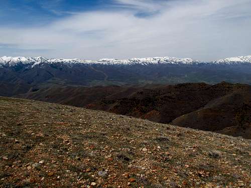
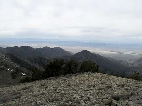
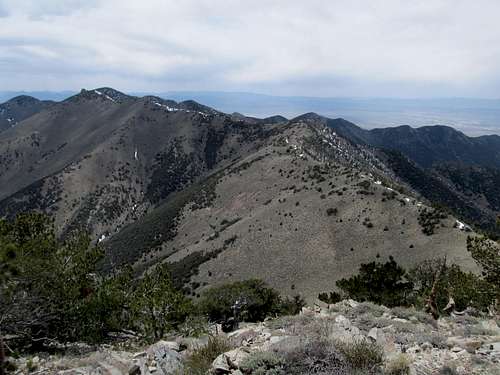
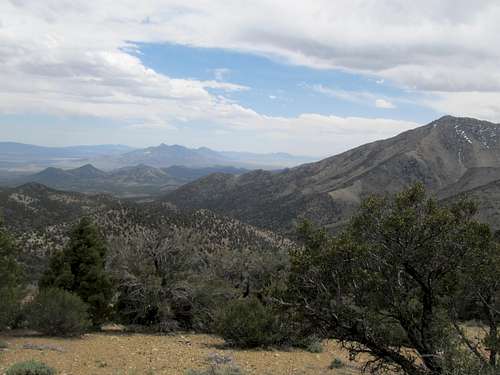
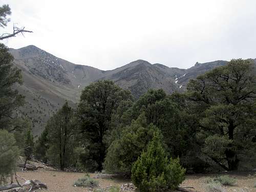
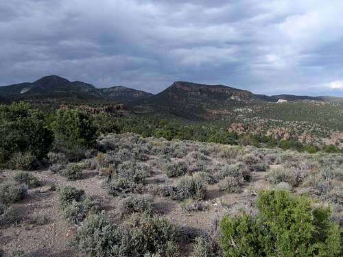
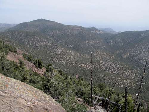
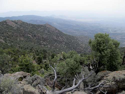
The sun glazed down on the next section that followed, a gentle ascent up a broad slope to gain the upper reaches of the Beckwith Plateau; this section was perhaps the most aesthetic of the ascent too, as you see both Price Canyon below, the high cliffs rising up to over 10,000 ft at Bruin Point to the north, and to the east the high reaches of the Tavaputs Plateau across the Green River.
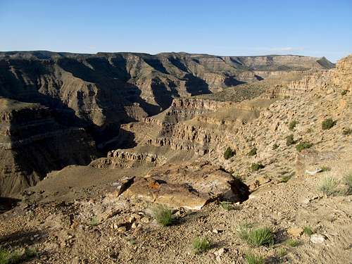
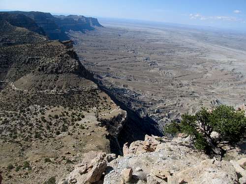
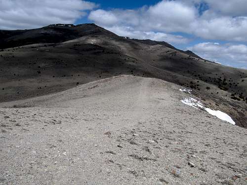
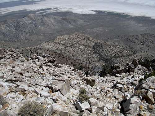
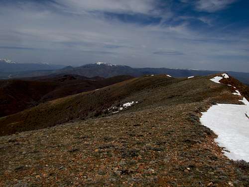
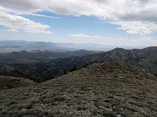
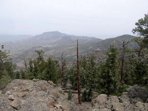
Things dulled down a little upon reaching the plateau crest. While Elliot loomed as a small knob still many miles away, after the first spectacular five or so miles the road winds somewhat dully through the flat landscape, but the monotony is broken upon passing by a spectacular viewpoint down into Long Canyon.
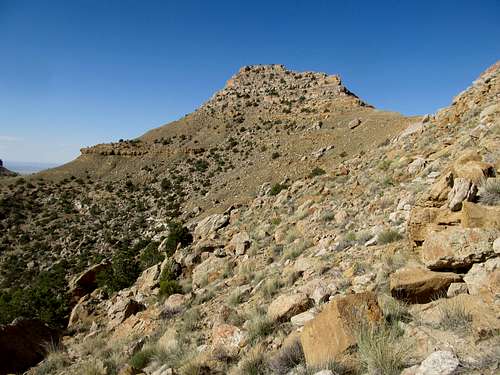
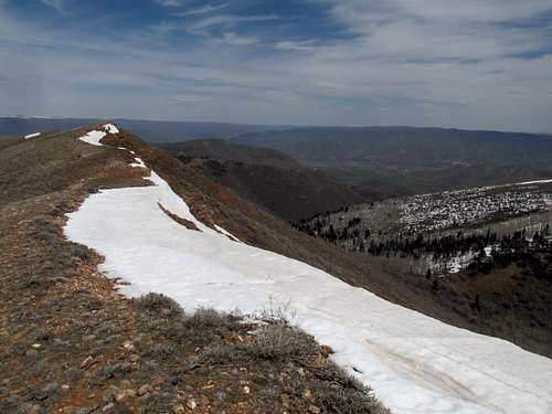
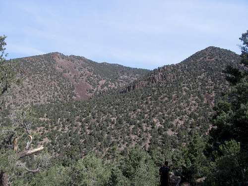
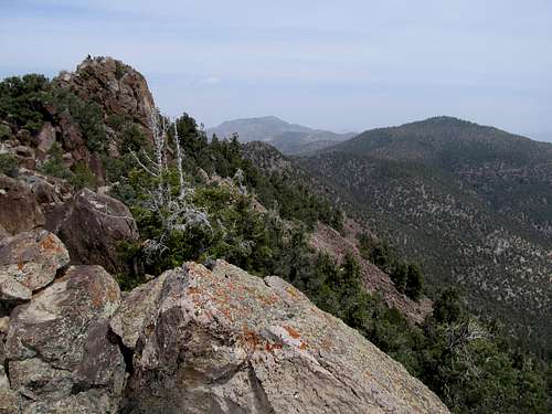
After that I found myself in the homestretch, as the road wound through a few quick ups then a significant downclimb from a saddle with Elliott now immediately ahead. Here you can pick and choose your departure point from the road as you see fit, whether all the way down at the base of Elliott or leaving a little before to sidehill a little to reach the saddle between Elliott and the summit to its north. I opted for the latter and it wasn’t too bad, but made for slower progress, and I wondered if just simply following the road a bit more might have caused me to miss less of the upcoming Bruins game.
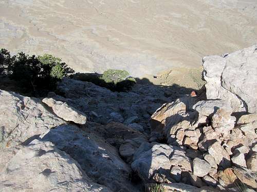
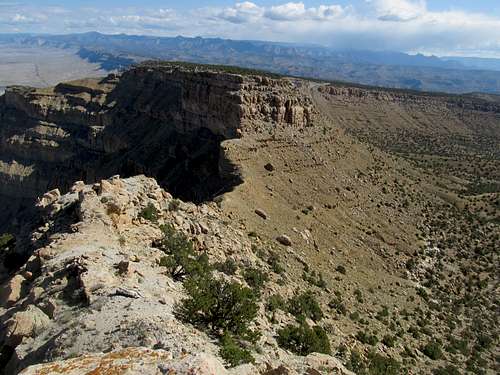
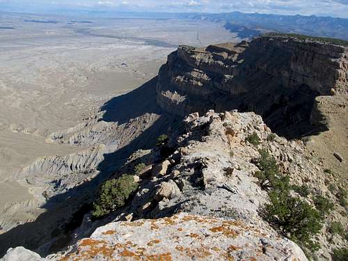
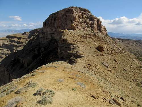
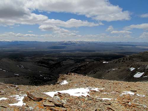
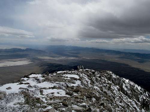
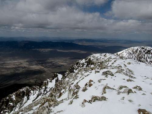
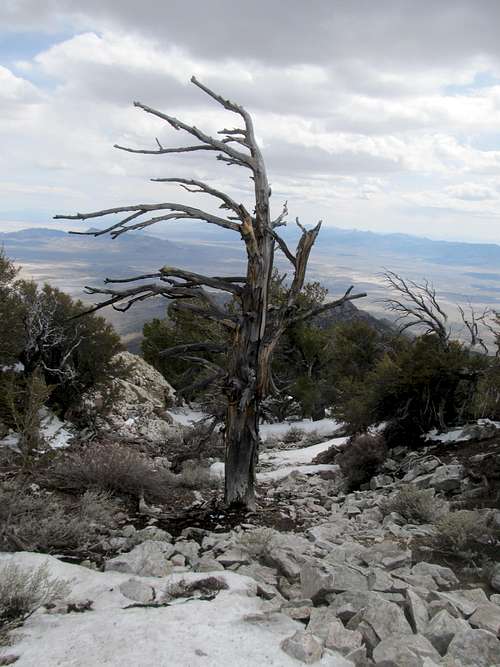
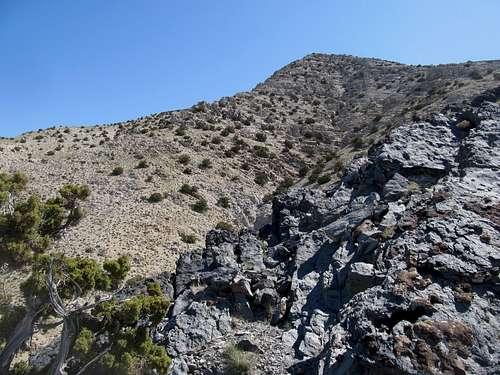
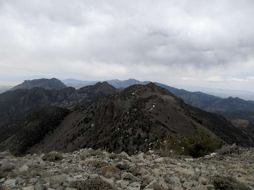
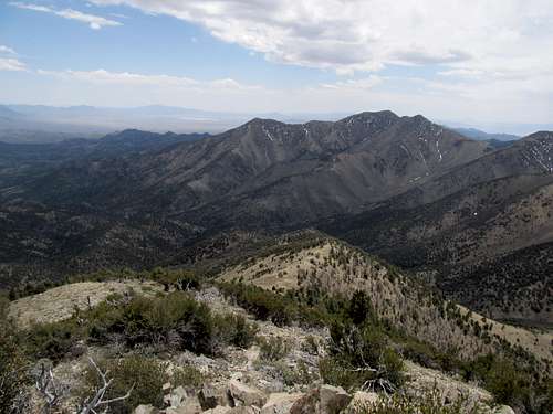
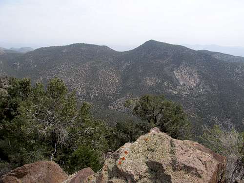
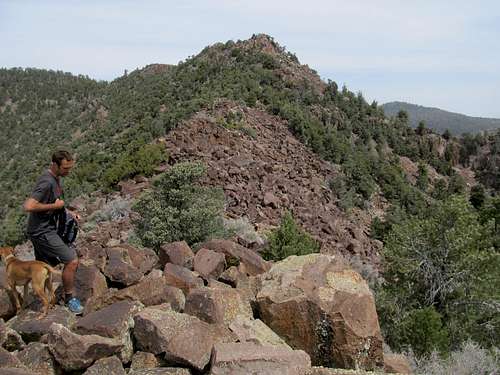
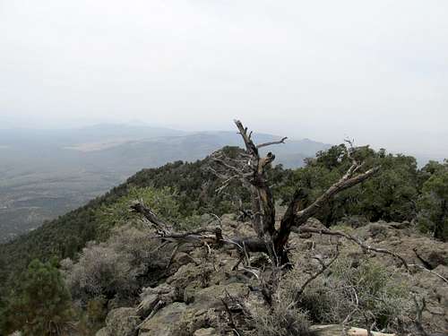
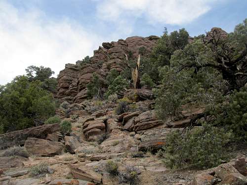
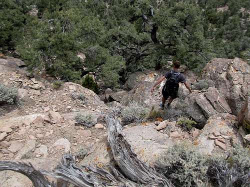
Reaching the saddle was breathtaking, as after over ten miles on foot and another five or so by car from leaving the highway, you’re suddenly gazing down at it again for the first time over a sheer cliff. The rest of the route is a fun scramble, as you first follow a narrow ridge crest before hitting the eastern face of the peak and picking your way through a few cliff bands, and a few brushy areas if you’re not careful, to gain the crux crack notch just below the summit. I opted to stay low and contour as left as possible before trying to hit the notch from directly below it, climbing through some pretty steep and loose terrain and a few rocky sections. On my way back down I cutting more of a diagonal straightshot back to the saddle, and thought it made for better progress.
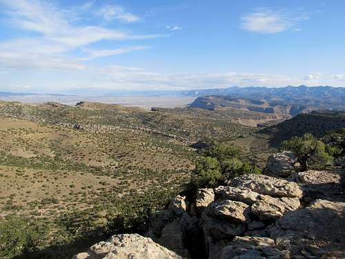
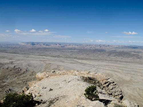
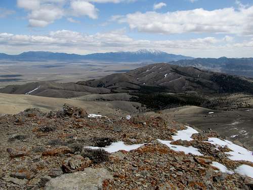
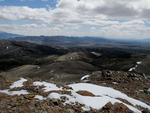
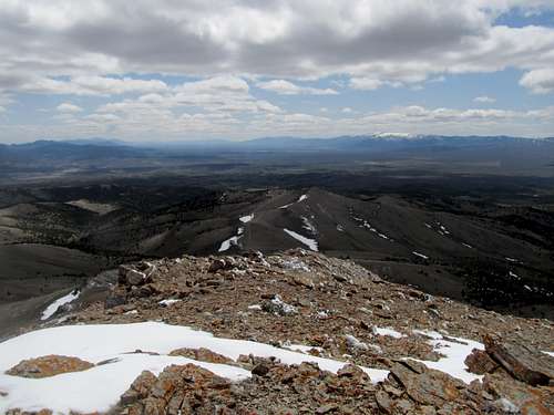
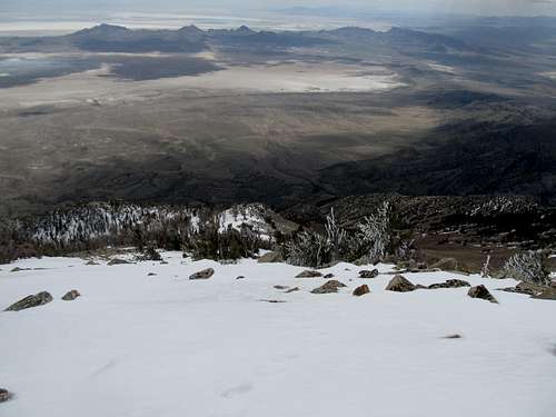
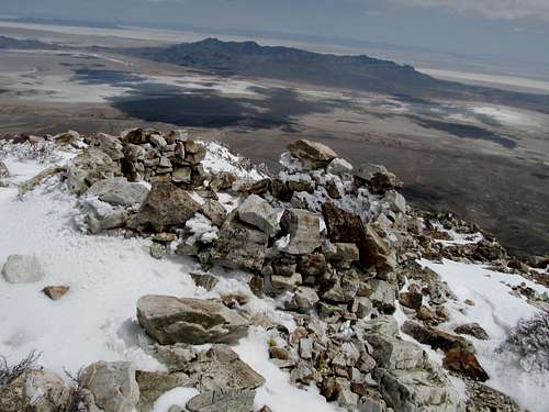
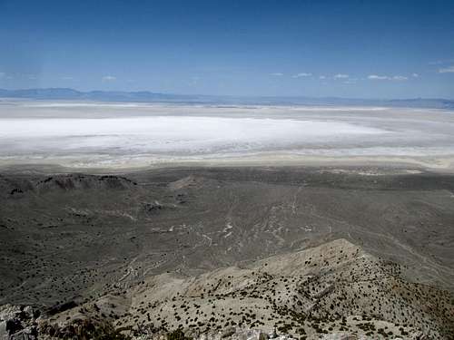
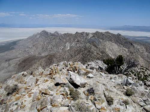
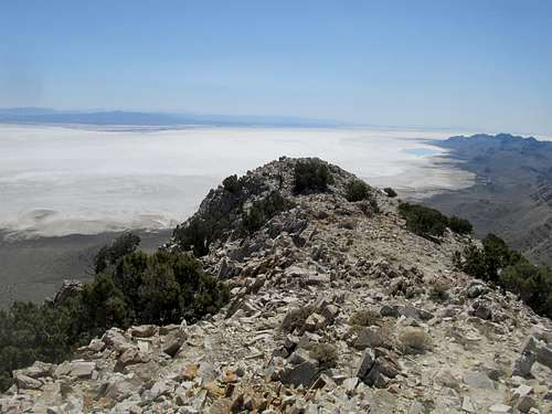
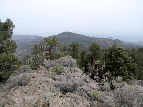
The crux was a fun and easy step, and the small rocky summit was as spectacular as any I’ve been on, yielding views of the San Rafael Knob, all of the higher Book Cliffs, the Wasatch Plateau, and both the La Sal and Henry Ranges to the south. Unfortunately I couldn’t stay long, but still lingered as long as I could before making the downclimb.
Then it was rushing to get back to my car as quickly as possible; the problem was that on my way up, with so many flat sections, I had tried running for bits and stretches, something I don’t do often, and never on the ascent for a peak. With heavy boots and all, my muscles, glutes and hamstrings, were shot a few miles after departing the summit, and I tried my best ameliorating it by doing long stretches in between stretches of jogging and fast walking.
I shot my load running down the section back to the river crossing, and could only hobble (at still a fast walk pace) the last few miles back. I ran out of water shortly after the crossing too, a rare occurrence, so the last mile back sucked.
I got back to the car seven hours after I had left it, and hurried back to Price as quickly as possible to a café in the center of town, and after some confusion trying to toggle the channel was able to watch a nice win over the Rangers.
Muddling up Murdock - April 20th, 2013
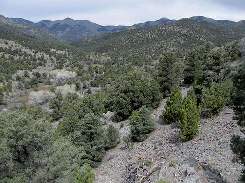
And now backtrack a month or so, and I found myself heading out to Wendover once more with coworkers. I prepared for this trip in advance, booking a room with one of my coworkers so I could stay and climb a few nearby peaks that weekend (he would hitch back with another coworker the next day while I stayed). It had been an emotional week though; the marathon bombings had hit very close to home, and the night before I tallied little sleep while listening to police scanners and following the manhunt that continued through the workday Friday and the ensuing drive to Wendover. I got the news that they caught the scumbag as we arrived in hotel room, pumped my fists, screamed, swore, got shitfaced, and woke up pretty damn hungover Saturday, still hoping to salvage a P2K despite my headache. I followed Dean’s directions to get to the base of Murdock Peak; the roads were long and somewhat confusing but not too rough for the 4Runner. I parked maybe half a mile short of where his directions had, and was surprised to find another truck parked there; it was a family of dirt bikers from Ely. After conversing with them for a bit I followed a rough road straight up the ridge from where I parked, before traversing off and crossing a few minor drainages.
All this time I was confused as to which peak was actually Murdock; I had to call Greg and get him to pull up google earth, describe my surroundings, so that he could give me my bearings. I slowly came to realize that one of the contenders I thought might have been Murdock, and had been subtly aiming for, was actually a separate foothill well to the southeast of where I was. Corrected, I headed up and eventually found myself along the jeep track that ascends a small knob to the south of the peak. I followed it down to a flat spot (I think the 4WD parking spot described on the SP page here) and headed steeply up the last few hundred feet.
It had gotten cold once I left the treed areas, with a stiff 30-40 mph breeze coming in from the west, and having foregone gloves I suffered my way to a chilly summit.
Following a different ridge on the way down I found myself severely lost once more when I reached the maze of dirt roads surrounding the peak, and unsure of my place I had to call Greg once more to have him guess my bearings and point me on the right way back to my car.
Not a banner day for my routefinding skills but I’ll take getting the summit and still surviving.
Pilot High, Boston Strong - April 21st, 2013
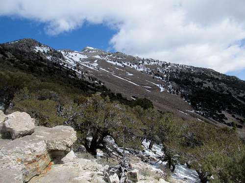
I called it an early night because I didn’t want to be banged up for my main objective of the weekend, Pilot Peak. The weather had been iffy all weekend, with spot storms moving in and out. The forecast was good for Sunday, but I was unsure of how much snow I would be dealing with after Friday and Saturday's precipitation. The drive to the 4WD parking spot in Miners Canyon was pretty brutal, lots of rocky spots, a few really rough and steep ones, and even the paved road was brutally potholed and bumpy. There looked to be a dusting on the peak on some northerly aspects, but the first few thousand feet would be dry for me, so after parking I prepped myself for the infamous Pilot talus.
And it honestly wasn’t too bad. The first few hundred feet from the parking spot is steep and rocky, but once you hit the first talus field proper, aiming for moderate, fist sized rocks lining the middle of the field allows for, dare I say, footing that was downright pleasant. Pick your footing right, and it honestly feels like ascending stairs for a thousand feet plus. And though it may sound corny to some, I huffed and puffed up the rocks thinking of the victims of the marathon bombings, some that I knew personally, those survivors still recovering from the most brutal of injuries, and thought to myself, this talus shit is nothing, it's a joke that with perspective, pales to the real tragedies and hardships going on even in my own hometown.
The tricky part is the small thick mahogany (?) lining the top of the first talus slope. They’re thickly, and angled awkwardly towards the slope, so you occasionally find yourself crawling below branches. But the open spots below the canopy had good footing and retained the only snow of this elevation; on a hot day I imagine this area would be a cool respite from the desert heat.
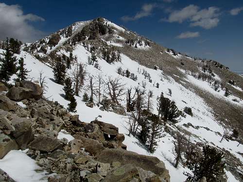
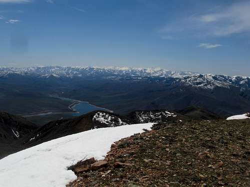
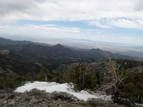
Upon reaching the saddle atop the first talus field, and beholding the first breathless views of the peak above, I strove to follow the ridge crest to the summit based on reports that it provided a better alternative than the ensuing talus field. It was once more fairly pleasant, at least until the snow cover made for some wet slogging as I approached 10,000 feet.
Suddenly I was in a different world, an cold, intimidating alpine one apart from the rocky desert below.
It had gotten cloudy, and the ridge I found myself on had gotten steep, and what’s this, a cliffy drop off to my left and somewhat of a knife edge?
I reached a point along the ridge crest where it met a minor notch, and I wasn’t sure whether there was a palatable way down into the notch, so I backtracked, exited the ridge, and sidehilled through a steep snowfield. Viewing the downclimb I shirked from below I realized it wasn’t actually too bad, probably only class 3, but oh well.
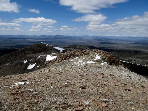
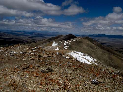
The rest of the way was through snowy talus and just snow, but again not too awful, and I arrived at the top three hours after leaving the car. The winter wonderland along the cliffs leading north seemed to add to the sense of accomplishment I felt, the first real mountain I’ve climbed in the year, and I reveled in it before heading back down.
First talus, then, avoiding the ridge crest, a long section of moderate sidehilling through a snow covered slope to reach a small knob and get back to the ridge. The snow was steep but not too bad, but the worst terrain I encountered all trip was in a small boulderfield trying to contour to the left and below of the knob; the rocks were large and loose, with large spaces in between them, and snow interspersed and hiding potential ankle twisting hotspots.
Once back on the ridge it was easy going. I reached the lower saddle, made my way blindly through the brush atop the lower talus field, then in contrast from my ascent, aimed as much as I could for the looser smaller scree on the downclimb.
The descent took less than three hours and was only respite from the next dreaded crux of this trip, the drive out. But it was a satisfying drive, knowing that I had my first major peak of the year done and over with, one that had been gnawing on me ever since I first glimpsed it from Grandeur Peak in the Wasatch 13 months prior. And pleasantly surprised at the quality of the talus; after dreading the worst slog of my life my advice is to aim for the larger rocks on your way up, the scree on your way down, and you’ll be up and down in no time.
A Desert Island - April 27th, 2013
My friend Jeremy wanted to do a peak with me. I had originally been batting the idea of George H. Hansen Peak for Saturday but scuttled it, figuring that complex and loose labyrinth of a P2K would be too much for someone who was not well versed in off trail peaks, so I decided on a closer alternative of Desert Peak in the Newfoundlands.
One of the reasons was the infamous drive along the long dirt road paralleling the railroad taking you deep into the heart of the Bonneville Salt Flats, one in which I had heard firsthand experiences from several people about their travails with wrecked tires along that track, so it seemed logical that having someone else along for the drive wouldn’t be the worst idea. The road did drag, but was a relatively decent gravel road, and I tried my best to watch for nails and other debris from the passing trains that supposed are the root of all the grief given to tires by that road. All in all it wasn’t too bad, besides a few bumpy areas that come out of nowhere after miles of graded surface.
The road leading into the range was actually worse…rutted, bumpy, rocky and as I found, composed of dirt and mud that, probably combined with all the salt in the area, sticks to your car for weeks. I parked maybe a mile or so before the 4WD road ended at a saddle, and we started along the road maybe slightly WNW from the peak. We followed the road to some mining remains, where a drainage seemed to lead to the towards the south ridge above.
The drainage had some big block boulders from where we started up, and some minor scrambling to reach a ridge going eastish that eventually met up where the 4WD route goes up from the parking spot, below the awe inspiring view of the peak’s south face.
The last thousand feet or was steep but fun, and in my opinion not a bad intro to off trail desert travel. It got a little rocky and loose near the top, but the summit was perfect, and the rare views sitting smack dab in the middle of the Salt Flats were striking even for a West Desert veteran such as myself.
After trying to explain the concept of prominence to Jeremy on the top we headed down. Jeremy was sick of this cross country terrain by now, though I thought considering looseness, brush, and ease of travel, it was downright pleasant compared to some other experiences.
Rummaging up Redrock - April 28th, 2013
Greg had to stay in Salt Lake for the weekend for work, so the next day we decided to hit up nearby Redrock Peak; it would be a threepeat for him, but for me another new peak to check off the Utah Top 100 Prominence list. I hung on for dear life as he sped his Subaru down the highways then backroads leading to the peak less than an hour outside of the city; this joyride might have been the crux of the trip. Redrock's summit is reached via a good trail coming up through a wide drainage on the southern slopes of the peak. As you can tell from the SP page Dean had first attempted the peak by following the drainage to its end and enduring some bad brush. Greg however had found a side trail gaining the ridge on the right (on the ascent), and fortunately he had it waypointed in his GPS.
Redrock turned out to be a surprisingly nice little gem close to the city; the lower canyon had some, well, pretty cool knobs of red rock, while the upper slopes had a lot of colorful and smooth rocks that looked like pebbles on a beach, if they were the size of your head. The last few hundred feet, off trail, seemed excruciatingly steep, and I struggled for breath with a set of weak lungs matched with a suddenly stiff wind at my back that seemed to drop the temperature a good fifty degrees or so.
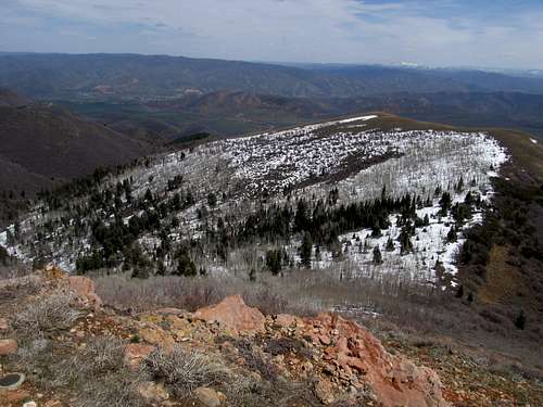
The views from the top are pretty decent, the peak being a good perch to view the Wasatch Range from its central to its northern reaches, but the cold weather bid us to hurry back down the trail, where the drainage once more shielded us from the wind, and I was allowed to gulp nervously at the thought of the drive back.
Spin up Quinn Canyon - May 4th, 2013
I’d do my own driving the next weekend, the plan being to meet back up with Greg in the middle of the Nevada desert. He had Thursday and Friday off to tackle some peaks near Alamo. We’d both do our own thing Saturday, then meet Sunday for the Seaman Range Highpoint.
I was extremely scared for this weekend's jaunts, the first and most important reason being that, since moving to Utah, I had yet to spend one night away when travelling from the comforts of a mattress, shower, and spotty wifi connection of your typical shitty dive motel out west. In fact, in all my years of doing outdoorsy shit as an able bodied adult I had camped only once, and that was for
Mt. Whitney, where I was part of a group of four, and the rest of the group had done all the camping work while I napped on a rock.
Not that I would be camping out this trip in the purest sense of the word, either. My plan was, now that I had the 4Runner, to put the back seats up and sleep in the back. Still, this was a treacherous new world for me, and I did much to prepare for my weekend off the grid…and by much I mean bought two pizzas from Domino's (immutable law of physics I have learned from my college days…pizza NEVER goes bad) and some snacks from the dollar store down the street.
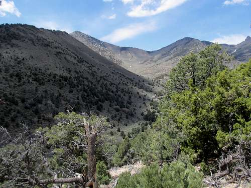
It was a long drive to my Saturday destination, the Quinn Canyon Range Highpoint, many miles past the middle of nowhere, and reached after several hours of driving along endless dirt roads. And despite carefully mapping out the way from google earth I still ended up hopelessly lost once I left the main dirt roads, circling around a ranch nowhere close to the trailhead and getting diverted off on a side road that got really rough as it wound through some drainages. I ended up parking in the desert plain near a burn area and, seeing the range ahead and that it was getting pretty late in the day, decided to just make a go for it and hope that I’d find the right peak.
I think the road I ended up on was somewhat parallel to the one I was supposed to be on, east of the road that leads into the North Fork Cottonwood Creek, the main approach from the south. Through a combination of setting off cross country a mile or two, ending back on the same road, then ascending a small ridge, I saw in front of me the main drainage, recognized the vaguely triangular profile of the peak that seemed similar to pictures I had seen on SP, and decided that I was likely now on the right track.
Various reports had found this peak to feature various degrees of brush. I wished to avoid such brush, and had mapped out what I thought was a reasonable route up the direct south ridge of the peak, which branches off deep into the drainage. Following the drainage and taking on the east-west running summit ridge seemed to involve more brush.
First was a somewhat long walk of 3 or so miles along the creek, which had gotten pleasantly toasty and, according to other accounts, was surprisingly lush. I looked to my right the entire time, hoping to be able to spot and differentiate the correct south ridge from a few ones roughly paralleling it to the south. Impressive summits loomed from hopelessly high over me along the way, but I could somewhat make my progress from how far away the east-west ridge was perpendicular to me. Based on that I made a guess at the ridge based on the fact that I was pretty obviously approaching the head of the drainage; finally, after a tiny bit of brush at the creek crossing, it was time to actually climb.
The summit looked distant at over 2,500 above me, but the going, aside from a steep portion leaving the drainage, wasn’t too bad. What I found especially was that as long as you try your best to stick along the highpoint of the ridge crest on your way up, it’s not brushy at all. Your progress is measured by several small hills and summits along the way, and the terrain alternates between gentle grassy slopes to some low trees. There were a few rocky areas, but nothing too bad.
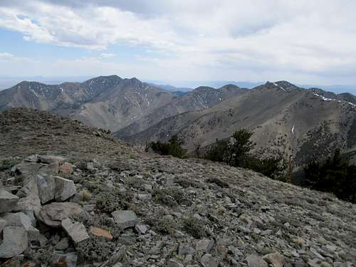
All along the way the easily recognizable profile of the true summit loomed over each bump along the ridge, while the landscape of this gem of a range revealed itself besides and behind you, offering glimpses in several directions of vast slopes and high ridges leading up to summits almost as tall as the unnamed highpoint. It got cloudy and darker by the time I was ascending the upper ramparts of the ridge to the base of the summit knoll, and the last few hundred feet were surprisingly steep and ends up being more gain than it looks.
A storm loomed over Troy Peak to the north, while sun bathed the Worthington Range to the south.
I took my time enjoying the views before absconding, hopefully before any nearby storms decided to come my way. Somewhere in the distance too was my target for the next day.
I tried my best to retrace my tracks on the way down, but my concentration wasn’t perfect and I found myself veering slightly off the ridge crest through a wooded section. Immediately the brush picked and I kicked myself for this mistake as I battled my way back towards easier ground.
I hopscotched the last few hundred feet of loose dirt to cross the creek. Both Greg and Dean had warned me about ticks in Nevada this time of year in the spring, and seeing that I had yet to encounter one while hiking, my horrified screams upon spotting one of those nefarious creatures on my pant legs after the crossing was well overdue. Thankfully it was the only one of the trip, even the year. The rest of the hike out was uneventful.
I felt the severe symptoms of civilization withdrawal by the time I continued my drive along miles of dirt roads through the interior Nevada desert to meet up with Greg at our predetermined camping spot at the base of the Seaman Range highpoint. Drinking and talking mountains around a campfire made being off the grid a little more palatable, though the fact that I had no cell signal and no clue how the Bruins were doing in their first round playoff game was torture at its finest. The first time sleeping in the back of the 4Runner was the worst as my lanky 6’3” frame struggled at finding a comfortable position, but eventually I unlocked a secret (putting one of my many blankets as a sheet underneath me) and dozed off blissfully.
Sauntering up Seaman - May 5th, 2013
I housed my final slices of pizza on a morning that started out bluebird clear. Greg finished packing up and we set our way directly towards the peak from the BLM trailhead, foregoing the sideroad rounding along the eastern side of the hill that we quickly ascended and descended down to a small drainage. Lying between us were still several ridges before we would near Seaman itself. At the time of our visit there was pretty much zero beta on the peak online. The mountain stretched out like an inverse U from where we stood, and though the summit stood on the left (east) side of the U, Greg suggest that we ascend the ridge leading up the right side at first, then make the full half circle around to the summit before descending the west side of the U. The ridge looked rocky, but Greg thought it would be easy.
We crossed and traversed some of the side ridges near some interesting rocky bluffs, eventually making our way up what seemed like the main eastern U ridge. Some sidehilling to avoid a false summit brought us to a notch, where from there we ascended up more steep terrain.
The ground was composed of surprisingly soft dirt though, and I had just commented about how pleasant this route was before I jinxed it; it quickly turned loose and even steeper, finding ending in some class 3-4 rock to crest atop the ridge.
What started out as a clear day had suddenly turned hazy, to the point where we could barely see the next batch of mountains to the south or in any other direction. Damn…the views of the peaks between highways 6 and 318 would’ve nice to have. The views of the traverse around to the summit looked intimidating too. There were several more rocky sections to round the U, and I trod carefully up and down the rocks while Greg (and Oquirrh) hopped ahead and waited patiently for me.
Eventually we made the saddle northeast of the summit and the terrain changed to a remarkably moist and open Ponderosa Pine forest, the largest such in Nevada. The fragrance of the trees reminded me of what I grew up for several years in Flagstaff, and I savored it before we scrambled up the final ledges to the summit top.
The views were just as blocked and hazy from here, though we had decent glimpses to the rest of this wooded range to the north. (There were some decent views east along the east side of the U too, towards some pretty cool looking chalky canyons lying between the peak and the highway.)
With the long drive back still in store for the day in mind, we headed down, but not before several more ledgy downclimbs. I was pretty grumpy by the time we skirted the last of the cliffs and hopped back down the now annoying loose terrain back towards the desert floor.
What we had thought would be an easy 2000 feet or so Nevada day had thrown us a few unexpected difficulties, but I think the crux of the problem was the buildup of my grid withdrawal PMS that was quickly reaching its breaking point. (I was due to fly to Portland Oregon for a vacation the following weekend; somehow Greg always gets me involved in one of these “adventures” every weekend before I’m due to fly somewhere). After crossing a few lastdrainages and calling for twenty or some minutes fruitlessly for Oquirrh in the first drainage before realizing he had straight-shotted it directly back to our cars at the campsite, we embarked on the drive back. I arrived back in Ely and logged back into the world, only to find that the Bruins had lost the night before. Fortunately they would rally miraculous the following week against Toronto to close out the series so that, by the time I was huffing up Mt. Elliott two weekends later they were already engaged in their Divisional matchup vs. the Rangers.


Comments
Post a Comment