Carolina Daydreamin'
According to my records my trip this past June marked my 25th visit to GSMNP. And according to those records, on the vast majority of those visits, I have spent most of my time on the Tennessee side of the park. That I knew! I also knew that making a visit to the North Carolina side was overdue. Long overdue!
It’s not that I dislike the mountains of North Carolina. In fact, it’s the exact opposite. When it comes to the southern Appalachians my love affair has always been with western North Carolina. This goes back a long way, back to 82’, on my first trip to the mountains. It was all those glorious views I had while I pedaled the Blue Ridge Parkway. Besides riding my bike through the Smokies, and into North Carolina over Newfound Gap, I was fortunate enough to spend a week
pedaling the entire Parkway. For three of those days I was blessed with countless western North Carolina vistas. For a first timer to the mountains, it was love at first site! When I returned home, and reminisced about that trip, western Carolina stood out as my favorite area. And to this day, when it comes to the southern Appalachians, yes, Carolina is the most special to me.
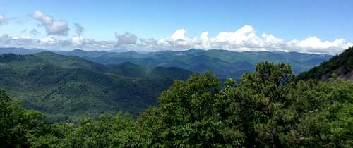
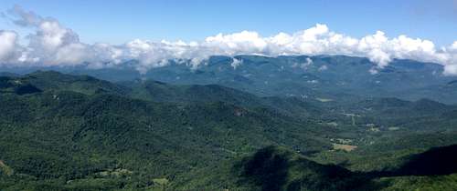
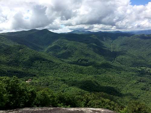
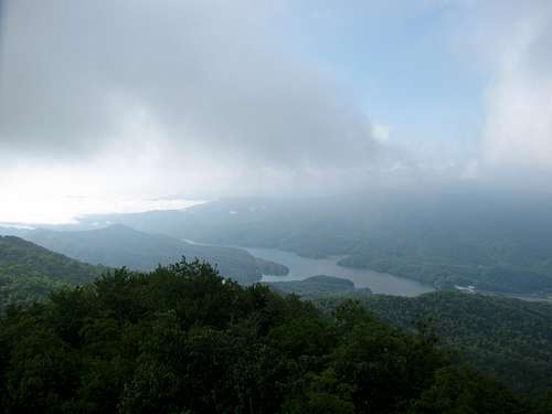
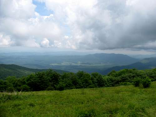
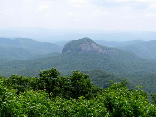
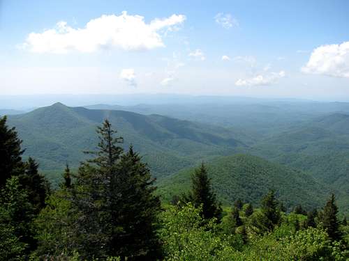
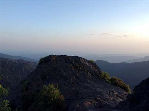
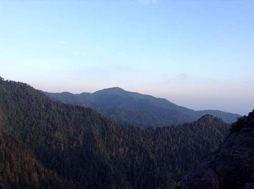
![Jones Knob Panorama]() Pano from Jones Knob
Pano from Jones Knob
But regardless, most of my southern Appalachian trail miles have been in Tennessee. When I started making my (at least) annual visits to the Smokies back in 97’ I always seemed to end up camping in Elkmont and then hitting trailheads on the Tennessee side of the park. It wasn’t until 2010 that I headed towards other North Carolina beauties, like Linville Gorge. And as for this year, I made up my mind that I was going to finally make it all the way out to the Fontana area. I had yet to see the dam and had wanted to for over 10 years. I also wanted to get to the Bartram Trail in southern North Carolina. So instead of booking my normal Elkmont campsite I booked Dave, Rob and myself at Smokemont for four nights. Being located right off Newfound Gap Road and on the far end of the Carolina side of the park it would end up being a perfect basecamp for the itinerary I had planned.
Bartram Trail (Section 2) and Cullasaja River Gorge
Also as a change from the ordinary, we drove straight through on Wednesday to the campground, as opposed to grabbing a hotel in the Knoxville area. It made for a late arrival, and having to set up Dave’s massive family size tent in the dark, but it would allow us an early start on Thursday morning.
Section 2 of the
Bartram Trail offered an opportunity for a full day of peakbagging, along with plenty of open mountain vistas. This section of the trail is reported to have some of the best views along the entire 100 mile trail. Starting at Jones Gap and doing an 8 to 12 mile or so roundtrip guaranteed bagging three or more summits, without a lot of elevation gain. Little work, lots of rewards!
It was about a one hour drive from Smokemont to the Jones Gap trailhead. Getting to the trailhead would prove to be the most adventurous part of the day. I had three different sets of directions with me, all three were slightly different, and in the end, none of the three were completely accurate. Let’s just say that road names didn’t match. We followed our instincts and stayed on the main road and eventually found a sign for the Bartram Trail. We followed this single lane road for about two miles and it fortunately did lead to the Jones Gap trailhead.
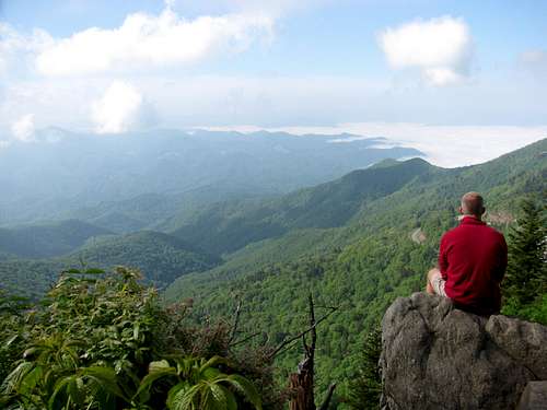
We went into the hike with no firm plan, other than knowing we wanted to at least reach Jones Knob and Whiterock Mountain. We made it to Jones Knob (elev 4622 ft.) in short order, taking the Bartram Trail for less than a half mile to the spur trail to the summit. The views are obstructed from the summit so we descended a bit to get some open views.
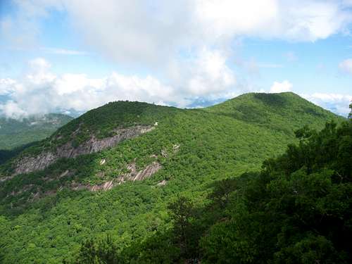
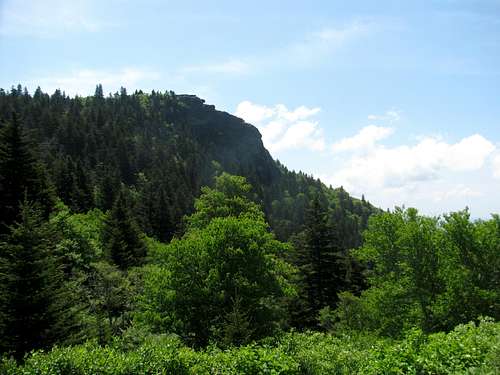
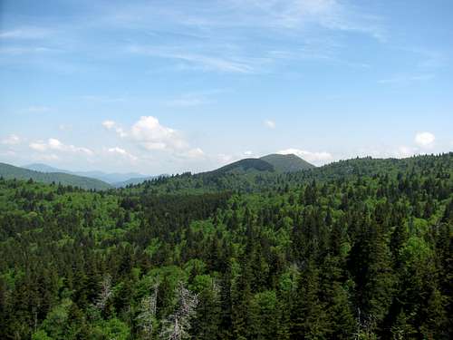
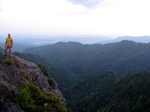
![Whiterock Mountain]() Whiterock Mountain
Whiterock Mountain ![Jones Knob Panorama]() Pano from Jones Knob
Pano from Jones Knob
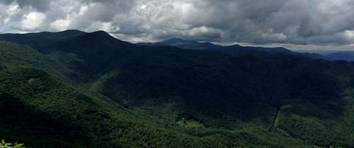
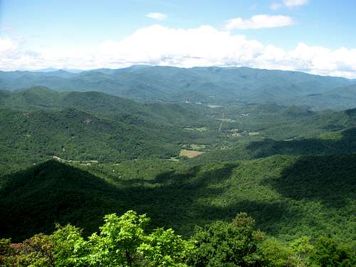
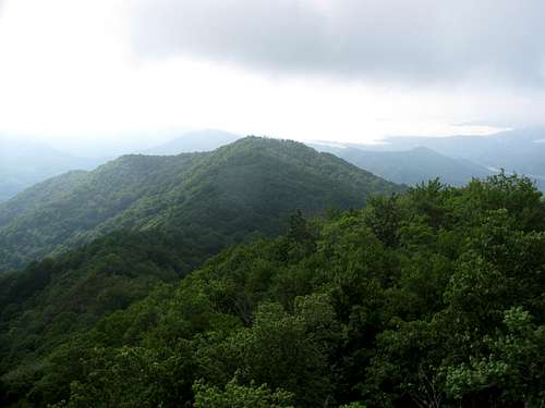
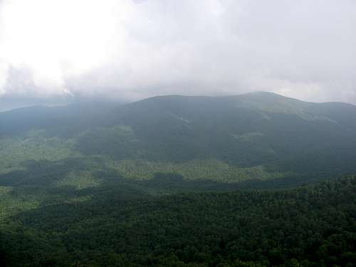
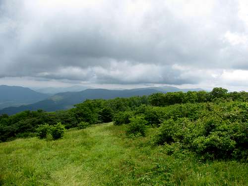
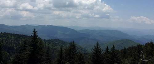
We didn’t stay long and made our way back to the Bartram Trail and continued on towards Whiterock Mountain (elev. 4480 ft). Like Jones Knob, the spur trail to Whiterock is well marked. We made it to the summit, and again, like Jones Knob, there are no views. There is a pretty obvious trail that continues on to an open area with outstanding views to the west. This is slick rock though, and you don’t want to get too close to the drop off as it is pretty severe. Slipping would be really bad!
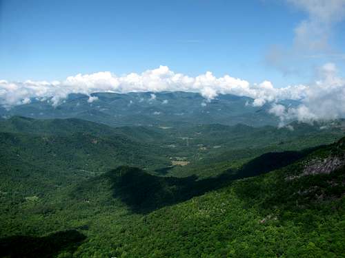
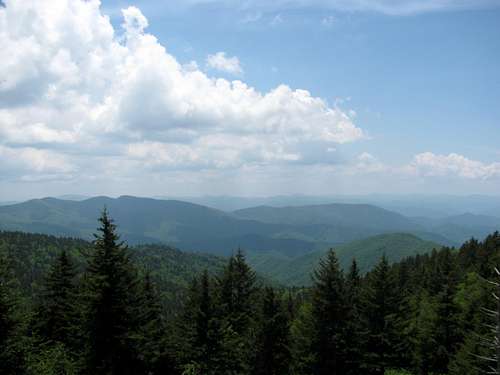
![Whiterock Mountain Panorama]() Pano from Whiterock Mountain
Pano from Whiterock Mountain ![Trail to Whiterock Mountain Viewing Area]() The trail to the summit is in there somewhere!
The trail to the summit is in there somewhere!
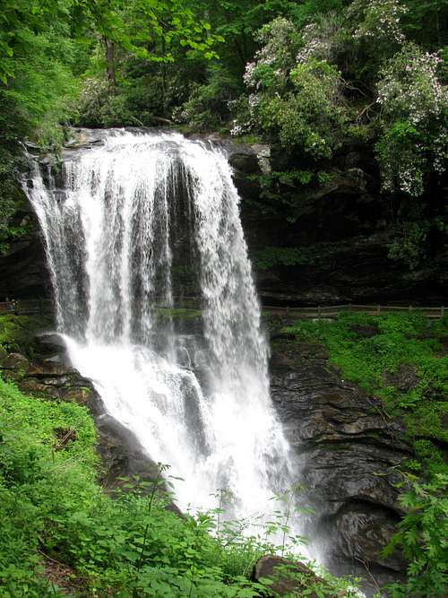
We stayed here quite a while, enjoying the views as well as the sandwiches we packed, and also pondered our next move. If we wanted, we could keep heading north on the Bartram Trail and bag a few more peaks, which would include Big Fishhawk Mountain and Wolf Rock. It really would have been a pretty easy day of peakbagging, all on a good trail and not that much elevation gain. But I wasn’t feeling it, and that was mostly due to Cullasaja River Gorge.
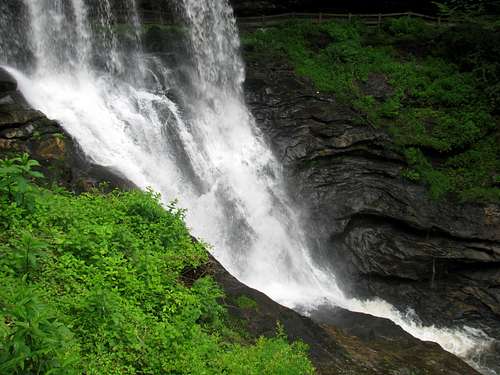
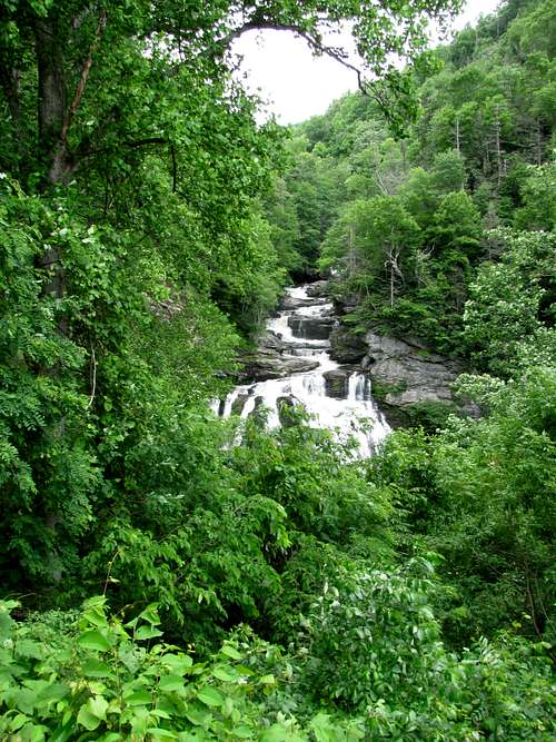
We drove through the gorge, which is right on Hwy 64/28, on our drive to the trailhead. We got a quick glimpse of the lower falls as we drove by. The area looked amazing and the thought of spending time scrambling along a river on a warm North Carolina afternoon sounded really good. Rob was interested in bagging a few more peaks, but I wasn’t that interested. There apparently aren’t any views from Big Fishhawk Mountain, and being more of a viewbagger than peakbagger, I convinced Rob that Cullasaja River Gorge had more to offer, so we headed back to the trailhead making for an easy 4.5 mile hike.
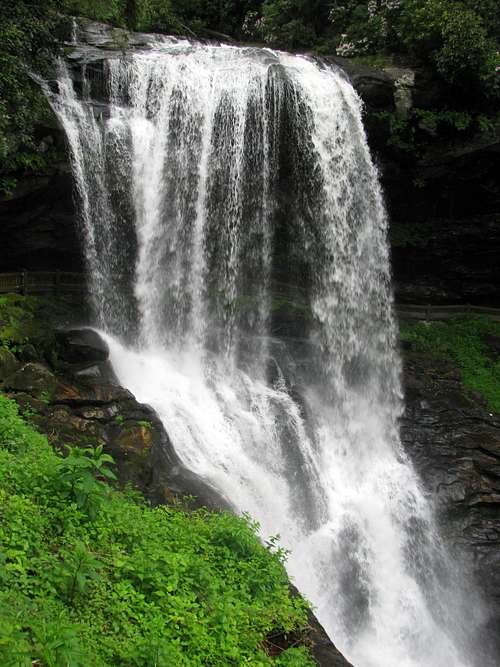
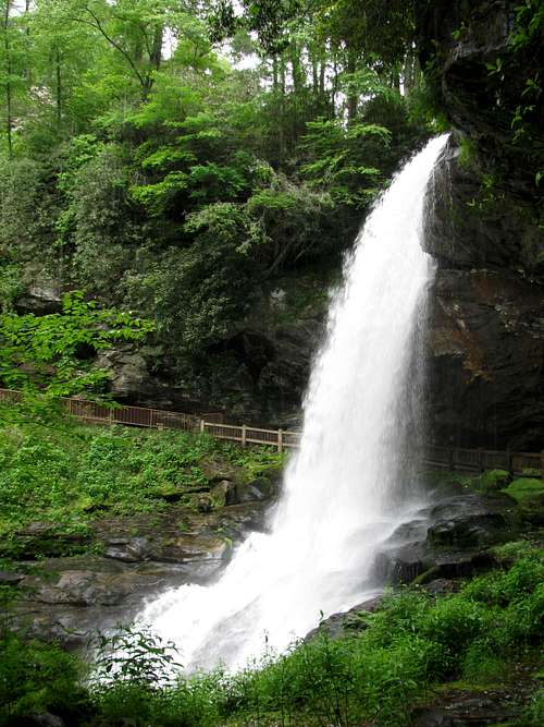
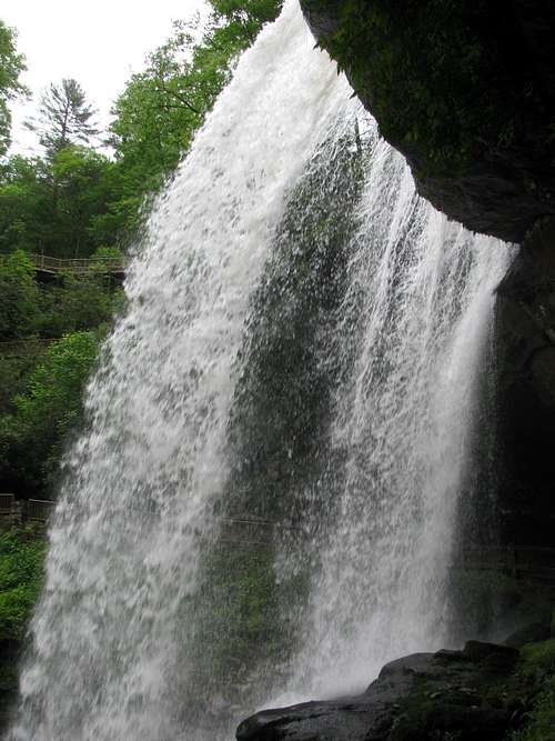
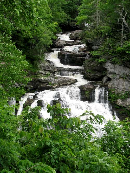
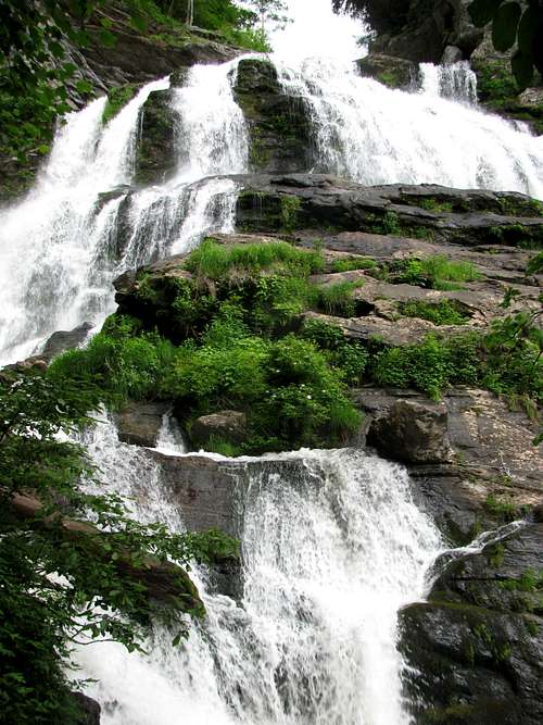
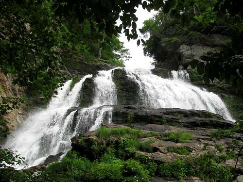
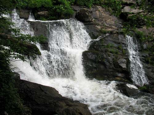
Cullasaja River Gorge did not disappoint! We first made our way to the High Falls parking lot. Like our peakbagging in the morning, this would not be much of a hike. There is a walkway that starts right at the parking lot and within a few hundred yards, if that, you get amazing views of the falls. The path does run behind the falls, which is a fun novelty. Being a waterfall, with easy access, the area was busy, so we snapped some pics and then headed back to the highway to try and find a place to park the car so we could scramble down to the lower falls.
We did find a small pull off right on the highway and made our way down to the river. I love this kind of off trail scrambling! There did appear to be a few social trails, or maybe it was just erosion from rain runoff, but we just picked one of the paths with little resistance. The biggest hazard was all the poison ivy that graced the path as well as the base of nearly every tree.
![Lower Cullasaja Falls]() Lower Falls from the Road
Lower Falls from the Road![Lower Cullasaja Falls]() Lower Falls from the Road - Zoom
Lower Falls from the Road - Zoom
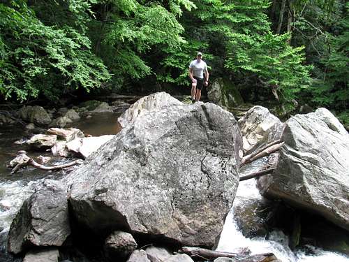
The lower falls were amazing. The three of us took off on our own, trying to find the best spots for photos. Dave took the opportunity as well to do some scrambling on some of the huge boulders in the river.
It was a great day, with awesome views on the Bartram Trail as well as the amazing Cullasaja River Gorge. We ended it with beers and rather large steaks back at Smokemont. We also started planning for Friday and our first visit to the Fontana area and our big hike from Twentymile Trailhead.
Twentymile Ridge-Wolf Ridge Loop and Fontana
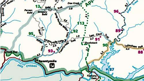
When I pull out my GSMNP trail map I am always looking for a long loop hike, something that hopefully offers some mountain vistas as well as being less than 20 miles. The Twentymile Ridge, Wolf Ridge loop from Twentymile Trailhead fit the bill, and it also fit in well with camping at Smokemont, keeping the drive to the trailhead at about one hour. It would also take us across Gregory Bald in June, which meant one thing, Flame Azalea.
The exact route we took goes: Twentymile Trail to the AT; backtrack on the AT to Shuckstack firetower; the AT to Doe Knob and the Gregory Bald Trail; Gregory Bald Trail to Gregory Bald; Gregory Bald to Wolf Ridge Trail; Wolf Ridge Trail back to Twentymile Trail. Based on the beta in
Hiking Trails of the Smokies I estimated the distance at 19-20 miles with around 5000 feet of elevation change.
We were up early on Friday morning and with Dave doing the driving we made it to the Twentymile Trailhead at first light. Being an old railroad bed the early section of the Twentymile Trail is nice and wide and is a very easy grade. The trail also, in quintessential Smokies style, hugs a creek for several miles, in this case Twentymile Creek. Not too far up the trail there is a spur trail to Twentymile Cascades. Normally I would have jumped at the opportunity to go exploring, but with a 20 mile day ahead of us I knew the cascades would have to wait for another day. Other than the cascades it was just a nice steady five mile hike in the woods towards the AT.
It did get exciting for a few brief seconds just below the AT junction. For the first time in all of my visits to the park I finally saw a bear on the trail. Actually, it was up on the ridge above the trail, less than 100 feet away, and the view was for a few brief seconds. I can only assume he heard us coming and started scampering away. It all happened so fast that I didn’t even have time to reach for my camera. The trail description in the
little brown book was spot on as it did indicate that the odds of seeing bears on this section of the trail were high.
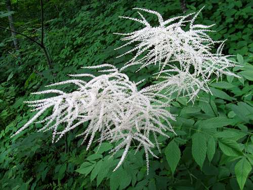
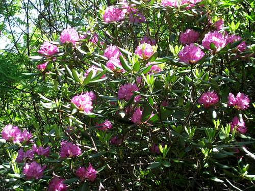
![Flame Azalea on the AT]() Spring flowers on the AT
Spring flowers on the AT ![Spring Flora on the AT]() Spring flowers on the AT
Spring flowers on the AT
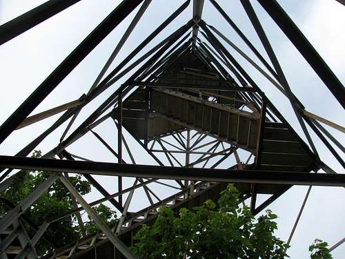
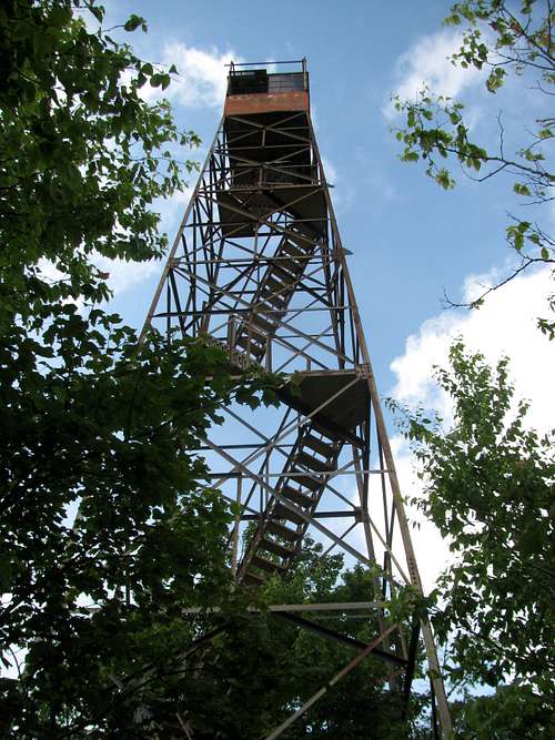
When we hit the AT we turned right so we could make the quick half mile hike to the Shuckstack firetower. On a clear day there are beautiful views in all directions. Unfortunately it was a bit overcast and there were enough low lying clouds to obstruct the views. And as for the firetower, I didn’t trust the wood on the deck, so I dropped down the steps a bit to get the views and my pics.
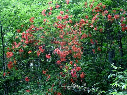
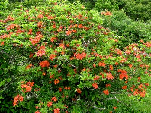
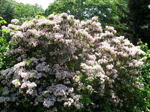
We headed back to the AT and made the ~ 3.5 mile hike to Doe Knob and the junction with the Gregory Bald Trail. From there it was three miles, on what is obviously a section of trail that doesn’t get used much, to Gregory Bald. Once at the bald we stopped to rest, have some lunch and enjoy the views down into Cades Cove. It was definitely not peak Azalea season yet, but there were still a good number of the bushes in full bloom.
![Between Doe Knob and Gregory Bald]() Gregory Bald Trail
Gregory Bald Trail
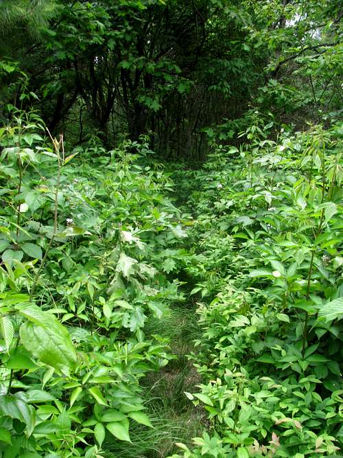
After our break we made our way to the Wolf Ridge Trail, which also is obviously not used very much, over Parson’s Bald and the 6.4 miles back to Twentymile Trailhead.
![Wolf Ridge Trail near Parson Bald]() Wolf Ridge Trail
Wolf Ridge Trail
As for solitude, which can be tough to find in the Smokies, a good portion of this route did get us some quiet time. Other than while we were on the AT and on Gregory Bald we didn’t see any other hikers all day.
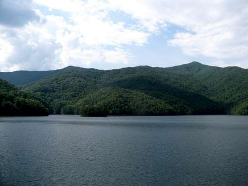
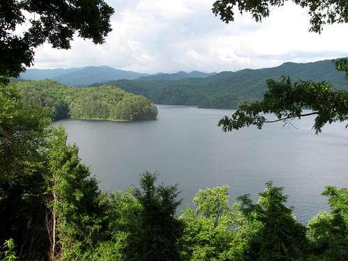
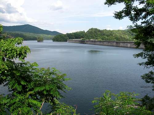
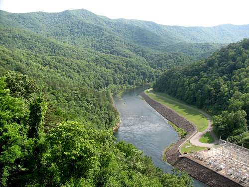
On our drive back we did stop at Fontana Dam. I had wanted to see the dam for a long time so we made sure to take the time for a quick tour of the area. The dam as well as the lake are impressive! At 480 feet it is the tallest hydroelectric dam east of the Mississippi, I had always been interested in the dam, more so from an infrastructure standpoint, but recently have gotten more interested in the history behind the building of the dam, as well as the impact on the area, and the history since the construction. The history is fascinating, and beyond the scope of a trip report, but this
link gives a good historical timeline. I found the history outlined in
The Wild East to be very informative.
![Shuckstack from Fontana Dam]() Shuckstack from Fontana Dam
Shuckstack from Fontana Dam ![Little Tennessee River]() Little Tennessee River
Little Tennessee River
After our tour of the Fontana area we headed back to Smokemont for a relaxing evening of local craft beer, a big meal and a big fire. There are benefits to frontcountry camping! We also discussed our plans for Saturday. I knew we were going to head up the Blue Ridge Parkway, but how much hiking we were going to do was up in the air, particularly after our 20 mile day today.
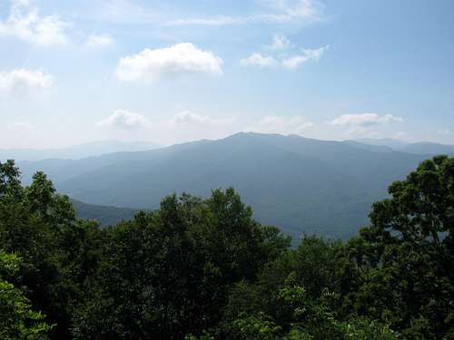
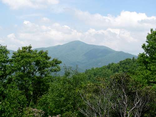
Playing the Parkway Tourons
We decided to make Saturday a rest day and just enjoy the views of western Carolina from the overlooks and a few short trails along the Blue Ridge Parkway. Rob had never travelled the southern section of the Parkway so I decided he deserved to see this stellar stretch of road. The plan was just to do a little driving, get out at some of the overlooks and enjoy the views, as well as make a couple of short hikes to a couple of “summits”. And that is all we did!
![Wesner Bald]() Wesner Bald
Wesner Bald![Cold Mountain]() Cold Mountain
Cold Mountain![Looking Glass Rock]() Looking Glass Rock
Looking Glass Rock
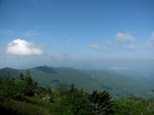
As for hiking, we stopped at the Waterrock Knob parking area at MM 451 and made the short < 1 mile hike to the summit. While the views from the parking area are pretty amazing in themselves, it was good to finally make the short hike and get some summit views.
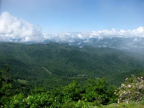
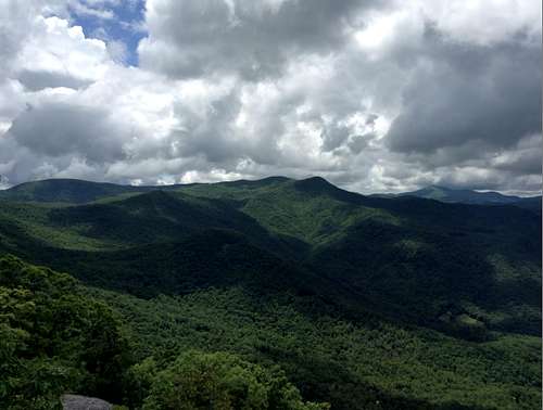
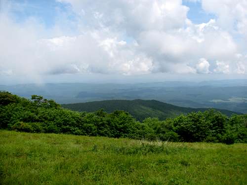
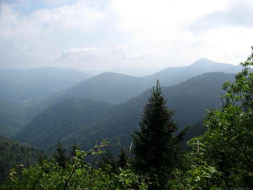
We continued with the driving and hitting pulloffs until we reached Devils Courthouse at MM 422 and again made the short < 1 mile hike to the summit. The views to the east and then back to the west into Shining Rock Wilderness were again stunning.
![Devils Courthouse Panorama]() Pano from Devils Courthouse
Pano from Devils Courthouse
When we drove by the trailheads for the Shining Rock Wilderness I was very glad we decided to just take it easy today. My other alternative for the day was to hike out to Shining Rock. A weekend and Shining Rock meant one thing, crowds! The parking areas were packed and I knew that the trail and summit would have been packed with plenty of weekend warriors. I’ll hit it someday, but that day will be a weekday!
We turned around somewhere near MM 410 and headed back towards camp, but of course not without stopping at my favorite lunch spot. The highpoint of the Parkway at 6,047 feet and MM 431 is at Richland Balsam. We stopped for lunch and enjoyed the beautiful view to the east.
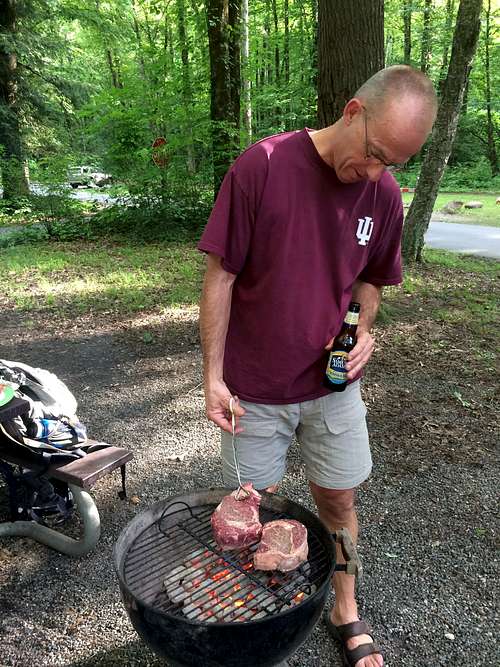
I was looking forward to another relaxing evening in Smokemont and we would get that. Another big meal, a big fire and of course we finished off the local craft beer we still had in the cooler. Rob did decide though that he wanted to be the overachiever and complete the 5.7 Smokemont Loop. Dave and I joined him for the first mile or so to the creek crossing and then let him continue on solo, and then we headed back to camp to relax. It was a great way to unwind after three stellar days in Carolina.
Sunrise at Charlies Bunion and Homeward Bound
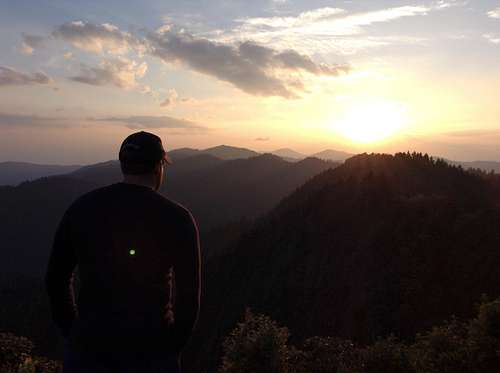
Picking a hike for Sunday morning was pretty easy. Rob had never been to Charlies Bunion before and had expressed interest in heading there. With the trailhead at Newfound Gap it made for the perfect choice as we had to drive over the gap on our way home anyway. To make the hike even more interesting we also chose to aim for reaching the bunion at sunrise.
The early start offered many benefits, besides just seeing a perfect Smoky Mountain sunrise. First, it guaranteed we would be past Pigeon Forge and Sevierville long before the tourists got out of bed, eliminating at least an hour sitting in traffic (the traffic hell in this area cannot be underestimated); second, both Dave and Rob have little ones at home and they both wanted to get back home by late afternoon and the early start guaranteed that; and finally, from a purely selfish standpoint, sunrise at Charlies Bunion pretty much guaranteed that we would have the place all to ourselves!
We were up at 3 AM, broke camp, packed up my wife’s Tribute and headed for the trailhead. We were on the trail by 4 AM which guaranteed reaching the bunion by sunrise. Of course hiking this four mile section of the AT via headlamp does guarantee some slower going. This is a pretty rugged section of trail, with plenty of large rocks and tree roots in the way. Picking your way along in daylight can be challenging enough. Doing it via headlamp makes it more interesting.
About 15 minutes before we reached the bunion we were able to ditch the headlamps, and we did time things perfectly, arriving about 15 minutes prior to sunrise. And yes, we had the place to ourselves.
![Charlies Bunion at Sunrise]() Charlies Bunion
Charlies Bunion ![Mount Kephart]() Mount Kephart
Mount Kephart ![Mount LeConte]() Mount LeConte
Mount LeConte
We enjoyed the sunrise, and probably hung around for a good 30 minutes before heading back to the car, and the eight hour drive home.
The early start really did help with the traffic. Using the Gatlinburg Bypass and then taking the Veterans Parkway shortcut around Pigeon Forge, we were on I-40 in right at one hours time. This has to be a record for us!
Smokemont and Parting Thoughts
This ended up being a fantastic trip to the Smokies and Carolina. Both Dave and Rob said it was one of the best trips either of them had had to the area. Getting to some new areas always helps with perspective, but the major reduction in crowds and traffic helped as well. When I say traffic I mean both foot traffic and auto traffic. On two of the mornings we stopped in Cherokee for breakfast. Unlike Gatlinburg, parking onsite was a non-issue, and while the place was plenty busy, it was still easy in, easy out. We also didn’t deal with lines of traffic on our way to the Bartram Trail or to Twentymile. Sure, there was plenty of traffic on Saturday on the Parkway, but hey, it was Saturday!
I always had a thing against Smokemont, which unfortunately kept me from going back there sooner. The second time I camped there a number of years ago it happened to be bike week in Cherokee. With the campground right along Newfound Gap Road, there was no peace and quiet. The constant roar of motorcycles went late into the evening. It was just bad timing, and it sort of soured me to the area. But having been back, I will definitely be visiting Smokemont again. There are plenty of hikes that I still want to get to where basecamping in Smokemont just makes sense.


Comments
Post a Comment