
-
 25935 Hits
-
 97.31% Score
-
 68 Votes
|
|
Area/Range |
|---|---|
|
|
36.10000°N / 81.82°W |
|
|
Hiking, Trad Climbing, Ice Climbing, Scrambling |
|
|
Spring, Summer, Fall, Winter |
|
|
6047 ft / 1843 m |
|
|
Overview

Lower Yellowstone Falls
“Upon the Blue Ridge Mountains,
There I’ll take my stand.
A rifle on my shoulder,
Six-shooter in my hand,
I’ve been all around this world.”
--The Grateful Dead, “Been All Around This World.”
First of all, I am no Deadhead or hippie, and my feelings about those people kept me from giving the Dead a chance for a very long time. But I found they made a lot of great music (and a great deal of junk, too), and I am now a fan of the music.
But the lines above resound with me because of my proximity to the Blue Ridge and the amount of time I’ve spent there. I have been all around this country, but the Blue Ridge still holds a special charm for me, for it is where my mountain adventures began, and I have found lovely places deep within those ridges and hollows that would be as good a spot as any to lie down and pass away when the time for my mountain adventures to end comes. Hopefully, though, the guns won’t be part of that.
After seeing the mountains of the American West, a person can easily overlook or dismiss the older, tamer Blue Ridge, but doing so would be a terrible mistake. The mountains of the East do not pierce the sky or tempt the lens for the most part, but a quiet beauty and a special magic there beckon one’s spirit into a world of serene beauty that seems to be a living manifestation of the imagery evoked by landmark American poets such as Emily Dickinson and Robert Frost, whose verse about New England seems almost equally applicable to the southern Appalachians. Perhaps restful is the word I seek to describe how I feel when I am out in the woods of the Blue Ridge, and the range’s shaded recesses take me worlds away from the frenetic urban madness of the East Coast and its cities, that world in which I live and work so I can escape to the mountains whenever the opportunity arises. Stepping into the Blue Ridge is like stepping into a folk song about a bygone era of bygone values and ways, and the breezes bear the songs of ghostly fiddles and the forgotten people who made them talk and who played a fundamental and lasting role in the development of American culture.
Near Linville, NC
March through October, the Blue Ridge is an outdoor wildflower museum. All year long, scenic streams (misleadingly called rivers in most places) tumble down the steep hillsides, pouring over countless cataracts and cliff-bound falls along the way; it is my personal opinion that the waterfalls in Virginia’s Shenandoah National Park are collectively the prettiest I’ve seen in all the areas of the country I’ve visited, but I certainly can’t prove that I’m right about that. The aspens and cottonwoods of the West make for a gorgeous fall, but there is more color, and a longer color season, in the Blue Ridge, though the Blue Ridge seems dull in comparison to the October displays in Vermont and New Hampshire. Wildlife abounds, and the clear winter air affords stunning views and spectacular sunsets. Hundreds of miles of hiking trails lace the range, and climbers can find challenging cliffs in numerous places. There is much more, and those who have been there over and over again have seen a great deal of it but never feel they have seen enough.
Part of the Appalachian Mountains system, the Blue Ridge technically extends from western Maryland south across a sliver of West Virginia at Harpers Ferry and down through Virginia and North Carolina (and along the very western edge of South Carolina) until it reaches its terminus in northern Georgia. But the range is principally in Virginia and North Carolina—don’t be fooled by John Denver’s “Country Roads, Take Me Home,” which places the Blue Ridge and the Shenandoah River in “West Virginia.” They are in western Virginia, and the Shenandoah River, like the Blue Ridge, only rolls through West Virginia at Harpers Ferry.
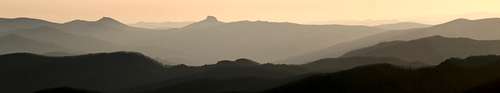
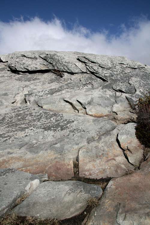
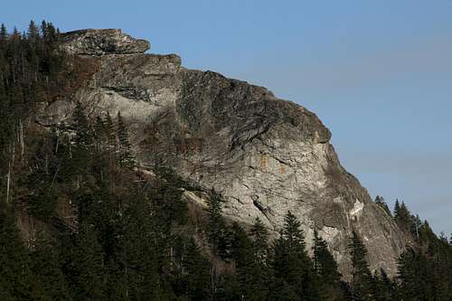
The mountains got their name long ago because of the bluish haze that frequently surrounds them-- not the same as the pollution-caused haze that destroys air quality and visibility for most of the late spring through the early fall these days and which is contributing to the decline of many stands of trees. In Virginia, the Blue Ridge really is a ridge, a narrow one that rises steeply on its east and west sides but very gently north-south between gaps, what the Southeast calls passes. Around Asheville, North Carolina, though, the range broadens into numerous parallel ridges, and the mountains are wilder, though probably not as much so as in western Shenandoah National Park. In general, the mountains are also higher in North Carolina than they are in Virginia, and the range reaches its highest point at 5890’ Grandfather Mountain near Boone; Grandfather is also a rare “rocky” mountain in the East, and it offers several fun scrambling opportunities off the trail to its summit. The nearby Black Mountains, considered by some to be a spur of the Blue Ridge and by others to be a separate range, house the country’s highest point east of the Mississippi River, 6684’ Mount Mitchell. In New England, this would mean tundra, but the warmer climate of the South means the mountaintops are wooded.
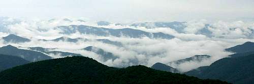
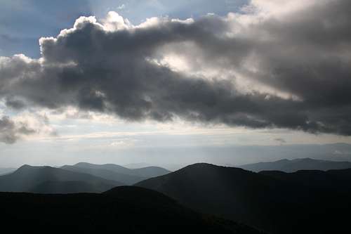
Blue Ridge Cloudscape-- by Mark Doiron
One of the best ways to experience the Blue Ridge is to visit Shenandoah National Park in Virginia. It is diversely beautiful in all seasons, and it’s the most pristine part of the range. Another great option is the Blue Ridge Parkway, a stoplight-free stretch of pavement running for 470 miles from Shenandoah’s southern end at Rockfish Gap to the southern gateway for Great Smoky Mountains National Park in North Carolina. A third recommendation I have is to explore the waterfalls region of North Carolina west of Asheville; U.S. 64 winds through an area with several lovely waterfalls, one of which, Whitewater Falls near the South Carolina border and Lake Toxaway, is by some measures the highest in the eastern United States. Down in Georgia, where there are no famous national parks, the range may not be as spectacular as it is along the heights of the Blue Ridge Parkway or the steep sides of Shenandoah, but it still has the forested slopes, waterfalls, and rock outcrops typical of the Blue Ridge, and its relative obscurity outside the local area makes it a much quieter place to visit.
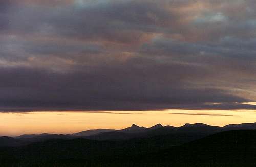
Blue Ridge sunrise
But this page focuses on the Blue Ridge Parkway. The Parkway, administered by the National Park Service and sometimes little wider than the road itself, winds generally southwest from Shenandoah National Park to Great Smoky Mountains National Park for 470 miles free of stop signs and stoplights. In many a vehicle, one could drive the entire length without stopping, but anyone who would do so would need his or her head examined. Because there are some gas stations, many campgrounds, and some motel-style lodges along the way, though, one could travel the entire way without leaving the Parkway, and that is a delightful trip indeed.
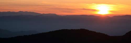
North Carolina sunset
Many travelers on the Parkway are headed to or from the Smokies and are fixated on that park, but consider the Blue Ridge Parkway or its vicinity as an alternate destination for the following reasons:
• Great Smoky Mountains N.P. is the nation’s most heavily visited, and it’s even busy much of the time in winter.
• The weather there isn’t very good; it’s often so hazy that visibility is almost nothing, it rains frequently, and cloudless days are rare. The longer Blue Ridge Parkway and vicinity offer more chances for finding good weather.
• You can see much of the same, but with far less company, along the Parkway, especially its western sections, or by leaving it near Waynesville and heading toward U.S. 64 and the spectacular waterfalls region briefly described above.
Those who don’t already know about the delights of the Blue Ridge are likely to find themselves pleasantly surprised when they visit. Don’t be surprised if you fall in love with the region.
Pages for mountains, areas, and routes attached to this page are locations along the Parkway, accessed by Parkway trailheads (and perhaps others), or accessed by short, dead-end spur roads from the Parkway. The focus of this page is on the hiking and climbing opportunities, not on attractions related to cultural history, of which there are many.
A Parkway Odyssey, Part One: Rockfish Gap to Peaks of Otter
Fallingwater Cascades
From Rockfish Gap to about Roanoke, Virginia, the Parkway goes through a landscape that looks like a continuation of Shenandoah National Park. Hikers will want to stop at Humpback Rocks (MP 6) and the Peaks of Otter (MP 84-87).
Humpback Rocks offers a short but steep climb to a rocky summit with excellent views west and scrambling opportunities galore. Unfortunately, the popularity of the site has resulted in a great deal of graffiti on the rocks, but don't let that ruin your fun or deter you from going at least once.
Crabtree Falls, Virginia's highest, is a short drive from the Parkway if one exits at Route 56 near MP 30 and heads east. Wigwam Falls can be accessed from an overlook between MP 30 and 40.
At the Peaks of Otter, trails climb to nearby summits, including Flat Top and craggy Sharp Top, and there is also the short, pretty, and easy Fallingwater Cascades loop nearby (MP 83), complete with benches along the way for the out-of-shape and the spellbound. Sharp Top is one of the best summits in the Blue Ridge, and there are many opportunities to scramble on rocks both at the summit and at a spur called Buzzard's Roost. A campground, lodge, and gas station are at the Peaks of Otter, and the facilities there are open all year; they are among the few Parkway facilities that are.
A Parkway Odyssey, Part Two: Peaks of Otter to Doughton Park
South of Roanoke, the high ridges soon give way to rolling, meadowy hills, and although the drive is pretty and peaceful, there isn’t much that’s spectacular until it approaches Doughton Park in North Carolina. Often, the Parkway land is only as wide as the road and its shoulders, and private property, usually farmland but sometimes subdivisions and small communities, abuts the road, canceling any sense of a pristine landscape.One good stop, though, is Rocky Knob, where a few rustic cabins are available for rent from May through October and a trail climbs a short distance up Rocky Knob, where an outcrop provides a nice view of Rock Castle Gorge.
Another popular location is Mabry Mill (MP 176), where you can get a sampling of frontier life when this part of Virginia was still a frontier. It isn’t my kind of thing, but many people love it. If you go in a cold winter, the mill wheel may be frozen and adorned with massive icicles, and that is a spectacular sight.
Doughton Park
Doughton Park, in North Carolina (MP 238-245), has a mix of some of what’s best in the Blue Ridge. There are lovely rolling hills framed by split-rail fences, rock outcrops, deep hollows, and some of the best wild stands of rhododendron I have ever seen. The summit of Bluff Mountain is accessible by trail, as is the summit of Fodder Stack. Wildcat Rock is a popular walk-up destination for its views, and the cliffs there could hold appeal for technical climbers willing to deal with the bushwhacking necessary to access the base. But the best thing to do is just get out and walk along the open meadows that make the park such a distinct location. There are few other places in the Southern Appalachians that offer such expansive views and so many of them all in one place.
Shortly after Doughton Park, where travelers can find gas, camping, and lodging, and dining, the mountains begin to rise again and march into the magnificent highlands of western North Carolina.
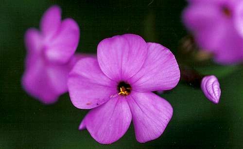
Phlox
A Parkway Odyssey, Part Three: Doughton Park to Asheville
Now we reach the best parts. Private land is still often adjacent to the road, and now trophy homes compete with each other to spoil mountain views-- at least the farms and small communities seem like a part of the landscape-- but there is also a wildness not found since the Peaks of Otter area. Pisgah National Forest surrounds much of the Parkway, providing more recreation opportunities and more buffers from development.Near MP 260 south of Doughton Park, a short trail to Jumpinoff Rock takes hikers to a nice view of the mountains. At MP 272, stop at E.B. Jeffress Park for a short interpretive loop through the forest and to a pretty waterfall.
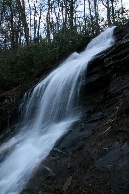
Cascade at E.B. Jeffress Park
Around the famous but overrated Linn Cove Viaduct (MP 304)-- it is less than half a mile in length, has nowhere to stop, and doesn't have views that are any better than those from nearby overlooks, but people into engineering and what man can build think it's pretty cool-- enjoy views of Grandfather Mountain, highest in the Blue Ridge. Less than a mile from the viaduct is the trail to Rough Ridge, where open outcrops yield outstanding views. The trail to Flat Rock, at MP 308, leads to an open, secluded view of popular Grandfather. Grandfather Mountain is not on public land, though. In 1996, which was when I last went there, it cost $9 to enter the commercialized park and hike its trails (very scenic area, though); I know it costs at least $15 now. I’d say it’s worth at least one visit to hike to the highpoint of the Blue Ridge, though. Near MP 302, there is a trail that does access the peak, but the trails from the private park are shorter and easier.
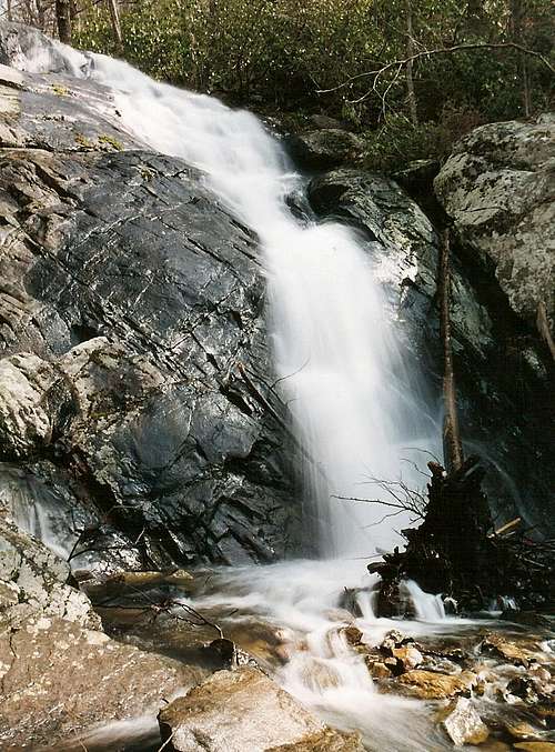
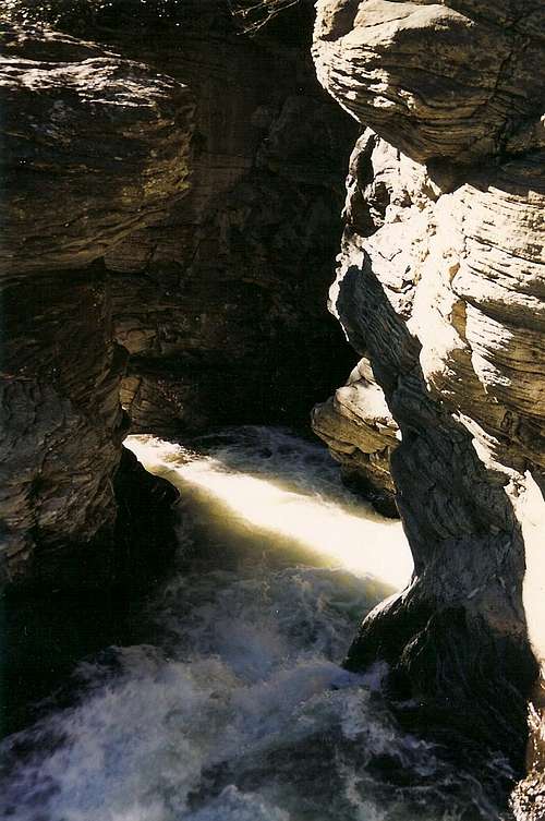
Back on the Parkway, stop at Linville Falls (MP 316, Linville Gorge), my favorite spot along the Parkway. Here, there is a rugged gorge with a high, thundering waterfall that cuts through a narrow rocky opening at its brink. Unlike most other streams that rise in the Blue Ridge, the Linville River really is big enough and broad enough to pass as a river, and it shows as it pours over its precipice and rushes through its gorge, where there is rugged hiking and challenging climbing.
Rough Ridge
Linville Falls
Stop at MP 339 for the trail to Crabtree Falls, not as mighty as Linville but a classically beautiful Appalachian waterfall. At MP 355, look for the spur to Mount Mitchell State Park, where a road goes almost to the very top of the highest mountain east of the Mississippi River. Mount Mitchell is in the Black Mountains, which are technically not part of the Blue Ridge.
Craggy Gardens, MP 363-370, is carpeted with blooming rhododendron around Mid-June. The short, easy hike up Craggy Pinnacle winds through dense rhododendron stands and ends at a platform with outstanding mountain views. For the flora and the views, this area is one of the most scenic along the Blue Ridge Parkway.
View from Craggy Pinnacle
Between MP 380 and 390, there are several exits for Asheville, the largest city in the area and one with a plethora of dining, lodging, and shopping options.
A Parkway Odyssey, Part Four: Asheville to the Great Smokies
Somewhere around Asheville, the Blue Ridge proper takes a southern turn, but the Parkway climbs into its highest zones, which botanically resemble southeastern Canada more than they do North Carolina, and winds its way to the Smokies, bypassing the town of Cherokee, the southern gateway to the park. Here, the Parkway is at its wildest and arguably its most scenic, and it reaches its highest point out here as well, 6047' at Richland Balsam.Pisgah and Nantahala National Forests surround the road almost everywhere, the land is generally too rugged to support anything but small communities, and the mountains themselves break from the predominant single-ridge pattern of the Blue Ridge and become higher and broader, creating the sense of an ocean of mountains.
The mountains, even the highest ones, are still tree-covered, but there are some exceptions that make excellent hiking destinations for views. Among the best are Black Balsam Knob, reached by a dead-end access road at about MP 422, and Devils Courthouse (MP 422), a rocky-faced peak steeped in legend.
Devils Courthouse
Another outstanding destination is Graveyard Fields and Yellowstone Prong, accessed from an overlook at approximately MP 419. Natural disasters occurring as recently as 1925 wiped out the forest here, and as it slowly recovers, this location offers something rare in the mountains of the Southeast: trail hiking under the open sky. A trail system follows Yellowstone Prong and Graveyard Ridge, visiting two waterfalls and yielding nice mountain views. So if you're in the East or Midwest and can't afford the time or the expense to visit Yellowstone Falls in Wyoming, try Yellowstone Falls in North Carolina!
Seasons
These mountains and the road are accessible all year, but each season has its own advantages and disadvantages. For color, the best times of year are late May through mid-July, when different varieties of rhododendron and laurel bloom, and October, when the turning leaves paint the mountainsides.Summer, although the time most convenient for most people, is probably the worst time to visit. Yes, the mountains have their share of lovely summer days, but it is more typical to find conditions hot, humid, and hazy.
Winter can be the most rewarding time to visit if also the most challenging. Road closures due to snow, ice, and blowdowns are common, though the Parkway is still accessible for driving stretches and for hiking where state and local roads cross it. But skies are clearest in winter, and there is the prospect of winter conditions adding an exciting and beautiful dimension to the mountains. It is always a good idea to call the Parkway information line before heading out, but especially so in winter and early spring.
Information line: (828) 298-0398
Red Tape
There are no entrance fees for the Blue Ridge Parkway. Some sites in the national forests require day-use fees.Camping
There are several campgrounds along the Blue Ridge Parkway, and there are several in the national forests of Western North Carolina.Many campgrounds fill on summer and fall weekends, especially during the autumn color season. Arrive early.
External Links
NPS Blue Ridge Parkway siteThis site has links for camping and lodging information.