|
|
Mountain/Rock |
|---|---|
|
|
42.11219°N / 80.15913°E |
|
|
Summer |
|
|
20279 ft / 6181 m |
|
|
Overview
A small group of summits between the famous peaks of Pobeda and Khan Tengri.
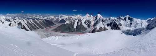
It has two ridge systems leading to the north which enclose a glacier basin at 5000m-5500m. Another mayor ridge leads to the south-east and includes the highest peak of the group with 6201m.
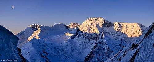
Ak-Tau 6181m is the central peak where all the ridges join.


Getting There
The nearest Airport is Bishkek or Almaty. Transport to Karkara at the Kyrgyz/Kazachs boarder is easy to organize. (~60 USD 2018)
Walk or fly in by helicopter to the South Inilchek Glacier Basecamp which is operated for climbing Khan Tengri and Pobeda.
Route
For sure several routes have been climbed in the past but it's not easy to find any information about it.
It seems that all possibilities to reach the glacier basin involve climbing steep faces, exposed ridges and/or very crevassed glaciers.
Markus Gschwendt and Simon Taffner did a north-south traverse in 2018 for acclimatisation purposes before climbing Pobeda.
Red Tape
A border area permit is needed for the Kyrgyz side but easily available through any agency for 20-50 USD.
Sometimes helicopters crash (as in 2018)
When to Climb
Best time is mid of July to end of August.
Camping
If you go with a full package of an agency they will provide tents in BC. Bring your own gear for the climb. No restriction for camp sites.
Because of the steep faces it can be difficult to find a spot for setting up a tent until arriving at the glacier basin.
External Links
American Alpine Journal 2019, Online Version, Ak-Tau Traverse

