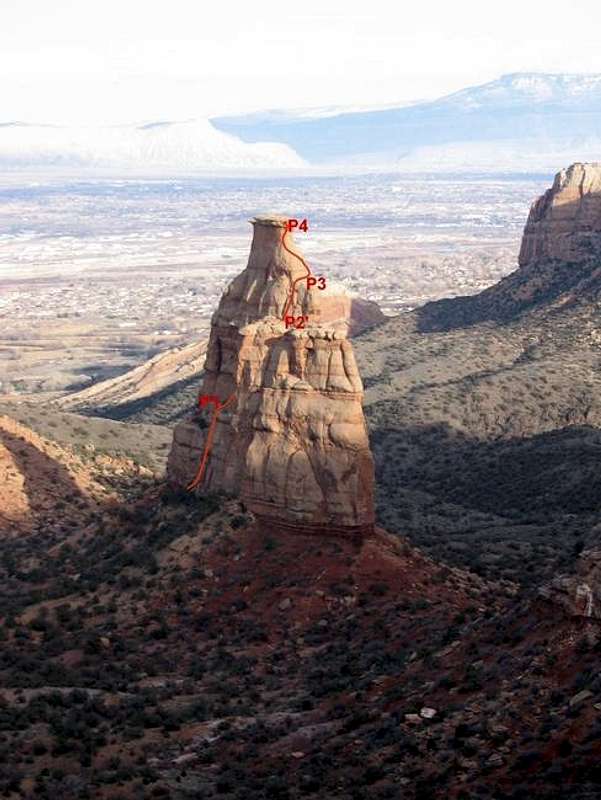
Approximate line of Otto's Route on the west face of Independence Monument as seen from the Rim Drive. Most of pitch 2 is not visible from this angle and neither is the top of the pitch. P2' denotes the location of the belay after it has been moved (class 2-3 unexposed walk via a gully). Photo taken on the afternoon of February 6, 2005).


