
|
|
Route |
|---|---|
|
|
47.82272°N / 123.68915°W |
|
|
Hiking, Mountaineering, Trad Climbing, Scrambling |
|
|
Summer, Fall |
|
|
A few days |
|
|
II |
|
|
Overview
Most summit approaches for Mount Olympus involve crossing the Blue Glacier. Sometimes referred to by climbers as the Blue Glacier Route, this is both the most accessible and most successful route approach for Mount Olympus. Although the Blue Glacier, itself, is only a small section of the nearly 20-mile jaunt to the Mount Olympus summit, it is an integral part of the approach and adds to its mystique. Looking Across Blue Glacier From Lateral Moraine
Despite those aspects, the Blue Glacier is not to be taken lightly. The glacier has many cracks and crevasses. The upper half of the glacier has many icefalls and bergschrunds. The glacier usually takes 1-2 days (assuming good weather and conditions) to access from the most popular starting location, the Hoh River Trailhead. Most summit teams must ascend and descend a steep lateral moraine just to reach the glacier, and then ascend and descend the lateral moraine again during the return-trip to camp and/or the Hoh River Trail.
 Numerous Cracks And Crevasses On Blue Glacier...
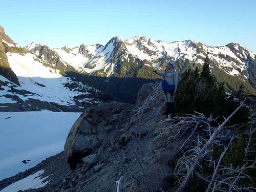 On The Lateral Moraine
Potential summit parties need to have experience with glacier travel and related gear, as well as some luck in terms of weather and route conditions, to help ensure success.
 On The Blue Glacier
Route Description
With extremely few and rare exceptions, the standard approach for Mount Olympus originates at the Hoh River Trail. Basic Route Map
FROM THE HOH RIVER TRAILHEAD:
-> Follow the Hoh River Trail for 17.5 miles to Glacier Meadows.
NOTE: Several slide areas and washouts have damaged the trail during the last two miles to Glacier Meadows. Use extra caution for each of these areas. Please contact the Hoh Visitor Center for current conditions.
 Descending Major Slide Area Along Trail
-> Sign the Climbers Register located at the ranger yurt stationed at Glacier Meadows, before proceeding with any further climbing trip.
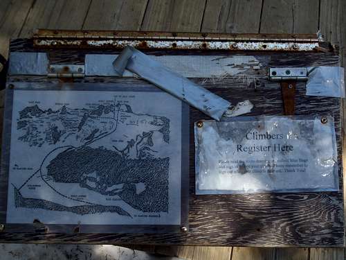 Climbers Register
-> From Glacier Meadows, there are two main options to reach the Blue Glacier:
OPTION #1: Follow the Terminus Primitive Trail south for 0.5 miles until reaching the lower end of the Blue Glacier at ~4800' elevation. This route option requires much longer glacial travel than the alternate option (see below).
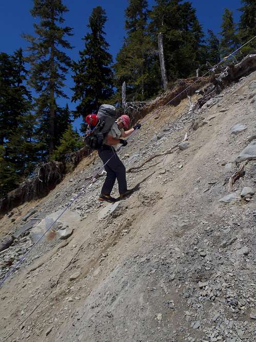
OPTION #2: Follow the Blue Glacier Primitive Trail southeast for 0.7 miles until reaching the lateral moraine of the Blue Glacier. This route option is used by most summit teams, although the lateral moraine is extremely steep, loose, and contains rockfall danger.
 Ascending To Lateral Moraine...
-> Once on the Blue Glacier, summit teams are greatly encouraged to rope-up before attempting to cross and/or ascend the glacier.
 Roping-Up On Glacier, Lateral Moraine In Background
-> Traverse southwest across the glacier until below the steep eastern slopes of Snow Dome.
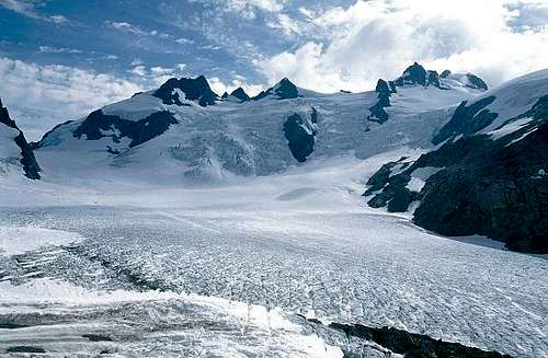 Looking Across The Blue Glacier Along Standard Approach
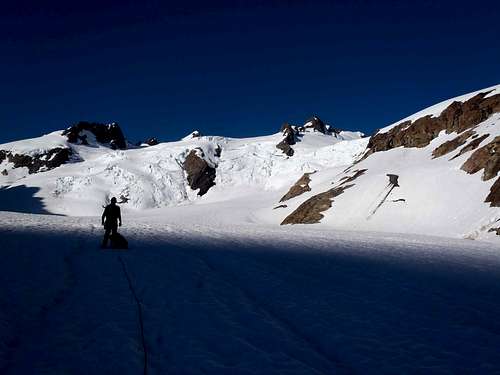 Heading Southwest Up Blue Glacier...
-> Ascend the steep eastern slopes of Snow Dome until at its wide open gentle-sloped mountaintop.
 Ascending From Blue Glacier Towards Snow Dome...
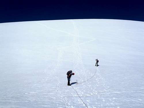 Ascending Snow Dome
-> Gradually ascend south from Snow Dome.
 Traversing South From Snow Dome...
There are several options from Snow Dome:
OPTION #1: Most summit teams use the "Crystal Pass" route. From Snow Dome, the route first ascends to Crystal Pass, then crosses over the pass, then traverses behind (immediately south of) Five Fingers Ridge, then over the false summit, and finally ascending the true summit (West Peak) block.
OPTION #2: Some summit teams ascend south from Snow Dome towards the saddle connecting the false summit and true summit (West Peak). This route variation is nicknamed the "Fourth of July" route, although bergschrunds and crevasses typically make this route option impassable by late June during most normal snow years.
OPTION #3: A few summit teams ascend south from Snow Dome towards the eastern slope/saddle of the false summit, then traverse over the false summit to reach the true summit (West Peak) block. This route variation is is nicknamed the "Early Summer" route, and as such considered as only an early season route due to bergschrunds and crevasses typically making this route option impassable by late June during most normal snow years.
OPTION #4: A few summit teams ascend south from Snow Dome directly towards the West Peak. This route variation is nicknamed the "Autobahn" route and directly ascends the north ridge to where it meets the north rockface of the summit block. This is considered a very early season route, due to bergschrunds and crevasses opening up sooner there than other areas.
 Example Of Bergschrund Complicating Routes
NOTE: As a general rule, and for safety reasons, the Olympic National Park recommends OPTION #1 (Crystal Pass) as the standard route for potential summiters to use. The Crystal Pass route is longer than the other route options listed above, but is generally considered a safer option during most of the standard climbing season for Mount Olympus.
-> The standard route for the true summit (West Peak) block is considered by most people to have Class 4 (scramble) difficulty on loose rocky ramps.
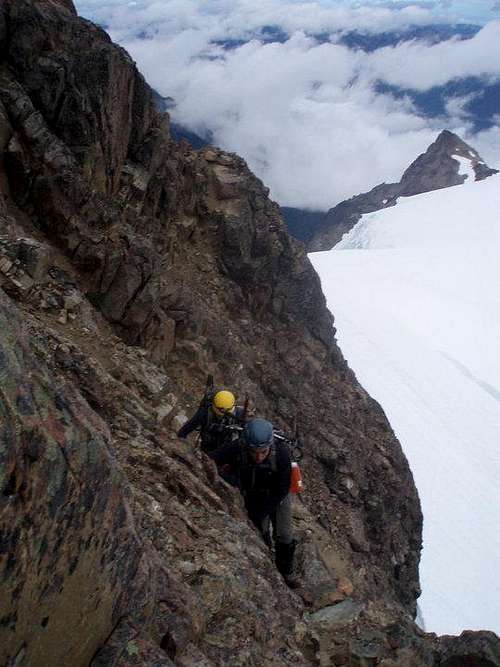 Summit Scramble
NOTE: Other possible summit options exist that have more solid rock to climb but also steeper slopes (i.e. rockfaces) and more exposure. These routes mostly range between Class 5.4-5.6 difficulty.
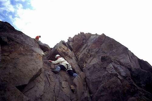 Example Of Summit Rock Climb (Alternate Option)
------------
A few mountaineers might be strong enough and have enough time to summit all three major peaks (West Peak, Middle Peak, and East Peak) during one trip. Most of such climbers, if starting from Glacier Meadows rather than Snow Dome, choose to go over Glacier Pass rather than Crystal Pass. However, this is a very long, time-consuming route which is not accomplished by many people.
Essential Gear
STANDARD GLACIER & CLIMBING GEAR:-> Trekking Poles
-> Ice Axe
-> Helmet
-> Climbing/Glacier Rope
-> Crampons
-> Rock Climbing Equipment (Cams, Nuts, Slings)
-> Glacier Goggles/Sunglasses
-> Sunscreen
-> Windbreaker Jacket
-> 10 Essentials
-> Common Sense
In addition, ice screws are highly advised for late season attempts.
------------
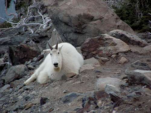 Mountain Goat On Lateral Moraine