
|
|
Mountain/Rock |
|---|---|
|
|
22.43349°S / 44.88939°W |
|
|
Hiking, Mountaineering, Sport Climbing |
|
|
Fall, Winter |
|
|
8202 ft / 2500 m |
|
|
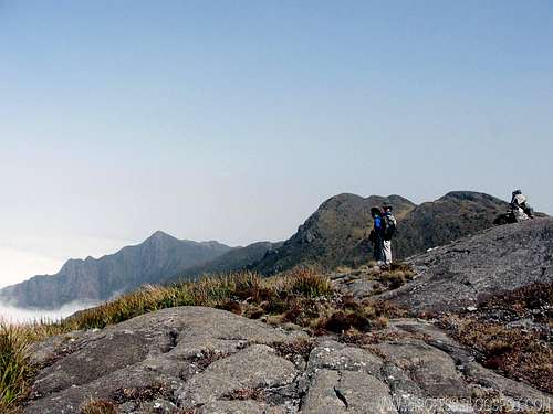
Capim Amarelo Peak as seen from the slopes of Mina Rock.

Capim Amarelo Peak, or "Yellow Grass Peak" if you will, is a huge mountain of Serra Fina, Brazil. Very popular mountain since it is the first summit of the famous traverse, Serra Fina traverse. The brazilian authority responsible for the mountains registry, IBGE, documents its altitude as 2.390 meters high. This is very much wrong, everybody here knows the right altitude is 100 meters higher then that.
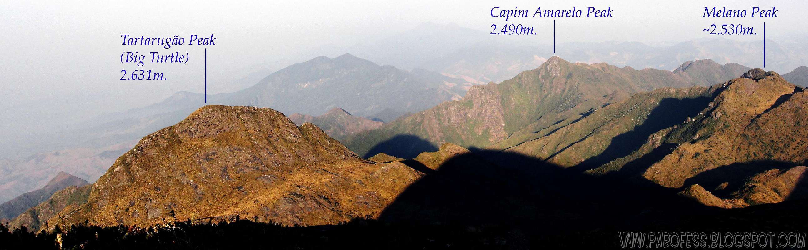
That mountain is one of several summits of Serra Fina range, but at this place, most of the mountains not even have a name. I saw and photographed myself at least ten different summits worthy of a name. But the only ones with a name and the proper registry are:
Pedra da Mina - 2.798 m. (4th highest peak of Brazil)
Pico dos 3 Estados - 2.665 m.
Pico Cabeça de Touro - 2.649 m.
Morro do Tartarugão - 2.631 m.
Morro do Melano - 2.566 m. (it has a name but not recognized by IBGE!)
Pico Alto do Capim Amarelo - 2.500 m.
Getting There

The volcanic shape of Capim Amarelo.

Now in close up.
There are 3 possible ways to get to that mountain, and for each one of them, first of all, you have to manage your way to a little city of Minas Gerais called Passa Quatro. From there, get yourself a private transport to one of the spots in red, depending of your choice:
First: SPOT: TOCA DO LOBO FARM: Starting the Serra Fina traverse from the west side. First summit: Alto do Campim Amarelo (this mountain). This is a direct route to this mountain only, sine it is the first one you do on the traverse route.
Second: SPOT: SITIO DO PIERRE: Starting from the Serra Fina traverse from the northeast side route. First summit: 3 States Peak (1 night) and go from there in the next morning.
Third: SPOT: SERRA FINA FARM: A never used route for this mountain: Starting from Serra Fina Farm, hike up to Pedra da Mina by the north side, 1 night. Go from there and be ready for a really tough task, it is 13kms hike to go and come back. 10 to 12 hours, full day job.
Red Tape
Take your garbage with you!!!Be careful, Serra Fina has a well known problem with water, find a gps archive to get the water spots, you don't wanna run out! During day time it is hot, but at the night, winter time, it can drop to -13°C. Cold!
Camping
Camping is permited anywhere you want inside the Sierra. Please look for ready camping sites along the traditional trailhead.Toca do Lobo Farm, Maracanã camp site, Alto do Capim Amarelo summit, valley after Morro do Melano (beside the red waterfall), Pedra da Mina summit, Pedra da Mina base, Ruah valley, small summit after Ruah valley, base of Cabeça de Touro Peak, 3 Estados Peak summit, and Sítio do Pierre. Plenty of places!
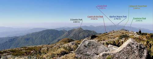
Panorama: east view from the summit of Pedra da Mina. 2.798 m.
Weather Forecast
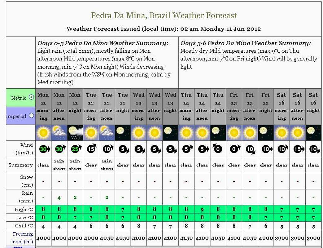
PS: The weather forecast on this link is not for this mountain but it will do just fine since the mountain from the forcast (Mina Rock) is close enough. The same mountain range.
Legal Issues
To hike/ climb is a dangerous activity and requires proper equipment and clothing, the owner of this page cannot be blamed by injuries caused to anyone who read this page for its info about the mountain, and eventually got hurt by doing so with reckless behaviour or bad weather conditions.
Paulo Roberto Felipe Schmidt – AKA: PAROFES
External Links
My youtube channel: www.youtube.com/parofes - Now with 270+ videos online!The biggest brazilian website about climbing and mountaineering, for which I'm a columnist: