"There are more mountains in Chile than any climber can truly comprehend"
That was just one of my quotes for the trip that brought me to Chile for the first time for a three week period in March and April. I had such a great time just being exposed to a different culture and witnessing some stunning mountains. The level of quality the mountains in Chile have is indescribable and I could easily spend 100 lifetimes in Chile alone climbing and exploring. Places I thought were obscure and having little beta in the US are the norm in Chile. Everywhere I went felt like I was breaching into a new area waiting to be explored. In many parts of Chile, few people actually embark in technical ascents and even relatively simple climbs are a great accomplishment in the eyes of a typical Chilean.
This trip report is designed to provide some general information about the area around Puerto Montt and Puerto Veras which is where we spent the majority of our time while visiting Chile. This area lies at the extreme southern end of the Lake District and the northern end of Patagonia so it has the appeal of both regions. There is a large amount of climbing potential in the Region de los Lagos but unfortunately local government bureaucracies make climbing during the off-season times quite difficult unless you are willing to sneak around, which really isn't much harder than it is in the US.
One of the first things I purchased while in Chile were a bunch of outdoor recreation maps and upon first glance I was speechless at the sheer amount of mountains, islands and big walls in Chile especially the southern third of the country coupled with literally no access to well over 75% of all the mountains. In fact, if you don't have a boat or access to one, you can't even think of visiting anything in the southern quarter of Chile unless you first travel to Argentina and approach the area from the east side of Patagonia. North-south travel within Chile is difficult in the northern two-thirds and impossible in the southern third of the country by car and with gas being the equivalent to $7 per gallon, few people own and use cars.
Nevertheless, I rented cars while I was in Chile and found it very helpful. The bus system throughout the country is likely the best in the entire world. I mean, large buses will go for hours on narrow gravel roads daily to connect towns with less than 200 people to the larger cities! But enough rambling, let me begin by describing my trip and hopefully provide some helpful information about travel in the area and provide some ideas for anyone interested in visiting this area.
Part 1 - Chiloe and Calbuco Volcano Hike
It was the middle of March and I was in continuous contact with Stephan, who finally had the dates for his sisters' wedding in Chile. Luckily, it matched perfectly with a large break from work for me and we agreed to spend a couple weeks in Chile after the wedding to explore and hike around. Before leaving, we agreed this would be more of a hiking trip rather than a climbing trip so we left all the ropes and cams at home and planned just to attempt some of the volcanoes and do some trekking. I spent a little bit of time looking for places to visit but the total amount of planning made for this trip was tiny which led to a relaxed trip without any specific goals or destinations. It didn't help that we both finally decided we could do the trip only a week before the trip started! I was lucky to get my round-trip plane tickets from Seattle to Puerto Montt for $1500 when it is typically over $2000 that close to the departure date.
So I made the long, long flight to Chile with layovers in Dallas and Santiago before finally arriving in the moderate sized city of Puerto Montt which is about 1,000 kilometers south of Santiago. Looking out the window of the airplane shortly before we landed confirmed my suspicion that southern Chile is virtually identical to the North Cascades...only better! Same climate, large volcanoes, rugged mountain peaks, large glaciers and huge lakes were what I saw and I kinda felt like I was home as we landed in the green and somewhat damp airport. Upon exiting the plane though, I realized no one spoke any english and after grabbing my bag, I managed to get on the correct bus into town.
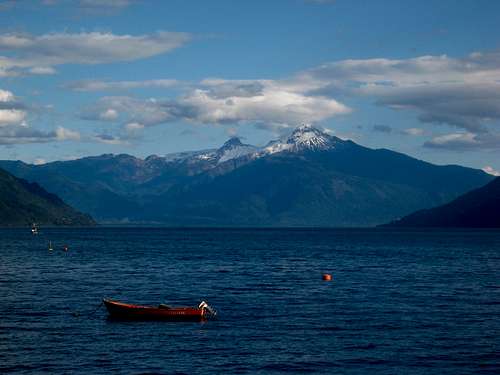
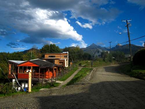
The bus ride into Puerto Montt was 2,000 pesos ($4) and upon reaching the bus station, I wasn't all that thrilled with the city. A local on the plane told me to head straight for Puerto Veras though so I transferred onto another bus towards Puerto Veras. However since I knew zero spanish at that time it took me over an hour to find the right bus and I still had to find a place to trade my US dollars for Pesos. Puerto Veras is only 15 minutes north of Puerto Montt, which lies at the north end of a large gulf which sits between the huge island of Chiloe and the mainland of Chile. When I reached Puerto Veras, I managed to find a place to exchange money and made a little walk around town to the shore of Lago Llanquihue (second largest lake in Chile) and took in the beauty of the place. Still unable to speak to anyone, I got onto another bus heading east towards the mountains. I informed the bus driver I wanted to be dropped off at the Casa Ko B&B and luckily he knew exactly where it was. The views of the main volcanoes were amazing and the lake seemed to never end. After 30 kilometers I got off and started walking up the gravel road towards Casa Ko, where I had planned to stay for the night.
I walked onto their farm and was quickly greeted by Pauline who invited me in. Both her and her husband, a french couple, were very nice and gave me loads of great information to aid my planning for the trip. I stayed there for the night and decided I would head back into town to rent a car the next day to drive over to Chiloe to meet Stephan. Unfortunately, the next morning it began to rain and it didn't stop for a solid 3 days. The drive over was beautiful though and the ferry ride from the mainland to Chiloe was nice. It was only about 10 minutes or so and I heard they were in the works of building a bridge there.
![Casa Ko B&B]() Part of the farm at the Casa Ko B&B
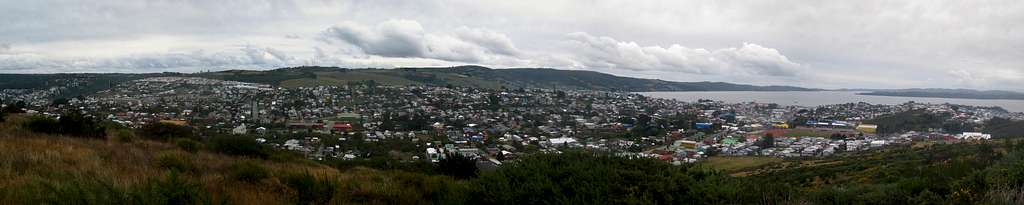
Part of the farm at the Casa Ko B&BSo I continued south and stopped in the town of Ancud and walked around town myself for a bit. I hiked up to the top of a small hill where some power poles were located. Looking down on the town and I realized just how different life in Chile really is. Although everyone is still active each day, the lifestyle is so much simpler here. One thing that never seemed to end was that everywhere I went, literally everyone felt the need to stare at me. I suppose it had to do with the fact that people are shorter there and no one has blonde hair.
![Town of Ancud]() Town of Ancud from a small hill just above.
Town of Ancud from a small hill just above.
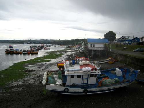
![Low tide at Dalcahue]() Low tide at the coast town of Dalcahue
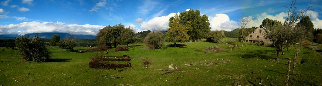
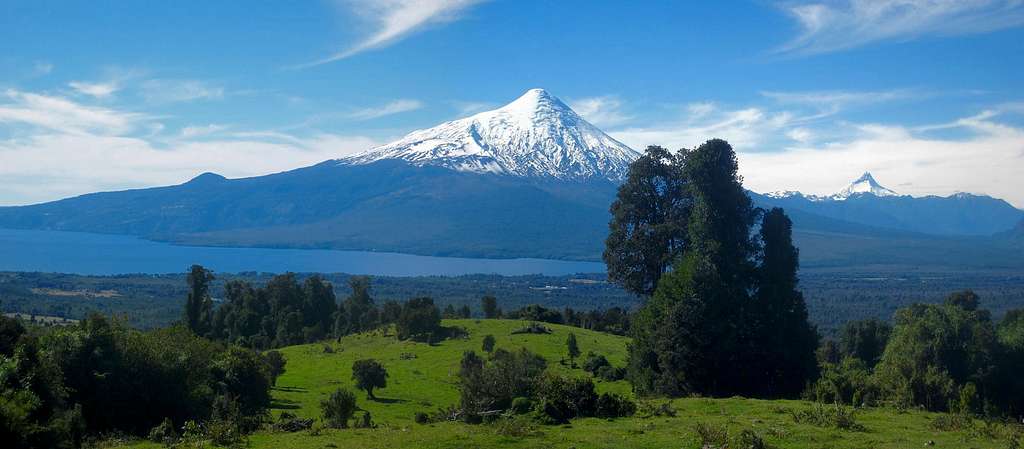
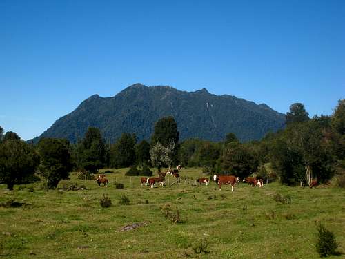
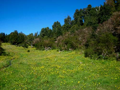
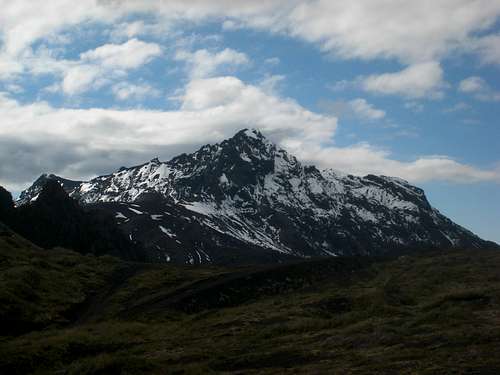
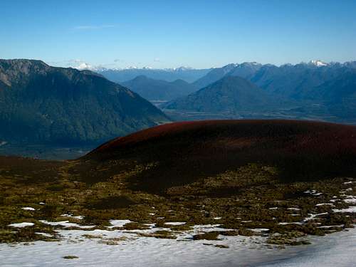
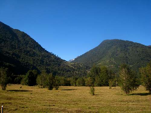
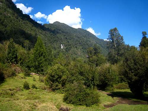
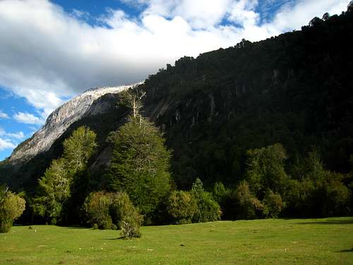
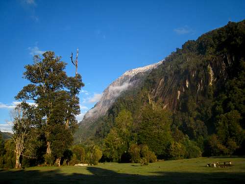
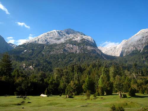
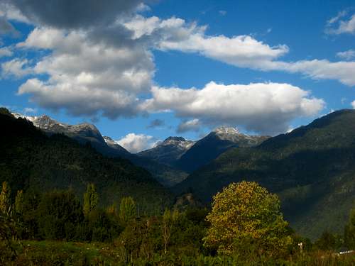
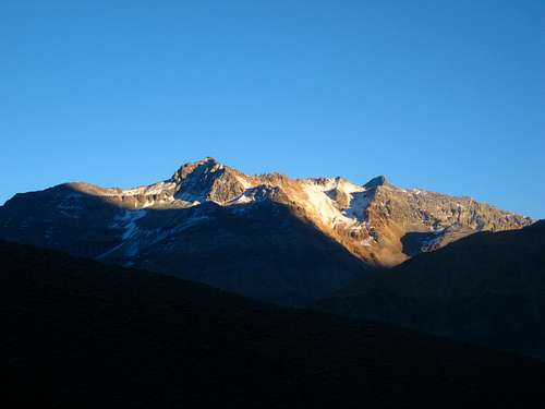
Low tide at the coast town of DalcahueI then continued south on the Island of Chiloe down to Castro, the main city on the island. At the small airport just north of town, I met Stephan as his family was flying out to return to Texas. It had been raining off and on the past few days and it reminded me of Seattle a lot. Stephan and I decided to do a hike on Calbuco Volcano first since it was literally in the backyard of the Casa Ko B&B I had stayed at. We actually drove through Puerto Montt and were going to hike up the standard route from the south, however after 15 minutes of hiking up the trail, we got to the Ranger Station where we found no one was there and the gate said the trail was closed probably due to the fresh snow that had fallen the past few days. I would have kept going but Stephan wasn't comfortable with it so we hiked back and returned to the north side of the mountain and began hiking up the route that starts at Casa Ko. The meadows are spectacular and the grass was so green. Views of Osorno to the north were among the best views I have ever seen. I couldn't find out who owned the land but cows were grazing everywhere. No one seemed to care if hikers passed through.
We continued to the south end of the first large set of meadows, then after a few minutes located the steep muddy trail. We quickly emerged into a second set of meadows which we hiked along the left edge of and crossed the mud bridge. The highest meadows are just across this bridge and this is where we set up camp. A small stream of crystal clear water flowed right next to us and it was an incredibly peaceful night. We made sure to locate the "port-hole" into the dense forest directly above us. Finding this was crucial as this is the trail that takes you the rest of the way to tree-line. A couple small, planted trees marked the entrance. See my Calbuco Volcano page for more information about the route description if you are interested in hiking this mountain.
![Osorno]() Osorno seen from the meadows on Calbuco
Osorno seen from the meadows on Calbuco![Meadows]() Cows grazing the meadows
Cows grazing the meadows | ![Calbuco meadow]() The meadow where we camped
The meadow where we camped | ![Calbuco sunset]() Sunset over Calbuco
Sunset over Calbuco |
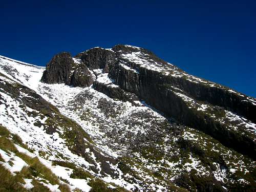
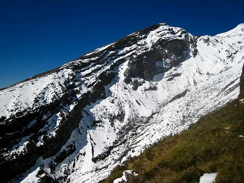
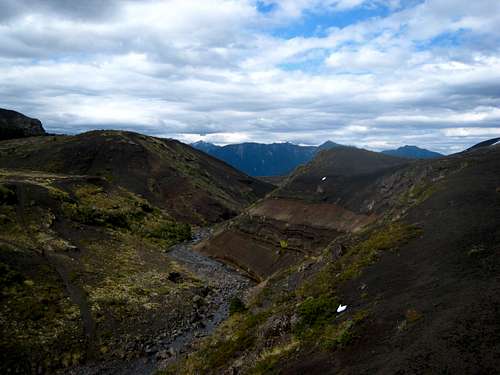
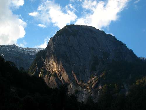
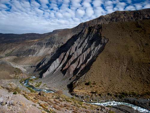
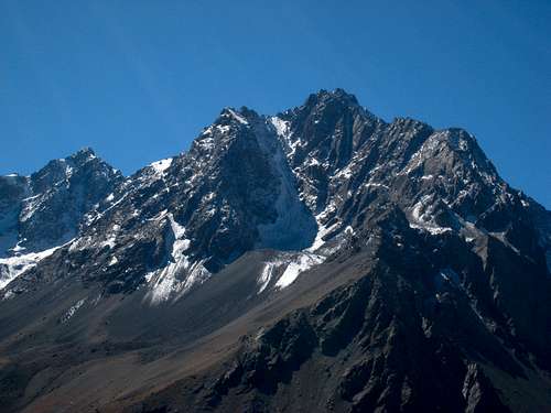
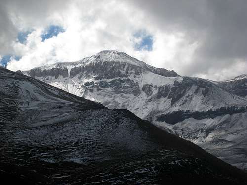
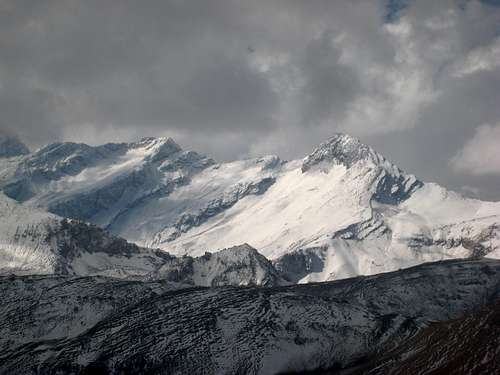
The next morning, we started up the trail as it weaved through very dense forest. There were not as many large trees like I expected but many shorter bushes and small trees. It was so thick though, the direct sunlight wasn't able to penetrate through. It wasn't until we got to about 2,900 feet in elevation the forest began to thin out and we could begin to see the upper part of the mountain. Just to the left of us was an enormous cliff dropping into a massive chasm cutting the north side of the mountain in half. In this gully, we saw the big waterfall cascading over 100 feet down which started about eye level to us but very quickly descending well below us. We reached treeline at about 3,500 feet and continued hiking up along the prominent ridge guarding the west side of the massive gully. It was easy hiking up grass to 4,400 feet where it turned into very loose scree. Stephan decided to stop here as the rest of the route was covered in a few inches of fresh snow. I decided to go up a little more and I believe I made it to about 4,800 feet. I could have easily summitted but was more than satisfied with the views we had. Calbuco appeared to have at least 8 different peaks surrounding the massive summit area and we were never able to find the highest point from our vantage despite having a good map. We took a nice long break enjoying the views and returned to our tent. We made the scenic hike back to Casa Ko and stayed there for the night.
![Calbuco Volcano]() Our first up close views of Calbuco from near treeline
Our first up close views of Calbuco from near treeline![Calbuco Volcano]() One of the many sub-peaks
One of the many sub-peaks | ![Calbuco]() Looking across the large gully to another sub-peak
Looking across the large gully to another sub-peak | ![Osorno from Calbuco]() Osorno and nearby mountains from Calbuco
Osorno and nearby mountains from Calbuco |
Part 2 - Hiking around Osorno
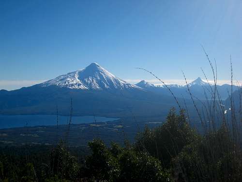
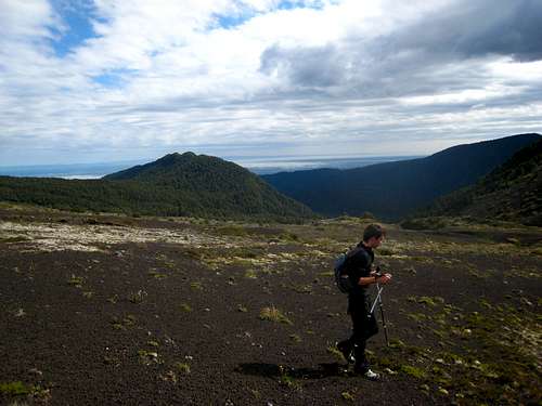
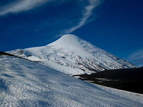
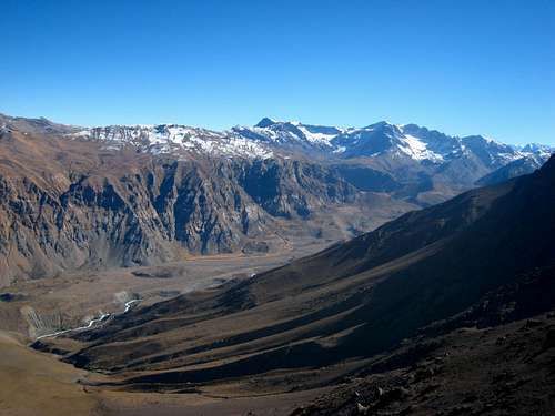
We returned to Puerto Veras and explored the town a bit more and met a bunch of awesome people. We still had my rental car another day and due to Stephan having his ice axe taken at airport security, we were not able to climb Osorno Volcano but we were able to drive around to its north side on a long gravel road that began off the paved highway on the east side of Lago Llanquihue. The car made it up nicely and the end of the road had a small hut that appeared to be occupied at least for part of the year. There was a locked gate guarding the 4WD road that continued further. We assumed jeep companies used this road for tourists at times but it also made for a nice trail. We didn't really have an exact destination but thought we would just wander and see how far we could get towards Cerro La Picada, a smaller peak just northeast of Osorno.
We quickly rose above the trees and started walking on an eerie moonscape of dark volcanic rocks. We reached a broad saddle separating Osorno and Cerro La Picada fairly quickly however due to the low clouds the summit of Osorno was hidden. I was hoping to scout a route on the north side of Osorno to bypass the red tape of the standard south side route for the future but the clouds obstructed the final 1500 feet or so. We continued hiking up towards La Picada and reached an awesome overlook where Lago Todos Los Santos was visible below us and a large section of mountainous terrain to the west that reminded me very much of the North Cascades. I felt right at home here!
![Lago Todos Los Santos]() Lago Todos Los Santos and rugged peaks from our final viewpoint
Lago Todos Los Santos and rugged peaks from our final viewpoint![Views around Osorno]() Views around Osorno
Views around Osorno | ![Cerro La Picada]() Cerro La Picada
Cerro La Picada | ![Hiking near Osorno]() Interesting moonscape around the slopes of Osorno
Interesting moonscape around the slopes of Osorno |
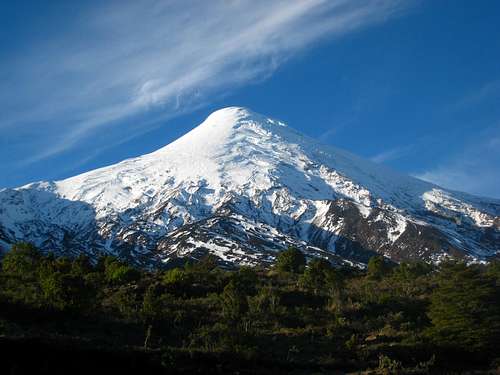
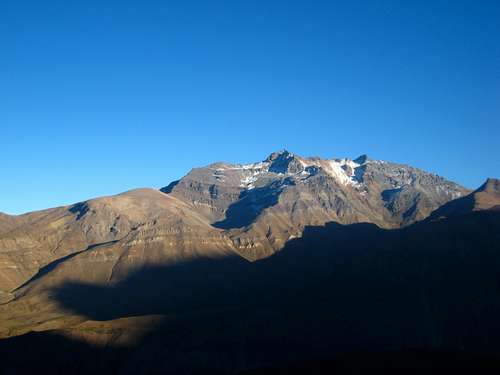
We returned to the car and decided we should drive up to the ski club on the south side of the mountain. So we drove back to Lago Llanquihue and made the very steep and windy drive up the crazy paved road to the ski club. At one point, the road was so steep, the standard transmission car we had would not go from a stop! We had to back down a hundred feet or so to a flat spot to get started again. The ski area is quite amazing actually as the lifts can take you about 70% of the way up the mountain making the climb very easy from the top of the lifts as long as the officials don't have the summit closed. Since it was very late in the season in April, we weren't able to summit (although I knew for a fact I could have). Oh well, next time!
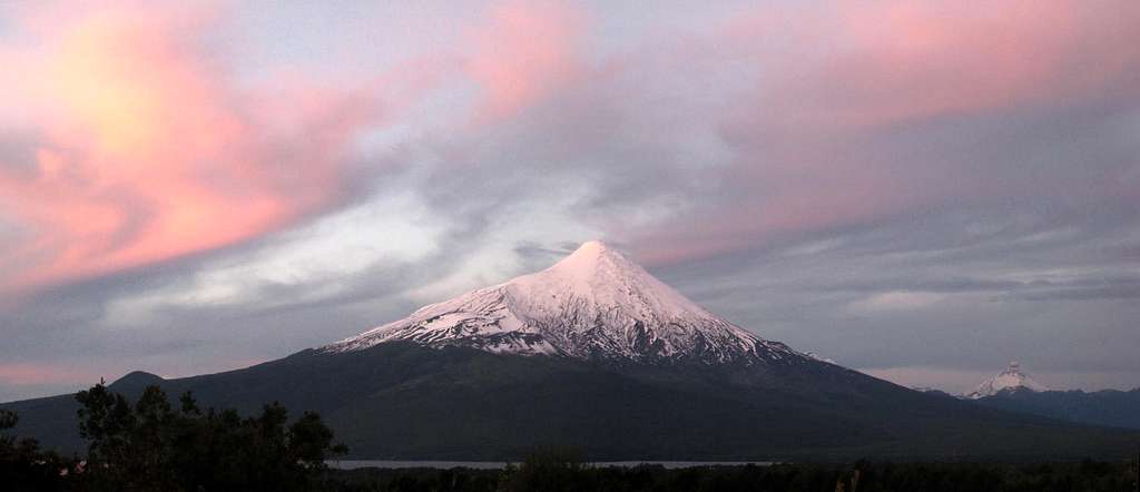
Views from the parking area were incredible and we walked around for a bit to get another view of Lago Todos Los Santos as the sun was coming back out for the afternoon. Calbuco was glowing across the lake and made for incredible scenery. We were also able to see exactly where we had been a couple days prior and was finally able to locate the highest point on Calbuco. The time came when we had to head back to Puerto Veras since the rental car was due back at 6pm so we drove back, returned the car and had a great dinner at Cassi's Resturant located right on the lake. I highly recommend this place for lunch or dinner!
![Osorno Volcano]() Osorno Volcano from the ski club road
Osorno Volcano from the ski club road | ![Patagonian Andes]() View east to the Patagonian Andes
View east to the Patagonian Andes | ![Osorno Volcano]() Osorno Volcano from the base of the ski lifts
Osorno Volcano from the base of the ski lifts |
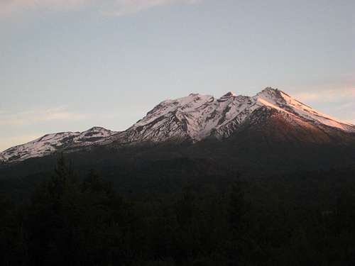
![Sunset on Osorno]() Sunset on Osorno from the highway
Sunset on Osorno from the highwayPart 3 - Cochamo Valley
The next couple days it decided to rain once again so we stayed in Puerto Veras and mingled around town meeting with other travelers. We met quite a few Germans one of which we kept running into over the course of a few days. Once the weather forecast improved, we knew exactly where we were headed next. While I was doing my research before leaving for the trip, I discovered Cochamo Valley. I then realized it was only a two hour bus ride from Puerto Veras. I don't remember which morning it was but we loaded up on the daily bus that heads all the way to Cochamo and beyond. It was a long charter type bus so the ride was much nicer than the Collectivio buses common to the area. I believe it was only 4,000 Pesos per person ($8). We continued past Ensenada and hit gravel roads shortly after.
I was downright shocked that a charter bus went down this road which wasn't anything more than a one lane gravel road with massive cliffs on one side and the Fjord on the other. The road followed the coast for many miles and finally reached the town of Cochamo with no more than a couple hundred people. We didn't get off the bus here but continued another few miles to the bridge over the Cochamo River where it dumps into the fjord. We got off here and walked the 5 kilometer gravel road to the actual trailhead.
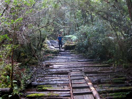
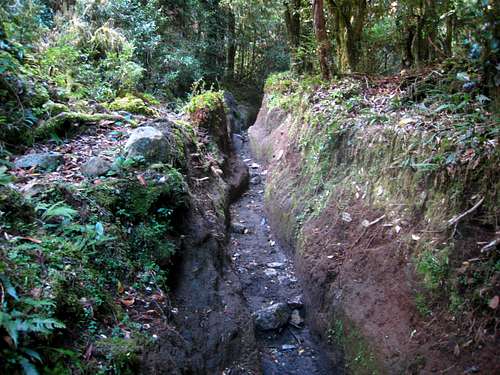
A nice family living in a small hut at the trailhead had bread, jelly and tea that we had before continuing up the trail. At about 1pm we started up the trail as it followed the left side of the pristine river. From the trailhead it was 8 more kilometers (13 total from the bus stop) to the large meadow where everyone camps, known as La Junta. The trail was both awful and bazaar as it suffered from the worst trail erosion I have ever seen. Many places the trail was a 6-8 foot canyon only a couple feet wide. We assumed the horses were responsible for this. Parts of it were boardwalked but not nearly enough. The entire way was very muddy and we ended up probably doubling the distance weaving around muddy sections and avoiding the chasms. The forest was dense and the trees were nothing like what's found in the US. None of the trees were very tall but they were very leafy and made the forest dark.
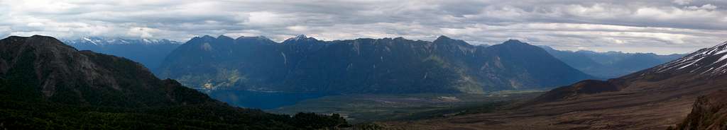
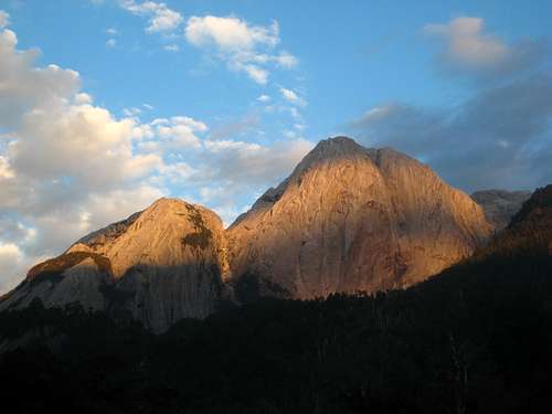
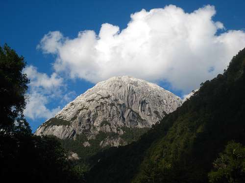
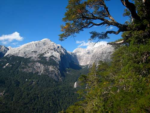
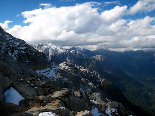
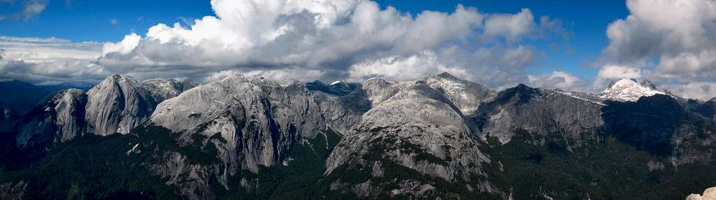
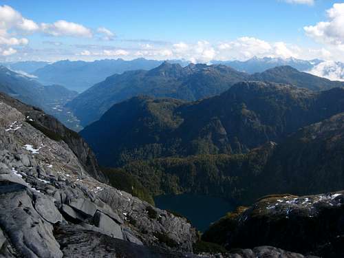
A mile or so before La Junta, we got a small clearing and I was able to see a large granite dome in the distance. I was awe struck at this first sight no doubt. I got my first glimpse as to why this is such a great alpine climbing area. Much like Yosemite, the Cochamo Valley is probably one of, if not the best granite bigwall climbing destination in the world but no one knows about it! An hour before sunset we arrived at the large meadow and found a nice place to pitch the tent. Only a few other parties were here. Only a month earlier this place would have been filled with climbers from all over the world but we felt surprisingly alone. Both of the hostels had closed and the owners left for the winter, allowing us to be able to camp for free. Normally it's 2,000 Pesos per night I believe. Below are the photos from the hike in and that sunset from La Junta at only 800 feet elevation. The surrounding domes rose to over 6,000 feet! Many of them had names. Cerro Trinidad and Arco Iris are probably the two most known.
![Entering Cochamo Valley]() Looking up Cochamo Valley from the bus stop
Looking up Cochamo Valley from the bus stop | ![Cochamo Valley]() Cochamo Valley Trail
Cochamo Valley Trail | ![Boardwalk trail]() Boardwalk trail
Boardwalk trail |
![Cerro Trinidad]() Sunset Light on Cerro Trinidad
Sunset Light on Cerro Trinidad | ![First view of the granite domes]() First view of the granite domes from the trail
First view of the granite domes from the trail | ![Arco Iris]() Arco Iris seen from our camp
Arco Iris seen from our camp |
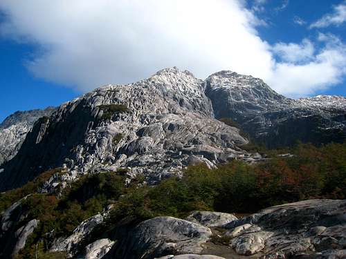
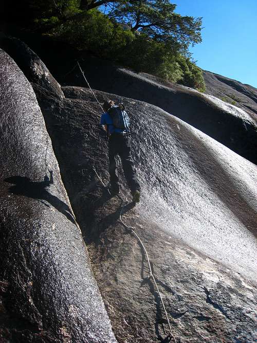
We woke early the next morning and decided we would take the steep trail up Arco Iris. It's really the only way to hike to the summit of one of the surrounding domes without intense bushwhacking and/or rock climbing. That being said, this route isn't a "hike" it was more of a stiff scramble only made possible due to hand lines bolted into the slabs in a few places. It was a great way to get up above the trees and view some of the most beautiful mountains in the world.
From the large meadow, signs pointed to the start of the Arco Iris Route and as soon as we entered the trees the trail got steep, and never let up! After nearly an hour we got to a clearing where some steep slabs below us reduced the amount of trees. Here, we could see head on, the granite walls across the valley. Just beyond the first clearing the trail traversed right and we scrambled up a series of very steep slabs utilizing hand lines that at times we need to weight with at least half our weight. Some of them looked questionable at best and in a couple spots, had they broke it would have been a death fall!
The most exposed part was a hand line drooping down a 25 foot near vertical slab with a large tree at its base that we basically needed to climb, then scramble up roots and such to get up, all while dripping with water and everything you touch being drenched! Once we finished the last hand line, the terrain eased up and we located a nice trail once again as the slope eased and we emerged onto a ridge. We reached treeline at about 4,000 feet on a nice granite bench surrounded by similar alpine plants I am familiar with in the Cascades. Stephan decided to call it a day here and agreed to wait for me as I continued on to the summit. The views even from this point were some of the best views I had ever seen but what I saw higher up really cemented as the best views I have ever seen.
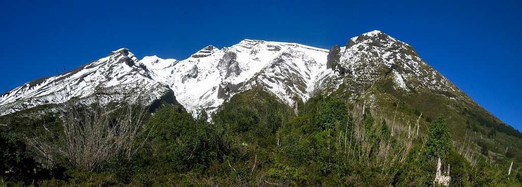
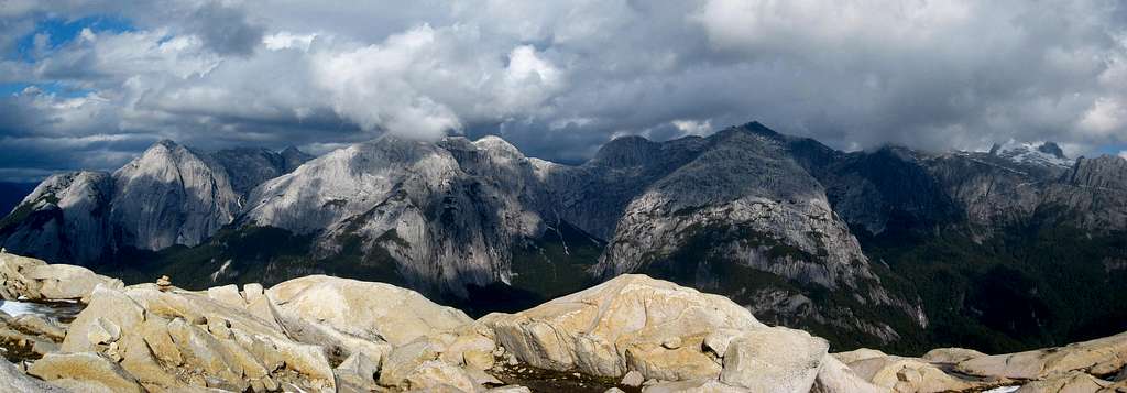
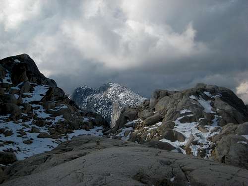
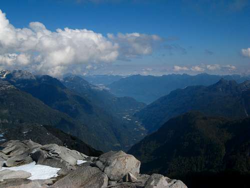
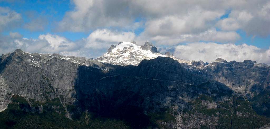
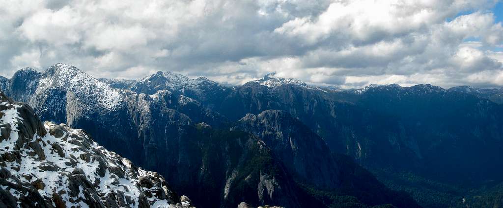
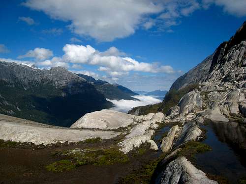
The trail had ended but cairns marked the path up the now low angle granite slabs and ledges. It was amazing how much the terrain eased up once we got above the cliffs guarding the lower valley. Granite domes could be seen in every direction rising over 5,000 feet above the valley floor! The weather was also perfect with just the right amount of clouds to make it perfect. Off to the east the clouds were rolling in over the Andes along the Chile/Argentina Border then dissipating as they moved west where I was located. Since the elevations were low, I was able to very quickly gain another 1,000 feet and reach the base of the summit block, guarded by one more cliff of decent size. At this point, a few inches of fresh fall snow covered the granite slabs and talus. I was able to simply drink the meltoff to stay hydrated.
![La Paloma]() La Paloma - one of the popular bigwalls
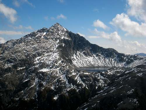
La Paloma - one of the popular bigwallsI followed the cairns as the route traversed horizontally westward to reach a weakness in the final cliff band. Some class 3 scrambling got me above, and then I began traversing snow covered ledges back to the east. In some spots the ledges were both narrow and sloping so I had to be very careful as 100-200 foot drops greeted me on the south side. I finally reached the ridge-crest a little south of the summit and was so awe struck at the views I was unable to move. I got my first clear view to the west and saw an untouched, raw alpine lake at 4,760 feet just below a pyramid shaped peak rising to about 5,550 feet! Such a low elevation for glacial tarns if you ask me.
I stood on the crest of the ridge for at least an hour just looking around. Even writing this now, I still can't get over the mountains I saw, and to top things off, a huge Condor was flying maybe just 50 feet above me for quite a while. I can safely say that Condors are the only birds I actually enjoy watching. Hovering above me in the wind almost wondering what the heck I was doing up there!
I was so satisfied with what I had seen I almost turned back but knowing I hadn't summitted anything on the trip yet, I mustered up the will to continue and finish the route to the top. It only took 20 more minutes and a little more class 3 scrambling to reach the top and I am glad I did! I saw a perfect 360 degree view and for the first time in my life, I was absolutely blown away by the view in every direction. The only place I had ever come close to feeling this way was in the North Cascades. I kept telling myself Patagonia is like the North Cascades on 5 levels of steroids!
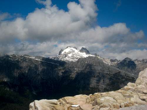
I stood on the summit for perhaps another half hour shooting photos and just exploring what I was looking at for potential climbs and other adventures. One peak off to the south which rose to over 6,000 feet really caught my attention. Arco Iris only tops out at 5,450 feet. It reminded me of Mount Logan in the North Cascades but even harder to access. Every approach I tried to find looked like days of bushwhacking. Hundreds of peaks surrounded me and I could easily imagine many of them have countless first ascent opportunities and maybe even possible first ascents of various peaks themselves! Enjoy the photos below as they depict the best views of my life to that point, rivaled only by the views I saw in the Cordillera Blanca only a few months after this trip. See that trip report here!
![Hiking up the Arco Iris trail]() Hiking up the Arco Iris trail
Hiking up the Arco Iris trail | ![Unnamed peak above Cochamo Valley]() Unnamed 6,000 foot peak above Cochamo Valley
Unnamed 6,000 foot peak above Cochamo Valley | ![Sunrise at La Junta]() Sunrise on Arco Iris from La Junta
Sunrise on Arco Iris from La Junta |
![Cochamo Valley]() Cochamo Valley from treeline on the granite bench at 4,000 feet
Cochamo Valley from treeline on the granite bench at 4,000 feet![Looking down Cochamo Valley]() Looking down Cochamo Valley from the top of Arco Iris
Looking down Cochamo Valley from the top of Arco Iris | ![Unnamed Peak and lake]() Unnamed peak and lake just to the west
Unnamed peak and lake just to the west | ![Cochamo Valley]() Another unnamed lake seen from Arco Iris
Another unnamed lake seen from Arco Iris |
![Cochamo Valley]() Unnamed 6,000 foot peak I want to climb!
Unnamed 6,000 foot peak I want to climb!![Cochamo Valley]() View east from the route up Arco Iris
View east from the route up Arco Iris![Hand lining down a steep slab]() This is a hand line...not a rappel!
This is a hand line...not a rappel! | ![View from La Junta meadow]() View from the meadow at La Junta
View from the meadow at La Junta | ![The deep chasms in the trail]() Deep chasms in the trail
Deep chasms in the trail |
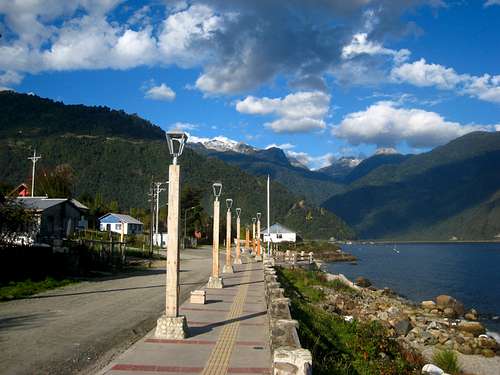
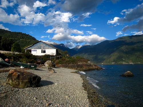
I think it was around 2pm when I decided to leave the summit. It didn't take me long to get back to treeline and meet Stephan and we made our way back to the meadow on the valley floor. It was just before sunset when we reached the tent and the small hut at the center of the meadow made for a great place to cook dinner and relax by a small campfire. The next morning we packed up and hiked out. The weather was still nice and when we got back to the trailhead, the nice guys in the hut took us back to Cochamo so we didn't have to walk the extra 5 kilometers but they did charge is 5,000 Pesos ($10). Once back in Cochamo, we chose one of the many small homes that offer a place to stay for travelers. I was surprised that so many people, even families with kids would openly allow complete strangers into their home. They let us shower and mingle around the yard making us feel very welcome. That afternoon we walked around the small town and along the beach. The lighting was fantastic for more nice photos. With so many fresh water rivers draining into the fjord, the water had very little salt in it making it a fantastic place to fish for salmon. Many people in Cochamo did this for a living and the salmon dinner we had that night was one of the best I have ever eaten, although it cost the equivalent of $25!
![Cochamo]() Beach in Cochamo
Beach in Cochamo
![Mountains around Cochamo]() Nice beach in Cochamo
Nice beach in Cochamo | ![Volcano Yates]() Volcano Yates across the fjord from Cochamo
Volcano Yates across the fjord from Cochamo
![Small houses in Cochamo]() Small houses in Cochamo
Small houses in Cochamo | ![Mountains from the town of Cochamo]() Mountains from the town of Cochamo
Mountains from the town of Cochamo
![Cochamo Valley]() And... one more to fill this space
And... one more to fill this space |
Part 4 - Santiago and a taste of the High Andes
Well the time had come for Stephan to head back to the US so after we took the bus back to Puerto Veras the next morning, I dropped him off at the airport in Puerto Montt and bought a bus ticket from Puerto Veras to Santiago since the weather was going to turn sour once again. Heading north would allow me to both explore a new area a little bit and stay under nice skies. I took the 12 hour night bus to Santiago and actually managed to get some sleep. The long distance charter bus companies really have comfortable bus seats. Upon arriving at the Santiago bus depot, I took the subway to the central bus station to finally catch the bus to the Santiago International Airport. Not knowing any Spanish made this whole ordeal a tough experience. And may I add, the subway system in Santiago is incredible. I would easily say twice as efficient as any in the US.
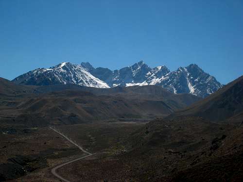
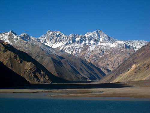
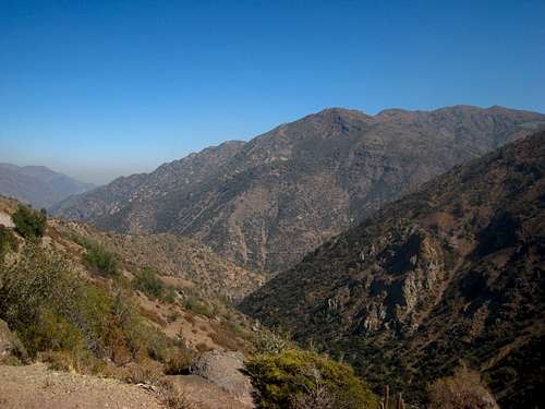
Once at the airport, I arranged for a rental car. We agreed on $55/day for a 4 day period and so began the task of driving through Santiago. Luckily it isn't as crazy as in Mexico or Peru but the road system made no sense. Signage was poor and I ended up going the wrong way on one-way highways more than once! I was trying to get to the La Florida neighborhood on the southeastern part of the city to take the road to San Jose de Maipo. I was recommended to this area by the owner of the climbing shops in Puerto Veras. I managed to get all the way to the nice town and as I drove up the valley, I noticed this part of Chile is considerably drier and the mountauins reminded me of Colorado!
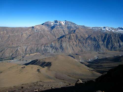
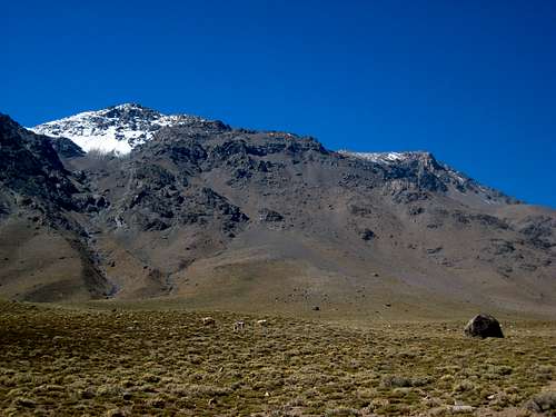
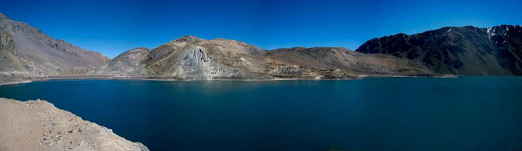
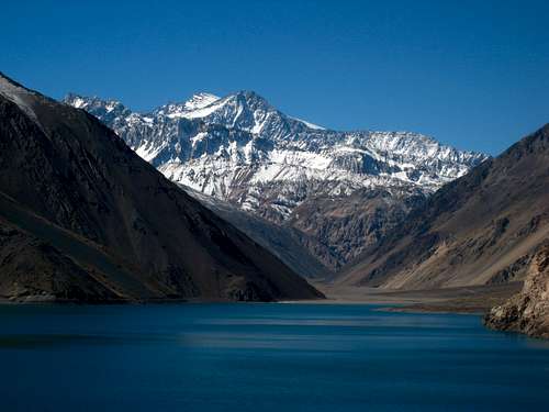
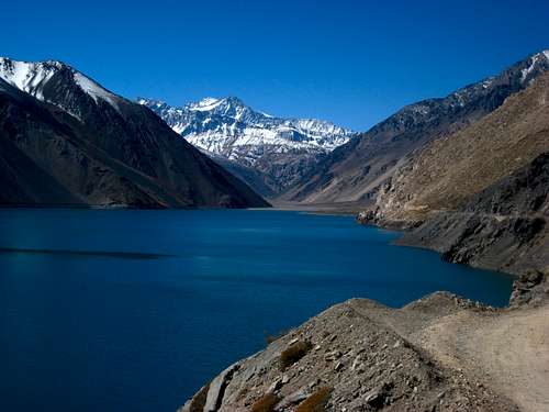
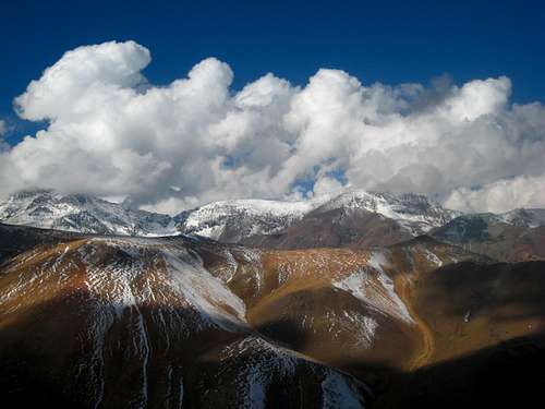
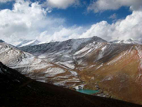
I continued up a fairly nice gravel road along Rio Yeso which took me to a beautiful high alpine lake (called Embalse El Yeso) surrounded by 14, 15 and 16,000 foot giants. It was getting dark so I set up camp near the lake on some less than desirable rocks for the night. I was all alone, only 30 miles or so from a city of 10 million people. The next morning brought crystal clear skies and since it was a Saturday, people started coming up in the droves! I was amazed at the beauty of the lake. Even though it was man made, it had a distinct alpine feel. I had a brief route description for Cerro San Francisco which can be climbed from this gravel road starting just above the switchbacks about halfway up to the lake from the paved road to the south. I drove down and parked along the road and began hiking completely off trail up towards a broad grass covered plateau on the west slopes of Cerro San Francisco at 7,800 feet. It was only 1,400 feet of gain to reach this large plateau that was covered with grazing goats, cows and horses!
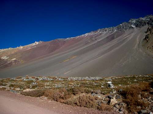
I hiked upwards on the slowly steepening slopes and began to become confused as to where to head up when the grassy plateau steepened into what looked like steep, awful talus and somewhat solid rocky buttresses. I began to veer rightward (south) to get to a slope that didn't look as bad and at first the talus was fairly solid. However I cut back left too soon and missed entering a small valley that would have given me an easy path to the south ridge of Cerro San Francisco where Class 3 scrambling on the ridge would take me to the summit. I instead found myself on the awful talus and at about 11,400 feet, after 5,000 feet of gain I decided to turn around. I hadn't been at higher elevations in a while and was feeling it a little, plus I was alone and it was already past noon. I did get some fantastic views of this attempt though. The mountains were eerily similar to Colorado, just a little higher.
I was quickly able to scree slide down back to the grassy plateau and get a better look at where I was and where I should have gone to have a better chance of topping out. The route description here on SP for this peak was very vague and even to this day I am not completely sure what route is best. Returning to the car I ran into a group of locals who came up on ATV's and gave me a funny look wondering why I was walking down from somewhere high above the road. Unfortunately I wasn't able to speak to them and I was getting tired of having literally no communication with anyone other than "No Habla Espanol" for the 3rd day by this point.
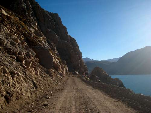
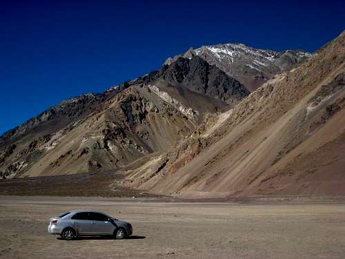
After returning to the car I returned to the lake and realized the road actually continued along the south shore of the lake! It was even in good enough condition to take my small Toyota rental car on so I drove to the upper end where a large area of dry mud flats made for a much more comfortable place to camp for the night. This area, covering at least a square mile is typically covered by the lake but since it was mid-April (equal to mid-October in the US) it was the driest time of year for this area and all the lakes were low and the only snow was the fresh dusting that fell a few days prior. I ended up meeting a nice group of friends from Santiago who came up for the day to have a BBQ. A few of them spoke English as well and I had a nice conversation with them. They were nice enough to share the meat they were cooking up as well. Some interesting types of sausage that looked disgusting but actually tasted great. Below are the photos from my Cerro San Francisco attempt and others of the lake at the headwaters of Rio Yeso.
![Rio Yeso]() Rio Yeso from the slopes just above the road
Rio Yeso from the slopes just above the road
![The Andes]() Morning Light on the The Andes
Morning Light on the The Andes | ![Mountains at the head of the Rio Yeso valley]() View up the Rio Yeso Valley
View up the Rio Yeso Valley
![Grassy plateau]() Hiking up the east slopes
Hiking up the east slopes | ![Sunrise on the Andes]() Sunrise on the Andes
Sunrise on the Andes
![Rio Yeso Valley]() Rio Yeso Valley
Rio Yeso Valley |
![On the grassy plateau]() Looking up at the east slopes of Cerro San Francisco
Looking up at the east slopes of Cerro San Francisco![Rio Yeso headwaters]() Embalse El Yeso Panorama
Embalse El Yeso Panorama
![Peak I don't know the name of]() Peak I don't know the name of
Peak I don't know the name of
![The Andes]() The Andes above Embalse El Yeso
The Andes above Embalse El Yeso | ![Road along Embalse El Yeso]() Road along Embalse El Yeso
Road along Embalse El Yeso
![Embalse El Yeso]() Embalse El Yeso
Embalse El Yeso | ![Embalse El Yeso]() Embalse El Yeso
Embalse El Yeso
![My rental car]() My rental car parked on the dry mud flats
My rental car parked on the dry mud flats |
![Awful Andes Talus]() Awful Andes Talus. It is not to be messed with!
Awful Andes Talus. It is not to be messed with!After a nice afternoon relaxing along the lake enjoying the views of the surrounding peaks covered in a dusting of fresh fall snow, I drove back down the gravel road and found a nice spot to camp on a nice flat area between the road and the river below. The next morning I went back to Santiago where I then proceeded to once again get lost over and over again. The one thing that really pissed me off is that if you exit off one of the freeways, you cannot get back on! Only a small handful of the exits let you back on easily. Otherwise you are stuck on the maze of surface streets. Costanera Norte in particular was an awesome road to drive on once you get on it, but once you are off it, good luck! I was trying to get to the neighborhood of Farellones on the northeast corner of the city. After getting turned around on various roads that didn't go where I thought, and taking directions from people I didn't understand, I finally found the correct road that leads all the way up to the ski resorts for Santiago.
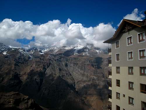
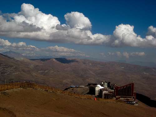
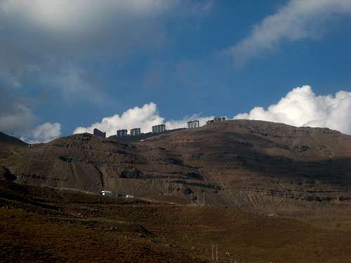
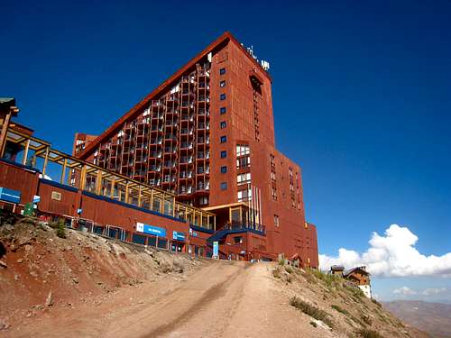
Now this road was a real treat. I think I counted like 65 switchbacks as the road climbed very steeply all the way to 9,000 feet where it reached La Parva, the first of three large ski resorts. It was easy to tell they were all getting prepared for the winter season. Just a mile or so further is El Colorado which is another smaller resort right next to La Parva. I stopped for a couple photos here and continued all the way to the highest resort called Valle Nevado which sits at 10,000 feet. I parked at the end of the road which ended at two enormous hotels! These were some of the most incredible man made structures I have ever seen! 20-30 story, 5 star hotels were built into the mountain at 10,000 feet! Crazy.
I wanted to get a view of Cerro El Plomo, an 18,000 foot mountain off to the north that is a fairly easy climb in the right season. At the hotels, small amount of fresh snow was scattered around in shady areas but as I began hiking up the ski runs, the air began to really become chilly and more snow was found. People were working with heavy equipment all around on the lower areas of the resort getting ready for the season. It was a mostly sunny day and I saw at least 10 condors flying around. I hiked up to the top of the highest lift following mostly roads where I was finally able to get a view of El Plomo. It's huge.
I continued north a little more and realized that all 3 resorts are all connected! One can easily ski around at the upper most areas and utilize ski lifts starting at any of the three bases. Taking this into account, this was easily the largest ski area I have ever seen and at least twice as big as any in the US. I didn't realize so many people in Latin America skid!
At about 12,500 feet I turned around as there were some very dark clouds rolling in. Actually, right as I got within a half-mile of the hotel, clouds enveloped the hill I had just been standing on. I didn't see a single person anywhere above 11,000 feet. Once back at the hotel parking area (which was very small compared to the hotel...I wondered how everyone parks), I made the drive back down the switchbacks and into Santiago, where I splurged with another nice meal at a pizza parlor. The server also spoke English which was nice. I need to learn Spanish though. I then proceeded to spend most of the night driving through Santiago helplessly lost and unable to navigate in the dark. I roamed around for at least a couple hours trying to find any familiar streets. The map I had of the city only labeled major roads and freeways. I eventually just gave up, parked and fell asleep in the car. Below are the photos I took while hiking around the ski resorts.
![This is the view from Valle Nevado]() This is the view from Valle Nevado
This is the view from Valle Nevado
![Supermassive Hotels]() Looking down on Supermassive Hotels
Looking down on Supermassive Hotels
![The Andes]() The Andes
The Andes | ![Supermassive Hotels]() Supermassive Hotels
Supermassive Hotels
![Cerro El Plomo]() Cerro El Plomo
Cerro El Plomo
![Small tarn from the top of the ski areas]() Small tarn from the top of the ski areas
Small tarn from the top of the ski areas | ![Supermassive Hotels]() Supermassive Hotels
Supermassive Hotels
![El Plomo]() Cerro El Plomo
Cerro El Plomo
![View from the switchback road]() View from the switchbacking road
View from the switchbacking road |
The next morning, I tried to ask for directions to the airport where I could return the rental car. I was able to locate the way with some Spanglish speaking and finally found Costanera Norte which I was able to follow west to the airport, which is located on the northwest corner of the city. I returned the car and took the bus back to Central Station. Now this part of the trip was stupid but I had no choice. Since my flight left from Puerto Montt, I had to buy a return 12 hour bus ticket back to Puerto Montt (they are only $20!), then wait 6 hours the next morning, catch my flight from Puerto Montt BACK to Santiago, then wait another 4 hours for my flight from Santiago to Dallas. I eventually arrived in Dallas around 10am the NEXT day and then had one more flight to Seattle which was nice since we flew right over the snow covered Colorado Rockies but I sat next to a guy who was sick, and when I arrived back home in WA, I was sick for the next week!
All in all though this was a great trip to get my feet wet and I cannot wait to go back!


Comments
Post a Comment