
-
 9178 Hits
-
 71.06% Score
-
 1 Votes
|
|
Route |
|---|---|
|
|
Hike and Scramble |
|
|
One to two days |
|
|
Scramble |
|
|
Approach
Please see the main page for the general "Getting There" data. Since this trekking trail traverses the heart of the Lienz Dolomites there are two possible trailheads.
You reach the western trailhead from the city of Lienz by going south to Tristach, where the "Dolomitenstrasse" the road into the Lienz Dolomites starts. It is marked by signposts. Follow this road (toll!!) until you reach Lienzer Dolomitenhütte.
The eastern trailhead is at Unholdenalm to the east of Hochstadel. It can be reached by the town of Oberdrauburg by going west to Oberpirkach and from there along a forest road towards Unholdenalm. Most of the trekkers, however, already start their hike from Oberpirkach along a footpath which cuts short the bends in the forest road.
General Overview
- Start altitude: 1616m Lienzer Dolomiten Hütte / 1780m Unholdenalm
- highest point: Laserz Törl 2497m
- Prevailing exposition: E and W
- Type: 30min over forest roads, 9h over paths
- Protection: marked
Arguably this is the most beautiful trail in the Lienz Dolomites. It runs along Three passes, Laserztörl, Kuhleitentörl and Baumgartentörl. You can hike the trail in a long day but most of the time the trail is done in three days. Day one takes you from the Drau River Valley floor to Lienzer Dolomiten Hütte or (better) Karlsbader Hütte. On day two you cross over to Unholdenalm with a summit traverse of Hochstadel and on day three you hike back down to the Drau River.
The descriptions are given from west to east.
Lienzer Dolomiten Hütte - Laserz Törl
Follow the forest road along the Laserzbach Valley. At a chapel near Insteinhütte you can decide on leaving the road and hike up a short cutting footpath or remain on the road with all its bends. Both lead through Laserzbach Valley with Bloßkofel and Gamswiesenspitzen to the west and Laserzwand to the east. In the end they reach Karlsbader Hütte after 2h 30min.
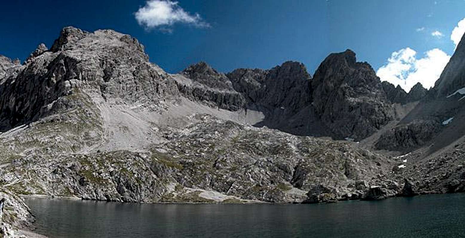
Take a rest here on the shore of the beautifully located Laserz Lake. The trail follows the western shore steeply but easily climbing towards Laserz Törl. Here you are awarded with a close-up view of the impressive Hochstadel north face.
 |  |  |
Laserz Törl - Unholden Alm
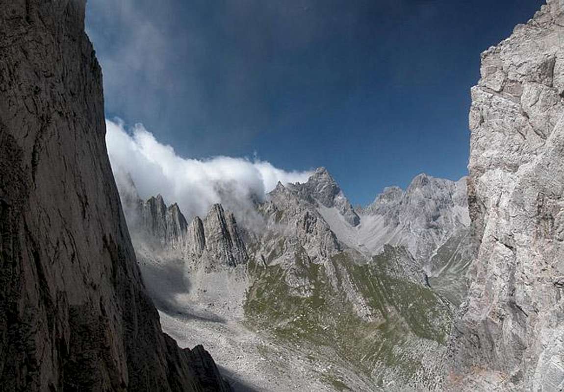
From Laserz Törl the path first descends steeply into the upper Frauenbach Valley. The trail is not secured and runs along scree covered rocks so pay close attention. Once in the valley, at Lavanter Alm, a trail turns off to the south, ultimately heading for Böses Weibele and Riebenkofel. Instead you have to go straight on on a very steep ascend to Kuhleitentörl. The trail circles Schwarza before reaching the pass.
The next part of the traverse is a long and beautiful ridge crossing in the general direction of Hochstadel (north-east). You reach Baumgartentörl after 45 min and after another hour get to the intersection where the Hochstadel ascent along Schneeklamml starts. See the Schneeklamml Route on the Hochstadel page for more info. If you don't want to climb the mountain, Drei Törl Weg turns to the south-east through the Badstüblkar Cirque before it turns northward again to reach Unholdenalm.
 |  |  |  |
Essential Gear
Hiking gear is sufficient.