|
|
Route |
|---|---|
|
|
40.75320°N / 110.3592°W |
|
|
LONG hike/scramble |
|
|
A few days |
|
|
Up to Class 3+, but most of the ridge is Class 2+ |
|
|
Approach
First drive to the town of Duchesne, which is along US Highway 40. From Duchesne, turn north onto State Highway 87. Follow State Highway 87 until it joins with State Highway 134 (this is where state Highway 87 heads due east instead of continuing north) between milepost 15 and 16. Follow State Highway 134 north to the little town of Mountain Home. Where State Highway 134 begins to head due east at Mountain Home, Continue north on the Moon Lake Road. After five miles, turn east on the Yellowstone River Road and to the Yellowstone River Power Plant. From the Yellowstone River Power Plant, drive north along the Yellowstone River Road to the first major road heading east (right). With a map in hand, follow this gravel road east to Dry Gulch. From Dry Gulch, turn left and follow the road north through Dry Gulch to its end.Click for captions and full size:
Route Description
This route is very seldom used and the trails marked on the map bear no resemblance to reality. The area has several long faded trails and a few old logging roads, but no marked trails. There is no guidebook/website to check current conditions or for more information on the route, and the Forest Service doesn't know anything about the trails or routes here. To complicate things, sometime before 1997, a huge storm caused a blow-down of several of the trees around the area south and east of Bollie Lake, which obscured what old trails there were. If you enjoy total solitude and cross-country travel, this is an excellent route. If you are not good with a map and compass, this is not the route for you. The route description will be rather brief as you must be able to route-find on your own to follow the route. A GPS comes in very handy in the forest.There are several possibilities, but I will describe the route we took in mid-August 1997.
From the trailhead at 8800 feet, follow the old track to Heller Lake. Rather than trying to find any of the old trails marked on the map, we found it easier to route-find over into the drainage that is west of Jefferson Park. Just head up the drainage through the forest and meadows to its head and a minor saddle at 10,402 feet. If you can find a good route, the saddle is about 5.5 miles from the trailhead. From the saddle, follow a route west along the trail marked on the 7.5 minute Bollie Lake topo map. The trail is completely covered by fallen trees from a blow-down from a huge storm. The going is pretty tedious because of all the fallen trees. Bollie Lake is reached after 1.8 miles from the minor saddle, but it seems like much longer. The lake is at 10,650 feet elevation and is in a beautiful setting. It makes a really nice base camp.
From the lake, head north to the ridge by any convenient route, and then along the rocky ridge to the Flat Top Benchmark (12,194 feet), where a large cairn is located. This is 2.2 miles from the lake. Mount Emmons summit is reached in another 6 miles along the ridge. You will climb over several highpoints along the way. All are un-named and two are sometimes known as Owl Peak at 12,826 elevation and South Emmons at 13,170 feet elevation.
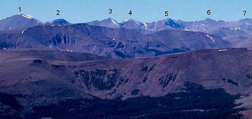
From Mount Emmons, you continue following the main ridge north to Peak 13,068 (“North Emmons”), Peak 13,287 (“Roberts Peak”), Peak 13,247 (“Trail Rider Peak”); Peak 13,387 (“Painter Peak”); South Kings; and Kings Peaks. Most of the ridge is class 2+, but there are a few short class 3 and class 3+ sections.
From the summit of Kings, the easiest way to return is probably by way of the Uinta River Route, but you could return the same way. If you don't have a car shuttle, an old trail heads back to Bollie Lake by way of the Uinta River. I haven't hiked the trail, but my guess is that it is faded away and effected by the blow-down mentioned.
Alternate route to/from Bollie Lake:
From Bollie Lake, we took an alternate route back to the trailhead. We followed the route shown as a trail over the ridge and down to Lily Pad Lakes and down to near Heller Lake. There were scraps of trail down to Lily Pad Lakes, but the trail was totally lost further down beyond the lakes. A compass and map is necessary and a GPS recommended if you wanted to try and follow this route. The very end of the route through the forest was a real test in navigation.
Time Needed For Climb
Most climbers will need 5-6 days to complete the route.Essential Gear
This ridge is very long, and completely above timberline. The weather is the number one concern. Thunderstorms and even summer snowstorms are very common. Bring a good pair of boots, and a pair that won't wear out after many miles of off-trail hiking/climbing. Since this is a multi-day trip, bring full camping gear.Proper gear?


