Overview
Dutchman is an 18.2 mile long trail in the Superstition Mountains east of Phoenix Arizona. It goes deep into the wilderness connecting First Water Trailhead to Peralta Trailhead. I had thought of doing it as a one way day hike but arranging a car shuttle was just too much of a hassle. Alternatively, I decided to combine the western parts of the Dutchman Trail with Bull Pass and Black Mesa Trails to create a manageable day hike. The sources that I had did not give the distances between trail intersections so I did not know how long the hike that I had chosen would turn out to be. I had estimated it to be 12-14 miles.
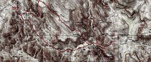
![Map]() Map
MapGetting There
Left our rental home near the Superstition Mountains just before 6 a.m. Drove to Apache Junction and took route 88 a few miles north Past the Lost Dutchman State Park until I saw the sign for First Water Trailhead Road. Turned right on the well graded dirt road that was passable by any car and drove 2.5 miles to the trailhead at the end of the road.
Hike Statistics
Total uphill measurements and all distances are per my GPS
| Place | Elevation | Distance |
| First Water Trailhead | 2280 ft | zero miles |
| Parker Pass | 2630 ft | 2.50 miles |
| Black Mesa Trail Jct | 2300 ft | 1.85 miles |
| Boulder Canyon Creek | 2280 ft | - |
| Bull Pass | 2750 ft | 0.85 miles |
| End of my hike | 2420 ft | 0.70 miles |
| Back to Black Mesa Trail Jct | 2300 ft | 1.55 miles |
| High Point | 2750 ft | - |
| Second Water Trail Jct | 2420 ft | 3.0 miles |
| Back to First Water Trailhead | 2280 ft | 1.80 miles |
| Total | - | 12.25 miles |
| Total vertical uphill | 2050 ft | - |
Trip Report
Tuesday April 2, 2013
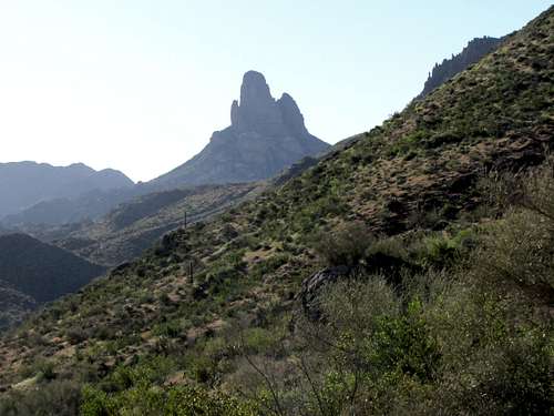
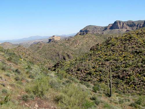
Started my hike at 6:49 a.m. The car’s thermometer had gone down to 41 degrees F but the sun was now up and by the afternoon hours the high reached lower 80s. Headed southeast on Dutchman’s Trail. The 4553 ft Weaver’s Needle was visible in front of me. The early morning sun was behind it making it appear as a black shadow.
![Weavers Needle]() Weavers Needle
Weavers Needle
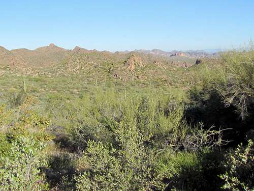
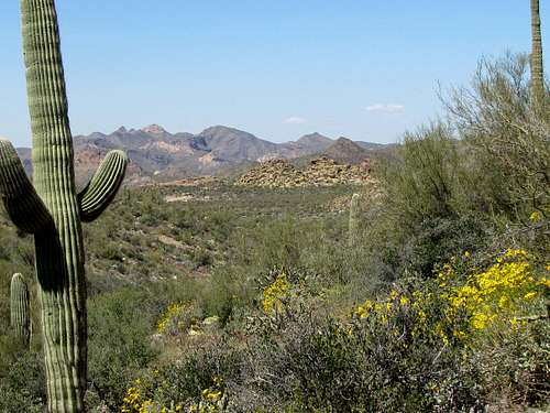
The trail went into the hills going up in elevation slowly. The sun was in my face making me hot already. There were very few saguaro cacti in that area.
After 2.5 miles, at 7:54 a.m. I reached the 2630 ft Parker Pass.
![Looking west from Parker Pass]() Looking west from Parker Pass
Looking west from Parker Pass
The trail then descended on the east side of Parker Pass getting me closer to Weaver’s Needle.
![Weavers Needle]() Weavers Needle
Weavers Needle
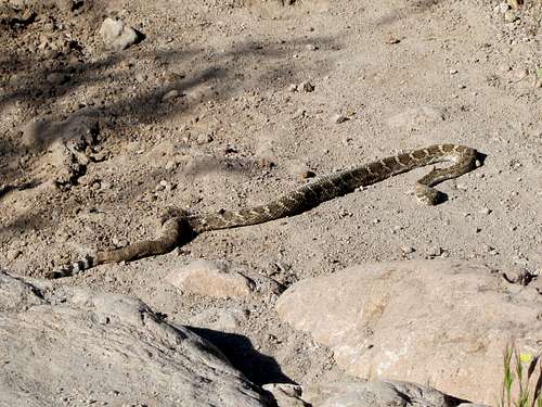
I then noted a snake sun bathing right in the middle of the trail. As I approached, it did not move or make any noise. I was wondering if it was dead. A part of its body appeared swollen. Maybe it had swallowed a large meal and could not move. I did not want to jump over it so I went out of the trail and bypassed it.
At 8:41 a.m., I reached the junction with Black Mesa Trail. I planned to come back here to follow this trail later. For now, I remained on Dutchman’s Trail.
![Junction of Black Mesa & Dutchman Trails]() Junction of Black Mesa Trail
Junction of Black Mesa Trail
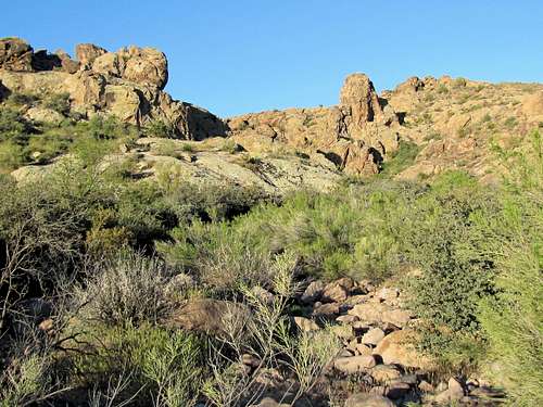
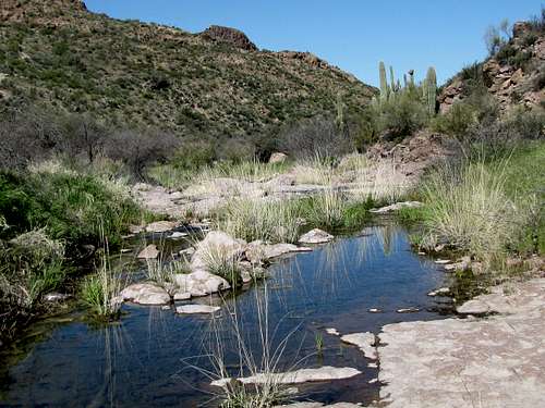
0.2 miles later, I reached the junction of Boulder Canyon Trail and then Bull Pass Trail. I left Dutchman’s and went onto Bull Pass Trail. Had to cross Boulder Canyon Creek which had a little running water in it. I found shade and cool air for a moment.
![Weavers Needle from Boulder Canyon Creek]() Weavers Needle & Boulder Canyon Creek
Weavers Needle & Boulder Canyon Creek
The trail began to go up a hill rather steeply toward Bull pass. It was only a 470 ft vertical climb but the sun felt very intense making me sweat a lot. At 9:11 a.m., I had reached the 2750 ft Bull Pass.
![Looking west from Bull Pass]() Looking west from Bull Pass
Looking west from Bull Pass
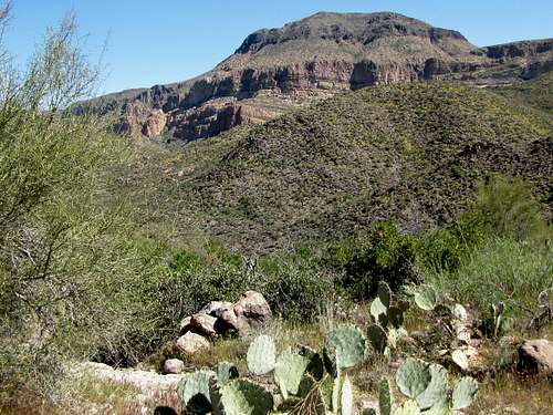
East of the pass, the trail went down slowly. To the north, I had a good view of the 2797 ft Battleship Mountain. Yesterday, I had seen the north face of it from low elevation. It had appeared quite impressive. Now, I was seeing the south face of it from a spot almost as high as its summit. It did not seem so impressive anymore.
![Battleship Mountain]() Battleship Mountain
Battleship Mountain
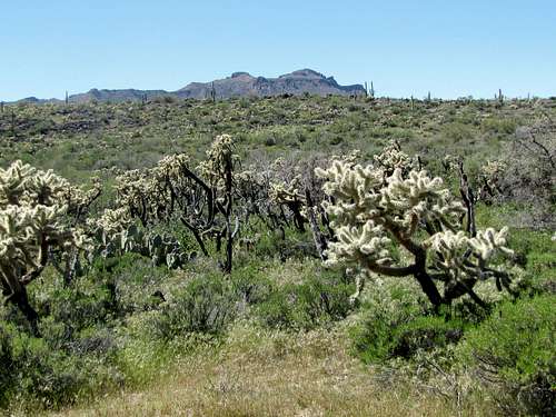
I then reached slopes that were covered by green grass. Saguaro cacti, somehow appeared out of place.
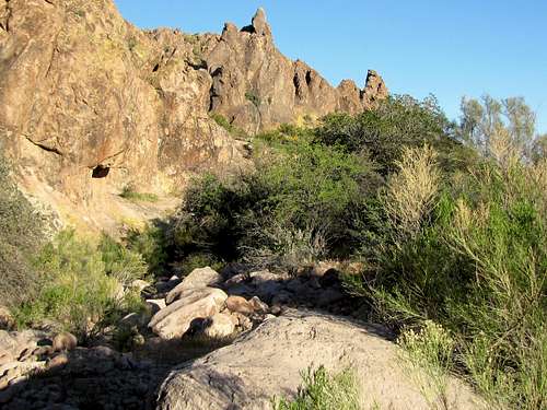
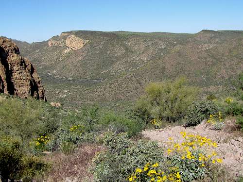
As the trail continued to go downhill, a beautiful valley with a running stream appeared below me. I was wondering if that was Marsh Valley.
I reached the stream at 9:36 a.m. and realized that I was in Needle Canyon. Decided to go no more. Sat there and enjoyed the pretty valley. There was no shade.
![Needle Canyon]() Needle Canyon
Needle Canyon![Needle Canyon]() Needle Canyon
Needle Canyon
Left at 9:53 a.m. and began to walk back up the way I had come toward Bull Pass. Now that the sun was higher, I could see the mountains to the east much better.
Went over the pass and got down into Boulder Canyon again. Weaver’s Needle was back in view. The wall of Palomino Mountain could also be seen.
![Weavers Needle & Palomino Mountain]() Weavers Needle & wall of Palomoni Mountain
Weavers Needle & wall of Palomoni Mountain
At 10:40 a.m., I reached Black Mesa Trail and went on it. The trail went up very steeply at first but then it eased up. I reached a lone hiker. He was the first person I had seen all day.
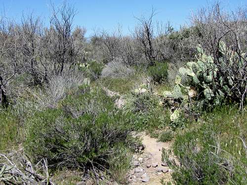
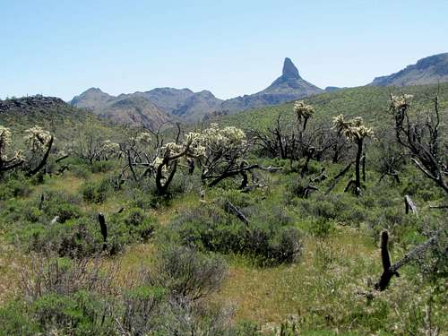
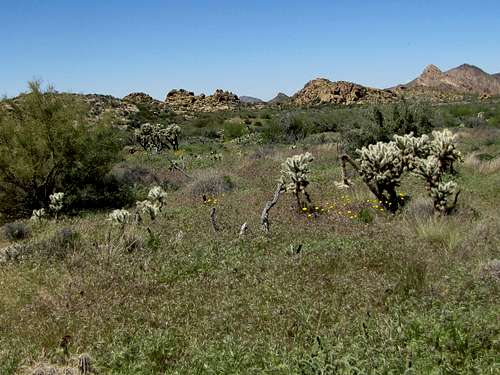
I then reached a plateau that was covered by grass, bushes and Cholla Cacti. That area looked very pretty.
![Weavers Needle]() Weavers Needle
Weavers Needle
I sat there a little to enjoy the views.
The trail reached a broad high point and then began to go down slowly. I now had beautiful views to the northwest. After this, I ran into a few more groups of hikers. In one place, I was trying to get out of the way of a hiker who had brought his dog. Cactus needles went right through my shirt into my arm. I pulled out the big ones but the little ones had to be pulled out later with magnifier and tweezers.
I then reached the junction of Second Water Trail. The next 1.8 miles was a repeat of
part of my hike 2 days ago. Reached the First Water Trailhead at 12:53 p.m. for a total hike of 12.25 miles.
![Four Peaks]() Four Peaks
Four Peaks


Comments
Post a Comment