
-
 1880 Hits
-
 79.78% Score
-
 11 Votes
|
|
Area/Range |
|---|---|
|
|
38.88300°N / 110.455°W |
|
|
Spring, Summer, Fall, Winter |
|
|
4622 ft / 1409 m |
|
|
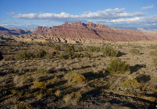
Overview
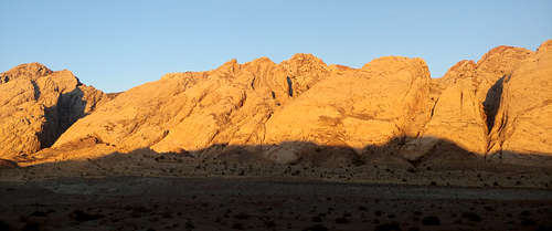
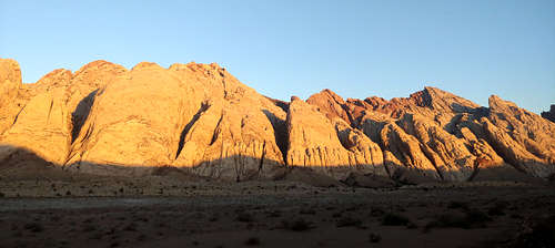
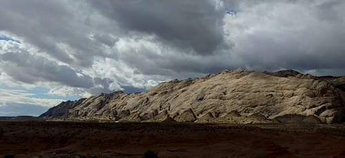
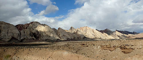
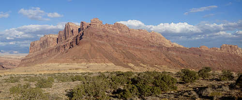
As you drive west from Green River into the San Rafael Swell, you'll see a long, spectacular line of sandstone cliffs and peaks. This is the Eastern Reef (of the San Rafael Reef). The portion south of I-70 contains dozens of long multi-pitch routes. Because these are some of the longest routes in Utah, the area's other name is the Sandstone Alps.
Canyons cut mostly east-west through the Sandstone Alps, and because official names are few and far between out here, on the Mountain Project page they've labeled the crags and canyons alphabetically from north to south (some, like Spotted Wolf Canyon and Three Finger Canyon, do have actual names) and then added the routes found on/in them.
The area is exceptionally beautiful, and even though it's easily visible from the interstate, it gets relatively little traffic. Most seems to come from climbers and canyoneers. There are no established hiking trails. In addition to the beautiful sandstone peaks and canyons out here, you can also find and enjoy ancient petroglyphs (Don't touch!). Three Finger Canyon has some nice ones that are quick and easy to get to from road's end; unfortunately, there's also been some vandalism there.
|
|
As for the climbing, the area has a reputation for soft rock and long runouts, and I can attest to both. I've placed gear that I knew would probably fail in a fall, and I've led 200' pitches on poor rock where I only placed one marginal cam. On another occasion, I set out to rope-solo a 2-pitch 5.4 and placed not a single piece of gear aside from clipping to bolted anchors.
For these reasons, the recommendation by Paul Ross, a climber who did much of the route development and FAs out here, to be solid leading 5.8 or 5.9 even if you're on a 5.6 is probably a good one.
Ross also notes that the rock and pro tend to get better as the grades get harder, and he recommends carrying a hand drill and some angles or bolts in case you get way off-route or too spooked. Because much of the area is now federally designated wilderness, I'm not sure if placing new hardware is allowed, and I encourage you to check with the local BLM office to find out about that.
It's also worth pointing out that Ross and others who established the climbs here placed bolts and anchors from stances on ground-up onsights, adding to the old-school style and feel out here.
Most routes are trad, though there are some sport, some mixed, and some with "sporty" bolting.
Bottom line: there's a lot of fun adventure climbing out here with a good deal of pucker factor built in. It's not a very good place for new leaders or people trying to break into a new grade. Although I can lead 5.10 trad, which is no great shakes, I've been pretty damn scared here on 5.6.
Here are a few of the "classics" out here:
- 1000' of Fun-- 5.6, 5 pitches
- The Great North Ridge-- 5.6, 9 pitches
- Firebird-- 5.7, 5 pitches
- Death by Chocolate-- 5.8, 9 pitches
- Day of Atonement-- 5.8, 9 pitches
- Super Crack of the Reef-- 5.10, 2 pitches
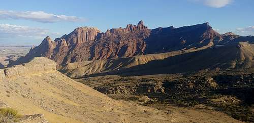
Except for traverses, the Great North Ridge is the longest route here. Over 9 pitches, it contains about 2,000' of climbing, not vertical gain. With long runouts and poor rock, it's definitely an adventure route; it's the one where on a 200' pitch, I placed one marginal cam, and on another 200' pitch, 2 slung bushes were all my son got for pro.
|
|
|
Getting There
There are 2 main ways to access the crags.St
The first is from I-70. Two miles west of the exit for UT 24, turn off onto a dirt road to the right. This road leads into Black Dragon Wash, where the well-known Black Dragon pictograph panel is. Open the wire gate, reclose it after driving through, and head for an underpass. Once through it, you'll be on a dirt road that parallels the reef for about 6 miles before bending east.
Before entering the underpass, check to see if it's flooded. If it is, there is another turnoff and gate on eastbound I-70. You can get to it by crossing the highway on a service road, which technically is illegal, or by driving for quite a ways to the first exit (I believe it is 131) that allows reentry to 70 in the other direction. Of course, if you're coming from the west, this turnoff is the one you want in the first place.
The second approach is from UT 24 via a turnoff about 7 miles south of I-70 and just past MP 153. This road is said to be usually in better condition than the one from I-70, and it connects to the road that parallels the Reef.
Note: the road paralleling the Reef receives regular maintenance but does change according to conditions. I've been on it when I could have driven a regular passenger car with little trouble, and I've been on it when there have been washouts making me thankful I was in a Jeep.
Red Tape
Stay on marked vehicle routes, don't mess with petroglyphs and pictographs, and obey any other posted regulations. Do your part to keep this place pristine and awesome.
Camping
Dispersed