
-
 13830 Hits
-
 82.48% Score
-
 15 Votes
|
|
Route |
|---|---|
|
|
37.91576°N / 119.2696°W |
|
|
Hiking |
|
|
Summer |
|
|
Half a day |
|
|
trail and easy x-country |
|
|
Overview
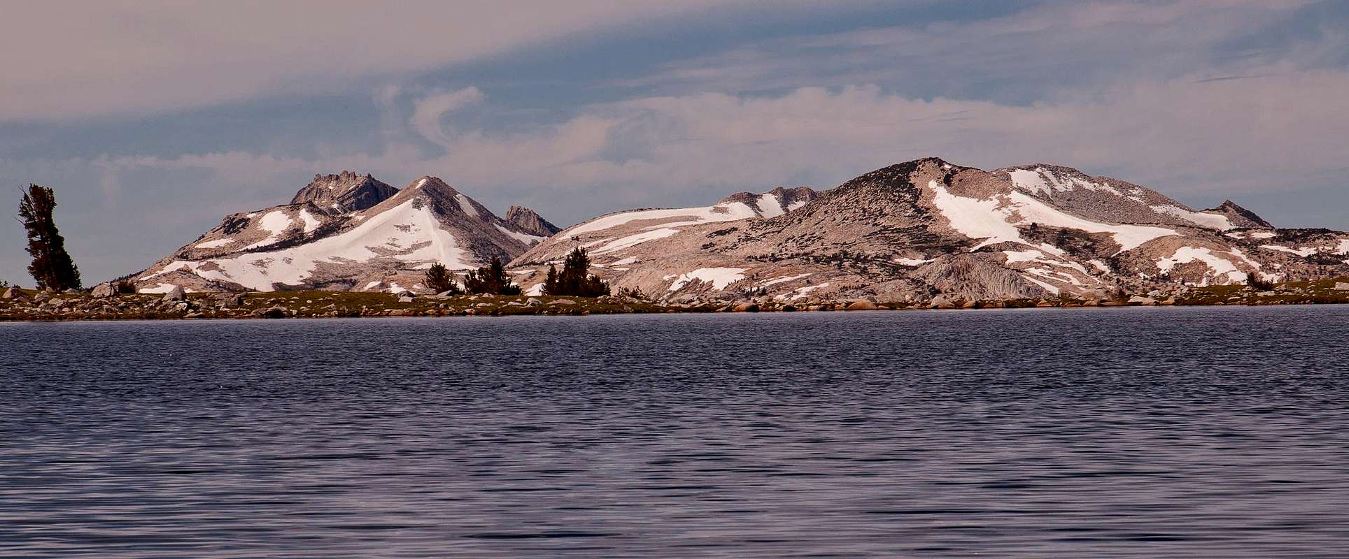
The Gaylor and Granite Lakes lie in a beautifully stark alpine meadow in a glacial basin in close proximity to the Tioga Pass and the East Entrance to Yosemite National Park. Although close to the road and its hordes of visitors, one gets a sense of solitude and remoteness while hiking in the basin. Thankfully, most visitors to Yosemite National Park seem to continue on the Tioga Pass Road and as a consequence the hike to the Gaylor and Granite Lakes does not seem to be over-crowded. The description here illustrates the hike from the Tioga Pass Entrance Station up the forested ridge and down to the lakes basin. From the (Middle) Gaylor Lake we hiked to the Upper Gaylor Lake and continued to the Great Sierra Mine atop the Sierra Crest. From there we hiked cross-country to the Granite Lakes and back to the (middle) Gaylor Lake and the trailhead. Many excursions to surrounding peaks and further into the backcountry can be taken from the basin. Cross-country travel is generally very easy. Although the hike itself does not pose any technical difficulties, you should of course be aware that the hike is basically at all times between 10,000 and 11,000 feet altitude, so acclimatize accordingly.
Overall, the hike from the Tioga Pass to the Gaylor Lakes – Great Sierra Mine – Granite Lakes totals to about 4.5 miles round-trip with about 1,500 feet of elevation gain.
|
Route Description
From the trailhead (~9,950’) immediately south of the Tioga Pass Entrance Station of Yosemite National Park the trail leads west through a forest and some meadows first gently and later rather steeply to a ridge separating the Gaylor Lakes Basin from the Tioga Pass. While hiking up the ridge, views are becoming increasingly more splendid: beautiful views to the east to Mount Dana and Gibbs and to the Kuna-Koip Crest and the Cathedral Range to the south. After about 0.5 miles from the trailhead you reach the ~10,500’ high saddle on the ridge, from where you first get a glimpse at the Gaylor Lakes Basin to the west. From the saddle an easy climb leads to the summit of ~11,000’ Gaylor Peak. After catching some breath and enjoying the views, the trail now leads downhill from the saddle to the lakes basin. After a few short switchbacks you approach the shore of (Middle) Gaylor Lake at ~10,350’ (0.7 miles). From here you have fantastic views east to the Cathedral Range, which seems to rise immediately beyond the lakeshore. To the west you will see a series of unnamed peaks forming a glacial cirque. Below the cirque lie the Granite Lakes, which are still hidden behind a low ridge. To the north the terrain climbs gently to the Sierra Crest. A trail leads from the (Middle) Gaylor Lake to the Upper Gaylor Lake (~10,520’) along a small stream. However, at the time we hiked in this area (August 2011) the mosquitoes were in full force around the lake and along the stream so we turned a little bit north away from the water and hiked cross-country towards the crest. Since the lake basin lies in a barren alpine meadow, cross-country hiking is generally very easy in this area. After about 1.5 miles you reach the Upper Gaylor Lake. From here a short trail leads further uphill to the historical remains of the Great Sierra Mine at around 10,800’ (2 miles).
| Gaylor Lake | Gaylor Lakes Basin |
|---|---|
 |
 |
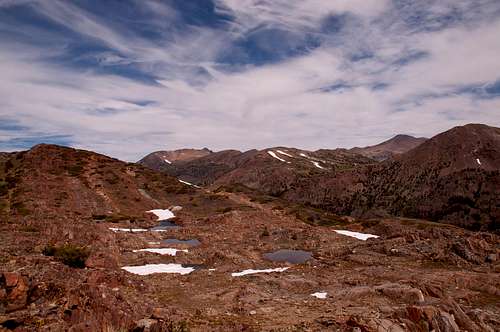
The mine, which is located on the Sierra Crest in an area known as Tioga Hill, was intended to work the Sheepherder silver lode. The Sheepherder lode was discovered in 1860. A small mining town of Dana was established here by the Great Sierra Consolidated Silver Mining Company. However, due to the high elevation of almost 11,000 feet the site of the town was soon relocated to the bottom of Tioga Hill to the east at Bennettville. Operations were closed in 1884, resumed again in 1933, but finally ceased thereafter. The silver lode was never found. Ruins of several stone cabins of the town of Dana and some shafts that have collapsed or have been filled in is all that remains today. Wandering around this area is very interesting but you should be somewhat careful as the shafts are not protected or fenced off. Beautiful red-colored metamorphic rock is found in this area and the views from the crest down into the Lee Vining Canyon are breathtaking. From the mine you can cross-country hike in southwesterly direction towards the Glacial Cirque. Soon, you have first views of the beautiful Granite Lakes below the cirque. Easy cross-country travel brings you down to the lakes at ~10,400+‘ (3 miles). From the Granite Lakes you can hike southeast through the alpine meadow towards the (Middle) Gaylor Lake and the saddle, which leads you back to the trailhead. On our way back we cut short along the southwest talus slope of Gaylor Peak, which led more directly to the saddle without losing elevation when hiking to the lake.
| Great Sierra Mine | Granite Lakes |
|---|---|
 |
 |
Getting There
The trailhead to the Gaylor Lakes is immediately south of the Tioga Pass Entrance station of Yosemite National Park along Highway 120. There is a small parking lot.
Essential Gear
No essential gear is necessay.