
|
|
Area/Range |
|---|---|
|
|
37.91062°N / 119.25814°W |
|
|
Hiking, Mountaineering, Trad Climbing, Ice Climbing, Scrambling, Skiing |
|
|
Spring, Summer, Fall, Winter |
|
|
9943 ft / 3031 m |
|
|
Overview
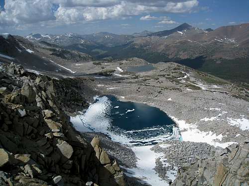
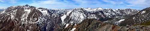
Tioga Pass area from the Kuna Crest South 12,462'
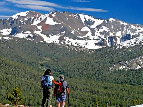
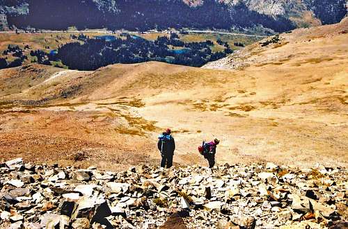
Hikers descending Gaylor Peak
Tioga Pass on the northeast border of Yosemite National Park is the highest auto pass in the Sierra Nevada. At over 400 miles long the Sierra is the longest continuous range in the United States.
There are several auto passes to the north with each one lower in elevation as the range tapers off in height. To the south however the Sierra crest gets higher and more rugged. There is not another major auto pass for 170 miles until Walker Pass at 5,250' near the southern end of the range and little known Sherman Pass that runs from Pearson to the Kern River then over the Great Western Divide.
With a sustained elevation of well over 9,000' for most of 8 miles of Hwy 120 the hiker/mountaineer has access to a wealth of peaks, lakes, meadows and trails with skiing and seasonal ice climbing that can be done in a day in classic alpine settings. Similar lofty pristine settings generally require backpacking to reach further south.
Nevertheless in winter the pass becomes a major cross-country ski pull from lower Lee Vining Canyon.
This page defines the general boundary points (the natural boundaries created by the mountains themselves) of the Tioga area as: McCabe and Lundy Passes to the north, Lee Vining Canyon to the east, Koips Peak Pass to the south and the Dana Fork to the west.
Appreciation is owed to Windsor Riley (aka Noondueler) who created this page, and who passed away in 2016.
Tioga Pass area peaks
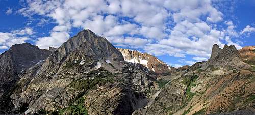
Tioga Pass area from Excelsior Mtn. 12,446' to the north
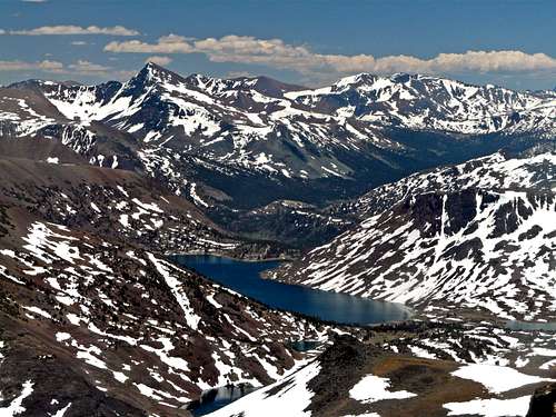
Tioga Pass High Sierra from Canyon Peak 11,282'
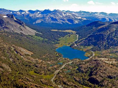
Lee Vining Canyon
Clockwise from the west:
North or west of the pass
Gaylor Peak, 11,004'
Tioga Spur, 11,091'
False White Mountain, 12,002'
White Mountain, 12,057'
Mount Conness, 12,590'
North Peak, 12,242'
Shepherd Crest, 12,000'
Saddlebag Crest, 11,239'
Dore Cliff, 11,911'
Tioga Peak, 11,526'
Mount Warren, 12,327'
Warren Fin, 12,177'
Lee Vining Peak, 11,690'
Canyon Peak, 11,282'
South or east of the pass
Mount Dana, 13,057'
Dana Plateau, 12,466'
Mount Gibbs, 12,773'
Mount Lewis, 12,324'
Parker Peak, 12,850'
Koips Peak, 12,962'
Kuna Peak, 13,002'
Kuna Crest North, 12,170'
Kuna Crest South, 12,462'
Mammoth Peak, 12,016'
Main trailheads accessed from the Tioga Pass area.
Tioga Pass area from Tioga Peak 11,526'
From the north:
Gaylor Lakes/Peak, directly west from the pass. (Gaylor Peak, Tioga Spur, False White Mt.) This is a short easy (3-5 mile round trip) hike over a small saddle to the beautiful Gaylor Lakes region.
Directly east of the pass is the use trail to Mt. Dana with the trailless Dana Plateau which is off to the left via Glacier Canyon.
Lundy Pass, from the north end of Saddlebag Lake (1.5 miles to the pass). (White Mt., Mt. Conness, North Peak, Shepherd Crest, Saddlebag Crest, Dore Cliff)
This is the main pass dropping into Lundy Canyon to the north.
Gardisky Lake, from the Saddlebag Lake Road. This is a short hike up to Gardisky Lake and Tioga Peak (less than 3 miles roundtrip)
Warren Fork, From Lee Vining Canyon to the east 5 miles north of the pass on Hwy 120 to a hairpin turn to the north. Access to Mt. Warren, Warren Fin, Canyon Peak and Lee Vining Peak.
From the south:
Mono Pass Trail (4 miles to pass) leads to Parker Pass (5 miles) and Koips Peak Pass (8 miles). (Mt. Gibbs, Mt. Lewis, Parker Peak, Koips Peak and Kuna Peak) This trail leads south out of Dana Meadows off the Tioga Road.
Getting there

Entrance station at the pass
Mt. Gibbs 12,773' from Dana Fork
From the west: At the junction of Hwy. 120, 5 miles east of the Yosemite entrance turn northeast and drive 46 miles on 120 to the pass.
From the east: From the junction of Hwy 395 and Hwy. 120 go west 12 miles up to the pass.
Tioga Pass usually closes after October 15 with the first snow in winter and doesn't usually reopen until about June depending on the seasonal snowfall.
To check current road conditions with Caltrans click here.
Camping
Hikers descending Mt. Dana with Tioga Pass below
There area numerous Inyo National Forest Campgrounds just north of the pass.
1 - Tioga Lake, 1.2 miles north of the Pass at 9,600'
2 - Ellery Lake, 2.3 miles north of the pass at 9,000'
3 - The junction of Hwy. 120 and Saddlebaglake Road at 9,600'
4 - Sawmill, 1.8 miles north on the Saddlebag Lake Road.
5 - Saddlebag Lake, 2.6 miles at the north end of the Saddlebag Lake Road at 10,100.
Red Tape
There are no permits required for day hiking the area. For camping permits for Yosemite National Park click here.
Many of the peaks in the area can be done from Inyo National Forest access with no permits.
For access via Yosemite National Park there is a $35 permit per vehicle which is good for 7 days.
Be prepared for mosquitos during the early summer especially around trees, lakes and streams. Pack some deet.
Current weather and forecast
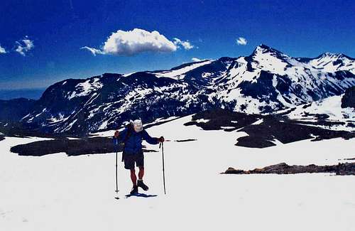
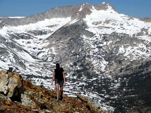
Ascending False White Mtn.
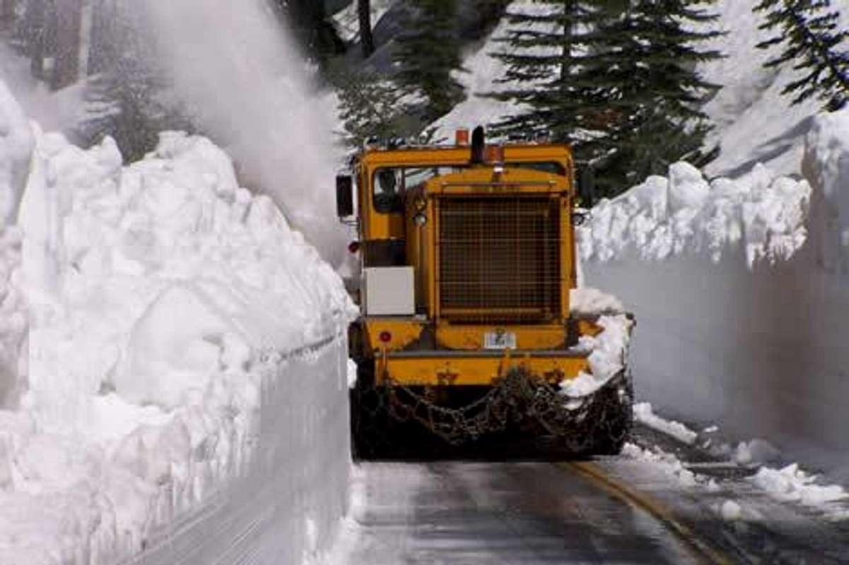
Plowing open the pass
For the current weather forecast click here.
Etymology
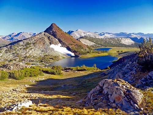
Gaylor Peak 11,004' and Lakes
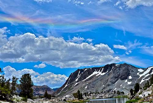
Circumhorizon arc over Saddlebag Crest
Tioga Pass Tuolumne Meadows 15"
Tioga is an Iroquois name meaning "where it forks" Farquhar, "at the forks", "Swift current" or "a gate" (Gannet 253). The name has been preserved in counties, towns and a river in Pennsylvania and New York.