There are many landslides that in Centuries have afflicted Alps. Sometimes are solid, other liquid but always caused by Water or Ice factor. Others for drought.
Not all were bloody and fatal to Climbers or Men, but certainly all have left their mark in the underlying Populations. A sign that has left an indelible
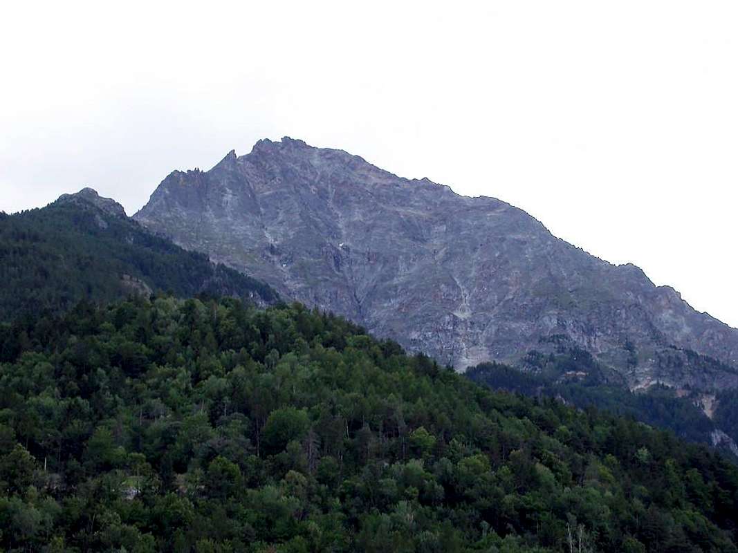
"track" in the collective memory for Years, Centuries and even Millennia. Sometimes Am bringing to the fore Hills, Glaciers and Mountains that would otherwise have remained in complete anonymity as the Aiguille de l'Eboulement, Becca France or the cliffs at the foot of the North slope of Becca di Seneva. On other occasions they did understand that even less high mountains or famous could become dangerous in certain situations. As in the case of Becca Luseney, Becca Viou, Monte Zerbion, Mont Delà and numerous others of which little is spoken and have fallen into oblivion; forgotten by the mass and survived only in the memory of some small group of local inhabitants or some visitor that he accidentally rediscovered. Perhaps after the passage of several Decades. But from these
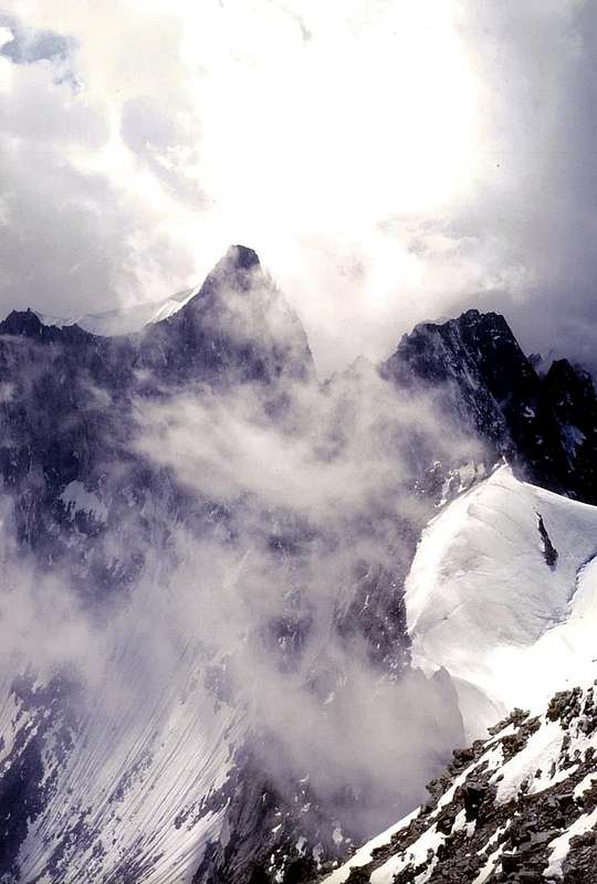
Natural Calamities are not exempt even the great mountains and famous glaciers, such as the Aiguille Blanche de Peuterey, Mont Blanc on the East and North sides, the Drus, the Grivola with the collapse of its summit (otherwise is more another 4000 of the Alps ) or the ice Brenva and the Grandes Jorasses. In other cases it is even a lake that has collapsed, as for what the Rutor causing a flood in Aosta Valley that swept away all the bridges, along
150 Kilometres up to the City of Ivrea; or into the Val di Rhêmes, where the Country Couthoud had to be rebuilt on the opposite side. We do not talk about avalanches and landslides, the recurrence of which, unfortunately, has a frequency that is often repetitive, if not annual coming to light in newspapers and television broadcasts day to day in the succession of winters; but rare phenomena and almost never frequently, that such as occur occasionally. Other times their scanning is intermediate in time and often becomes almost, if not dated, predictable as now happens by several decades on the
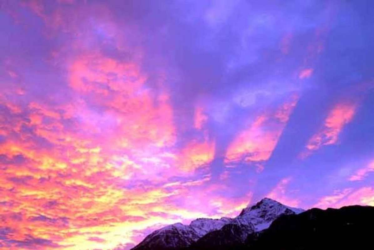
"Cresta del Leone" on the
"eternal" Cervino or Matterhorn. Partial or small collapses which show that even the mountains are, as for men, destined to fall with
"folds back" on themselves.
Nature Law that applies to everyone and everything. In context we must make a first substantial differentiation surely valid for a classification in this regard always useful against a statistical update, even in order to better plan and control future events:
1)- an unexpected phenomena with victims and 2)- expected phenomena and almost under control.
Consider by way of example for all Grandes Jorasses or the Mont Blanc, about foreseeable or unforeseeable large ice fall typically through seracs suspended. One thing are the expected collapse of the serac from Punta Walker towards Val Ferret, anticipated and monitored for a long time, or the same routine collapses of the Eastern Wall on the Glacier Brenva. Completely different and much to suspicion but always as unpredictable as the Glacier of Grandes Jorasses or the
"Corridor" on the Glacier des Bossons on the respective Vie Normals that have caused several accidents sometimes figured in real massacres. Wanting to make even an addition you can safely enter the way of the
"Corridor" above the Glaciers du Grand Combin and de Corbassière below the Grand Combin de Grafeneire, these last two abitual climbing routes from France and Switzerland. Even for the rocky landslides we can keep the same considerations taking as examples the
"classic" landslides from the Eastern Wall of the Aiguille Blanche de Péuterey directed towards the Glacier Brenva and up to the
"Notre Dame de la Guérison" Shreene or the Aiguille de l'Eboulement on the Glacier de Triolet that, between the end of 1800 and the beginning of '900, have upset local people and terrified mountaineers. Totally unexpected and perhaps even less suspected (but others have already occurred since 1955 and until 2005 with especially in 1957) that in September 2011 canceled the renowned
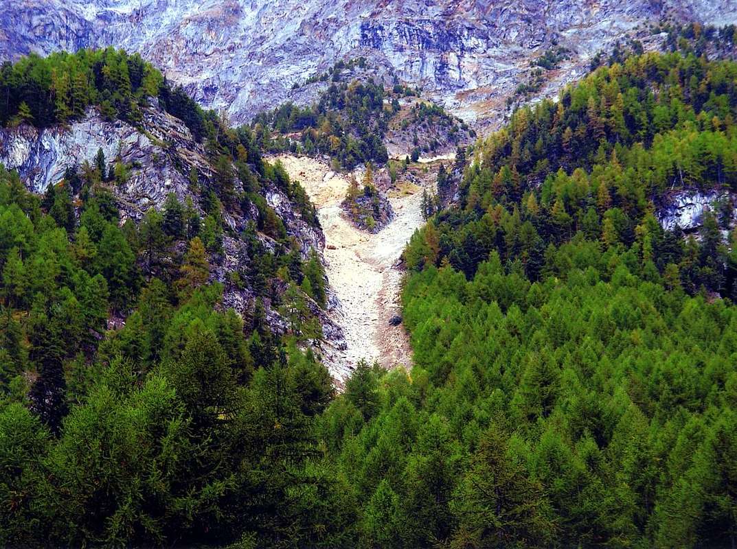
"Via Bonatti" in the Southwest Pillar of the Dru plummeting towards the Mer de Glace. Others are of mixed character, or with water and rock material and then drag in their race even entire forests and villages; among these we can remember the landslide of Becca di Luseney of June 1952 over the Village Chamen in Valpelline or the great landslide of Becca France in July 1564, with the difference that the former is quite natural, while the second is involved in about the hand of the man with the construction of a
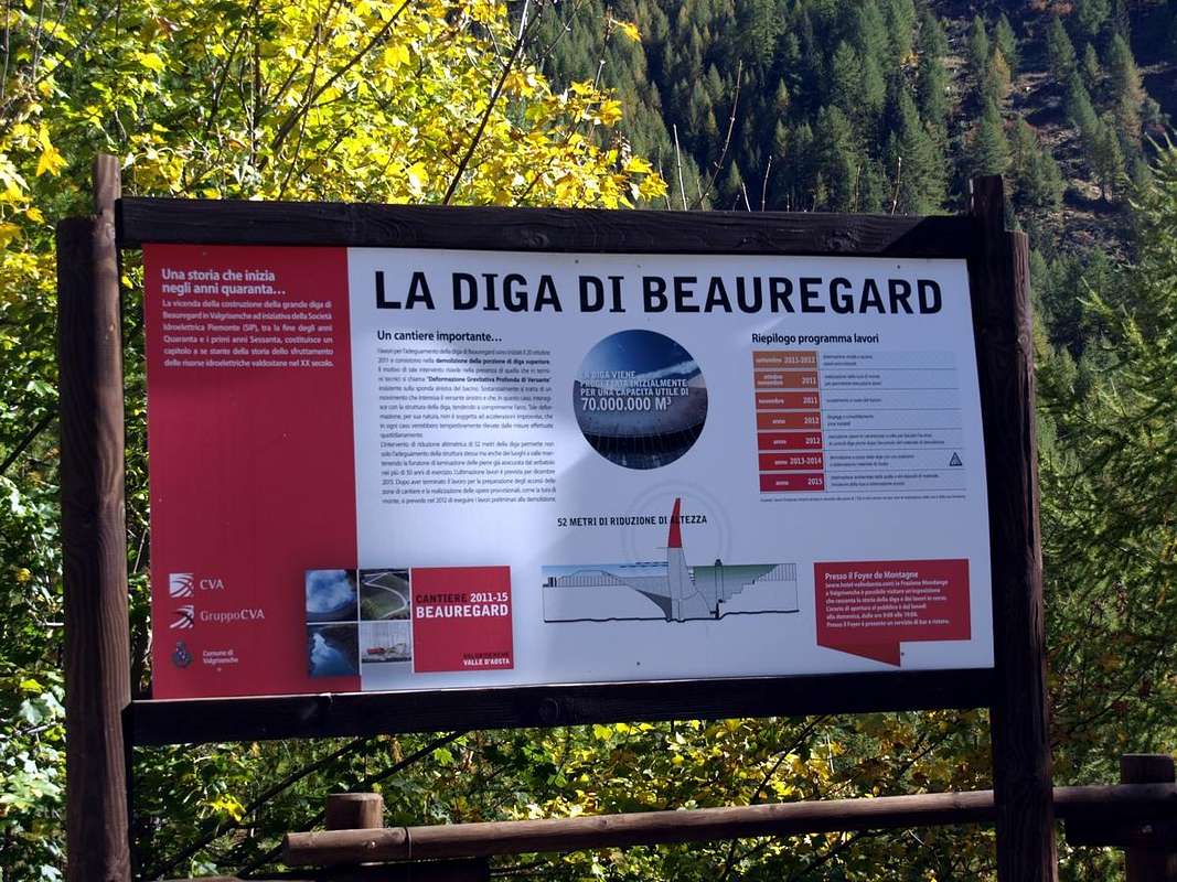
"Ru" for irrigation. As for the Vajont Dam in the October 9, 1963 in Venices territory, where the landslide from Monte Tòc into the same is the result of a natural event, but the construction of the work (duration 1957-1960) in a high-risk area it is definitely blame to be shared among men. Equal conditions for the Beauregard Dam in Valgrisenche Valley (concrete barrier erected in 1954 at an altitude of
1770 metres) where now, for a precautionary measure, is carried out the complete dismantling, after burying during the construction completely with the waters the Fornet Village with even its small Bell Tower.
Molte son le frane che nei Secoli hanno funestato le Alpi. A volte solide, in altre liquide ma sempre causate dal fattore Acqua o dal Ghiaccio. Altre per siccità.
Non tutte sono risultate cruente e fatali per Alpinisti od Uomini, ma sicuramente tutte hanno lasciato un segno nelle sottostanti Popolazioni. Un marchio che ha inciso nella Memoria collettiva un'indelebile
traccia per Anni, Secoli ed anche Millenni. A volte portando alla ribalta Colline, Ghiacciai e Montagne che altrimenti sarebbero rimaste nel più assoluto anonimato come l'Aiguille de l'Eboulement, la Becca France od i dirupi ai piedi del Versante Settentrionale della Becca di Seneva. In altre occasioni hanno fatto comprendere che anche montagne meno elevate o famose potevano diventare pericolose in certe situazioni. Come avvenuto per Becca di Luseney, Becca di Viou, Monte Zerbion, Mont Delà e numerose altre delle quali poco s'é parlato e sono cadute nel dimenticatoio; dimenticate dalla massa e sopravvissute soltanto nella memoria di qualche sparuto gruppo di abitanti locali o di qualche visitatore che le ha casualmente riscoperte. Magari dopo il trascorrere di diversi lustri. Ma da queste
Calamità Naturali non sono esenti neppure le grandi montagne nonché famosi ghiacciai, quali l'Aiguille Blanche de Péuterey, il Monte Bianco sui versanti Est e Nord, i Drus, la Grivola con il crollo della sua Sommità (altrimenti sarebbe un 4000 in più delle Alpi) oppure i ghiacci della Brenva e delle Grandes Jorasses. In altri casi é addirittura un lago che é collassato, come per quello del Rutor provocando un'alluvione in Valle di Aosta che ha spazzato via tutti i ponti per
150 Kilometri fino alla Città di Ivrea; oppure in Val di Rhêmes dove il Paese di Couthoud ha dovuto essere ricostruito sull'opposto versante. Non parliamo di valanghe e slavine, la ricorrenza delle quali, purtroppo, possiede una frequenza spesso ripetitiva, se non addirittura annuale venendo alla luce su giornali e trasmissioni televisive di giorno in giorno nel succedersi degli inverni; bensì di fenomeni rari e quasi mai ripetitivi, tali da manifestarsi saltuariamente. Altre volte la loro scansione risulta intermedia nel tempo e spesso diventa quasi, se non databile, prevedibile come succede ormai da alcuni decenni sulla
"Cresta del Leone" dell'
"eterno" Cervino o Matterhorn. Parziali o piccoli crolli che dimostrano che anche le montagne sono, come per gli uomini, destinate ad abbassarsi
"ripiegandosi" su sé stesse. Una
Legge di Natura che val sempre per tutti e per ogni cosa. In questo contesto bisogna effettuare una prima sostanziale differenziazione sicuramente valida per una classificazione al riguardo sempre più che utile nei confronti d'un aggiornamento statistico, anche per potere meglio programmare e controllare gli eventi propri del futuro:
1)- fenomeni imprevisti e con vittime e 2)- fenomeni previsti e quasi sotto controllo.
Prendiamo a mò d'esempio per tutte le Grandes Jorasses oppure il Monte Bianco, nei confronti di prevedibili od imprevedibili grandi cadute di ghiaccio in genere da seracchi sospesi e sempre più in bilico. Una cosa sono il crollo atteso del seracco dalla Punta Walker verso la Val Ferret, atteso e monitorato per lungo tempo, oppure i crolli abitudinari di medesimi dalla Parete Orientale sul Ghiacciaio della Brenva. Completamente diversi e tanto sospettabili quanto imprevedibili quelli dal Ghiacciaio delle Grandes Jorasses o dal
"Corridor" sul Glacier des Bossons sulle rispettive Vie Normali che hanno provocato vari incidenti a volte figurate in vere stragi. Volendo fare un'aggiunta si può tranquillamente inserire la via del
"Corridor" soprastante i Glaciers du Grand Combin e de Corbassière anche al Combin de Grafeneire, queste due ultime abituali vie di salita da Francia e Svizzera.
Anche per le frane rocciose possiamo mantenere le medesime considerazioni prendendo come esempi le
"classiche" frane dalla Parete Orientale dell'Aiguille Blanche de Péuterey sul Ghiacciaio della Brenva e insino al Santuario di
"Notre Dame de la Guérison" o quelle dell'Aiguille de l'Eboulement sul Glacier de Triolet che, tra fine del 1800 ed inizi del '900, hanno sconvolto popolazioni locali ed atterrito alpinisti. Forse totalmente imprevista e forse neppure sospettabile (ma altre si sono verificate sin dal 1955 e fino al 2005 con fattispecie nel 1957) quella che nel Settembre 2011 ha cancellato la famosa
"Via Bonatti" al Pilastro Sudovest del Dru precipitando verso la Mer de Glace. Altre ancora sono di carattere misto, ovvero con acqua e materiale roccioso per poi trascinare nella lor corsa anche intere foreste e villaggi; tra queste possiamo ricordare quella della Becca di Luseney del Giugno 1952 sopra il Villaggio di Chamen nella Valpelline o la grande frana della Becca France nel Luglio 1564, con la differenza che la prima risulta del tutto naturale, mentre a riguardo della seconda é implicata la mano dell'uomo con la costruzione di un
"Ru" per l'irrigazione. Come per la Diga del Vajont nel 9 di Ottobre 1963 in Veneto, dove la frana dal Monte Tòc dentro la medesima é frutto d'evento naturale, ma la costruzione dell'opera (dal 1957 al 1960) in un territorio ad alto rischio é sicuramente colpa da imputarsi agli uomini. Uguali condizioni per la Diga di Beauregard (Valgrisenche, sbarramento in cemento eretto nel 1954 alla quota di
1770 metri) ove attualmente, per via precauzionale, vien effettuato completo smantellamento, dopo aver completamente sepolto con l'acque durante l'allestimento l'antico Villaggio di Fornet, Campaniletto compreso.
3)- Another thing are the disasters due to floods and the 4)- odd and unexpected phenomena and almost completely out of control..
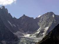
Among the latter we can record large landslides like those personally views (North Wall of Tour Grauson in 1971 or on the South Face of Mount Emilius in 1974) or in person born as landslides from the Southwest Face of Mont Velan (collapse of a column of
about 70 metres on the edge of the Mont Velan and Glacier above us) and the Grand Combin de Valsorey towards the refuge of the same name and over the Shoulder Isler (both in September 1973) or on the Northern side of East Ridge or Standard Via on the Aiguille de Talèfre in the August Holiday 1985. typically these are consequential to terrible rainstorms, but they can occur, as for Velan, in beautiful sunny days and without any clouds.
Among the first we catalog instead of those events that are subject to a flood, so frequent in Aosta Valley since Roman times that as Augusta Praetoria Salassorum had been built by the same West of the Torrent Buthier and
approximately 20/25 metres from the level of the Dora Baltea; nevertheless, the first, coming from the Valpelline and Great St. Bernard Valley, managed to soak his most Eastern side near the Arch of Augustus. Horrendous natural disasters that have lasted in the Centuries, perhaps reaching their climax with the great flood occurred in October 2000, but surely you are also registered first time as that by the documents at the Common of Pollein, there on the same hill at the foot of Becca di Nona, so tragically affected during this. But already in the year 1000 AD is arrived similar and perhaps more dramatic event, so that the top of the Church tower, located here, was recovered in the bed of the Dora. At nearly
1 mile away. But then the men, not the old villagers, quickly forgotten and everything has been rebuilt in the same place. Even now after the damage of 2000 it has risen a hamlet, indeed expanded amongst the Chenaux, Chenières and St. Benin Fractions. They were some storage works on the Torrent Comboé by building a series of small dams upstream, the site of the old Gym Rock of S.M.A., while the levees have been rebuilt by cleaning and excavating more the same. But all this will be enough for the future? Because you have to remember that this hill is a large alluvial cone not built by men with transportation by trucks of material, but rather the result of the
"anger" of the overlying Becca di Nona. Here, in addition to small liquid landslides recorded on the South Slope Becca Viou and on the North side in West of Great Shoulder Mont Delà, there have been the most calamitous events as those that occurred on the slopes Mont Saint Julien above the near Fénis Common.
3)- Un'altra cosa ancora sono i disastri a seguito di alluvioni ed i 4)- fenomeni saltuari nonché imprevisti e quasi del tutto privi di controllo..
Tra questi ultimi possiamo registrare grandi frane come quelle personalmente viste (Parete Nord della Tour Grauson nel 1971 dalla Punta Garin o sulla Parete Sud del Monte Emilius nel 1974 percorrendo il medio Vallone d'Arbolle) oppure personalmente sopportati come le frane dalla Parete Sudovest del Mont Velan (crollo di un pilastro di
circa 70 metri al margine Meridionale del Ghiacciaio del Mont Velan nonché sopra di noi) e dal Grand Combin de Valsorey verso l'omonimo rifugio e sopra la Spalla Isler (entrambi episodi avvenuti agli inizi del Settenbre 1973) oppure sul versante Nord della Cresta Est o Via Normale all'Aiguille de Talèfre nel Ferragosto del 1985. In genere tutti questi quasi terrificanti eventi sono consequenziali a tremendi temporali, ma possono verificarsi, come per il Velan, in splendide giornate di sole e senza segno della benché minima nuvola.
Tra i primi cataloghiamo invece quegli eventi che soggiaciono ad una alluvione, così frequenti in Valle di Aosta fino dai tempi dei Romani tanto che
Augusta Praetoria Salassorum era stata costruita dagli stessi ad Ovest del Torrente Buthier, nonché a
circa 20/5 metri dal livello del corso della Dora Baltea. Ciononostante il primo, proveniente dalla Valpelline e dalla Valle del Gran San Bernardo, riusciva ad allagare il suo lato più Orientale nei pressi dell'Arco d'Augusto. Orrende calamità naturali che sono durate nei Secoli, forse raggiungendo il loro apice con la grande alluvione avvenuta nel mese di Ottobre 2000, ma sicuramente che si sono registrate anche prima tanto che dai documenti presso il Comune di Pollein lo stesso sorgeva sulla collina ai piedi della Becca di Nona, così tragicamente colpita durante questa. Ma già nell'anno 1000 dopo Cristo risulta analogo e forse più drammatico evento, tanto che la sommità del campanile della Chiesa, qui collocata, venne recuperato dentro il letto della Dora. A quasi
1 Kilometro di distanza. Ma poi gli uomini, non i vecchi valligiani, velocemente dimenticano e tutto é stato ricostruito nell'identico posto. Anche adesso dopo i danni del 2000 é risorto un villaggio, anzi ampliato tra le Frazioni di Chenaux, Chenières e St. Bénin. Sono state costruite delle opere di contenimento sul Torrente Comboé con la costruzione di una serie di briglie a monte, dove sorgeva la vecchia Palestra di roccia della S.M.A., mentre sono stati rifatti gli argini pulendo e scavando maggiormente il medesimo. Ma tutto ciò sarà sufficiente per il futuro? Perché bisogna ricordare che questa collina é una grande conoide di deiezione non costruita dagli uomini con il trasporto tramite camions del materiale, bensì frutto della
"collera" della soprastante Becca di Nona. Qui, oltre a piccole frane liquide registrate sul Versante Meridionale della Becca di Viou e su quello Settentrionale dello Spallone Occidentale del Mont Delà, si sono registrati gli eventi più calamitosi come quelli avvenuti alle pendici del Mont Saint Julien al di sopra dell'adiacente Comune di Fénis, così luttuosamente colpito.
Great Landslide from "Becca" in Flood October 2000
The great liquid LANDSLIDE of the Flood in October 2000 at Chenaux in Pollein.
In the Year 2000 since Thursday 13th until Moonday 16th, cause the great flood that struck the whole Valley of Aosta, occurred an enormous landslide that, departing from a great fault to form of hole from letters, at the Western base of Northern Wall near the rocky
"clog", wide also 4 metres and long over 250 metres. This atypical cracking in soil in July of 1966 she was ascertained by the rope Ilario Antonio Garzotto - Dario Franco Cardellina and Walter Ferronato, that had looked for at first to climb along the right sector of the wall, abdicating then you cause the precariousness of the rock, the presence of such wide earthy crevasse, then from the 20 to the 30 centimeters and along less than about twenty metres. The same descents in the bed of the ancient basal, of Northwest, couloir for over 700 meters with such a blow of double-bladed razor to devastate him completely, widening him than at least ten times and deepening him of almost the same. The same, reached the bed of the Comboé's Torrent inside the Vallon of the Dard, it upset the course of it and (formed a knapsack of water with material sundry near the small Bridge of Rongachet
1100 metres about) exploding in the forenoon of the Sunday of October 15 th, 2000, it got wildly epressed on the underlying three Fractions of Saint Bénin, Chenaux and Chèniere, just overlooking the Municipality of Pollein and just below the Rock Gym or Climbing wall of S.M.A., causing the downfall and the death of seven people of it, among which a child; widening himself to fan also struck the wide Fraction of Pian Felina flooding the same from East to West for then to relieve himself in the River Dora Baltea. A story we have already told you on other occasions, but also a story that has a past prior learning, as a sadly ill omen, fatal and harmful. They called her
"La Raye du Morion", or split or ledge, if you want better, above the pasture. These were the years before the First World War and recently had suffered the great flood that had flooded the Plain of Feline or Felenna (ie the feyes or sheep) in those days absolutely free housing, passing by the shores of the small Hamlet Valpettaz little higher, about twenty yards, but where already in the flood of 1907 he arrived the waters was lapping houses. As told Venerand old Morion Shepherd, at his son Franco Lucianaz famous Cristallier Valpettaz and where he still lives nowadays in ancestral home. It was a wide, abandoned and desolated field, for grazing sheep and goats, for it was dangerously floodplain expansion of Baltea. They wore no there not even the livestock,
where we all live today ...
La grande FRANA liquida dell'Alluvione nell'Ottobre del 2000 a Chenaux di Pollein.
Nell'Anno 2000 dal giovedì 13 al lunedì 16 Ottobre, causa la grande alluvione che colpì l'intera Valle d'Aosta, si verificò un'enorme frana che, partendo da una grande faglia a forma di buca da lettere, alla base Occidentale della Parete Nord nelle vicinanze dello zoccolo roccioso, larga anche 4 metri e lunga oltre 250. Questa atipica fessurazione in terriccio nel Luglio del 1966 fu constatata dalla cordata Ilario Antonio Garzotto, Dario Franco Cardellina e Walter Ferronato, che dapprima aveva cercato di salire lungo il settore destro della parete, rinunciandovi poi a causa della precarietà della roccia, la presenza di tale crepaccio terroso allora largo dai 20 ai 30 cm. e lungo meno d'una ventina di metri. La stessa scese nel letto dell'antico canale per oltre 750 metri con una doppia rasoiata tale da devastarlo completamente, allargandolo di almeno dieci volte ed approfondendolo di quasi altrettanto. La stessa, raggiunto il letto del Torrente Comboé dentro il Vallone-Gorgia del Dard, ne sconvolse il corso e, formata una sacca d'acqua con materiali varii presso il minuscolo Ponte di Rongachet
1100 metri circa ed esplodendo in mattinata di Domenica del 15 Ottobre 2000, si abbatté violentemente sulle Frazioni di Saint Bénin, Chenaux e Chèniere, soprastanti il Comune di Pollein nonché appena al di sotto della Palestra di Roccia della S.M.A., causandone la rovina e la morte di sette persone, tra le quali un bambino; allargandosi a ventaglio colpì anche la Frazione di Pian Felina allagando la medesima da Est verso Ovest per poi scaricarsi nella Dora. Una storia che abbiamo già raccontato in altre occasioni, ma anche una storia che possiede un passato pregresso, come un presagio tristemente nocivo e funesto. La chiamavano
"La Raye du Morion", ovvero la spaccatura o cengia, se meglio si vuole, soprastante l'alpeggio. Eran gli anni precedenti la Prima Guerra Mondiale e da poco tempo avevano subito la grande alluvione tal da allagare la Piana di Feline o Felenna (cioé delle feyes o pecore) a quei tempi assolutamente priva d'abitazioni, lambendo le sponde del Villaggetto di Valpettaz di poco più in alto a monte della piana, d'una ventina di metri ma dove già nell'alluvione del 1907 l'acqua era arrivata lambendo le case. Come raccontava Venerand, vecchio Pastore del Morion, a suo figlio Franco Lucianaz, famoso Cristallier di Valpettaz, laddove vive ancor oggi nella casa di famiglia ancestrale. Era un vastissimo desolato campo abbandonato, da pascolo per pecore e capre, poiché costituiva pericolosamente la golena d'espansione della Dora Baltea. Lì non conducevan neppur il lor bestiame,
dove noi tutti oggi abitiamo ...
Comments
No comments posted yet.