|
|
Route |
|---|---|
|
|
40.74670°N / 110.7681°W |
|
|
backpack/scramble |
|
|
A few days |
|
|
Class 2+ |
|
|
Approach
The best trailhead for the hike is the Highline Trailhead located along State Highway 150 33.2 miles east and north of Kamas, or you could drive south from Evanston. You could also start at Mirror Lake, but you must pay to park there, and there isn't as much room to park.Route Description
This is the easiest route to the summit of Ostler Peak, but it is a longer hike than some other routes. From the trailhead at 10,347 feet, follow the Highline Trail .8 miles to the junction with the Mirror Lake Trail. The trail continues south and east and drops to 9900 feet. Scudder Lake is passed after 2.2 miles (from the trailhead). After another .8 miles, pass a junction with the Wilder Lake Trail. Stay left on the Highline Trail. After another 1.3 miles, stay right at the junction where the Naturalist Basin Trail branches left. Continue on the Highline Trail towards Rocky Sea Pass, passing the junctions with the Pinto Lake Trail after 1.5 miles and the 4-Lakes Basin Trail after another 1.2 miles. Rocky Sea Pass is another 1.2 miles along a steady up hill grade. The pass is 8.2 miles from the trailhead. Enjoy the spectacular views.Continue east and down the steep east side of the pass for 1.9 miles to a junction. Leave the Highline trail here, turning left on the head of Rock Creek Trail. After another mile, take a left at the junction with the Lightning Lake Trail. Follow the Head of Rock Creek Trail (the trail isn’t used much and is faded in places) passing Rosalie Lake after another .9 miles and Gladys Lake after another .75 miles. Both lakes are right at timberline a 10,900 feet. Find a nice base camp anywhere in the area. This area is lightly used, so its easy to find a huge lake all to yourself!
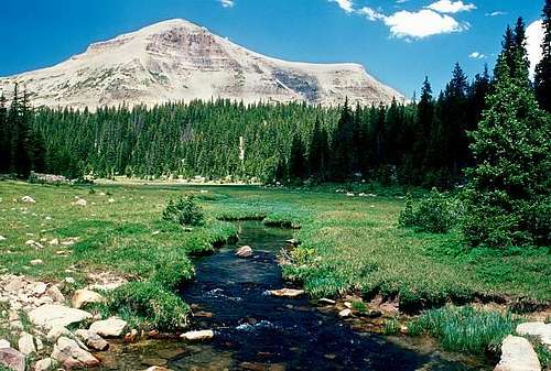
From Gladys Lake, scramble up the very steep South face of Ostler Peak. There is a lot of boulder-hopping, but this is still the easiest route to the summit of Ostler Peak. Once on the summit ridge, follow it north to the highest point. This is about 1.5 miles from Gladys Lake, but with much boulder-hopping, it’s a slow climb.
Total round trip distance for the climb is 27 miles and usually takes three days. If you’re in a big hurry, you could do it in two, but with all the lakes and fantastic scenery, you could easily spend a week exploring the area.
 Ostler Peak from Rock Creek Basin. The route up the peak follows the left hand slope passing between the two visible cliffbands.

