
|
|
Mountain/Rock |
|---|---|
|
|
35.90691°N / 81.49005°W |
|
|
Caldwell |
|
|
Hiking |
|
|
Spring, Summer, Fall, Winter |
|
|
2239 ft / 682 m |
|
|
Overview
Hibriten Mountain is a mountain very near Lenoir, NC, and marking the far west of the Brushy Mountains. Hibriten stands at 2,239 feet and holds a prominence of 859 feet. These stats vary a bit depending on the source used. While neither of these stats are particularly impressive Hibriten is very popular locally, there are several reasons for this.
1. The mountain stands as a backdrop to much of Lenoir, especially just behind Hibriten High School (you guessed it, named after the mountain).
2. There is a gated off road to the top of the mountain. This road is used by walkers, hikers, runners, equistrians, bicyclers, and dirt bike riders (I'm not sure that all of these methods are welcome, but have seen all on the mountain).
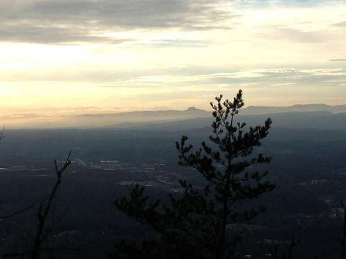
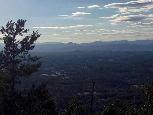
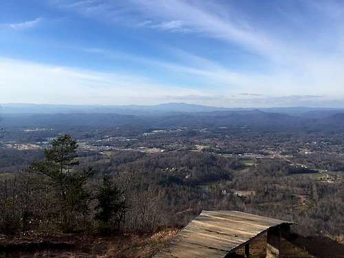
3. From the top there are excellent views to the north of Grandfather Mountain.
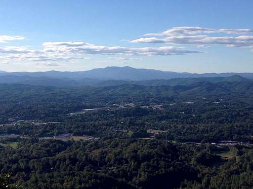
To the west there are views of the Linville Gorge, including Linville Gorge peaks of Table Rock and Hawksbill. As well as local views of Hibriten High School and much of the city of Lenoir.
4. In 1954 there was a light display built atop the mountain, every year around Easter a cross is lit and near Christmas a star is lit. This display can be seen through much of Lenoir, drawing attention to the mountain.
5. A fire tower, constructed in 1927, stands atop the mountain. The fire tower is now fenced off and climbing the tower was prohibited at the time this was written. There have been rumors of plans to repair the tower.
6. Also at the top is a hang glider ramp. This ramp was built in 1982, and the best views are from this ramp. The Buzzard Club maintains the ramp.
7. A final attribute adding to the mountain's popularity is that there is a cave on the mountain.
History
Hibriten's original name was Turkey Cock mountain. It was renamed in the late 1800s to High Brighton Mountain, and over time shortened to Hibriten Mountain.
Getting There
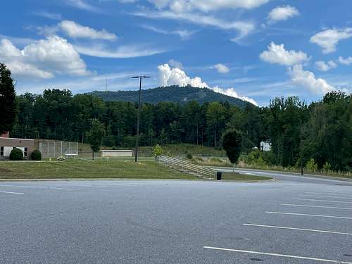
Use Google Maps to find Hibriten Mountain Rd. about a quarter mile from the gate is parking to the right side of the road. There are homes and private properties in this area, please be courteous to those living in the area. I've come back from a hike to find an upset homeowner because people had parked in their driveway. To get directions directly to the parking area you might use Hibriten Mountain Hike Parking (35.895714, -81.501523).
Route
The primary route is, when parking at the gate, to follow the gravel road (Hibriten Mountain Rd.) to the firetower at the top. The road, from the gate, is 2.7 miles one way, gaining about 700 feet, but getting steeper near the top.
A minor alternative to this is in a nearly 180 turn at approximately 2.2 miles from the gate a trail leaves the road and also takes you to the top. The total distance when using this alternative remains approximately 2.7 miles. This alternative would allow you to create a loop at the top for a bit of variety.
Another alternative route I've heard of several locals trying, but only one or two making it through, is to follow the power lines to the top from where they cross the Hibriten Mountain Rd. (after the gate). My understanding is that this option is a briery mess. I wouldn't suggest this path to anyone.
I've heard of other routes from other starting points, but never been on them myself and believe, if they exist, they likely start on private property where you may not be welcome.
Red Tape
None for walkers, hikers, runners, bicyclers. I'm not sure if horses are welcome, and am pretty sure dirt bikes/ATVs are not welcome. I'd suggest you do research.
When to Climb
It's a year round walk-up.
External Links
https://peakbagger.com/peak.aspx?pid=59030
Images/Items I will work to add to this page
Hibriten itself - Added 7/4/21
The star and or the cross
The fire tower
The parking area/gate
Maybe a route to the cave