Sarner Scharte is a mighty mountain belonging to Monti Sarentini/Sarntal Alps, the Eastermost group of Rhaetian Alps, and emerging from the perfect meadows of Val Sarentino, Sarntal in German. It's a mountain showing two conflicting and completely different sides: the large West face with its mighty ridges, smoothing slabs and wide corners of solid volcanic rock dominates the village of Sarentino, the most important center of this beautiful Tyrolean valley. Surprisingly, on the opposite side, Sarner Scharte gently slopes down with bucolic meadows, lowering Eastward and towards right to the wide saddle named Schartl, 2380 m high.
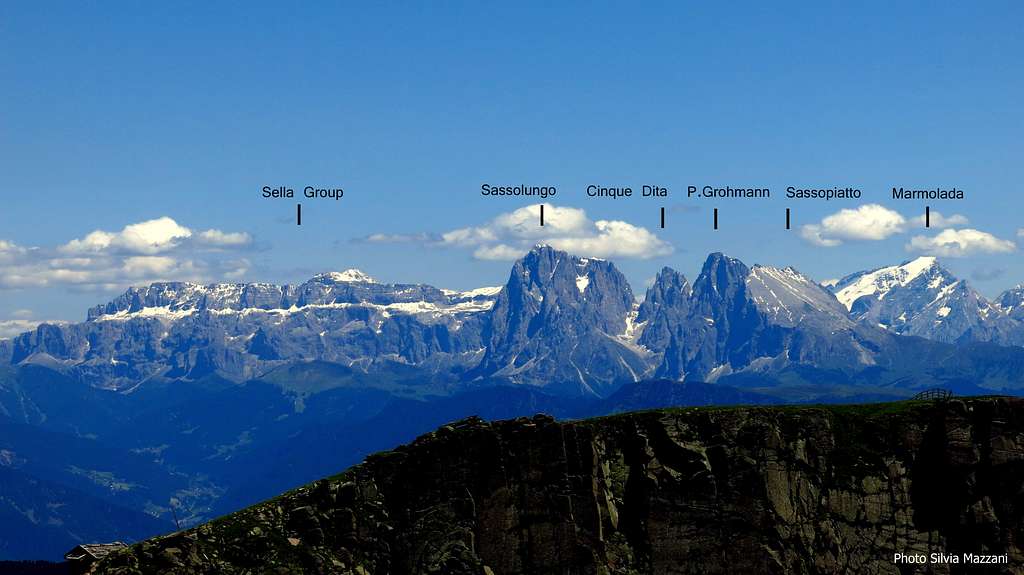
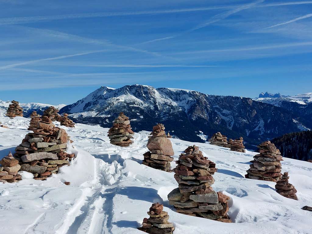
Dolomites wide pano seen from Sarner Scharte
The wide and fine West Face of Sarner Scharte projects mighty ridges, smoothing slabs and great dihedrals of solid volcanic rock (Bozen Quarz-porphyry) towards the village of Sarentino. It's a nice place for rock climbers, who can choice amongst several routes, amongst which one of the more affordable is located on the right sector of the broad face. It's Holzerkante (Wood Ridge), a plesant climb following a perfect ridge, the last one on the right hand of the wall.
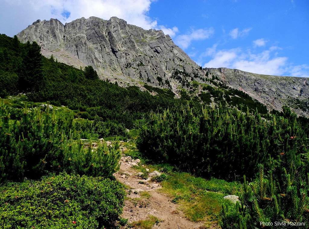
Sarner Scharte from the approach path
Getting There
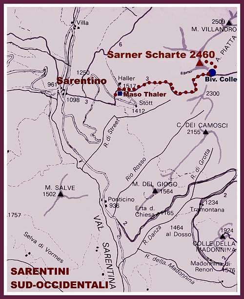
The starting point to climb is the village of Sarentino.
Road access
- Road approach from Bolzano: from the Brennero Motorway exit Bolzano Sud, cross the town of Bolzano toward North (signposts Val Sarentino), then follow the SS 508 entering Val Sarentino, very narrow at its beginning, then wider, and getting to the village of Sarentino. Before the road bends to left to reach Sarentino, leave the main road turning right and taking the Riedlsberger Höfestraße, a narrow road rising for a long time (about 6 km.) between the meadows and the typical Tyrolean country - houses (“masi” in Italian). Follow th signposts “Sarner Scharte”, leading to a grassy parking close to Maso Riedlerhof and Hallerhof, at about 1510 m.
Start of the trail to Sarner ScharteJunction of the two trails to Sarner Scharte
Route report
Holzerkante (Wood Ridge) report - UIAA scale
Summit altitude: 2550 m Difficulty: V- max (a short move) UIAA scale Climbing length: 350 m Equipment: pegs Exposure: West Starting point: Parking lot near Maso Riedlerhof
Beautiful climbing line that follows the last clear ridge on the right hand of the wall. The rock is a porphyry of good quality and the route is pleasant and fun, in a setting of great beauty.
Approach - From Riedlerhof m. 1510 follow the path n. 3 starting from the parking lot, rising amongst beautiful meadows, skirting a small lake and leading in 15 minutes to Almschank Tengler 1628 m. Here the path enters the beautiful shady forest, reaching a junction after about 45 minutes (crucifix). Follow the left path leading to the base of West wall(the right path leads to the summit of the mountain), rising steeply and reaching a wooden shrine (climbing topo inside the shrine) just below the West face. Just behind the wooden shrine it starts a track leading to the starting point of the routes Engelskante and Holzerkante. Up some rocky steps behind the shrine, then follow a trail not always clear that climbs up through the vegetation, reaching the base of a sloping edge (start of Engelskante). Continue to rise along the grassy gully, then traverse to the right below the rock reaching the base of a steep, reddish slab (visible old bolts). Traverse further to the right for about 50 meters to reach the upper part of a steep grassy gully, flanked on the left by a clear edge. Just below it starts a sloping slab with an old bolt in the middle, the starting of Holzerkante (about 1,30 h. from the parking lot).
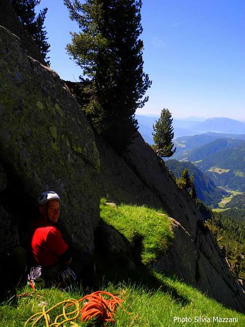
Starting point of Holzerkante
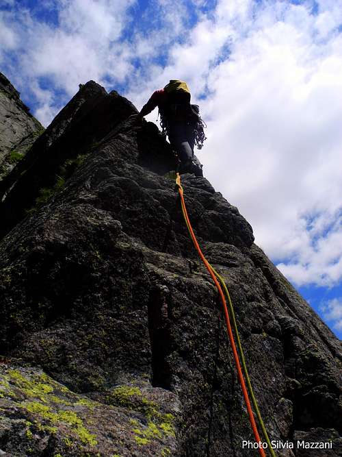
Holzerkante crux pitch face
Route report
L1 - Climb the slab, reaching the trees on the right and the edge, then up a short dihedral and belay, III, IV, 55 m.
L2 - Follow some easy steps on the ridge, interspersed with grass, getting to the next belay, III, II, 50 m.
L3 - Still along easy rock steps to a compact slab. Up the slab and belay, II, IV, 55 m
Fine slabs on HolzerkantePeople climbing Holzerkante
L4 - To the right of the stance climb a sloping groove, then turn to left and continue along the edge of the ridge, reaching a convenient stance just below a steep pillar, III, IV, 55 m.
L5 - Reach the base of the short pillar and climb it with clever movements, stopping just above, IV+, 20 m
L6 - Pass a short hardest passage on the edge of the ridge and continue with beautiful climbing, V- (a short move), IV, 50 m.
L7 - After reaching a notch up on vertical rock and on grassy steps at the end of the pitch, III, IV, II, 50 m.
L8 - Rightward on easier terrain to reach the wood tabernacle and the bench at the end of the difficulties, III, 20 m.
Airy climb on HolzerkanteCelebrating at the wooden tabernacle
On grassy slopes skirting a fence up to the vast summit meadows, then to the summit cross. The views are breathtaking!
Sarner Scharte summit crossThe little shelter on Schartle
Descent: follow Eastwards the wide summit meadows eastwards, then heading right reach the obvious saddle (wooden bivouac) and here follow the path n. 3 getting to a junction below the wall. Take the shortest path to the left that leads to the wooden crucifix and the parking lot.
Essential Gear
Normal climbing gear: ropes 2x55, helmet, 10 quickdraws
Red Tape
There are not particulary restrictions in hiking and climbing.
Sarner Scharte summit views
Sassolungo Group seen from the summitCatinaccio group seen from the summit
Where to stay
Various possibilities in Sarentino - Touristic Info Tel +390471623091
When to climb
Best season goes from June to October
A winter image of Sarner Scharte taken from the summit of Hohe Reisch
Parents refers to a larger category under which an object falls. For example, theAconcagua mountain page has the 'Aconcagua Group' and the 'Seven Summits' asparents and is a parent itself to many routes, photos, and Trip Reports.

 4871 Hits
 85.36% Score
 20 Votes