June 8, 2003
Taken from the...

June 8, 2003 Taken from the...

June 8, 2003 Taken from the saddle at 12,645 feet. Point 13,185 is in the foreground and the Pyramid is in the background. The red line indicates the ascent route we took, and the section shown in the picture is very loose, almost scree. The green line indicates the descent route we took and in my opinion would be an easier way up, except for a 300 foot scree slope, which can be bypassed on the left.
Grant
on Jul 9, 2003 12:22 pm
Image ID: 22775

Comments

Post a Comment
Viewing: 1-1 of 1

djilk - Aug 28, 2006 3:52 pm - Hasn't voted
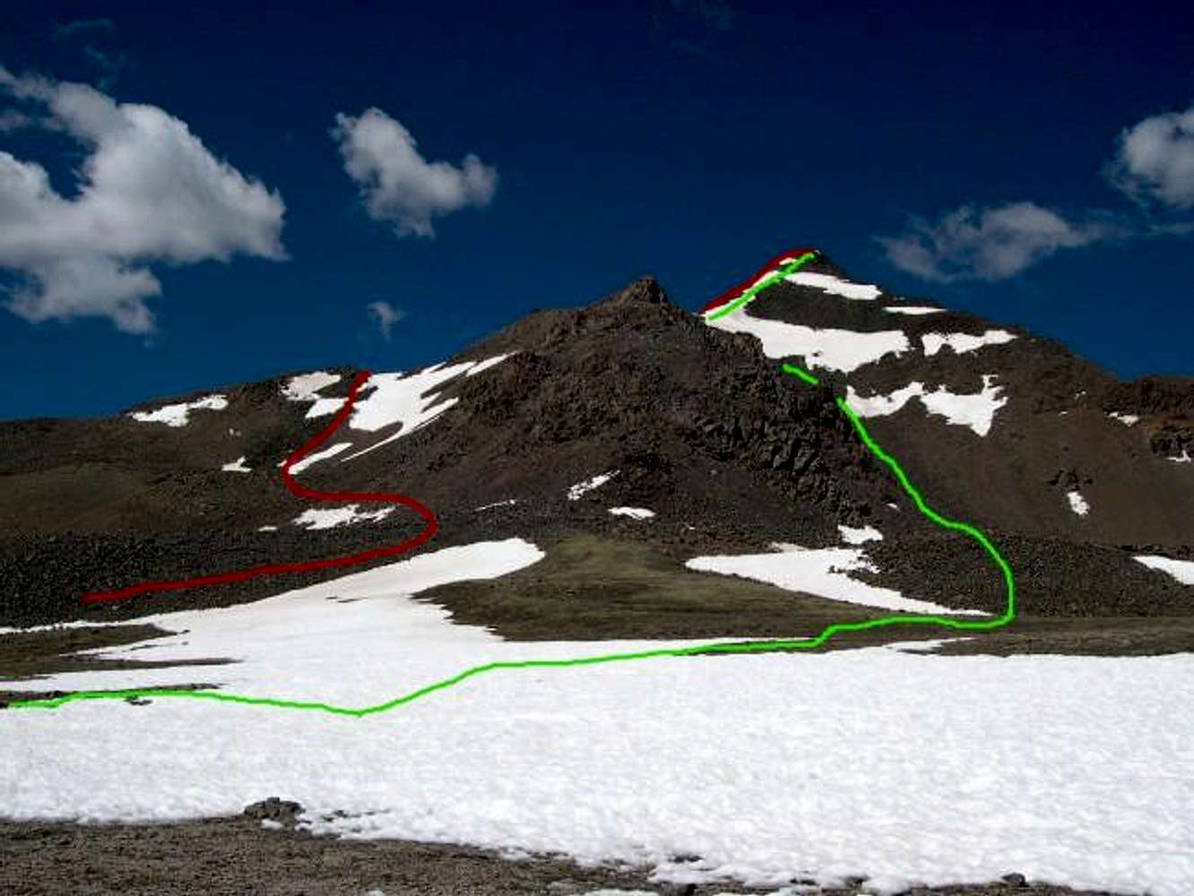
Even better route...

We started up the red line but continued left (south) along the ramp and then turned back northwest at the top. This completely avoids these two scree slopes and is just talus-hopping with a detour of maybe 100 yards.

Viewing: 1-1 of 1