
-
 669 Hits
-
 81.84% Score
-
 14 Votes
|
|
Route |
|---|---|
|
|
46.70958°N / 11.49562°E |
|
|
Hiking, Scrambling |
|
|
Summer, Fall |
|
|
Most of a day |
|
|
EE |
|
|
Overview
Kassianspitze - Samspitze crossing
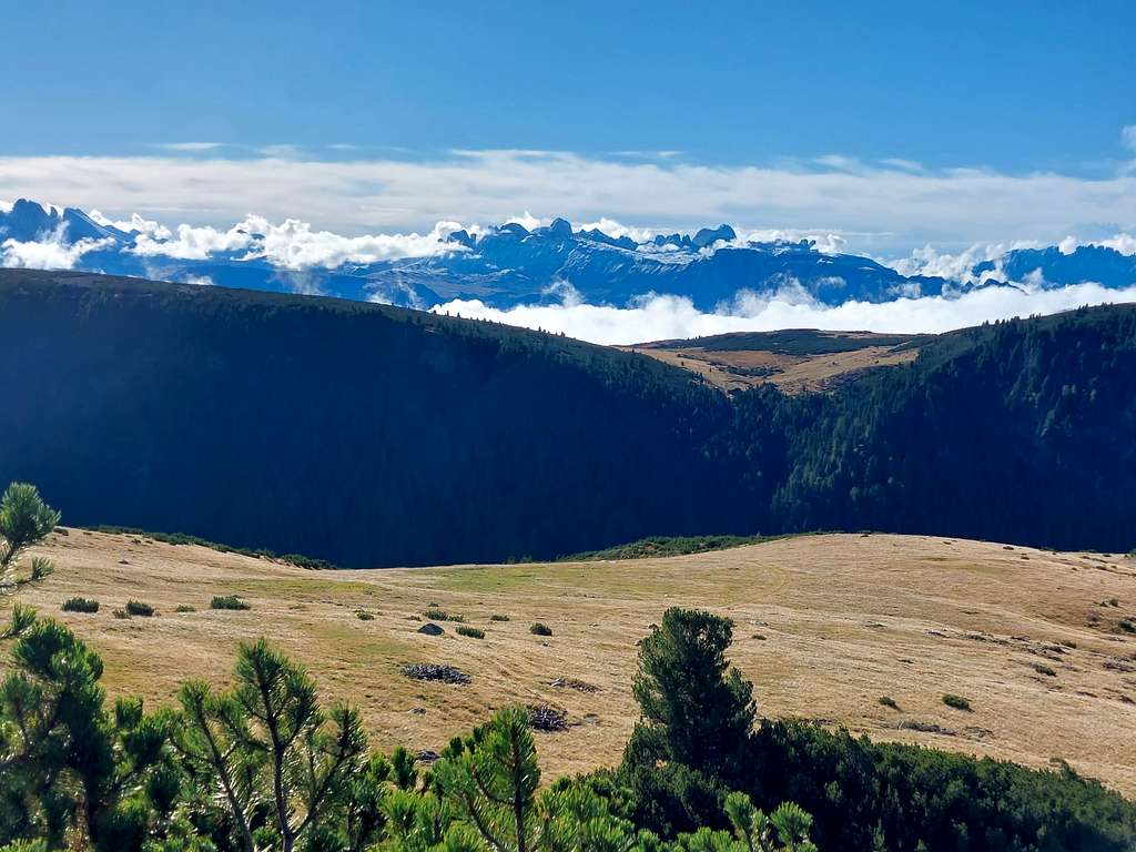
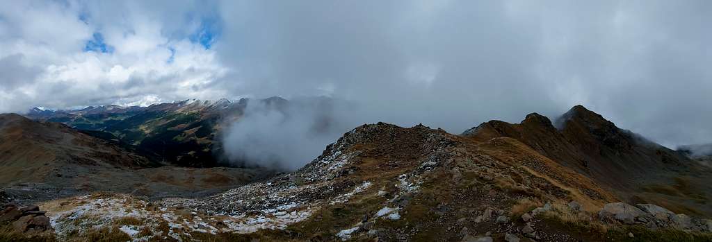
Kassianspitze 2581 m is the main summit in the mighty chain on the Eastern side of the Val Sarentino, precisely between the Val Sarentino/Sarntal and the Valle Isarco/Eisacktal. Together with the adjacent Samspitze 2563 m it belongs to the Sarentino Alps, Eastern Rhaetian Alps, in the province of Bolzano. From the summit of Kassianspitze and Samspitze on clear days you can enjoy a very wide view of the neighbors Sarentino Alps and besides them innumerable other more distant mountain chains: Brenta, Adamello-Presanella, Ortles-Cevedale, Aurine Alps (Ötztal, Stubai and Zillertal Alps) and various Western Dolomites groups. Below the summit of these mountains there is the Santa Croce/Latzfonser Kreuz Refuge with the close small church of Santa Croce di Lazfons, a high place of pilgrimage.
The two mountains have various possible accesses. Here we describe the route starting from the village of Reinswald near the valley station of the cable car and the shorter one that starts from the Pichlberg, the upper mountain station of the Reinswald cable car.
Getting There
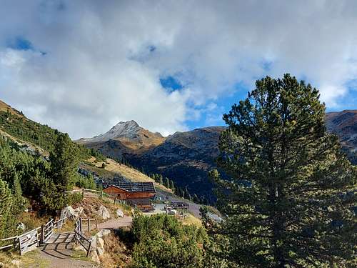
The starting point of the routes is the village of San Martino (Reinswald), located at the confluence of the Durnholzer tal and the Getrum tal. The latter is enclosed to the north by a chain of peaks that culminate with the Cima San Cassiano (Kassianspitze, 2581 m). From Bolzano drive up the Val Sarentino to Astfeld, where you leave the main road and turn right towards Durnholz. At a second crossroads, turn right again to Reinswald.
Routes Description
From Reinswald there are two possibilities to climb these mountains.
Kassianspitze - Samspitze crossing from the Pichlberg mountain station
Difficulty: EE
Difference in level: 500 m from Pichlberg mountain station plus some ups and downs along the loop
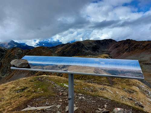
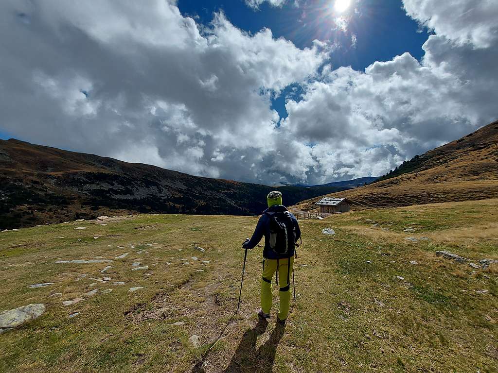
The ascent to the Cima di San Cassiano starts from the upper station of the Reinswald cableway, 2150 m, near the Pichlberg refuge. From the mountain station head Eastward on the gravel mule track n. 11, following the signposts "Kassianspitze" and "Getrum Alm". After a brief climb, the mule track gets the first panoramic point, where an illustrative table helps us to give a name to the surrounding peaks, from the Sassolungo to the Adamello- Presanella and Ortles. The landscape is very bucolic, populated by ringing cows.
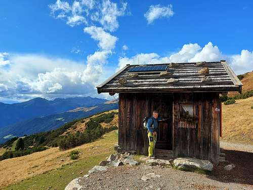
Continue to follow the mule track, passing nearby a beautiful small wooden hut, always open. Follow with some ups and downs the long mule track n. 11 which, meeting various crossroads, in about a hour leads between pastures and other wooded stretches to the Getrum alm 2094 m, where the imposing bulk of the Samspitze is clearly visible.
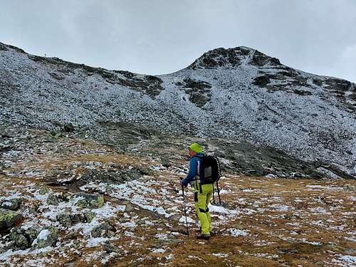
From the alm continue on the path n. 7a along the valley, then after crossing a brook on a wooden bridge you will arrive at a fork. Turn left on the path 8B and leave to the right the deviation to Latzfonser Kreuz. The path runs leftwards along the North West side of the Samspitze, then heads to the right on increasingly rocky and impervious terrain, reaching a wide saddle with wooden signposts. From the wide saddle turn left on less steep terrain, reaching in about ten minutes the panoramic summit of the Kassianspitze.
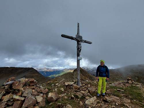
On top there are the summit book, a wooden cross and three panels for the recognition of the numerous mountains that surround it. From the summit you quickly return to the saddle and from here proceed in the direction of the clearly visible rocky ridge of the Samspitze.
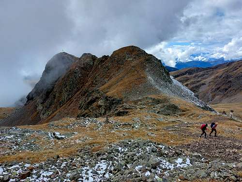
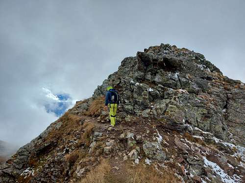
Proceeding on a narrow track a little exposed and a few short rocky stretches, you gain a saddle from where you can reach the wooden summit cross in a few minutes (summit log).
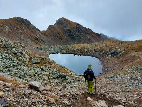
From the top of the Samspitze you return for the second time to the saddle and from here you descend to the right (south) along path n.17, reaching the beautiful San Cassiano lake, just below the Kassianspitze.
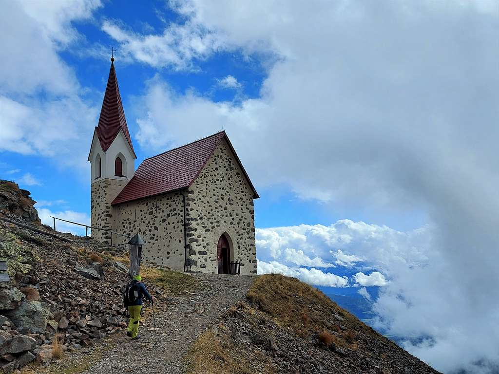
Proceeding downhill you reach the beautiful small Chapel of Santa Croce di Lazfons, a high place of pilgrimage, and the adjacent Schutzhaus Latzfonser Kreuz 2309 m.
From Latzfonser Kreuz head West on the path n. 7, initially fairly level, then slightly uphill in the direction of to the Lückl/Passo del Lucolo 2378 m, a small saddle giving access to the Getrumtal. Briefly cross a sloping and somewhat steeper flank, then a short descent leads into the Getrumtal. Shortly thereafter, you come across the familiar ascent path again and hike comfortably to the Getrum Alm and back to the Pichlberg mountain station.
Kassianspitze - Samspitze crossing from Reinswald
Difficulty: EE
Difference in level: 1000 m from Reinswald plus some ups and downs along the loop
The starting point of our alpine hike is the parking lot at the valley station of the Reinswald cable car 1570 m. Initially we proceed along the path n. 7 "Plankenhorn-Getrum", along a forest road between meadows up to Malga Getrum 2.094 m. Here we follow the same itinerary of the previous route up to Kassianspitze and Samspitze, then down to the chapel of Santa Croce di Lazfons and the adjacent Latzfonser Kreuz Refuge. We continue our tour along the path n. 7 to the "Lücklpass" 2378 m, which we pass, then proceed downhill to Malga Getrum as per the previous itinerary. From the alm take the path n. 7a along Getrumtal, which descends directly to Reinswald.
Essential Gear
Usual mountain equipment and clothing
Red Tape
No fees no permits required
Huts and alms
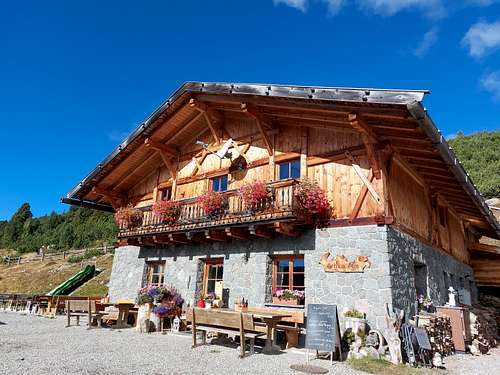
Schutzhaus Latzfonser Kreuz 2309 m
Getrum Alm 2094 m
Accomodation
Various possibility of accomodation in Reinswald
When to climb
From June to October
Meteo
Guidebooks and maps

50 vette facili - Dalla Val Venosta alla Val Pusteria by Hanspaul Menara
Compass n. 56 Brixen/Bressanone 1:50.000
Tabacco n. 40, Alpi Sarentine 1:25.000