
Comments
No comments posted yet.
|
|
Trip Report |
|---|---|
|
|
19.23108°N / 98.03273°W |
|
|
Feb 12, 2024 |
|
|
Hiking, Mountaineering, Scrambling |
|
|
Winter |
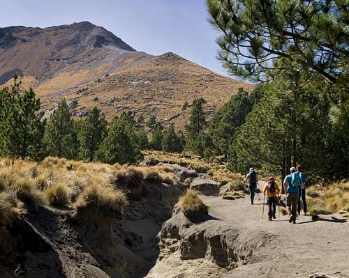
On February 12, 2024 we hiked up the North Ridge of Volcan La Malinche (4,430m) to begin our acclimatization for Pico de Orizaba. We also summitted a subpeak called Tlachichihautzi (4,100m).
La Malinche is an inactive stratovolcano in the Trans-Mexican Volcanic Belt and the fifth highest in Mexico. The volcano is also known as Matlalcueye or Malintzin.
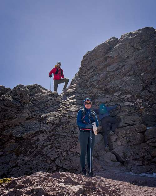
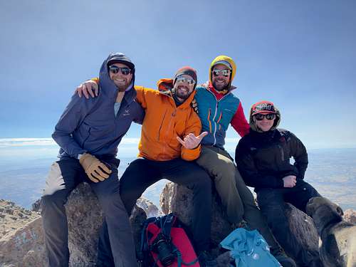
Team: Chelsea, Mike, Cam, Ken, Ivo
We started at 9:00am from a parking lot near the trailhead, following signage and an obvious pathway that occassoinally crosses a service road. We hiked 5km before exitting the forest to slopes with long grasses. The trail got steeper, but still well defined and relatively easy to travel on.
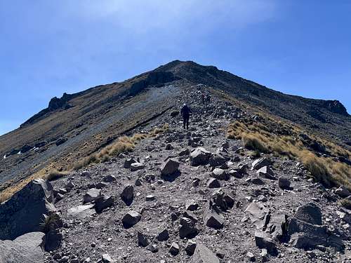
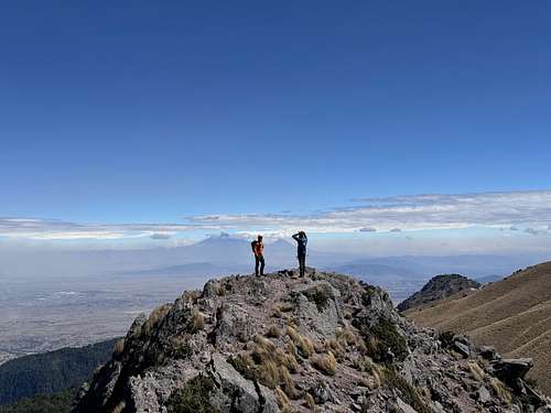
The ridge led directly to the summit, with a few options for short scrambles. There are no water sources along this route. Routefinding was not a problem.
The crux for the day may have been focusing on speed bumps during the drive from Puebla (I say this even though I was a passenger in the back seat). However, there is a summit block that, from what I could tell, has two ways that both require some degree of scrambling. We went up the north side and down the west side. Alternatively, the west may be easier to scramble up than the north.
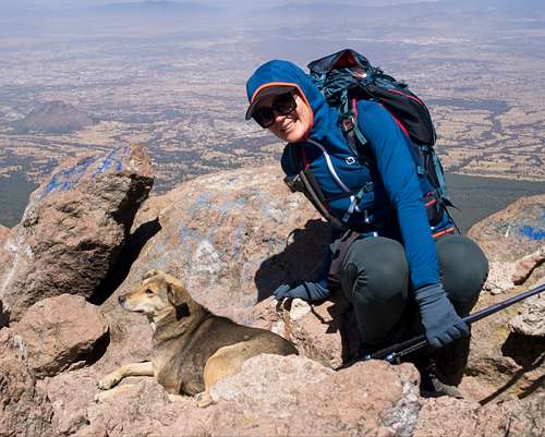
On the summit, we met a local who had climbed La Malinche over 300 times! We were also joined by a couple summit dogs who regularly tag along with climbers. They seemed hopeful we'd share our lunch at the top. They're harmless, and one even came with us to Tlachichihautzi.
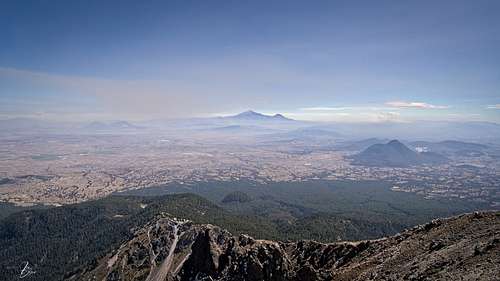
La Malinche gave us a good view of Popo, Izta, and many other volcano-looking bumps. We could even see Orizaba in the distance. It was nice to get this perspective of the area.
We exited the summit on the west side and descended the ridge along the same trail we followed up. At the low point on the ridge, we carried on to Tlachichihautzi. Four out of five of us opted to scramble the ridge. The fifth person was me. My legs were tired and i found a nice gradual path that would eventually connect woith the ridge from the west side. After some photos, we continued withg our descent. Everyone seemed to take a line of their own, but we reconnected on the lower trail.
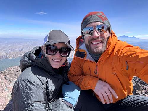
My favourite part of the trip was spending a little extra time at the summit to eat, rest, and generate red blood cells. I often find myself rushed to get off a summit due to weather or an urge to keep moving.
Parking for the trailhead (19.280180, -98.042325) is 40km from the Historic Centre of Puebla. We used Google Maps for directions and it took 2 hours with traffic and speed bumps. We crossed a few gates within the National Park. We hads to register at the first one, but didn't need to pay any entry fees. Apparently the gates close around 7:00pm.
I would consider this an easy to moderate hike with some easy scrambling at the summit. The route starts above 3,000 meters, making it a good objective to start acclimatizing for higher elevations. The hiking may feel more difficult than the the stats indicate, depending on a person's fitness and current acclimatization.
We only needed day packs, light hiking shoes, poles, and about 2 liters of water each.
Having not done much for the previous three months, lack of fitness kicked my butt! It didn't help that I was carrying the extra wieght of my drone, remote, batteries, and helipad. The winds were 40kmh or greater so I couldn't fly, and this extra weight esentially became training weight. What did I learn? Well, at 43 years old, I better take training for international peaks more seriously.
More photos from this trip on Flickr
I'm also on Instagram