
-
 6670 Hits
-
 82.48% Score
-
 15 Votes
|
|
Route |
|---|---|
|
|
45.94787°N / 6.84766°E |
|
|
Sport Climbing |
|
|
Summer |
|
|
Half a day |
|
|
D sup., French 5c |
|
|
5.9 (YDS) |
|
|
10 |
|
|
Overview
Label Virginie Route
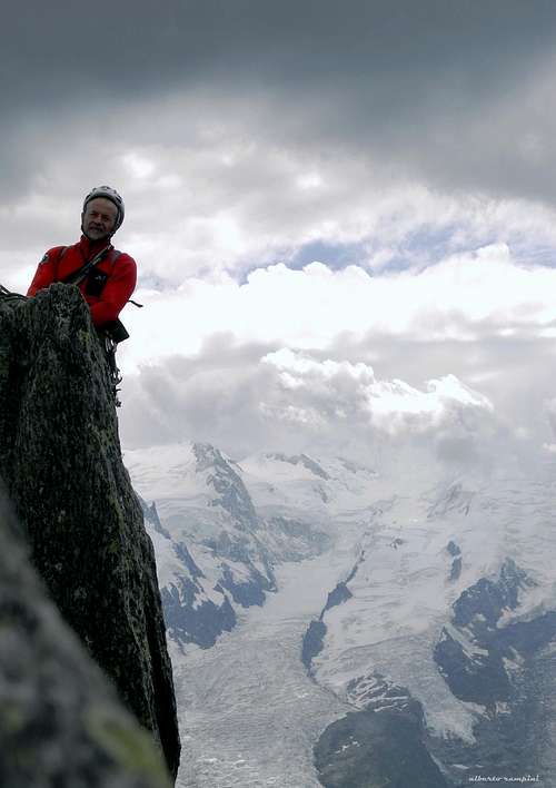
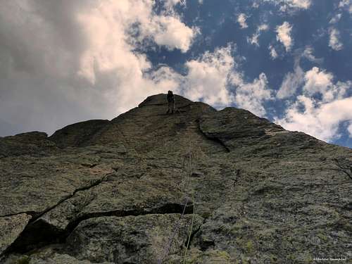
On the sunny South-East face of Clocher de Planpraz, Label Virginie route offers a technical climb on first class gneiss, leading to this magnificent thin summit. The climbing way is satisfactory and various on slabs, cracks, little walls, chimneys. The views over Mont Blanc group just in front of are unforgettable. A route that the climbers can't miss out!

|

|
Getting There
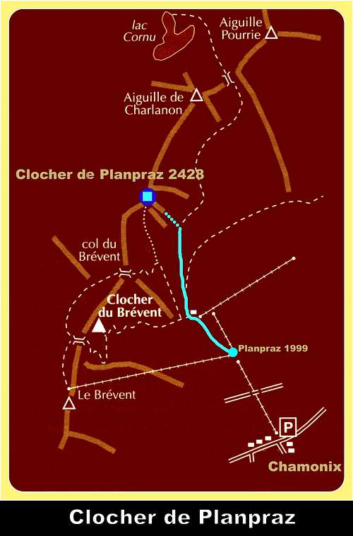
The starting point is Chamonix-Mont Blanc m. 1087
Main road approach:
- From Aosta Valley (Italy) - Follow the E25 Motorway towards Courmayeur, then the Mont Blanc Tunnel to Chamonix (65 km. from Aosta)
- From Martigny (Switzerland) - Follow the road leading to the Switzerland – France border, then to the village of Argentiere and to Chamonix (45 km. from Martigny, 13 km. from the border)
- From Geneve (Switzerland) - Follow the E25 Motorway to St. Gervais les Bains, then the RN 205 to Chamonix
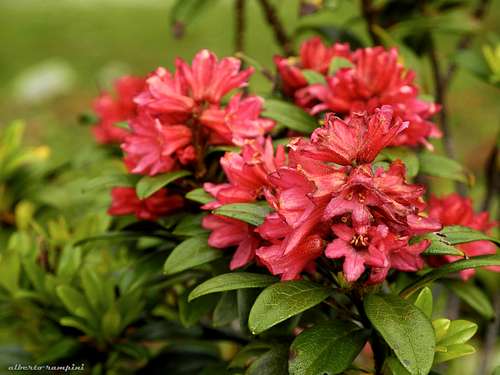
A rhododendron growing on Clocher de Planpraz slopes
Cable-car approach: from the lower station of the Brevent cable-car in Chamonix (m. 1087) take the Planpraz cable-car (the first section of the Brevent cable-car) reaching the station of Planpraz m. 1999. BREVENT-LA FLEGERE
Walking approach: from Planpraz station m. 1999 follow on your right-hand side the good trail to Cornu Lake (signs), reaching at first the bottom slabs of Hotel California, then crossing a scree. After the scree leave the main path and rise along a steep grassy and rocky slope, leading to the starting slabs (45 minutes from the Planpraz station).
Route Description
Label Virginie route report – French scale
Summit altitude: m. 2428
Difficulty: D sup., F5c max, F5b obbl.
Equipment: bolts
Climbing length: 250 m
Exposure: SE
First ascent: Yannick Brucker, Julien Cellier and Manu Mèot 11-7-2007
Starting point: Planpraz station (middle station of Brevent cable-car)
Starting point of the route climbing a slab situated below a chimney-crack.
L1 - Climb the slabs leading to the chimney-crack, 4b
L2 - Another pitch climbing the slabs - cut by thin cracks - situated in the left hand side of the chimney and leading to a stance on the summit of a spur, 5b
L3 - Scramble on some easy rocks to the base of a little wall; climb it and reach a great steep wall, 5a
L4 - Climb the beautiful wall and belay on a grassy stance, 5b
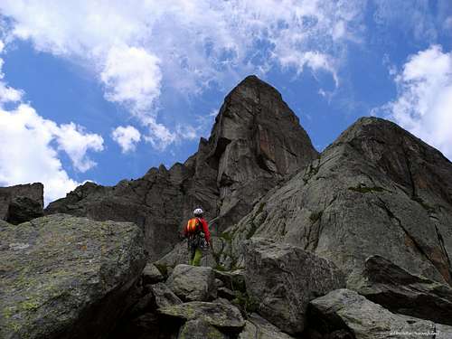
L5 - Scramble on towards the bottom of a spur
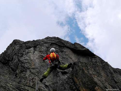
L6 - Climb a fine crack to a stance below an overhanging wall, 5a
L7 - Climb the overhang, athletic but with good holds, reaching a stance along an edge. Crux pitch, 5c
L8 - Up the edge with easy climb leading to the summit of a tower, 3°
L9 - Go down by a 20 m. abseil to a narrow rocky saddle below the summit needle
L10 - An athletic corner leading to the sharp summit ridge and to the magnificent thin summit, 5a
Descent: a 25 m. abseil on the W side leads to a characteristic rocky saddle; from here scramble down and get to a narrow trail with cairns. Follow it, joining the main Clocher de Planpraz trail and then the Brevent path. Follow it to Planpraz.
Essential Gear
Rope 2x50 m, helmet, 10 quickdraws.
Red tape
No particulary restrictions in climbing and hiking.
When to climb
Best season goes from the end of June to the end of September
Where to stay
Accomodation in Chamonix Mont Blanc - Chamonix is a primary destintion, offering several kind of accomodation (hotels, huts, gites, renting rooms) and numberless campsites, situated both in the Northern and Southern ends of the town. Main campsites:
- Camping la Mer de Glace - Les Praz (3 km. North to Chamonix) +33(0)450534403
- Camping les Deux Glaciers - Les Bossons (3 km. South to Chamonix) +33(0)450531584
- Camping les Arolles - close to the centre of Chamonix - +33(0)450531430
- Camping les Cimes - Les Bossons (3 km. South to Chamonix) +33(0)450535893
- Camping les Marmottes - +33(0)450536124
- Camping Glacier d'Argentière - Argentière (8 km. North to Chamonix) +33(0)450541736
Meteo
Other information
- Office du Tourisme in Chamonix www.chamonix.com">www.chamonix.com Phone +33 0450 530024
- Office de la Haute Montagne de Chamonix www.ohm-chamonix.com Phone +33 0450 532208
- Cable-car informations www.chamonix.com">www.chamonix.com www.compagniedumontblanc.fr Phone +33 0450 532275
Guidebooks and maps
 |
 |
|
|
- Guidebooks
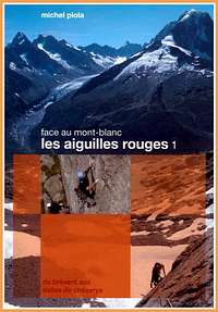
“Les Aiguilles Rouges – Face au Mont Blanc” by Michel Piola – This guidebook is in English text throughout.
"Monte Bianco classico & plaisir" by Marco Romelli, Edizioni Idea Montagna 2013
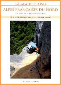
“Alpes Francaises du Nord” by Hervè Galley
"Mont Blanc & the Aiguilles Rouges" selected climbs guidebook
- Maps
IGN 3630 OT Chamonix 1:25.000