Intro/Stats
Little Giant Peak (13416')
King Solomon Mtn (13220')
5.2 miles RT, 2900'
Participants: Dwight Sunwall, Sarah Thompson, Adam McFarren, & Kevin Baker
May 23, 2009
We had our sights set on a weekend of couloir climbs in the San Juans, but the pesky spring weather had other plans. It seems like the majority of weekends this spring have been gloom and doom forecasts after a fairly mellow winter.
After a successful but gloomy day on nearby 13ers Tower and Dome, we set our sights for a couloir climb on remote West Needle. The long approach was unknown, so lucky for us we scouted it out the night before. We quickly found out that there was no way we would be able to cross raging Lime Creek! The streams are ferocious in the San Juans right now with all the dust layers accelerating the snowmelt. Onto plan B.
We drove back over Molas Pass and camped near Howardsville at the exact spot as the night before. We took CR-21 south, then wound our way up a good jeep road to around 10900' where we were stopped by a few drifts. We were happy to make it up this far and save some vertical.
Little Giant & King Solomon
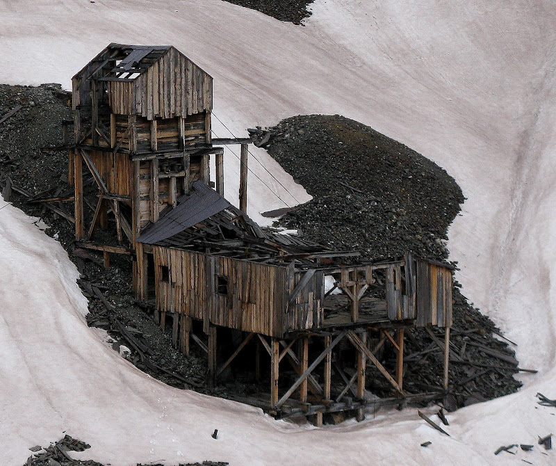
We set out at 6:20am up the mellow road. The weather was again looking unsettled as the high peaks were enshrouded in clouds. The road only had a few patches of snow here and there and we efficiently made our way into the Little Giant basin, passing two mines on the way.
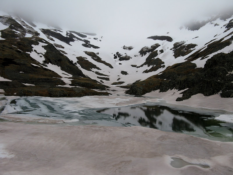
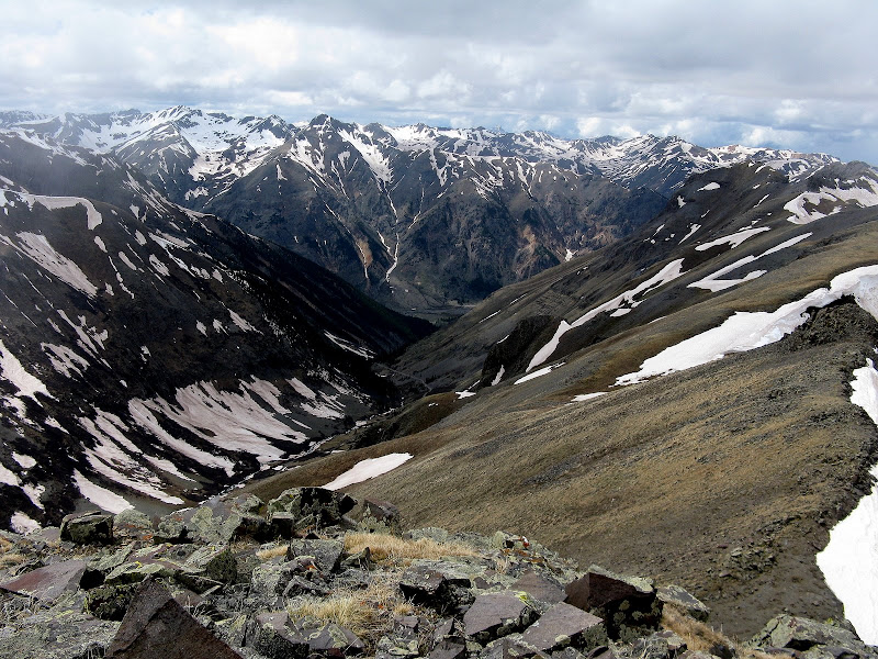
We cut a long switchback in the road and made our way up to a thawing lake in Little Giant Basin, our goal still obscured by the clouds.
We somehow missed the trail that heads all the way up to the saddle on the left side of the lake and ended up taking a steep but efficient line on mostly bare tundra slopes to the trail, hitting it just below the saddle at 12800'. The wind picked up as we came to the saddle and there was a bit of rime ice on the rocks to deal with from the overnite storm.
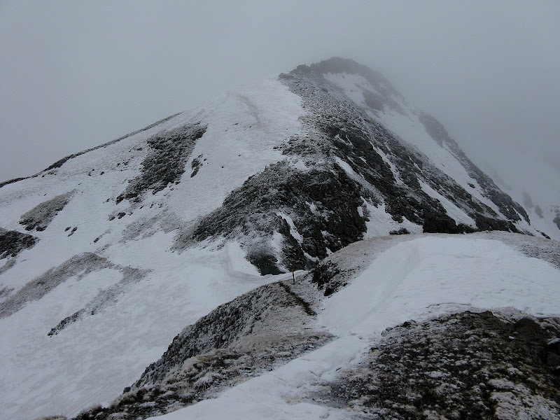
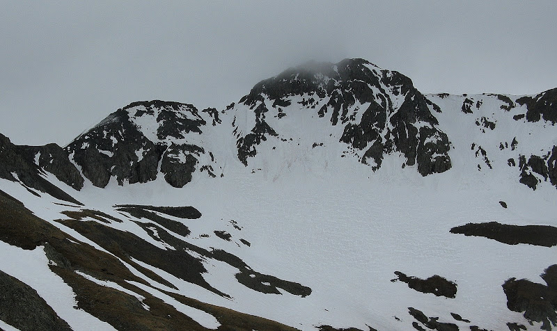
Little Giant from the saddle:
We headed up the n.e. ridge, skirting some difficulties on the south side. We picked up a trail again and followed it to just below the summit. The finish was on loose, slick rocks covered in rime ice, which was a bit tricky even though it's only class 2. We topped out on the ridge and plunge stepped our way to the summit, arriving at 8:45. Dwight said it was in the low 30's and the wind was brisk, so we only took a short break before heading down.
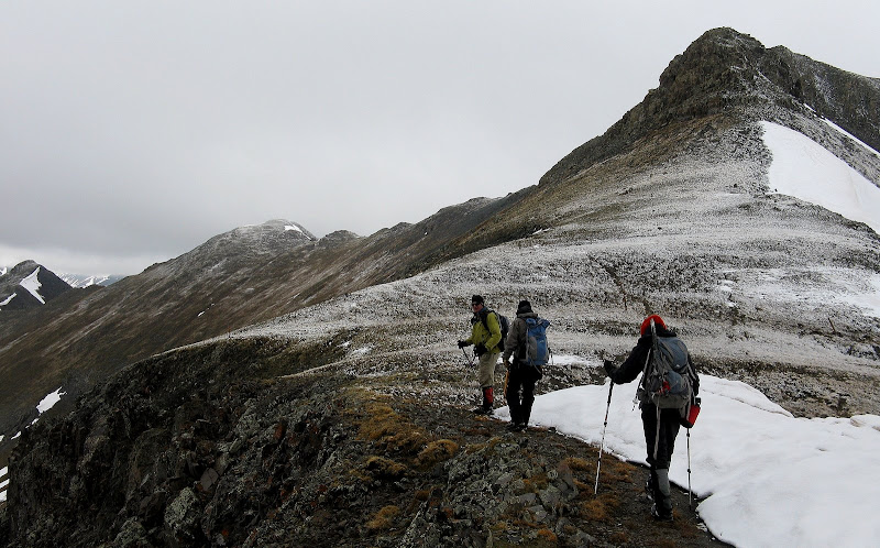
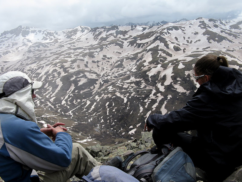
The descent seemed easier than the climb, maybe because the visibility improved. We took a lower line on the descent and had to break out the axes as we traversed a couple of steep snowfields. Back at the saddle, we followed the trail down a bit and then started a sidehilling slog on steep tundra and across moderate snowfields to soft ranked King Solomon. This sidehill avoids some difficulties on the ridgecrest.
King Solomon:
We topped out on King Solomon at 10:17. We measured the prominence of this peak with our GPS's and determined that it's around 80 feet short of being ranked, which is probably not even close enough to be considered even with GPS error. This peak had some meaning for me as I enjoy reading Solomon's books in the Bible. I told Sarah that I may have to get her an Old Testament for her wedding as Song of Solomon makes for some excellent reading material for newlyweds!
Song of Solomon 4:
1 How beautiful you are, my darling!
Oh, how beautiful!
Your eyes behind your veil are doves.
Your hair is like a flock of goats
descending from Mount Gilead.
2 Your teeth are like a flock of sheep just shorn,
coming up from the washing.
Each has its twin;
not one of them is alone.
3 Your lips are like a scarlet ribbon;
your mouth is lovely.
Your temples behind your veil
are like the halves of a pomegranate.
4 Your neck is like the tower of David,
built with elegance;
on it hang a thousand shields,
all of them shields of warriors.
5 Your two breasts are like two fawns,
like twin fawns of a gazelle
that browse among the lilies.
No wonder Solomon had so many wives! I wonder if Little Giant was named after King David. He indeed was a little giant. Back to the hike. For the descent, we bombed down steep tundra and picked up the trail and it was a quick descent back to the car, arriving at 11:35.
Little Giant makes an appearance on the way out:
Unnamed 13069: A View At Last!
Unnamed 13069
5 miles RT, 2620' gain
via Maggie Gulch
4 hours RT
The weather was holding, so we decided to see if we could squeeze in UN 13069 while we were in the area. Adam decided he had had enough of slogs for the day, so we dropped him off at camp. Luckily we wouldn't need his kick stepping skills on this hike as it was completely dry.
We first tried our hand at going up Minnie Gulch. A road closed sign discouraged us, but we headed up anyway to see how high we could get. A pile of rocks was the end of the road, but we were high enough up to make an afternoon attempt. Not more than 400 yards up the road and we came to a huge washout, which was a big time San Juan show stopper. You never know what obstacles you'll run into out here!
There was no way we could get across and there were no safe looking options further down. We drove back down and decided to head up Maggie Gulch to the west. This basin is steeper, although we could possibly get closer. We made it all the way up to 10400' and parked the car at a junction to the Ruby mine.
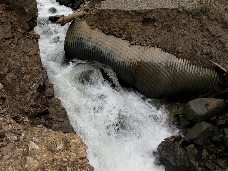
A spectacular waterfall offered some sweet eye candy early on.
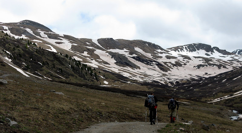
The road ascends slowly up the basin. I didn't have a waypoint set for this peak and it was unclear which one was it.
Heading up Maggie Gulch:
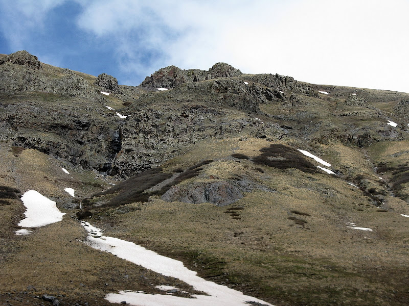
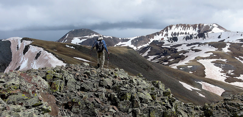
At around 11500', we left the road and headed due east up very steep tundra to the ridge. We stashed some gear just above the road.
I pretty much hit the wall here as you climb 1400 feet in 1/2 mile to the ridge, which is quite a bit steeper than the Manitou Incline! Once on the ridge, we enjoyed a short catwalk to the summit. I had not eaten enough during the day and was famished when I reached the summit. We were finally rewarded with some classic San Juan views up here.
Looking north down Maggie Gulch from summit:
Looking s.w. from summit:
Dwight & Canby Mtn leaving the summit:


Comments
Post a Comment