
-
 15819 Hits
-
 85.36% Score
-
 20 Votes
|
|
Mountain/Rock |
|---|---|
|
|
49.69400°N / 125.608°W |
|
|
Hiking, Mountaineering |
|
|
Spring, Summer, Fall |
|
|
5797 ft / 1767 m |
|
|
Introduction
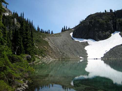
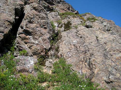
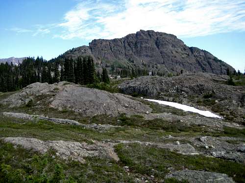 Marble Peak east aspect Marble Peak east aspect |
Initial access is by boat since there are no roads on the west side of Buttle Lake. Once across the lake, however, onward travel is easy enough on the engineered and graded Marble Meadows Trail.
Although Marble Peak is the closest of the Meadows mountains to the plateau crest, the route to the top involves some tricky route finding and exposed, stiff Class 3 scrambling on loose rock.
The rewards, however, are superb. If the weather is fine, almost the whole of Strathcona is visible from here in one stunning 360° panorama, all underpinned by the giddying drop down to Buttle Lake over 1500 metres below.
Marble Peak west aspect
Getting There
Details regarding the initial approach are exactly as for that to Marble Meadows and for the east approach to The Golden Hinde.Vancouver Island can be reached by air from Toronto, Vancouver, Seattle, Calgary and Edmonton to Victoria, Nanaimo, Comox or Campbell River and by ferry from Port Angeles to Victoria on The Coho and on BC Ferries from Vancouver to Victoria or Nanaimo. Public transport on the Island is notoriously poor and anyone arriving by air would be advised to rent a car. Road access involves driving only on paved roads, so a normal 2WD sedan is fine.
From Campbell River, at the end of the freeway section of the Inland Island Highway 19, take highway 28 west towards Gold River. After approximately 30 km the road meets Upper Campbell Lake and after 47 km you will enter Strathcona Park at Elk Portal. Exactly 1 km further on, highway 28 makes a right turn over the bridge at Buttle Narrows. Ignore the turn and carry straight on down the paved Buttle Lake Parkway (also known as Westmin Mine Road). 21 Km after passing the turn-off for Gold River, park at the Augerpoint day use area if you are using a canoe or kayak. If you’re using a power boat it can be launched from Karst Creek a few kilometres beyond Augerpoint or simply launch it from Parks’ campground at Buttle Narrows – just across the bridge to Gold River – and motor 15-20 minutes down the lake.
Marble Peak from the start point at Phillips Creek.
Cross the lake to the outlet of Phillips Creek, where there is a marine camp-site with facilities. Avoid a late afternoon crossing in a small craft. Winds funneling up the valley can make the lake very rough.
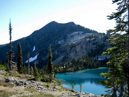
From Phillips Creek, Parks’ excellent, switchback trail takes you in about 4 hours up to the plateau crest. Make your base camp by any of the stunning lakes west of here or proceed to the A-frame Wheaton Hut – the only such hut in Strathcona Park – with Wheaton Lake nearby. Well cairned and booted-in paths follow the north side of Limestone Lake and traverse both sides of Globeflower and Marblerock Lakes to the Wheaton Hut in 1-2 hours from the crest.
Final approach and summit route
View west from upper SW ridge
Find a clear and cairned track going NE off the col. Proceed up the easy lower part of the SW ridge for 400 metres and through a characteristic limestone band to N49° 41.505 W125° 36.795 where a large bluff bars further easy progress. From the west (Wheaton) side, and apart from this bluff, the SW ridge looks like an easy walk-up. From the east (Limestone) side, however, the true nature of the beast is apparent. There are at least two places where the SW ridge is divided right through from east to west by impassable gaps which must somehow be crossed in order to make forward progress.
 Marblerock/Globeflower Col | 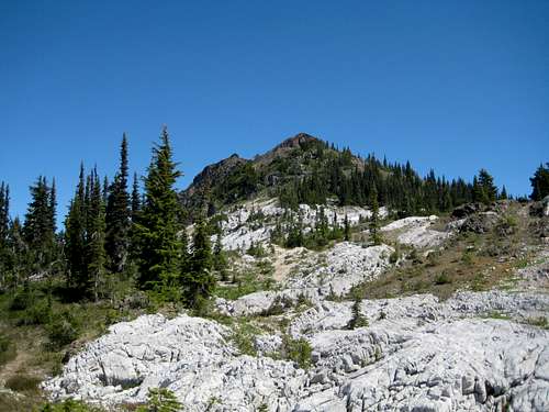 Lower SW Ridge | 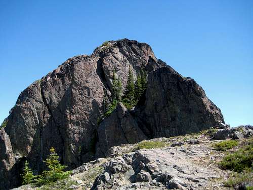 First Bluff Obstacle on SW Ridge | 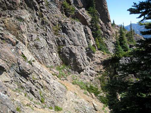 1st Traverse Route |
Emerge from here in the neighbourhood of N49° 41.574 W125° 36.592 and hopefully back on the SW ridge once more.
Proceed along the ridge for only 75 metres before the next gap in the ridge bars the way. You are faced with a short but vertical wall above a “landing” ledge right in the middle of the gap. It looked climbable to me but not down-climbable and not on my own. Instead, follow the majority and descend to the right once more, this time for quite a distance - perhaps 30 or 40 metres - before finding the gully that leads back to the ridge for the second time. This one has a bushy juniper at its base. Either hug the cliff and squeeze behind it, or hang off its branches and go round the front with some exposure. Go up the gully and back to the ridge at N49° 41.621 W125° 36.539.
 End of 1st Traverse. Up here to the "squeeze" gully | 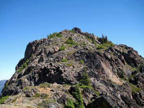 Upper SW Ridge | 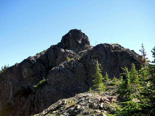 Summit Block just before the last gully | 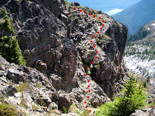 Final Gully Crossing |
The summit has a large cairn but no register and has a big pole stuck in it. The best all round views, particularly down to Buttle Lake, are to be had be going a few metres north down off the summit and climbing back up to the east to the edge of the bluff.
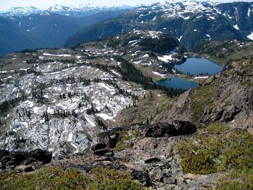
View down from the summit to Marble Meadows and Limestone Lake.
Red Tape
None. You’re outside the Strathcona Park core area where camping fees are due.Camping.
Anywhere you like in Marble Meadows. But please respect this beautiful and delicate place. Stay on trails even near campsites, hang food bags out of reach, clean up all cooking scraps, practise good toilet discipline etc.Giardia is well documented throughout Strathcona Park, so boil or treat all water.
Fires are strictly prohibited, so you must pack a stove.
Bear and cougar frequent the mountains and forests of Vancouver Island, so hang or otherwise isolate all food at night.
Additional Information
Be aware that BC Parks does not operate an intentions system. Make sure, therefore, that you have left a detailed trip plan with someone responsible. The RCMP and the appropriate SAR agency will respond in an emergency but it is up to you to have the mechanism in place that will initiate the call-out process if it becomes necessary.There is line-of-sight from the summit of Marble Peak to the cellular repeater tower on the summit of Mt Washington and, therefore, reasonably reliable service from there. There is no service anywhere else on any of the approaches or sub-summits described above.
Map required for this trip is the government 1:50 000 topographical map sheet 92F/12, “Buttle Lake.” Advance copies can be ordered at BC Government Maps on-line. Copies are usually readily available in good bookstores and outdoor stores throughout the Island.
Suggested Reading
Island Alpine – A Guide to The Mountains of Strathcona Park and Vancouver Island, Philip Stone, Wild Isle Publications, 2003, ISBN 0-9680766-5-3 and/or visit Island Alpine Climbing GuideBeyond Nootka – A Historical Perspective of Vancouver Island Mountains, Lindsay Elms, Misthorn Press, 1996, ISBN 0-919537-29-4 and/or visit Beyond Nootka
Weather
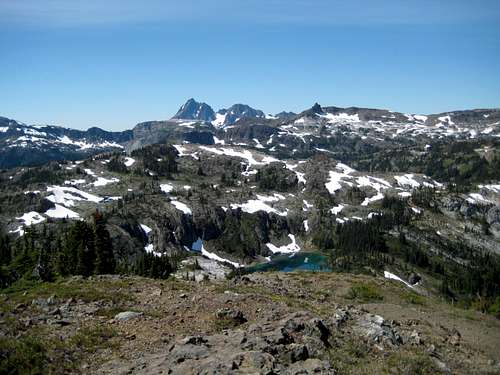
Nearest point forecast is Gold RiverSummit Panorama
  |