
-
 20176 Hits
-
 84.27% Score
-
 18 Votes
|
|
Mountain/Rock |
|---|---|
|
|
37.56632°N / 118.81104°W |
|
|
Mono |
|
|
Hiking, Scrambling, Skiing |
|
|
Spring, Summer, Fall, Winter |
|
|
10886 ft / 3318 m |
|
|
Overview
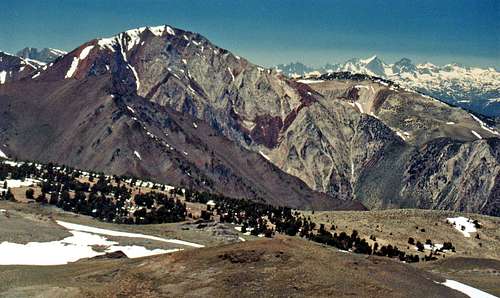
Laurel Mtn. and the Ritter Range from McGee Mtn.
The northwest and south slopes are class 2.
Starting with the colorful Sevehah Cliff on the east face of Laurel Mountain there is an expansive view northwest emcompassing the Ritter Range and the big peaks west of Mono Lake. To the south is the impressive Nevahbe Ridge directly over Mc Gee Canyon. To the southwest the views include Mount Crocker, Red Slate Mountain, Mount Baldwin, White Fang and Mount Morrison.
Getting There
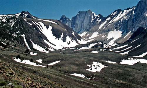
Hanging Valley northwest of McGee Mtn.
Turn southwest and go 2.3 miles to the Campground area at 7,700'.
Scramble south about 500 verticle ft. up a sagebrush moraine into the hanging valley between Mono Jim Peak (the dark brown peak in front of Mt. Morrison) and McGee Mountain. Hike about a mile south up the valley and ascend the northwest slope to the big upper hanging valley. Continue another 1.3 miles southeast to the peak.
South Slope from McGee Creek: From the junction of Hwy 203 and 395 go south 8.7 miles to the McGee Creek Road.
From Bishop go north 30 miles from the junction with Hwy. 6 at the north end of town.
At McGee Creek road go south 4 miles to Upper McGee Creek Campground at 8,100'.
Ascend the south slope 1.5 miles starting with relatively stable sandy sagebrush and on up to the plateau at 10,470'. Go east .5 miles to the summit.
4WD road up McGee Mountain: Trip report by Bob Burd
Red Tape

Northwest from McGee Mtn.
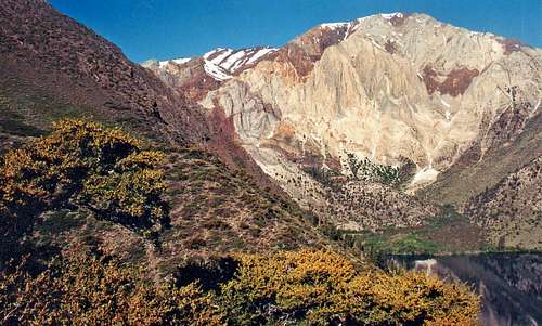
Laurel Mtn from Convict Lake area
Camping
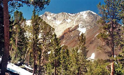
Mt. Morrison from McGee Mtn. northwest slope
There is a campground at the end of the Convict Lake road at the northeast end of Convict Lake at 7,700'.
There is the McGee Creek Campground 1.8 miles in on the McGee Creek Road to the left at 7,600'.
There is also the Upper McGee Creek Campground 4 miles in at the end of the McGee Creek Road at 8,100'.
Current weather and 5 day forecast

Nevahbe Ridge and Mt. Morgan north from McGee mtn.
Etymology
Three McGee brothers, Alney, John, and Bart were pioneer cattlemen in Mono and Inyo counties. This McGee Creek was named for Alney Lee McGee. All these other "McGee" names probably are derived from the creek. The creek and the mountain are named on the first Mt. Morrison and Mt. Goddard 30-minute maps.,1914 and 1912 respectively. (Robert M. Harper, great grand nephew of Alney Lee McGee.) (INF)Place Names of the SIerra Nevada by Peter Browning