Middle Palisade Day Hike 2015 via South Fork
Indeed a hike to remember. I had my eyes on the class 3 Middle Palisade for 2 years, I just thought I wasn't ready for it. But it was time to get things accomplished, so Middle Palisade made it to the list of peaks to hit in 2015. This was my 4th hike in 4 days, after Boundary & Montgomery, Split and Agassiz.
The trailhead
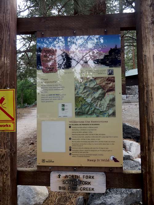
![Big Pine Creek Trailhead sign]() Big Pine Creek Trailhead sign
Big Pine Creek Trailhead sign
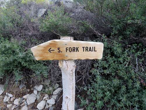
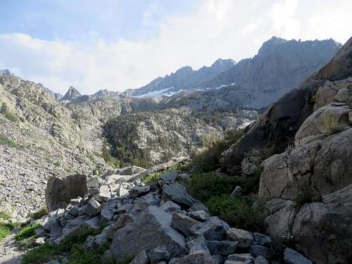
| ![South Fork trail]() South Fork trail
South Fork trail
| ![South Fork trail]() South Fork trail
South Fork trail
|
At 5:00 AM I was at the end of Glacier Lodge Rd. From the reviews I read, I was under the impression that there were two different trailheads at Glacier Lodge: South Fork and North Fork. In the reviews I read about hiking to Middle Palisade, everyone was talking about getting on the South Fork, arriving at the creek that can only be crossed after removing shoes and socks. (The ice cold water, about 50 feet wide and at least a foot deep, brought shivers to my body, including a brain freeze.) It is not true that this is the only way to get on the South Fork trail, but that's exactly what I did. I found out in total disbelief, at the end of the day, that there was a bridge for hikers to cross the creek, on the other side. To clear the confusion up, this is how it should go: From I-395 in Big Pine, take Crocker Ave (only goes West). That road becomes Glacier Lodge Rd. Take that road until it dead ends. Once feet away from where the road dead ends, there is a bridge to the left that would allow cars to cross the South Fork Big Pine Creek on the other side. That's not what a hiker going to either Middle Palisade or Mt. Sill wants. At that small intersection, which is not confusing at all, there are a few parking spots for day hikers. One just has to remember that the trailhead for either Middle Palisade or Mt. Sill are right where the street dead ends, and not passed the small bridge over the creek on the left. There are a few parking sports there, some toilets, a metal barrier and the Big Pine Creek Trailhead sign (however, the sign is passed the metal barrier.) That is where the trailhead is located, for both South Fork and North Fork trail. After a short distance, the trails split, but the sign is easily noticeable.
The hike to the mountain
![Willow Lake]() Willow Lake
Willow Lake
| ![Breinard Lake]() Breinard Lake
Breinard Lake
| ![Finger Lake]() Finger Lake
Finger Lake
|
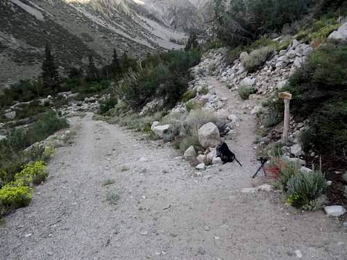
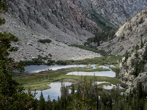
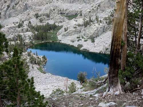
From here to Brainerd Lake, the trail is obvious, very easy to follow. Sice I did not get on the trail at the trailhead, but rather on the other side where there is a gravel road between some cabins, I ended up bushwhacking along the creek on use trails (probably made by people that fish,) until I got to a dead end. Out of frustration I turned right and uphill, away from the creek, and walked that way until I hit the trail (I figured that the only logical place one would have a trail was higher on the valley and not literally by the creek.) From there on, I did not have any other bad events for the rest of the day. It was about 5:45 AM when I was finally on the good trail. Being in the valley was nice and cool, the Sun hadn't made it's way over the mountains yet. Going up, passed the switchbacks on the other valley, swarms of mosquitoes were very happy to see me. I was not prepared for them, but I was lucky to have a very light hoodie which provided me the necessary protection. I was a little nervous by this time because of the fact that there was absolutely no sign of human life in that direction. It always gives me comfort to know that there are other people around, especially on a hike like this, unknown to me, very long, where there is really not much flexibility for getting off trail and losing valuable daytime. But to my surprize, a camper and his dog were coming down. The guy camped at Brainerd Lake and he assured me that there was absolutely nobody else anywhere passed that point. I didn't like that, but I pushed on. At 7:20 AM I was at Brainerd Lake where, to my surprise, a camper was laid out on a rock, sleeping in the Sun. Once I got at this lake, the obvious trail went to the left, around the North edge of the lake. However, the trail for Middle Palisade and Finger Lake split to the right, not even 20 feet to Brainerd Lake. But that wasn't obvious, being it was covered by some bushes.
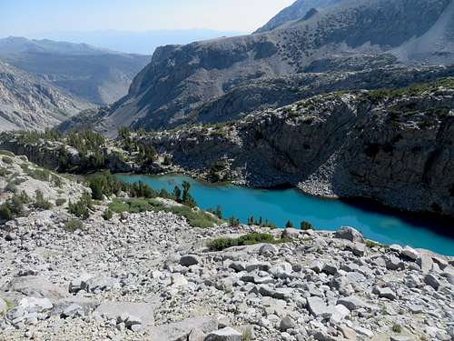
From Brainerd Lake to Finger Lake it was a pain of a hill to hike over, in the baking Sun. There were cairns, sometimes the trail fades underneath my feet, but the goal is to make it to the top of the hill. From there, Finger Lake was not immediately visible. I kept following the trail bearing left, until I saw the lake. I got to Finger Lake at 8:20 AM. However, I was on its left side and the map I had showed that I had to cross on the other side, at the lower tip of the lake. This is where the lake forms a creek that goes down into a mighty waterfall. So I had to go back to the lower tip of the lake, a 5 minute backtrack. I stopped to get water and crossed toward the final hill and field of boulders that separated me from the mountain. There were two tents close to the river crossing, but I did not see anybody and I couldn't tell if people were sleeping or the tents were empty.
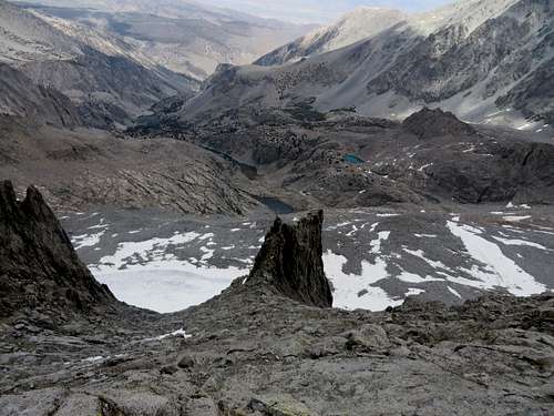
![Middle Palisade boulder field]() Middle Palisade boulder field
Middle Palisade boulder field
| ![Middle Palisade]() Middle Palisade - boulder field, glacier & moraine
Middle Palisade - boulder field, glacier & moraine
| ![Middle Palisade]() North face of Middle Palisade
North face of Middle Palisade
|
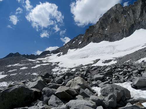
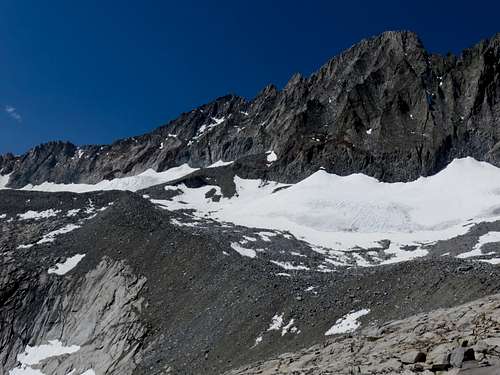
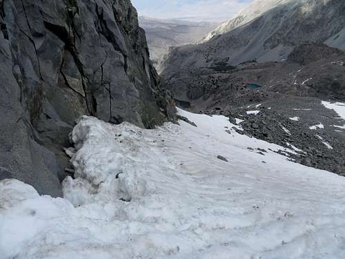
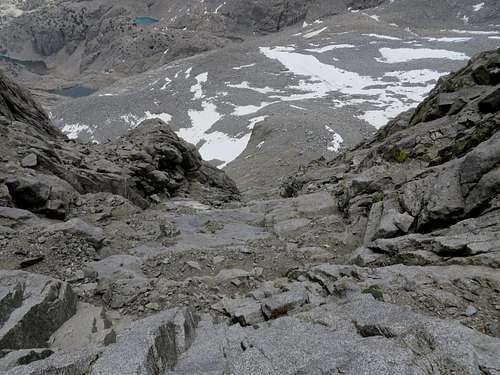
Getting up the first hill, I noticed the infinite field of boulders, every imaginable size. From there, going up the hill and onto the field of boulders, there are millions of cairns that would drive one mad if followed. Probably were been built just to make fun of hikers, since some of them don't lead to anything. So, I used my sense of orientation and tried to go up the hill without hitting a wall or losing elevation. The boulder field, although not difficult to negotiate, seemd very boring and slow advancing. Although the mountain was right in front of me, I wasn't getting there any faster, despite the effort. I started noticing fairly fresh steps in the snow fields I was approaching. Since I didn't see anyone, I figured the foot prints were from the day before. I continued on boulders and snow, until I got to the moraine in front of the mountain, the one that separates the glacier.
The climb
![Middle Palisade]() Middle Palisade - 4 hikers on the moraine
Middle Palisade - 4 hikers on the moraine
| ![Middle Palisade]() Middle Palisade - 2 guys trying to go up on class 4-5
Middle Palisade - 2 guys trying to go up on class 4-5
| ![Middle Palisade moraine]() Middle Palisade moraine from above
Middle Palisade moraine from above
|
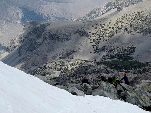
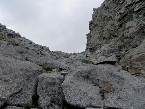
There, to my surprise, I saw 4 climbers resting. I was so happy, in my mind I made them my friends, instantly. When I looked back, there was another hiker right behind me! Now, that was crazy! He looked like a mountain/trail runner, having nothing on him but a belt with a bottle of water. He said he was behind me the entire way up. Whatever he meant by that I don't know, but I didn't see him the whole day, and I have the habit of looking back all the time. He was a very fast hiker, probably he was behind me, but didn't really start at the trailhead until 2 hours after I did, I suppose. The other 4 hikers, who got to the base of the mountain some time before me, had tried to go up the elusive ledge. However, they felt it was above their skill level, and now they were prospecting climbing onto the mountain directly from the moraine. That to me looked like something I could not have done with my climbing experience, but they also shortly gave up themselves.
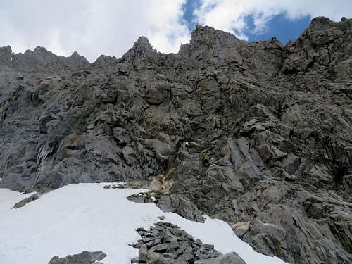
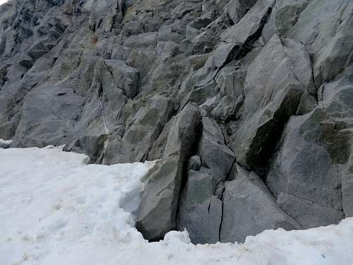
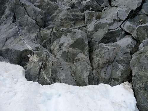
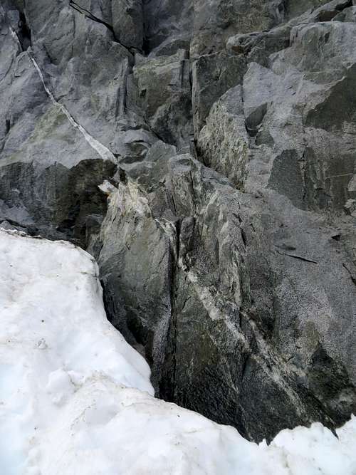
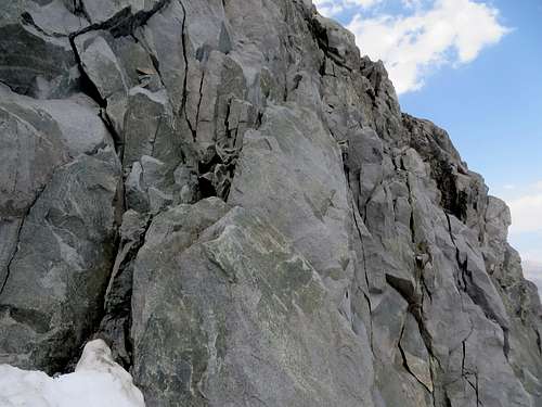
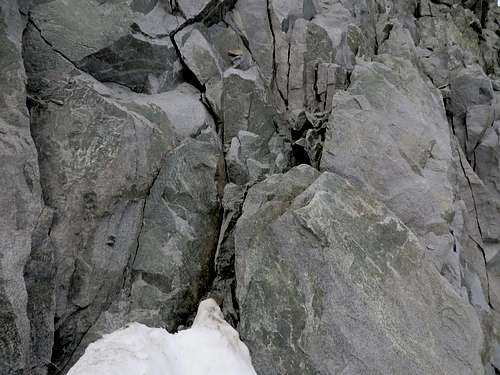
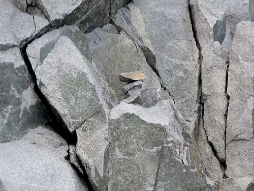
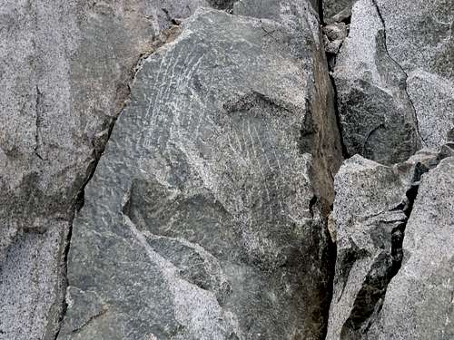
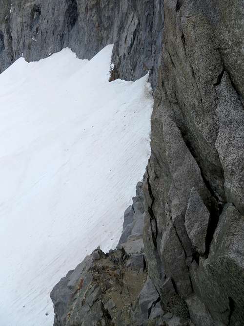
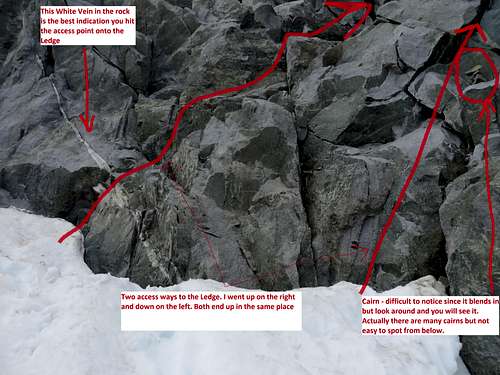
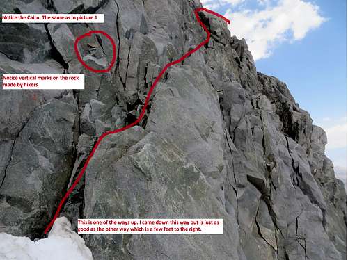
The Ledge
![Middle Palisade ledge]() Middle Palisade ledge
Middle Palisade ledge
| ![The ledge]() The ledge
The ledge
| ![The ledge]() The ledge
The ledge
| ![The ledge]() The ledge
The ledge
| ![The ledge]() The ledge
The ledge
|
![The ledge]() The ledge
The ledge
| ![The ledge]() The ledge
The ledge
| ![The ledge]() The ledge
The ledge
| ![The ledge]() The ledge/ vertical scratches on rock
The ledge/ vertical scratches on rock
| ![The ledge]() The ledge
The ledge
|
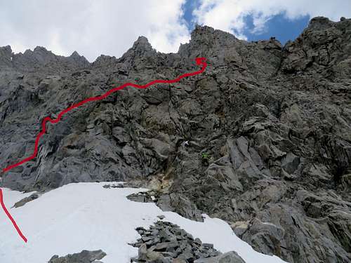
![Middle Palisade Ladge Route]() Middle Palisade Ledge Route from the morraine
Middle Palisade Ledge Route from the morraine
| ![Middle Palisade Ledge Route]() Middle Palisade Ledge Route from the glaciar
Middle Palisade Ledge Route from the glaciar
| ![Middle Palisade Ledge Route]() Middle Palisade Ledge Route from the glaciar
Middle Palisade Ledge Route from the glaciar
|
However, it was thanks to these 4 guys that I found out where the ledge was. If it wasn't for them, I don't know if I would have found it. I mean, it is really elusive. Even being next to the ledge, providing that one hikes left from the moraine, along the mountain, on the glacier/snow, gaining some elevation, one cannot see it. But because these guys were there and the footprints were clear, I climbed right onto the first rocks (I actually found two different ways of getting onto the ledge), made two crazy (I'd say class 4) moves, and then I was on the ledge. I waved at the 4 guys who were looking at me, I screamed at them to come back and climb the mountain, since the ledge was not as bad as they initially described it to me, but they didn't make another attempt. Once I got onto the chute I was about to climb, the one hiker that came behind me, his name was Joey, popped up right next to me. He'd hiked here before and now he came up the class 4-5 portion at the top of the moraine.
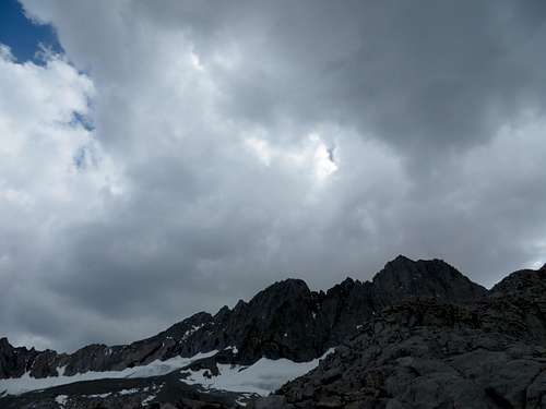
I was so happy I ran into all these guys, my life became better all of a sudden. The guys at the bottom of the mountain showed me the ledge and Joey, who maid it to the top way faster than I did, pointed out the summit. The summit was not really visible from the chute I was climbing. Actually, I don't even think that the real summit is visible from the field of boulders either. Some clouds were ganging up on the summit, with some drops of rain coming down on me. I did not like that. Everywhere I read about this climb, people were saying that the mountain is a pain to descend when the rocks are wet. As things were going so well for me thus far, Joey, who was hiking down and met me again about 3/4 of the way up, told me not to worry because the clouds didn't look like a storm just yet.
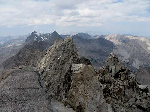
![Middle Palisade class 3]() Middle Palisade class 3 looking down
Middle Palisade class 3 looking down
| ![Middle Palisade class 3]() Middle Palisade class 3 looking up
Middle Palisade class 3 looking up
| ![Middle Palisade Gendarme]() Middle Palisade Gendarme
Middle Palisade Gendarme
|
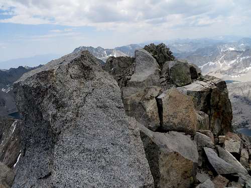
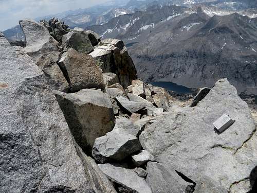
So, I continued my climb until I got to the summit. Going up the main chute, the invisible summit is all the way to the left. The summit rock was again very difficult for me to climb, since it is a very big rock with little to grab on. But I got on top of it somehow and on the summit I was, at 12:50, about 7 hours and 15 minutes from the start. I did the summit stuff (pictures, food, registry, admiring the view, calling people - good cell reception on the summit) and at 1:10 PM I headed down. Sliding down from the summit rock was again a careful move that I had to make, taking me a few tries to get on the most manageable side, but after that everything was a pleasure.
![Summit of Middle Palisade]() Summit of Middle Palisade
Summit of Middle Palisade
| ![Summit of Middle Palisade]() Summit of Middle Palisade
Summit of Middle Palisade
| ![Disappointment Peak]() Disappointment Peak
Disappointment Peak
|
Coming down, happier than going up, I saw in the distance the 4 hikers hiking down on snow, heading toward Finger Lake. I came all the way down until I got to the ledge again, which is easy to pass by. Climbing down the ledge I discovered that there was an easier way of going up, than the one I used. Again, I got to a section which was a bit difficult for my skill level, but not that difficult to slow me down.
The hike back
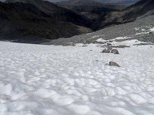
Being back onto the snow/glacier, my already tired core muscles were put to the test again, helping me to keep my balance on the snow. I got back to the moraine and I prepared to slide down the scree hill till I reached the snow field. From there I glissaded a good distance, following the paths of the 4 hikers that made them a little earlier. The field of boulders was as difficult to hike down as it was to hike up, but I managed to get passed that, and once Finger Lake was in sight, I knew things were only going to get easier.
![Middle Palisade]() Middle Palisade - gissading on snow
Middle Palisade - gissading on snow
| ![Dark clouds over Middle Palisade]() Dark clouds over Middle Palisade
Dark clouds over Middle Palisade
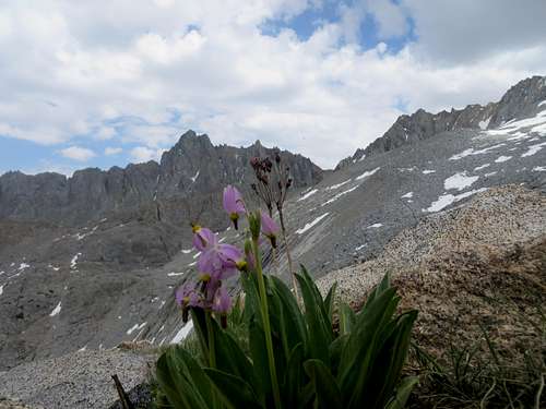
| ![Flowers on the trail]() Flowers on the trail
Flowers on the trail
|
And they did. I came down the hill, again using my orientation skills and judgement and not the million cairns placed everywhere just for fun. As I got to the lake, 2 of the 4 guys I met on the moraine were jumping into Finger Lake to cool down. They were screaming at the top of their lungs because the water was ice cold. I stopped by their tents and we talked for about half an hour, time I also used to eat something, drink water and I prepared for the hike down.
From Finger Lake to Brainerd Lake and from there to the trailhead, things did not get interesting anymore. Actually they did a little: about an hour (going up) to Brainerd Lake I met a group of 9 Asian hikers, passed 50 most of them, who were going to camp at Finger Lake and hike around the Palisades for a few days. That entertained me greatly, since these poor people had major difficulties hiking up the regular trail, looking as exhausted and out of shape as one could be. But boy, they had the best hiking equipment there was! They did not look like they would be able to hike anywhere from Finger Lake, let alone hitting Middle Palisade, Disappointment Peak and other summits they told me they wanted to climb. I wished them a sincere good luck, and continued on my way.
![Middle Palisade]() Middle Palisade
Middle Palisade
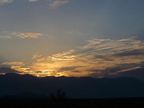
| ![Sunset]() Sunset over the Eastern Sierra
Sunset over the Eastern Sierra
|
I made it to the South Fork Creek crossing again, took my shoes off and socks off and crossed it. It was so cold that my feet, and actually all my body, got rejuvenated by the ice cold water, so much so that I did not feel any more pain. Continuing on the gravel road, I ran into a ranger lady and we talked for a good while. She told me about the real trailhead and what I should have done to make my life easier. But everything was passed tense now, since I was 100 yards from my car, having Middle Palisade in my bag and a long story to tell. The whole hike took me 13.5 hours with an actual hiking time of 10 hours and 5 minutes. Obviously, I lost more than one hour to talk to the hikers at Finger Lake, lady ranger and crossing the creek, twice. But I wasn’t in competition with anybody, so I did not have reasons to rush. As long as I made it to the car before nightfall, I was happy. At this time it was 7:00PM, so I still had 1.5 hours to sunset.
Middle Palisade was my 7th 14er. Many thanks go to summitpost's member Cab for giving me a very good topo map with the route, and good info about the hike. Without Cab's map I would've lost a lot of time and spent a lot of energy finding the route. There were at least three instances where my intuition was wrong.


Comments
Post a Comment