The Stars Align
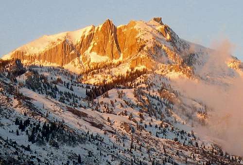
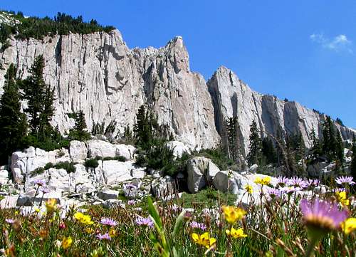
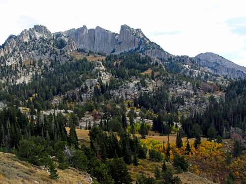
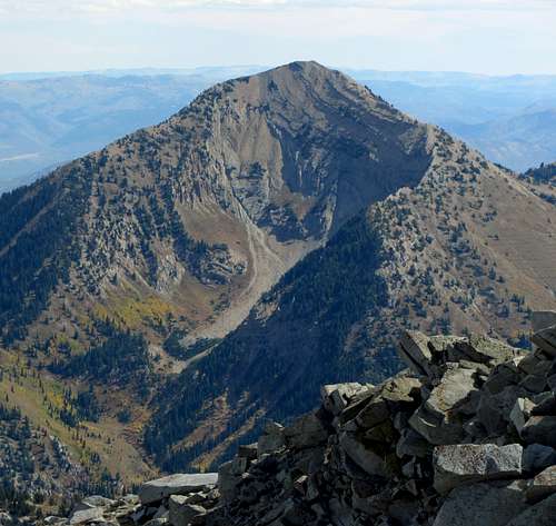
Lone Peak is a stunning mountain. Arguably the most difficult peak to climb within the Wasatch, its jagged summit is a prominent part of the skyline above Salt Lake City, and on a clear day from the top you can see all the way to Ben Lomond in the north and Mount Nebo in the south. Of the various types of rock found within the Wasatch, the granite in Lone Peak's alpine cirque is the best around. Just getting to the cirque requires considerable effort though, since all of the trailheads are at relatively low elevations (over a vertical mile below the summit).
![Lone Peak from Suncrest Dr.]() Lone Peak from Suncrest neighborhood on Traverse Ridge
Lone Peak from Suncrest neighborhood on Traverse Ridge![Yellow & Red Trees on Lone Peak]() Northwest aspect
Northwest aspect![Lone Peak from Orem]() South aspect
South aspect
After doing Twin Peaks I really wanted to climb Lone Peak as well. Unfortunately during the month of September last year it rained or snowed every single Saturday that my friend Kendrick and I were free, and as much as I like scrambling on exposed ridges, I didn't feel up to tackling the last few hundred feet in icy conditions. The arrival of a new baby and the realization of the responsibilities that come with being a dad caused me to shrink down the list of harder mountains I wanted to climb, but Lone Peak was still a must-do. During the next spring, I went on several easy, scenic hikes with the family, which helped me both get in better shape and gain a better appreciation for the amazing variety of outdoor opportunities Utah has to offer. Liz agreed to let me go on one difficult hike (but nothing technical requiring any special gear) each summer, so after getting to the top of all of the other major Wasatch peaks on my list in previous years, Lone Peak was an easy pick.
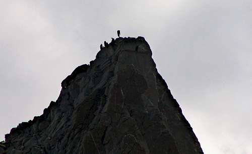
![Lone Peak from Pfeifferhorn]() East aspect
East aspect
The 90-degree temperatures throughout most of the days in June and July helped melt the deep snowpack quite quickly, and each day my anticipation grew. A few weeks in advance, Kendrick and I picked August 9th for the big climb, and as the day drew closer we found a couple other friends from work who wanted to come along as well. James and his friend Todd had just backpacked up Bells Canyon the week before, so I predicted that they'd probably have the fastest pace in the group, but I wasn't sure about Scott and his girlfriend Melissa. They hadn't climbed anything as difficult as Lone Peak, so I warned them about what to expect in terms of mileage, elevation gain, technical difficulty, and the amount of water they should bring with. After several hikes with Kendrick I knew my pace would be similar to his, and since he had the route mapped out on his GPS, we'd be the ones who tried to keep everyone together. I found out that there would be several other SP members on the mountain that day as well, so getting lost wouldn't be an issue. I checked the weather forecast every day leading up to the hike, and although at first it looked like there were sure to be thunderstorms that day (I rolled my eyes and thought "here we go again"), the forecast looked much more optimistic the night before. With all the preparations in place, I went to sleep dreaming of climbing on nice, solid granite.
Granite Paradise
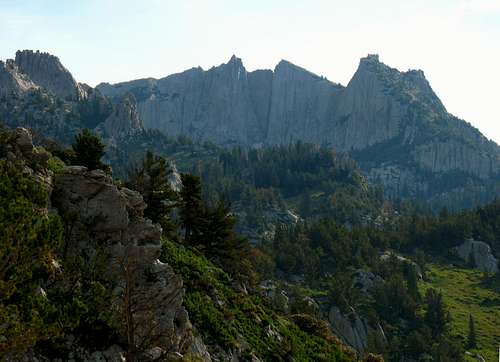
![Morning light on Kennecott]() Morning light on Kennecott
Morning light on Kennecott![Movie Rocks]() Movie Rocks
Movie Rocks
It took some convincing on my part to get everyone to meet at Kendrick's house in Salt Lake at 5:30 am (I would have preferred to meet even earlier), but in the end they agreed that less time on Jacobs Ladder in the hot sun was a good thing. Kendrick, James, Scott, Melissa, and I finally left Kendrick's place a little after 6, and we met Todd at the Corner Canyon gate in Draper a half hour later. The 2.6 mile dirt road to the Jacobs Ladder trailhead is definitely doable for a passenger car, but we all piled into my Explorer since that way we could drive faster without having to worry as much about all the bumps in the road. After getting all our packs loaded and applying our first coat of sunscreen, we set off up the trail.
![Jacobs Ladder wildflowers]() Wildflowers on Jacobs Ladder ...
Wildflowers on Jacobs Ladder ...![Lone Peak cirque from Jacobs Ladder]() ... below Lone Peak
... below Lone Peak
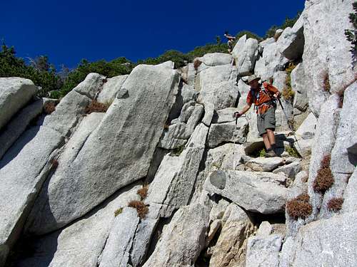
Immediately upon going up the steep 4-wheeler trail we came across the junction splitting the main Jacobs Ladder trail from the trail to Movie Rocks (where "Devil's Brigade" was filmed). We turned right, and followed the wide trail along the gently sloping spur ridge east towards Jacobs Ladder as the horizon began to get brighter. Right off the bat I noticed that James' pace was quite a bit faster than Scott and Melissa's, so I tried to stay in the middle (although I was probably a little bit farther back than halfway between them :)). We came across a split in the trail where we debated which way to go (we decided to stay right), and a couple hundred feet later the split trails actually came back together again. At this point we saw the actual trail-marker with "Jacobs Ladder" written on it, signifying the steepest part of the hike.
As the trail steepened, weaving up tightly between dry trees and bushes, I suddenly became thirsty. While hiking up the loose scree field below Broads Fork Twin Peaks last summer, I made the mistake of guzzling my water whenever I felt like it which caused me to quickly run out, so this time I disciplined myself to only drink 5 sips at a time from my Camelbak. I also brought a full 4 liters of liquid this time (2 liters of water and 2 liters of Gatorade, sticking the bladder from my wife's Camelbak in with my own), so my plan was to slowly go back and forth between the two, using up most of the water first (since lukewarm Gatorade is still tastier than lukewarm water, and can restore electrolytes lost from hiking). Todd commented that it looked cool having a tube coming out of each shoulder of the Camelbak, and for the most part this setup worked quite well (besides when Gatorade occasionally leaked out and turned my left arm all orange and sticky). Another trick that helped, which after all my previous hiking I was embarrassed to not even know about, was when Kendrick told me that blowing the liquid stuck in the tube back into the bladder before taking any sips can cool it back down.
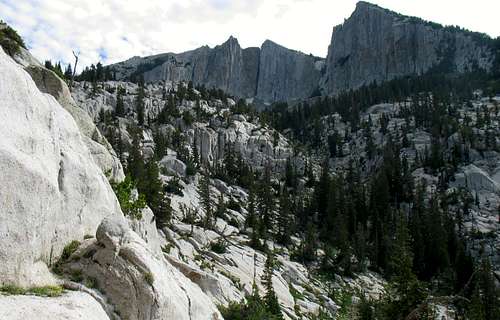
![Granite Spine]() Sweet, sweet granite
Sweet, sweet granite![Cirque drainage]() Looking back down the drainage
Looking back down the drainage
Besides the views looking south towards Mount Timpanogos and Utah Valley, Jacobs Ladder didn't offer much in terms of scenery. It was very dry, and I cringed thinking about going back down through the loose, overgrown trail later in the day when it was a lot hotter. We had chosen to do Jacobs Ladder because as far as time goes it offers the fastest route to the summit, even though the Bear Canyon trail is much nicer (also longer and less steep). As we went up, I gradually lost sight of James, Todd, and Kendrick, but I thought it would be best to stay with Scott and Melissa to make sure they were doing alright. We were still making pretty good time though, and passed a group of three who were hiking up with their two golden retrievers.
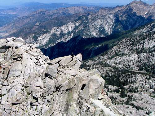
![Monarch of the Wasatch]() The cirque comes into view
The cirque comes into view![Lone Peak cirque drainage]() Cirque drainage
Cirque drainage![Melissa ascending Lone Peak s northwest ridge]() Getting up to the ridge
Getting up to the ridge![Lone Peak Summit]() Summit needle
Summit needle
Eventually the trail became more gradual as it met up with the trail from Draper Ridge, and the cirque (now much closer) looked incredible. We chatted with
tmcrane and a couple of his buddies from Idaho who had come up Draper Ridge, and followed them from this point. I told them about some other fun hikes in the Wasatch, and they told me about some of their favorite hikes in Idaho. I'm not sure if it was because we were all distracted talking to each other, but at some point we lost sight of the main trail that goes through a large meadow, and started veering to the left (north) towards some of the impressive granite rock formations leading up to the cirque. As we started bushwhacking (which was mostly pleasant off-trail hiking on granite, without nasty shrubs in the way to hinder our progress), Scott and Melissa stopped to rest. I assumed that Kendrick and the others were still ahead of us, so this time I decided to stay with the group from Idaho to catch up with them. After going back down a gradual granite slope we found the trail again, and because I wasn't sure where Kendrick, James, and Todd were, I tried calling Kendrick. Since the main trails on Lone Peak go up the ridge dividing Salt Lake Valley and Utah Valley, there is still decent cell phone reception most of the way up. Kendrick answered, and after talking a bit we realized that they were waiting for us down at the meadow and we had accidentally passed them. Scott and Melissa were still farther behind, traversing the granite slopes we had just come over, so I told Kendrick to come up the trail with the others and hopefully we'd all meet back up. I thanked the Idaho hikers for letting me tag along with them, and starting eating second breakfast as I waited for the others.
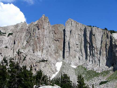
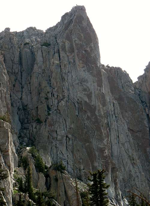
![North and South Summits]() North summit (left) and south summit (right)
North summit (left) and south summit (right)![Hyperform Wall]() Hyperform Wall
Hyperform Wall![James descending the northwest ridge]() Steep scrambling
Steep scrambling
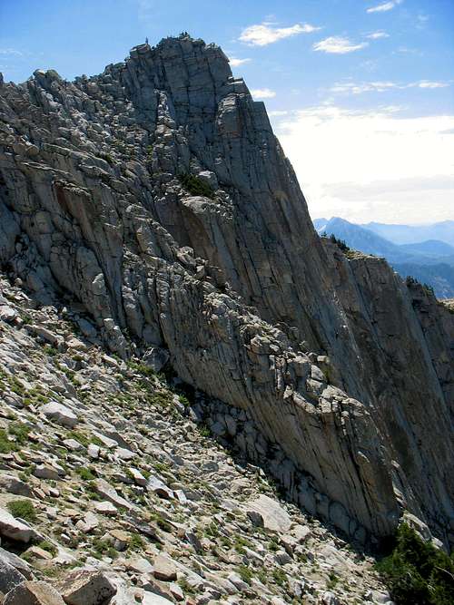
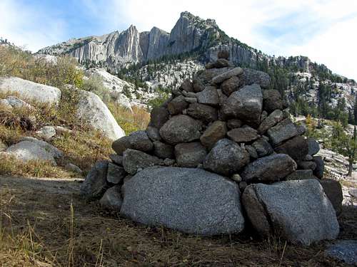
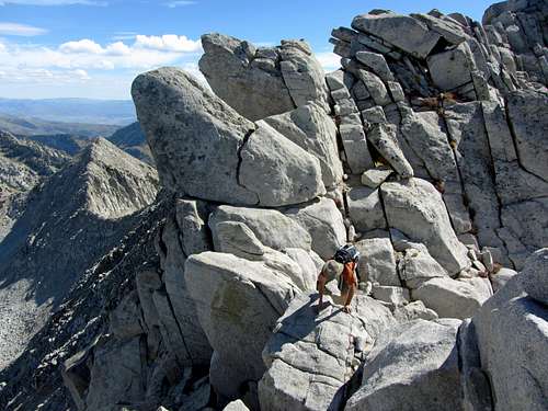
Kendrick, James, and Todd got there first, and a few minutes later Scott and Melissa found their way back onto the trail as well. After some more snacks and jokes about our navigational shortcomings, we continued on the trail, which now began to follow a faint stream coming from the cirque. As the drainage opened up, the views of the cirque were awesome. The area felt so remote and far-removed from civilization that it was difficult remembering we were only a few miles from the houses at the bottom of the mountain in Draper. There were small cairns throughout the cirque leading to where we wanted to meet up with the northwest ridge, but even without them it was pretty easy-going on the smooth granite. As we got closer to the northwest ridge, we could just barely see some people standing on top of the summit, as well as some rock climbers going straight up the west face.
![Summit Party]() Climbers at the top
Climbers at the top
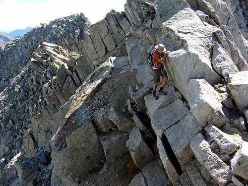
Upon reaching the ridge, the steep class 3 scrambling began. At about 11,000 feet, the altitude made it harder to ascend the steeper parts without stopping every now and then to catch my breath. Just before getting to the top of the ridge (where you can first see the Cottonwood Ridge to the north), I saw someone coming down from the summit ridge and immediately recognized him as
Matt, who I had talked with via phone and e-mail a couple times but had never actually been hiking with. After a brief exchange, we continued on up to the more exposed portion of the ridge. Just a few hundred feet from the top, I could now see down into Bells Canyon and east towards the rest of the Alpine Ridge. I was excited to join James and Kendrick on the summit, and see how difficult the scramble to get there really was.
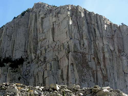
![Lone Peak summit walls]() Steep summit walls
Steep summit walls![Lone Peak summit ridge]() North ridge
North ridge![Lone Peak south summit]() South summit
South summit![Question Mark Wall]() Question Mark Wall
Question Mark Wall
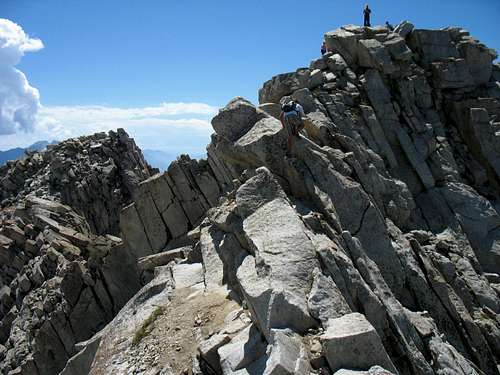
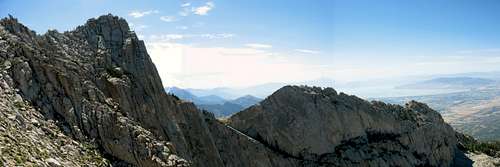
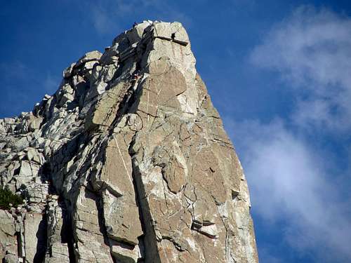
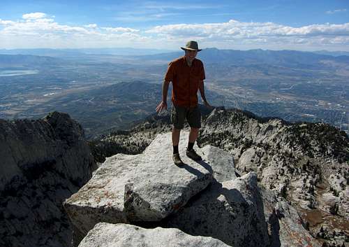
Remembering advice I'd heard in the past, I opted to go straight over the granite boulders on the ridge, and when an easier opportunity presented itself on the east side (Bells Canyon side) of the ridge, I took it. Although it wasn't really a knife edge (in summer conditions at least => winter conditions are another matter), there were a few places where a fall would definitely result in serious injury, but the rock was solid enough that there was never really any danger of slipping. There was one small spot at the crux that I might consider Class 4 (which I'd define as something that you'd have to down-climb while facing into the mountain), where I gripped the top of the rock in a bear hug as I carefully maneuvered my feet along a slightly inclined granite platform below, but for the most part it was enjoyable Class 3 scrambling. After traversing a few more boulders and climbing up one last steep section, I made it to the summit at exactly noon.
![Lone Peak crux]() The crux
The crux![Lone Peak ridge scramble]() Ridge scramble
Ridge scramble
The summit block itself is small (about the size of a big desk), but there was plenty of room on the other neighboring blocks for the dozen or so other people that were up there. The extreme exposure (especially off the south side) actually didn't bother me, even though I knew that it was over 600 feet straight down. The hikers from Idaho were up there, as well as
Denise, who I recognized from Summitpost. We had a nice relaxing lunch, admiring the scenery as I tried naming all of the peaks in the distance. Todd got to the summit shortly after I did, and we helped coach Scott and Melissa through the difficult parts of the scramble by shouting to them to stay on the east side of the ridge. Besides one little incident when Kendrick's GPS case accidentally got knocked over the edge and a rock climber below shouted to stop throwing rocks, everyone seemed to handle the steep cliffs around the summit alright, and it was rewarding looking down into both Utah Valley and Salt Lake Valley from such a high, exposed vantage point. Once Scott and Melissa were at the top, the storm clouds off in the distance to the east started growing pretty fast, and after hearing thunder a couple of times we decided to start heading back down. We'd be well on our way down the mountain if the storm actually did come our way.
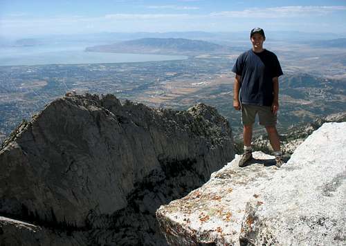
![Brandon on Lone Peak Summit]() Utah Valley and Question Mark Wall from Lone Peak summit
Utah Valley and Question Mark Wall from Lone Peak summitWhich Way Down?
![Pfeifferhorn from Lone Peak]() Pfeifferhorn
Pfeifferhorn![Thunderclouds behind Thunder Mountain]() Thunder Mountain
Thunder Mountain
On the way down, James started talking about how he wanted to go down the Bear Canyon trail, and this seemed like the best way to do it since Jacobs Ladder would be steep and unpleasant on the way back, and passing by the Outlaw Cabin on the other trail would allow us to fill up with water from the stream using James' filter. Since Todd's car was still at the Corner Canyon Gate, he could just drive some of us back to my car at the Jacobs Ladder trailhead, and we could meet back at Kendrick's place for steaks after that. Going down from the drainage to the meadow looked different because I had come up a different way, which was nice because it allowed me to see more of the mountain. We saw several people camping at the meadow, and I imagined how fun it would be to come back and do the same, exploring all of the neat granite formations up around the cirque.
James was feeling good and wanted to run the rest of the way down, but wasn't getting definitive answers from anyone who had come up the Bear Canyon trail exactly how to get there from Draper Ridge. Realizing that I had to get back home to run some errands in the evening, and not knowing for sure if we'd even find our way back to the Corner Canyon gate if we did try to find the Bear Canyon trail, I opted to go back down Jacobs Ladder instead. Kendrick, James, and Todd continued on the Draper Ridge trail while Scott, Melissa, and I went back down Jacobs Ladder.
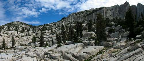
![Granite Paradise]() Sea of granite
Sea of granite![Lone Peak and Question Mark Wall]() View to the south
View to the south![Triple Traverse Peaks from Lone Peak]() Triple Traverse Peaks
Triple Traverse Peaks![Box Elder Peak from Lone Peak]() Box Elder Peak
Box Elder Peak
There were thunderheads all around in every direction, but the sun was still blazing right above Lone Peak itself. The added shade would have been nice, because Jacobs Ladder was very hot and dry. Going back down was murder on the knees because there were too many switchbacks to actually jog down, and the combination of loose dirt and overgrown tree roots required us to concentrate where we placed our feet on each step, putting a lot of pressure on our knees and feet. Melissa slipped and fell a few times, but luckily Scott and I were able to maintain our footing. Scott ran out of water near the bottom of Jacobs Ladder, but with my 4 liter plan I still had some left, so I gave him the rest of my water and rationed my Gatorade for the remainder of the hike down the spur ridge to the trailhead. The sun finally hid behind some clouds for the last 15 minutes of the hike, which boosted our spirits for the final leg of the journey.
![Wildflowers Below Lone Peak Cirque]() Wildflowers in Lone Peak cirque
Wildflowers in Lone Peak cirque![Timpanogos Eruption]() Timpanogos eruption
Timpanogos eruption![North Timpanogos from Jacobs Ladder]() North Timpanogos
North Timpanogos
Upon arriving at the Explorer just before 5 pm, I thought I'd call Kendrick to see how they were doing (if they had successfully found the Bear Canyon trail then they might have gotten down already). It's a good thing I did, because they were almost all the way down, but had ended up at a point halfway between the Bear Canyon trailhead and the Jacob's Ladder trailhead. We drove down to pick them up, and I dropped off everyone at Todd's car for the drive back to Kendrick's. Eating steak at his house sounded really good, but I had to get some things done since I was driving up to Idaho the next day. After decorating the road with the contents of his stomach (due to heat exhaustion, I think), Kendrick went back to his place with the others for some well-deserved steak, while I stopped off at Arby's on the way home for a few beef'n cheddar sandwiches to restore some of the day's burned calories.
I'd agree with many that Lone Peak has the most rewarding summit of any mountain in the Wasatch Range. Going with a large group of experienced hikers was something I hadn't done since I was a boy scout, and it made the experience that much more enjoyable. The Jacobs Ladder portion of the hike was actually more difficult for me than the scrambling at the top, and my feet, knees, and thighs were still sore for a couple days after the hike. If I do it again and time isn't an issue, I'll try out the Bear Canyon trail instead. Even consuming 4 liters within our 10 hour hike, I still lost over 5 pounds that day, and it wasn't until drinking a couple more liters of water later in the evening that I felt completely re-hydrated. With each new hike in the Wasatch I am continually amazed by the quality wilderness areas so close to Salt Lake City, and look forward to exploring more of the range's nooks and crannies in the future.
Lone Peak Stats
DISTANCE:
12.6 miles roundtrip
JACOBS LADDER TRAILHEAD:
5,600 feet
SUMMIT ELEVATION:
11,253 feet
ELEVATION GAIN:
5,700 feet
DIFFICULTY:
Class 3+
TIME:
10 hours
![]()
Wasatch Monarchs (Twin Peaks, Lone Peak, & Mount Timpanogos)
Neighborhood Outing
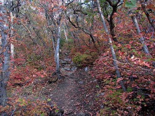
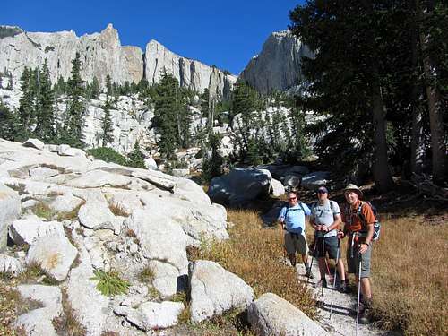
Several years later, a friend from my neighborhood named Bret expressed interest in hiking to the top of Lone Peak. It had actually been a goal of his for quite some time, so I was glad to join him on this Wasatch classic. Chad and Russ, a couple other neighborhood friends, decided to come along too. We started early on a Saturday morning in late September, with good hiking conditions throughout the day. On the way up the Jacobs Ladder Trail we encountered some fall colors:
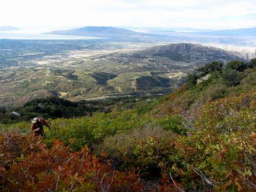
The trail disappeared shortly after a scenic meadow, but there were enough cairns along the way to help me remember the best way to get up into the cirque:
Russ and Chad stopped for some lunch before the start of the steep section leading up to the north ridge of Lone Peak, while Bret and I continued on. Closer to the summit we took in some impressive views:
The rock along the final summit ridge was perfectly solid, making for some fun scrambling. It was nice seeing Bret achieve his longtime goal as well:
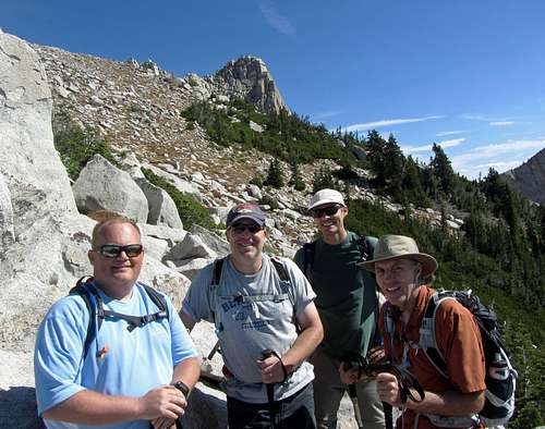
On the way down we met back up with Chad and Russ for some group photos:
![Group photo]() Russ, Chad, Brandon, & Bret ...
Russ, Chad, Brandon, & Bret ...![Group photo in cirque]() ... on our Lone Peak hike
... on our Lone Peak hike
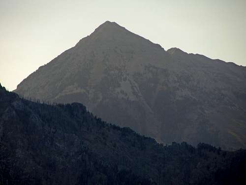
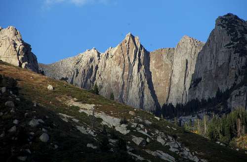
Throughout the day we saw several other impressive mountains:
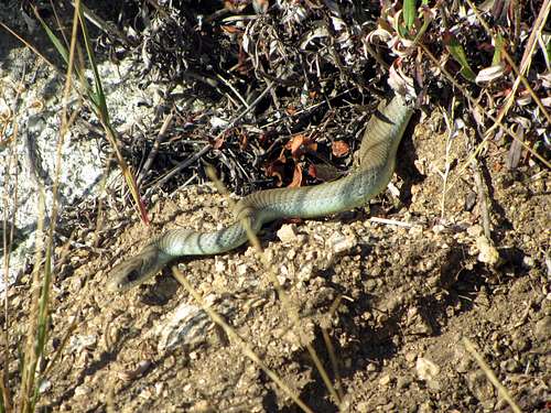
including a few animals and some other interesting sights:
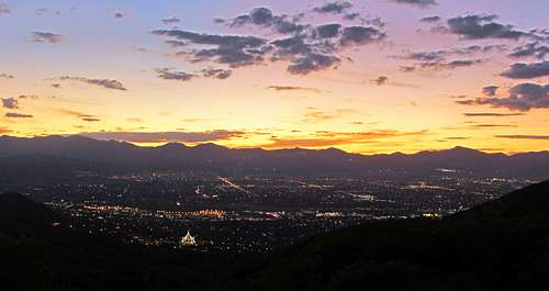
Just before arriving back at the car, we were treated to a beautiful sunset:
There are so many awesome places to explore in the Wasatch that I usually prefer to try somewhere new, but this is one hike that never gets old!


Comments
Post a Comment