Mont Velan toponymically and topographically speaking / 2

Mont Velan toponymically and topographically speaking / 2

Page Type Page Type: Article
Activities Activities: Hiking, Mountaineering, Trad Climbing

Topo Graphic & Nymic Overview


Mont Velan has begun to be explored until the 1700s and perhaps before, the Pioneers are the Canons of Great St. Bernard, Hunters and Christalliers. This great mountain, along the Chain of the Grand Combin (of Grafeneire the highest, 4314m).up to the Petit Combin, owns the largest ice mass, individually speaking, in the area that goes from Monte Bianco to Monte Rosa and then excluding all those Summits that "overlook" one by one on great Glacier of Otemma. In fact, the Velan must be considered as an Southern appendix to this, which is "firm" from Mont Sonadon through the hill with the same name with great Isler Shoulder (3650m) of Combin de Valsorey (4184m).


Velan with Southern view,

by Elijah Walton 1868 & posted by om


Il Mont Velan ha incominciato ad esser esplorato sin dal 1700 e forse ancor prima: i Pionieri sono i Canonici del Gran San Bernardo, Cacciatori ed i Christalliers.
Questa grande montagna, con la Catena dei Grand Combins (di Grafeneire il più elevato, 4314 m) fino al Petit Combin, possiede la più grande massa glaciale, singolarmente parlando, nel settore che và dal Monte Bianco al Monte Rosa e quindi escludendo tutte quelle Vette che s'"affacciano" una ad una sul grande Glacier d'Otemma. In effetti il Velan dev'esser considerato qual appendice Meridionale di questa, alla quale si "salda" dal Mont Sonadon tramite l'omonimo colle con la Spalla Isler del Combin de Valsorey (4184 m).


Velan Ice Cap above Valsorey Glacier,

by andrea.it


Has on its four sides (actually five since the Northern splits in North and North-Northeast) as many glaciers that descend to the Italian Valley of Menouve / Molline above the Municipality of Etroubles, towards the Switzerland in Val d'Entremont and the secondary thereof, or Tseudet and Valsorey, above that of Bourg Saint Pierre, while the last, without glacial masses, above the "Conca" (Basin) of By with the Municipalities of Doues and Ollomont. On this side remain, below a large (sloping with almost 3 Kilometres) and high rocky S-SE Wall of over 900 metres, some poor snow fields and large basal moraines which testify to the existence of an ancient ice now totally dissolved.


Winter Mont Velan from Praperiaz Alpages or Southeast,

by emilius


Possiede sui suoi quattro versanti (in realtà cinque poiché quello Settentrionale si sdoppia in Nord e Nord-nordest) altrettanti ghiacciai che scendono verso il Vallone italiano di Menouve/Molline sopra il Comune di Etroubles, verso la Svizzera in Val d'Entremont e le secondarie della medesima, o di Tseudet e Valsorey, sopra quello di Bourg Saint Pierre, mentre lo ultimo, privo di masse glaciali, sovrasta la Conca di By con i Comuni di Doues ed Ollomont. Su questo lato permangono, al di sotto di una larga (quasi 3 Km.) ed alta parete rocciosa di oltre 900 metri, alcuni miseri nevai e grandi morene basali che testimoniano dell'esistenza di antichi ghiacci ormai totalmente dissolti.


Menouve/Molliney Vallon & Southwestern Face,

by Antonio


On these slopes and through these glaciers by the Normal Routes climb the mountain
in the link from Cabane du Velan, under Northern Walls, through the Col de la Gouille (3149m) between Glacier Tseudet that of Valsorey at the higher (in the first exploration the climb was done completely on the latter), or, on the Italian side, with the ascent to the Col de Valsorey (3107m) starting from the Bivouac Rosazza-Savoie at Col du Bas Boegno (2674m; meaning ear down) and login after Mont Cordine the street earlier. In case of bad Glacier Valsorey (see "verglass" or large crevasses open that make problematic the crossing) is also entirely possible to follow the crest of the border, first with trend Southwest until the Quota 3672 metres and finally reaching the North-northwest the ice cap, where is located the Summit (3734m). This forced choice imposes a greater effort being higher difficulties, in such a way are climbs, after Mont Cordine and Col des Chamois and bypassing the North Doigt du Velan, also the summit of Mont Capucin, Col Capucin, the Tete Ariondet, the five Dents du Velan and Horns; is a path followed very, very rarely, but allows power up or down from the Mont Velan also in poor condition and, in the case of fog, undoubtedly offers the very best landmarks. From the slope Menouve/Molline goes up instead a way of Sci-Mountaineering that runs at the bottom of the slopes below the Western Saddle Faceballa, crosses the Glacier du Mont Velan from the Southwest to the Northeast and exit out, remaining just to the right of Via 1901, on West Ridge (Hannibal) at 3678 metres altitude is a little further away from the Summit. This trip has become quite popular in the last twenty years. A high side up to 1100 metres "broken" in two parts by the Glacier du Mont Velan, but it requires more than good snow conditions, and the same capacity and is suitable for OSA, or Good Skiers-Mountaineers. On the same there are two other glacial routes (1970, 1973) and a short but demanding of "mixed" to Quote 3708 metres rather difficult (1997), while the old ways (1872, 1901 and 1902) must be discarded poché too exposed to the fall of stones and then downright dangerous. The same goes for those South-southeast Face to the Horns of Velan or Tete d'Ariondet (1904, 1916, 1920, 1997 and 1998); same goes for the West Wall high over 550 metres and consists of three main gullies.

Mont Gelè summit view
Mont Velan
Mont Velan and Molari di Valsorey
Mon Velan from Paglietta
Testa Grisa to Aiguille du Dejeuner


"Ridges & Faces from East-northeast towards Southwest and West ...",

by marco979, alpinerunner, sergioenrico & emilius


Among these the one in the shape of "Y" can give rise to an ascension glacial interesting, but still dangerous. Through the field on the right (south) of this it occurred the first ascent of August 31, 1779 albeit partial, because the Canon of St. Bernard, and pastor of Liddes, Murith and Hunter Genoud ended ascension "repairing" the Western Ridge of "Hannibal Crest" on the Aiguille du Déjeuner. The North Face instead is the most beautiful and difficult and in its three routes, including the Aiguille du Velan (3635 m; 1935, 1936, 1939 and 1960?), Has high routes from 600 to 700 metres. On that of July 29, 1939 (Guide Pierre Bonnant with Loulou Boulaz) it was accomplished the first winter January 26, 1964 by François Beth, Jean Délère, Praz André and Jean-Jacques Saudan. All in all cases are rarely repeated, and some perhaps still awaits the second climb. Finally the ridges: said already the Northeast from Colle di Valsorey, remain the South-southwest from Faceballa Saddle, from the West Pass of Hannibal and the North-northwest that comes from petit Velan bypassing the Dents de Proz and the Aiguille du Velan. The first, climb twice in 1904 with its first winter ascent of Velan, knows some variants (Gino Buscaini with the wife Silvia Metzeltin, in October 31th, 1970), with workarounds or path integral (1997); the second is a safe and easy ridge covered in full for the first time in 1826, while the third knows undeservedly poor attendance despite being interesting and scenic but with uneven path (rock steps up to the III°; first ascent by W.B. Anderson, T. Ashby, C.L. and Tom G. Longstaff with Guides Swiss Joseph Georges, Jean and Pierre Maitre Maurys August 18, 1897). One last Cresta Northeast (not to be confused with the border) divides, starting from the Col de la Gouille to reach the cap, the two glaciers and Tseudet Valsorey; this pathway is also rarely frequented, although not difficult and very scenic. The first path is dated September 3, 1872 and was made by H.J. and Walter Leaf accompanied by Guides Hans Baumann and Daniel Bich.


North by "Glacier du Meitin, just above the Valsorey Hut",

by boriskrielen


Su questi versanti e tramite questi ghiacciai salgono le Vie Normali di salita alla montagna che riguardano il collegamento dalla Cabane du Velan per mezzo del Col de la Gouille (3149 m) tra il Ghiacciaio di Tseudet a quello di Valsorey nella parte più elevata (nelle prime esplorazioni la salita veniva effettuata completamente su quest'ultimo), oppure, sul versante italiano, con l'ascensione al Col de Valsorey (3107 m) partendo dal Bivacco Rosazza-Savoie al Col du Boegno Bas (che significa orecchio abbassato) per poi collegarsi dopo il Mont Cordine alla via precedente. In caso di cattive condizioni del ghiacciaio di Valsorey (vedi "verglass" o grandi crepacce aperte tali da rendere problematico lo attraversamento) é inoltre possibile seguire interamente la cresta di frontiera, dapprima con andamento Sudovest fino alla Quota 3672 metri ed infine Nord-nordovest raggiungendo la calotta glaciale, ove é sita la Sommità (3734 m). Questa scelta obbligata impone un maggiore impegno essendo più elevate le difficoltà, in siffatto modo vengono salite, dopo il Mont Cordine ed il Col des Chamois ed aggirando a Nord il Doigt du Velan, anche le Sommità del Mont Capucin, il Col Capucin, la Tete d'Ariondet, i cinque Dents du Velan ed i Corni; é un percorso seguito molto ma molto raramente, ma concede di potere salire o scendere dal Mont Velan anche in pessime condizioni e, nel caso di nebbia, offre indubbiamente dei punti di riferimento alquanto migliori. Dal Versante Menouve/Molline sale invece una via di Sci-Alpinismo che percorre nella parte inferiore i pendii Occidentali sottostanti alla Sella di Faceballa, attraversa il Glacier du Mont Velan da Sudovest a Nordest ed esce, restando appena a destra della Via del 1901, sulla Cresta Ovest (di Annibale) presso la Quota 3678 metri a non molta distanza dalla Sommità; questa gita é diventata abbastanza frequentata negli ultimi venti anni. Un versante alto fino a 1100 metri "spezzato" in due parti dal Glacier du Mont Velan, che richiede però più che buone condizioni di neve ed altrettante capacità ed é indicata per OSA, ovvero Ottimi Sciatori Alpinisti. Sul medesimo esistono altre due vie glaciali (1970 e 1973) brevi ma impegnative ed una di "misto" alla Quota 3708 metri piuttosto difficile (1997), mentre le vecchie vie (1872, 1901 e 1902) devono essere scartate pochè troppo esposte alla caduta di pietre e quindi decisamente pericolose. Lo stesso discorso vale per quelle della Parete Sud-sudest verso i Corni del Velan o la Tete d'Ariondet (1904, 1916, 1920 e 1998); analogo discorso per la Parete Ovest alta oltre 550 metri e segnata da tre canaloni.

Mont Velan
Mont Velan
Mont Vélan NNW side.
 03/2005
Mont Vélan NNW side.
 03/2005
Mont Vélan N side.
03/2005


"Mont V'lan North Walls with Northeast & Nort-northwest Ridges...",

by Gabriele Corvini aka Corvus & om


Tra questi quello a forma di "Y" può dare luogo ad un'ascensione glaciale interessante, ma pur sempre pericolosa. Tramite il settore di destra (Sud) di questa avvenne la prima ascensione del 31 Agosto 1779 anche se in maniera parziale, poiché il Canonico del San Bernardo, nonché Parroco di Liddes e grande amico del Naturalista Horace de Saussure, Murith ed il Cacciatore Genoud terminarono l'ascensione "riparando" sulla Cresta Ovest o d'Annibale sopra l'Aiguille du Dèjeuner. La Parete Nord invece é la più bella e difficile e nei suoi tre itinerari, compreso quello all'adiacente Aiguille du Velan (3635 m; 1935, 1936, 1939 e 1960?), presenta vie alte da 600 a 700 metri circa. Su quella del 29 Luglio 1939 (Bonnant-Boulaz) é stata compiuta la prima invernale il 26 Gennaio 1964 da parte di François Beth, Jean Délère, André Praz e Jean-Jacques Saudan. Tutte in ogni caso sono assai raramente ripetute e qualcuna forse attende ancora la seconda salita. Infine le creste: detto già della Nordest dal Colle di Valsorey, rimangono quella Sud-sudovest dalla Sella di Faceballa, la Ovest dal Passo di Annibale e la Nord-nordovest che proviene dal Petit Velan scavalcando i Dents de Proz e l'Aiguille du Velan. La prima, discesa parzialmente nel 1890 e salita due volte nel 1904 con relativa prima ascensione invernale del Velan, conosce alcune varianti (1970) con aggiramenti o percorso integrale (1997); la seconda é una cresta facile e sicura percorsa in modo completo per la prima volta nel 1826, mentre la terza conosce immeritatamente scarsa frequentazione nonostante sia interessante e panoramica ma con percorso disomogeneo (passaggi in roccia fino al III°; prima ascensione da parte di W.B. Anderson, T. Ashby, C. L. e Tom G. longstaff con le Guide Svizzere Joseph Georges, Jean Maitre e Pierre Maurys il 18 agosto 1897). Un'ultima Cresta Nordest (da non confondere con quella di frontiera) divide, partendo dal Col de la Gouille per raggiungere la Calotta, i due Ghiacciai di Tseudet e Valsorey; risulta anche questa via raramente frequentata, anche se non difficile e molto panoramico. Il primo percorso porta la data del 3 Settembre 1872 ed é stato realizzato da H. J. e Walter Leaf accompagnati dalle Guide Hans Baumann e Daniele Bich.

MONT VELAN...
Ollomont Valley & By ... Mont Velan E-SE Ridge 1976
Descent normal Route on Valsorey Glacier, near Mont  Cordine
Mont Velan...
<font color=red><b>AOSTA s</font> VALLEY in <font color=green>SUMMITS</font> <font color=red>EMO</font> & <font color=purple>SUGG</font> MISTER <font color=red>Moustaches</font></b>


"It is not always so easy to get on and off with the verglass even in Normal Route from Valsorey Pass...",

by Marco Cossard & Osw


Mont Velan Vélan or Velàn? No V'lan


Velan or better "V'lan" from Southeast by Becca of Viou,

by emilius


But which is the real name of the Mont Velan, how to write and how to pronounce? Often we read Vélan with é acute, which makes very "chic" but it is not exact. Someone comes to Velàn with the grave accent, but is even less fair. Velan, which comes from the Latin "Villanus" and then Medieval "Villan" is written simply Velan, no accents of any kind; but it should be pronounced from as V'lan by a liaison with that "eats" the e and replaces those accents improper with a single and elegant apostrophe.
For the "Guide des Alpes Valaisannes", Vol. I°, page 118 Marcel Kurz, Edit. C.A.S., 1963, the right is Velan pictograph writing and pronunciation precisely V'lan. Gino Buscaini in "Pennine Alps Vol. I", page 172, Edit. C.A.I. / T.C.I., 1971, following consultation with the Philologist Prof. Charles Tauber Zurich makes note the presence of a Monte Vilan in Prattigan. Julius Studer the place name, see the Latin "Vilanus" from "vilis" that is of little value and also "villosus" or rough. He concludes then with pasture of little value. In both cases we choose the second because there are good pastures around the Velan, at least on the Italian side, while at first glance the mountain looks pretty grim from everywhere it looks. Finally also the option of referring to the "Villa", ie mountain pasture belonging to the country house, perplexing, although Agostino Ferrari in "Bulletin C.A.I. No. 73, 1909", page 132, you see in this country the Montagne de Proz (1956m) above Bourg Saint Bernard. Even the similarities with the alp vigil at the Monte Leone or Viletta and Vella in the Val d'Herens leave make any difference. I think, supported by the observation of Umberto Pelazza on page 73 of "I wonder why it is called so for a walk in the Vocabulary of Aosta's Valley Mounts" over Mount of Village taken by Kurz and Gueux, sees the noblest radical VAL, VEL, a variant of PAL or Rock high. And in this direction personally prefer to conclude by referring to Aiguille, Ouille, Gouille, as neighbors Northern Col de la Gouille and Mont de la Gouille, above the Velan Hutte.
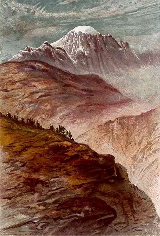
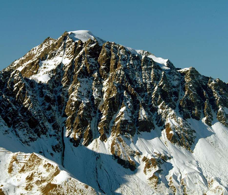
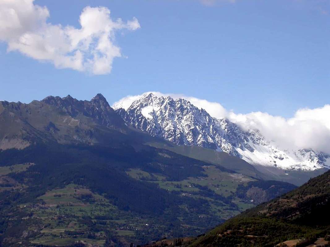


"Mons Villanus" or "Monte Villan" from South by Aosta Ville,

by SalVal


Ma quale é il vero nome del Mont Velan, come si scrive e come si pronuncia? Spesso troviamo scritto Vélan con la é acuta, il che fà molto "chic" ma non é esatto. Qualcuno arriva a Velàn con l'accento grave, ma é ancora meno giusto. Velan, che deriva dal Latino "Villanus" e poi Medioevale "Villan" si scrive semplicemente Velan, senza accenti di alcuna sorta; ma si dovrebbe pronunciare come V'lan con una liaison, che "mangiandosi" la e, sostituisce quegli accenti impropri con un elegante apostrofo.
Per la "Guide des Alpes Valaisannes", Vol. I°, pag. 118 di Marcel Kurz, Edit. C.A.S., 1963 la giusta scittura é Velan e la pronuncia appunto V'lan. Per Gino Buscaini in "Alpi Pennine Vol. I", pag. 172, Edit. C.A.I./T.C.I., 1971, a seguito di consultazione con il Filologo Prof. Carlo Tauber di Zurigo fà notare la presenza di un Monte Vilan nel Prattigan. Per Julius Studer il toponimo si rimanda al Latino "Vilanus" da "vilis" cioé di scarso valore ed anche 2villosus" ovvero ruvido. Conclude quindi con pascolo di poco valore. Nei due casi scegliamo il secondo poiché attorno al Velan esistono ottimi pascoli, almeno sul versante italiano, mentre a primo sguardo la montagna appare piuttosto arcigna da dovunque la si osservi. Infine anche la possibilità di fare riferimento al "Villa", cioé alpeggio che appartiene alla casa di campagna, lascia alquanto perplessi, nonostante che Agostino Ferrari nel "Bollettino C.A.I. n° 73, 1909", pag. 132, vede in questo paese la Montagne de Proz (1956 m) sopra Bourg Saint Bernard. Anche le similitudini con l'alpe Veglia presso il Monte Leone oppure vella e Viletta nella Val d'Hèrens lasciano il tempo che trovano. a mio avviso, suffragato dalla osservazione di Umberto Pelazza a pag. 73 di "Chissà perchè si chiama così a spasso nel Vocabolario dei Monti Valdostani", oltre Monte del Villaggio ripreso da Kurz e Gueux, vede il più nobile radicale VAL, VEL, variante di PAL, ovvero Roccia elevata. Ed in questa direzione preferisco personalmente concludere facendo riferimento ad Aiguille, Ouille, Gouille come i vicini Col e Mont.

AOSTA s VALLEY in SUMMITS: GRANDS COMBINS
North Valley Mont Velan from Mont Avril Summit 2008
Velan South West face
S side of Mont Velan
Grand Combin <i>4314m</i> and Mont Velan <i>3734m</i>  in the background behind Pointe de Drône <i>2949m</i>


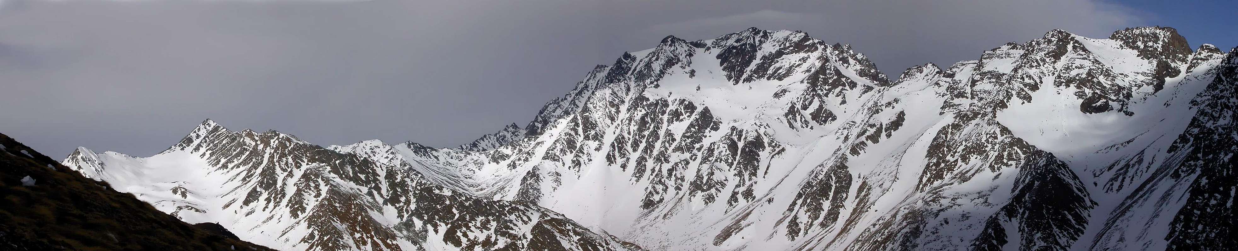
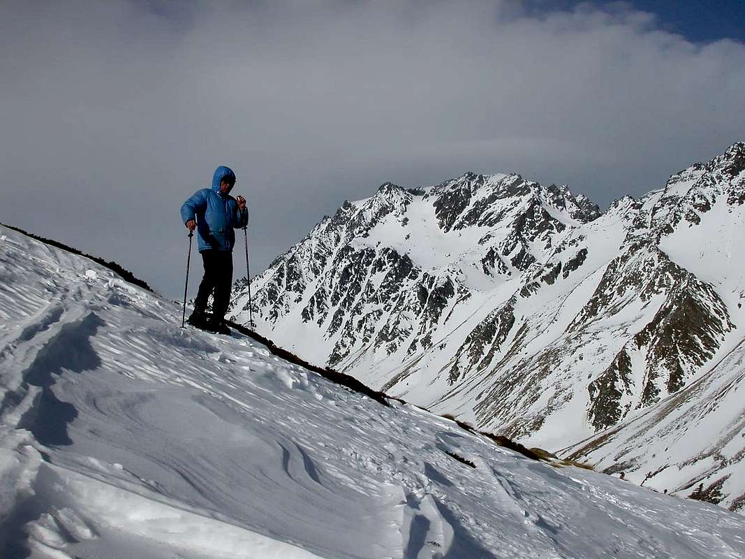
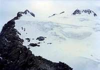
"V'lan from Monte Avril & Valsorey Hill or Northeast towards Great Saint Bernard & Grand Combin or Northwest ...",

by Antonio, sarme, andreaperino & livioz


Comments

No comments posted yet.


Children

Children

Children refers to the set of objects that logically fall under a given object. For example, the Aconcagua mountain page is a child of the 'Aconcagua Group' and the 'Seven Summits.' The Aconcagua mountain itself has many routes, photos, and trip reports as children.

Parents 

Parents

Parents refers to a larger category under which an object falls. For example, theAconcagua mountain page has the 'Aconcagua Group' and the 'Seven Summits' asparents and is a parent itself to many routes, photos, and Trip Reports.

Mont VélanArticles