
-
 5811 Hits
-
 77.48% Score
-
 8 Votes
|
|
Mountain/Rock |
|---|---|
|
|
29.25119°N / 13.50601°W |
|
|
873 ft / 266 m |
|
|
Overview
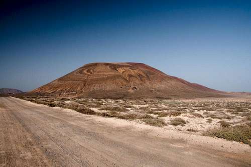 Erosion Layers on Montaña Pedro Barba Erosion Layers on Montaña Pedro Barba |
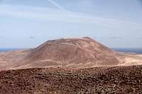
Montaña Pedro Barba is the highest of the four volcanoes of La Graciosa, a desert island to the north of Lanzarote on the Canary Islands. It is a twin peaked, triple cratered mountain, which takes up much of the northern part of the island. Its two summits, Agujas Grandes and Agujas Chicas differ only 13m in height and are divided by a slightly pronounced saddle, through which the most popular route runs. Thanks to its height and location, Agujas Grandes is one of the best lookout spots on the island.
 |  |  |
Currently it is not known when the volcanoes of the Archipelago Chinijo, the islands, located to the north of Lanzarote, have been created. Generally it is assumed that the creation was simultaneous to the eruption of Monte Corona across the strait El Rio on Lanzarote, which happened between 3000 and 5000 years ago. Montaña Pedro Barba was created on a fault line which also includes Montaña del Mojon and Montaña Amarilla in the south-west.The craters are open to the north-east, indicating that at the time of creation the same wind conditioned prevailed as today: north-eastern trade winds.
Thanks to its proximity to Caleta del Sebo, the only harbour on La Graciosa, Montaña Pedro Barba, or more accurately Agujas Grandes is one of the most photographed feature on the island. The south-east face of the volcano is decorated with a pattern, displaying layers of tuff, pumice, brimstone and lava in their different colours. From afar they look like man-made cornfield patterns, but are of natural origin. The best place to observe them is the saddle between Montaña Pedro Barba and Montaña del Mojon. Also, in the tuff parts you can find a big number of caves, eroded out of the soft material. Some wonderful examples can be found on the normal ascent route.
 |  |  |
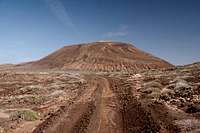
There are two routes to Montaña Pedro Barba. The more popular shorter but more difficult one starts from the road which connects Caleta del Sebo with the summer village Pedro Barba in the north-east of the island. It climbs the slopes between Agujas Grandes and Agujas Chicas and ends in the saddle between the two summits. From there the remainder is a short stroll onto either summit. The easier route passes the west face of Agujas Grandes and heads for the western side of the big crater of the mountain. From there it follows the crater rim to the summit.
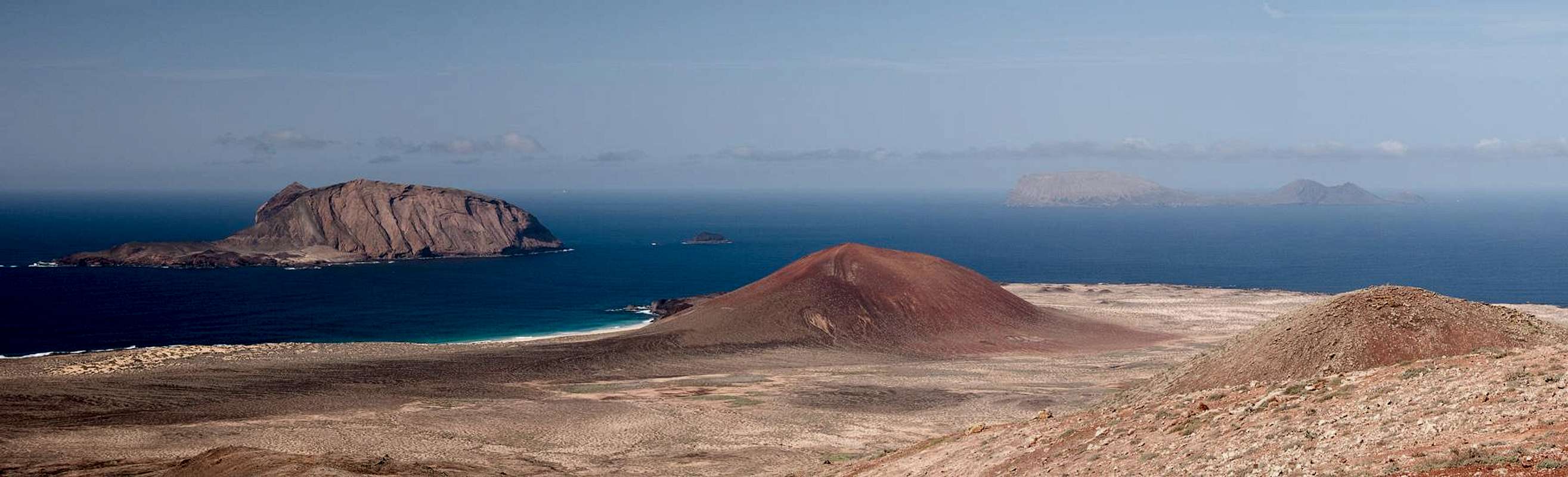
Summit view towards the north
  |
Getting There
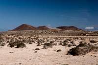
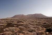
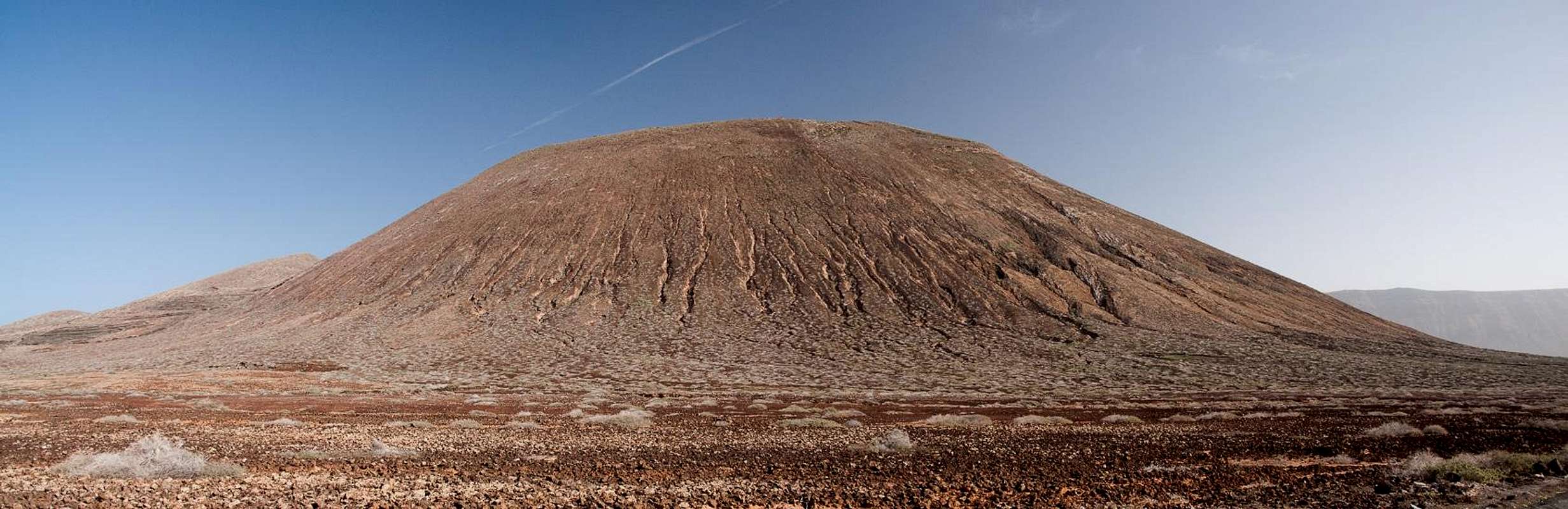
 Agujas Grandes seen during the approach from Caleta del Sebo
Getting to La Graciosa is a lengthy affair. Though there are ferries from the Spanish mainland to the Canary Islands, they take more than 24h for the trip. Therefore most visitors therefore go by plane. Every travel agency in Europe offers flights, hotel rooms, apartments, rental cars etc. so that reaching the Canaries is rather a matter of money than opportunity. During the summer season flight fares can be reasonable but during the Easter and Christmas holidays you have to be prepared for additional fees of 500€ per person.
Lanzarote has its own airport between the capital Arrecife and one of the main tourist centres, Puerto del Carmen. There are public bus lines but – like on all the islands – they don't run too regularly. If you plan to stay on your own, better take a rental car right at the airport.
From the airport take highway LZ1 through Tahiche and Arieta to Orzola, the northernmost village of the island. From the harbour the LLa Graciosa Ferry departs several times a day. The first departure is at 10:00 a.m, the last return ferry is at 4 p.m. in winter and 6 p.m. in summer. On La Graciosa the ferry lands at Caleta de Sebo from where within 2h you can reach the summit of any of the four volcanoes of the island.
Red Tape
 |
Accommodation
La Graciosa doesn't offer too many accommodation possibilities. Generally, most visitors take the first ferry in the morning and return by the last. If you miss the ferry there are opportunities to find a bed - you simply need to ask anyone who's hanging out at the harbour of Caleta del Sebo.There is a campground to the south of the village. Like everything on the island it is dry and sandy. However, a 15 minute walk will take you back to Caleta del Sebo.
As for holiday homes, hotels or apartments on Lanzarote either consult your nearest travel office, or – search for lodgings on Google. There are several sites on the web, dedicated to rent privately owned houses or apartments. Prices are generally a bit less expensive than for tour operators but you don't have as much security. With a bit of luck you even might find something in Caleta del Sebo but don't expect any luxury.
Weather Conditions
Maps & Books
Maps
Regular Maps
- Lanzarote
Kompass Map WK241
Kompass Verlag
1:50000
ISBN 3-85491-175-0
Digital Maps
Kompass is the only company known to me which offers GPS digital Maps. In addition for those of you with Garmin GPS receivers there is a map source map set of all Canary islands out there.
- Lanzarote
Kompass GPS4241
Kompass Verlag
ISBN 3-85491-223-4
- Islas Canarias
Map Source custom map
By Manfred Pepper
downloadable zip-file
Books
My recommendation is a guidebook by Rother Verlag, available in German. The book is an excellent hiking guide covering all the interesting areas of the island. Since it comes with small maps for each excursion it might even be used without a map to support them.
- Lanzarote
Rolf Goetz
Rother Verlag
ISBN 3-7633-4302-4