
-
 1073 Hits
-
 80.49% Score
-
 12 Votes
|
|
Mountain/Rock |
|---|---|
|
|
46.51767°N / 11.02692°E |
|
|
Bolzano Alto Adige |
|
|
Hiking, Scrambling |
|
|
Summer, Fall |
|
|
7933 ft / 2418 m |
|
|
Overview
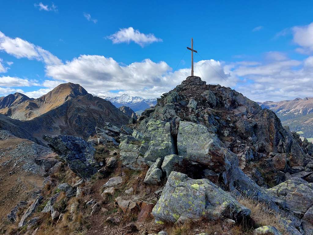
Monte Cornicoletto / Klein Kornigl 2418 m
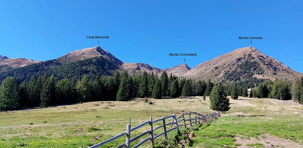
According to all the summits located in the South Tyrol region, this 2418 meter high peak has two names: Monte Cornicoletto (Italian name) and Klein Kornigl (the original Tyrolean name). It's a minor but very interesting mountain belonging to the Eastern Maddalene/Magdalener Group, range located between the high Val di Non and the Val d'Ultimo. Together with the nearby Monte Cornicolo 2311 m, more massive and a little lower, Monte Cornicoletto is situated along a crown of peaks going towards Cima Belmonte 2459 m and Vedetta Alta 2627 m.
The ascent to Monte Cornicolo is quite easy, while the ascent to Cornicoletto shows a last section, starting from the saddle between the two mountains, quite steep and with short 1st degree passages. From this saddle at 2290 m of altitude it's quick and convenient to combine the climb to the top of both mountains.
Getting There
Road access
From the A22 Brennero motorway exit S. Michele all'Adige - Mezzocorona and take the SS43 to Cles. From Cles continue towards Cagnò and Revò, then take the Val d'Ultimo state road towards Proves, a village in the German-speaking part of the Val di Non. Arrived at the crossroads to the village of Proves, continue following the main state road to the Val d'Ultimo. After about 5 km, immediately before Passo Castrin there is a tunnel leading to Val d'Ultimo. Before the entrance to the tunnel on the right there is a parking lot at about 1700 m of altitude where you can leave your car. Two others are located on the right at the exit of the tunnel and one on the left a little further on.
Route to Cornicoletto from Passo Castrin
Summit quote: 2418 m
Difficulty: F (passages of I degree)
Difference in level: 800 m
Starting point: parking lot near Passo Castrin
The itinerary described doesn't involve particular technical difficulties other than the familiarity with the high mountain terrain and with exposed paths and ridges, as well as some I degree passages in the final stretch. The itinerary is always well signposted.
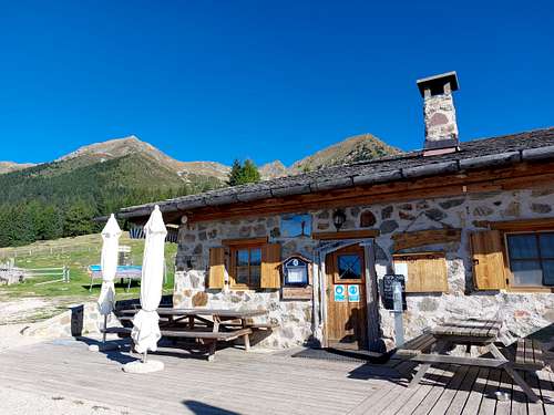
From the parking lot follow a pedestrian lane passing over the tunnel and then connecting to the forest road n. 8 into the wood, or alternatively take the shortcut track starting just in front of the parking lot and joining soon the mule track n. 8. In about 10-15 minutes of walking the forest road gets with moderate slope the beautiful clearing on which it's situated Malga Cloz 1734 m, dominated by a fine crown of peaks: from left to right we see Vedetta Alta, Cima Belmonte, Cornicoletto and Cornicolo.
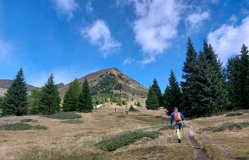
From here it starts the path SAT 7 leading to Monte Cornicoletto (on the left) and Monte Cornicolo (on the right). From the alm, starting near some illustrative panels, take this path heading sharply to the North (right) in the direction of the Malghetto di Cloz, at first along the meadows, then inside a sparse wood and reaching the place where it rises the Malghetto di Cloz at 1894 m (ruins), which can be left on the right or reached with a short deviation.
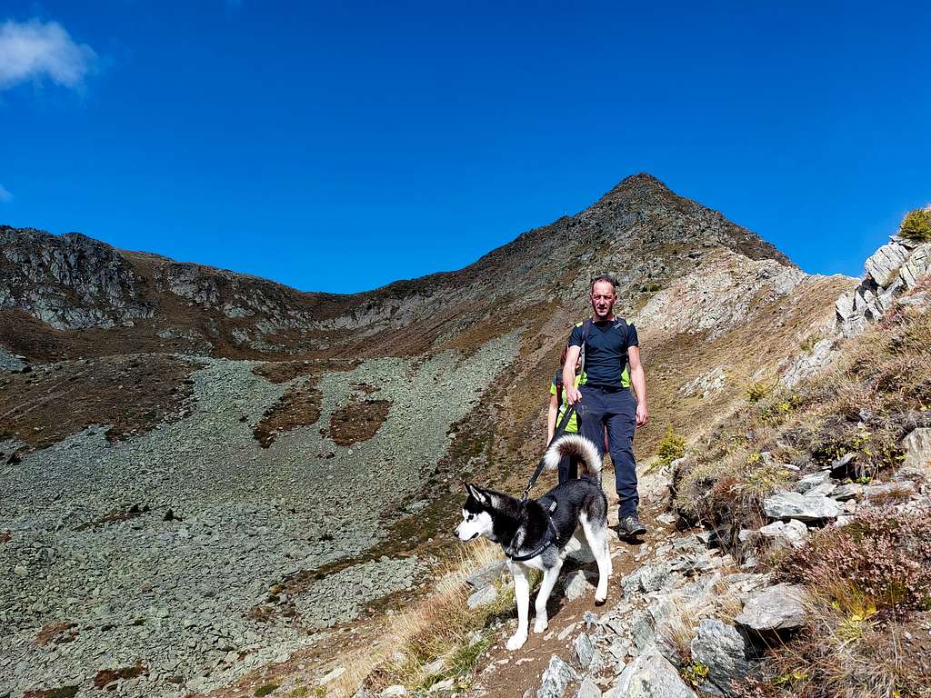
From the alm, located practically below the Cornicolo, you have to turn decisively to the West (left) and continue to follow the path n. 7. The path runs along a moderate slope with sparse vegetation, then gradually in a more rocky environment up to the steep stretch leading to the saddle 2290 m between Monte Cornicoletto to the left (North) and Monte Cornicolo to the right (South). From the saddle, heading to the right, it is possible to climb very easily also the Cornicolo with a detour of about 40 minutes.
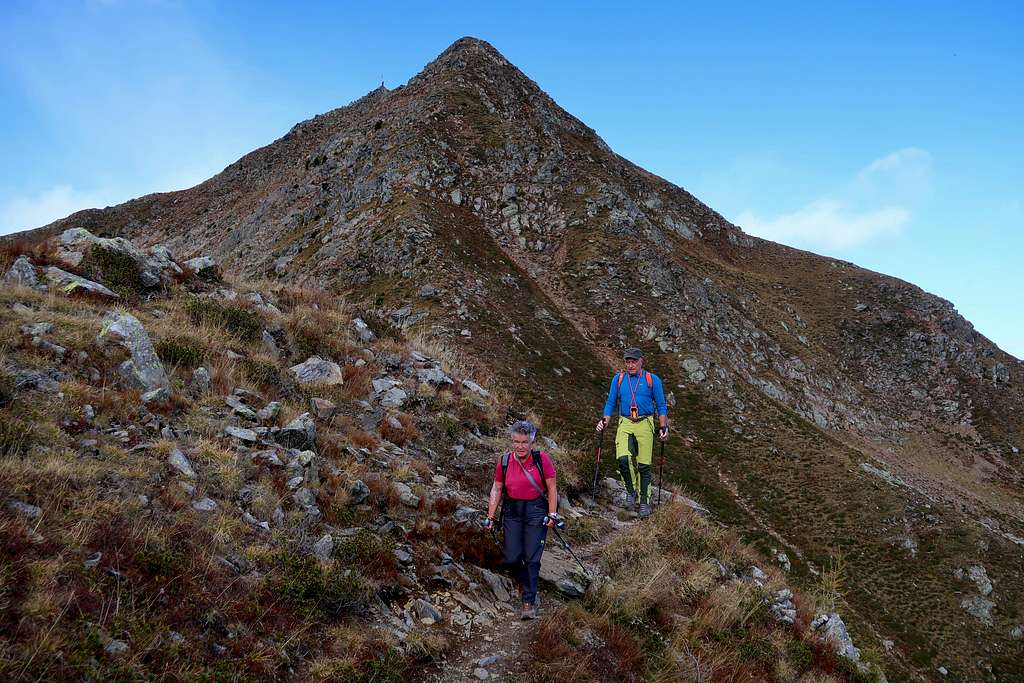
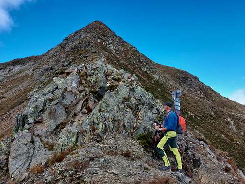
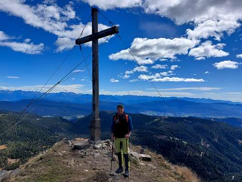
To the Cornicoletto you instead begin to climb carefully along the ridge, in many points rather sharp and with discrete exposition on the east and west side. To the east you can see the bulk of Monte Luco, the last offshoot of the Maddalene, overlooking Passo Castrin. The climb is not difficult but there are some short I degree passages. In presence of frozen snow, crampons are required. However, this ridge is often clean because it is exposed to wind and sun. At the top, an airy ridge flattens to the north to the actual summit with a large stone cairn surmounted by a high cross.
Descent: reversing the same route
Red Tape
No fees no permits required
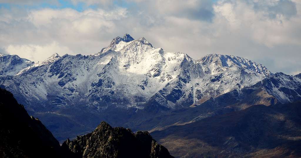
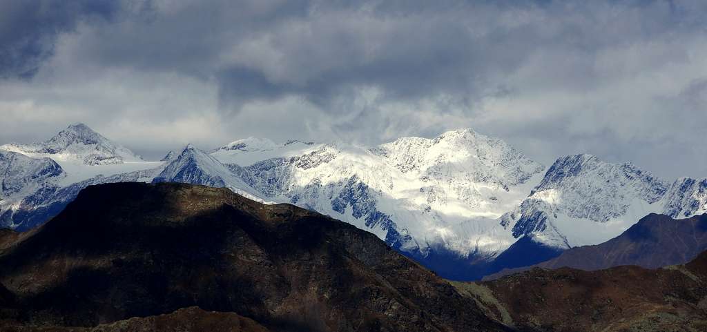
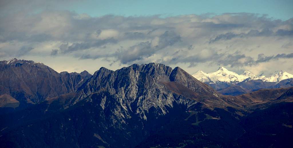
Summit views
When to Climb
From June to mid October
Where to stay
Different opportunity of accomodation in Proves and surroundings
Meteo
Guidebooks and maps
Maps
- Val di Non 4land Scala 1:25.000 2020 ISBN 978-8-88982-390-3
- Kompass n. 53
- Tabacco n. 42