|
|
Custom Object |
|---|---|
|
|
45.94972°N / 7.93419°E |
|
|
Historic page with routes information. |
|
|
Piemonte |
History of the wall and of the ones who ventured there
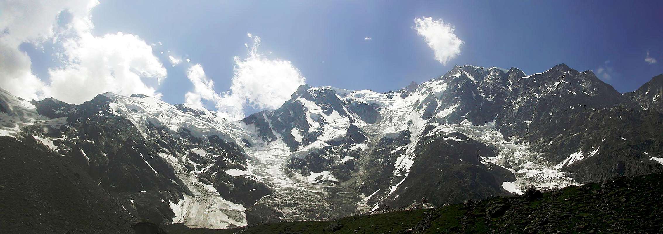
The only Himalaian wall of the AlpsNo other mountain in the Alps can show such a massive face like the East one of Monte Rosa.
The enormous oriental flank of Monte Rosa is high more than 2500 meters and is 3000 meters wide.
Its skyline dominates the horizon when you look towards the Alps from the vast plane of Padania and it’s still visible from the first summits at north of the Apennini range, more than 300 km at SW.
A huge series of long iced couloirs separated by vertical cliffs climb from the tormented glacier at the basis of the wall till the long summit ridge connecting from south to north the four principal summits of the group: Gnifetti(4556m), Zumstein(4576m), Dufour(4636m) and Nordend(4610m).
The central part of the wall, under the Zumstein and Dufour peaks, is almost totally covered by ice and has a more moderate slope in respect of the ones near the bordering ridges.
In this portion of the mountain, the Marinelli couloir, the longest couloir of the Alps, carves the east face for all its heght signing the route followed during the first ascent of Monte Rosa from this side.
Huge avalanches and rock falls often runs along this couloir reminding to the ones of the mountains of Himalaya, the name of the Couloir itself is th one of a climber that died here in one of the bigger accidents occurred on this dangerous wall.
On the 8 of August of 1881, Damiano Marinelli, with the pathfinders Battista Pedranzini and Ferdinando Imseng died under a frightening avalanche while they was climbing in this couloir.
Ferdinando Imseng was also the leader during the first ascent of the great East face of Monte Rosa on the 22 of July of 1872, when he was only twenty seven.
An expert hunter of chamois, he came from Saas Valley in Switzerland to Macugnaga, the village at the feet of the Mountain, when he was twenty two.
Imseng ventured many times on the wall, secure of the existence of a route to the summit, but when he proposed the feat to the English noblemen Charles Taylor, William and Richard Pendlebury, they initially claimed him as a mad man.
Anyhow Imseng's great faith, or maybe their common desire of fame, persuaded the English gentlemen of the possibility, and together with the other pathfinders Giovanni Oberto and Gabriele Specthenhauser, in two days, they won the frightening wall.
Four years later, Imseng carved its master piece in the enormous iced face, together with its brother Abraham, leaded the rich Italian Brioschi along a direct route to the Nordend.
This route is the safest of the East face and it’s still evaluated TD (very difficult), it ascends along rocky cliffs and iced couloirs following the surely most rational line to the summit.
Before the end of ‘800, another great guide of Macugnaga earned the nickname of “lord of the east face” thanks to its performances on Monte Rosa: Mathias Zurbriggen the first climber of Aconcagua (1897) and of other summits al over the world.
Born in Saas Fee in 1856, orphan of both his father and his mother, he roamed for years all over Europe before starting its career on the Mountains of the Alps.
He died by suicide, alone, in 1917 in Ginevra, Switzerland.
In the thirties years of ‘900 Ettore Zapparoli, a young Italian poet, climbed several times the East face alone tracing important routes, unfortunately he died during one of his lonely ascents along the Nordend east face.
The names of its routes still reminds to the romanticism of his climbing, like the ridge “of the poet” and the “lonliness” couloir, both on the Nordend.
Always in the thirties, two famous French climber, Lucien Devies and Jacques Lagarde, traced the route called “Dei Francesi” (of the French in italian) , an hard ice climbing route in the steepest part of the wall, under Punta Gnifetti.
This route was repeated by Alessandro Gogna alone during 1969.
Herman Buhl, the first man to tread the summit of Nanga Parbat climbed alone the Marinelli Colouir during the fifties.
The first ascent during winter is instead dated 1953, the climbers were the Italian Oliviero Elli and Emilio Amosso.
The latest important route to mention is the one called “del Centenario”, of the centenary. In two days in 1972, by Paolo Borghi and Ambrogio Cremonesi, an impressive route evaluated ED (extremely difficult) that wins the vertical rock pillar that descend from Punta Gnifetti.
The two ridges that delimits the profile of the Wall at south and at north, the Signal ridge and the Santa Caterina ridge were climbed for the first time in the 1887 and in the 1906.
The Signal one by Alois Supersaxo with Harold Topham, the Santa Caterina one by V:J:E Ryan with Franz and Joseph Lochmatter.
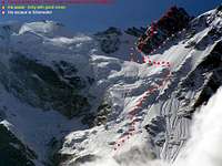
Overview of the main routes.
Getting there
Macugnaga is the nearest village to the wall and its made up of three smaller centers: Borca, Staffa and Pecetto.To get there the quickest route follows the Milano-Sempione highway till the exit of Pidimulera, then continues along the principal road of Anzasca Valley till Macugnaga.
The starting point for the Signal ridge is usually Alagna Valsesia.
To get there the quickest route follows the Milano-Genova Highway till the exit of Romagnano, then continues along the main road of Valsesia.
Huts.
For the routes that lead to Zumstein, Dufour and Nordend, the support hut is the Marinelli hut, located in the center of the wall, adjacent to the Marinelli couloir, sheltered from the avalanches by a long rock ridge.For the routes to Punta Gnifetti it’s instead better to start from the Zamboni hut, at the feet of the wall, near the Belvedere ice field, reaching these routes from the Marinelli hut would require a dangerous traverse under big icy cliffs.
Both the paths to Zamboni and Marinelli start from the Belvedere arrival of the chair lift from Pecetto.
For the Signal ridge the starting point is the Resegotti hut, at the Signal pass, reachable from the locality 'Acqua Bianca', at the end of the statl road of Val Sesia, after the village of Alagna.
To climb the Santa Caterina ridge it’s instead necessary to start from the “Città di Gallarate” hut, at the basis of the ridge, near the summit of Jagerhorn at 3900 meters.
To get there, always from the arrival of the chair lift of Pecetto, reach first the 'Sella' hut, then through the 'Nuovo Weisstor' pass get on the wide ice field called GornerGletscher, from here hike towards south on the glacier till the Gallarate hut.
On the summit of Punta Gnifetti, the Regina Margherita hut, the highest hut of the Alps can be an useful support during the return from the routes to Gnifetti, Zumstein and Doufur, the Nordend it’s too far away and the support hut during the way back could be the Monte Rosa one, on the Switzerland side of the mountain
Links
www.macugnaga.itwww.alagna.it
www.zermatt.ch/
The official web sites of the localities at the feet of Monte Rosa, with informations about the sleeping possibilities, the huts, the lifts and with useful phone numbers.


