"I'm woven in a fantasy, I can't believe the
things I see,
The path that I have chosen now has lead me to
a wall.
And with each passing day I feel a little
more like something dear was lost.
It rises now before me, a dark and silent
barrier between,
All I am, and all that I would ever want to
be..." (Kansas - 1976)
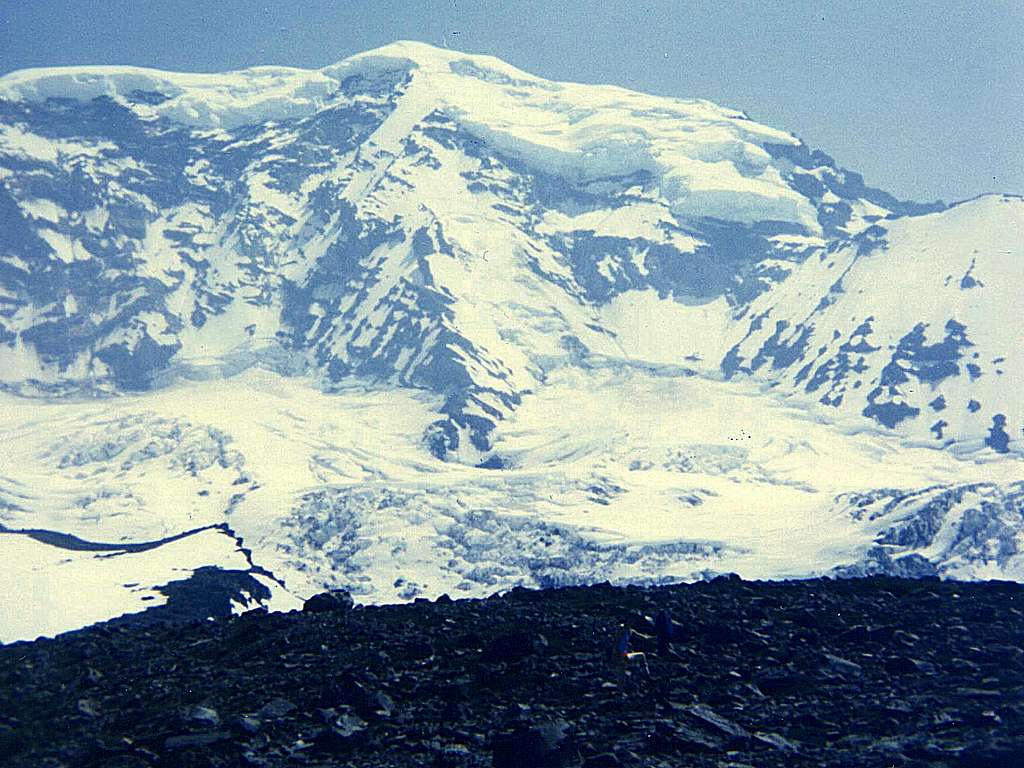
The nearly 4,000-foot-high cirque on the north
side of Mount Rainier, otherwise known as
Willis Wall on June 20,1982 in Pierce County,
Washington.
"5,600-foot-high Moraine Park allows an
impressive view of Rainier's upper Carbon
Glacier. Avalanches of snow and ice appear
to curl, and then roll down the nearly 4,000
-foot steep extent of Willis and Liberty
Walls. The ROAR is punctuated by the
bouncing of rocks. An awesome climbing route,
to be attempted by experienced mountaineers,
follows the slight rib between the two walls
known as LIBERTY RIDGE. It's perhaps the most
direct route on the north side to the
summit.
The oversteepened face of Willis Wall
discharged a major rockfall in 1916.
This rockfall may be responsible for much of
the glacier's surface rock visible today.
It's likely the insulating rock layer is in
large part responsible for the glacier's
remaining in equilibrium so far downvalley.
(The 3,500-feet-altitude of the Carbon
Glacier's terminus is the LOWEST of any
glacier in the contiguous United States."
- Carolyn L. Driedger (1986)


