
|
|
Mountain/Rock |
|---|---|
|
|
27.92336°S / 49.86°W |
|
|
Urupema |
|
|
Hiking, Mountaineering |
|
|
Winter |
|
|
5686 ft / 1733 m |
|
|
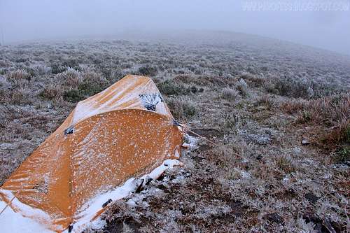
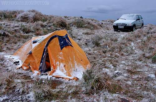
This is my tent, with some snow over it.
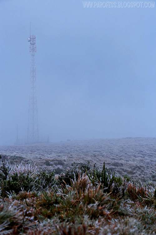
Waiting for the snow to come! Foggy summit.
Morro das Torres is a geographical accident of Brazil which is located in Urupema, Santa Catarina with an altitude of 1.733m. It's probably the coldest mountain in Brazil (even more than Morro da Igreja), with exceptional views in a radius of about 60 kms, it's possible to see the peaks of Urubici county (Morro da Boa Vista, Morro da Igreja, among others) with a waterfall that freezes completely and thus remains several days just below it's top in strong cold waves. Easily accessible (public place), with fences and taipa walls (old stone walls made of basalt, dacites, rhyodacites, rhyolites) of great extent, "heavenly visions", thus becoming one of the best places in Brazil to observe the rare event (here in Brazil of course) of snow, which ranks it as one of the most inhospitable climate margin of the American continent (as well as Morro da Igreja), as snowfall and shrub with thick layers of ice (frozen fog, Icicles/ rime in english or sincelo in portuguese), besides Freezing Rain, winds up to 120km/h, horizontal rain, bounds with icicles over a meter.
This is an exceptional and rare here in Brazil, but it happens in Morro das Torres, or Morro das Antenas. Or, better yet, Morro da Serra do Campo Novo, it's original name, which should be restored in the city of Urupema (or Urupemba), whose name comes from a sieve straw, in the language of the first guardians (Kaingang), this sanctuary of Saint Catherine, now known by Brazil, as the municipal seat colder country. A part of the "Sierra" of Morro das Torres borders Urupema with a rarely spoken county in the media, which is Rio Rufino.
:)
The unevenness over the years increased erosion there, there is always running water from the huge sponge that is the top of this mountain, greatly facilitated by the thinness of the soil, one reason being the intense fracturing sub-horizontalized this volcanic formation of Serra Geral, the biggest surface volcanism (effusion) of the face of our planet, with ages around 133 million years.
The posicion of Morro das Torres, along with the Serra da Farofa, its neighbor NW, are the first (or last) physical barrier to ocean currents laden with high humidity, which often produce fog on its top ("whirlwind"). It's high with the cold fronts come across over 1.700m of altitude, which is why they are sometimes the first, if not the only elevations with the rare and beautiful effect of frozen fog (rime in English), or even freezing rain or snow precipitation.
Getting There

Road info from Florianópolis
by bus
Florianópolis - Lages - Around 4 hours ride
From Lages you'll need to take another bus to Urupema, it leaves twice a day and the trip takes about 80 minutes.
For some extra info:
Red Tape
Forget the fact that you are in Brazil, this doesn't look like Brazil at all.
Some time in 2010 the temperature combined with strong winds made the wind chill of -46°C.
In 2012 the lowest temperature registered was -8,8°C
This year, 2013, I registered myself real temperature of -4,1°C at noon, and with the wind, -23°C of wind chill!;)
Be SURE to have with you:
Good hiking boots
Down jacket and second skin (if possible, goose jacket)
Water proof parka
Suncream
Glasses
40l backpack at least
Snacks/ food
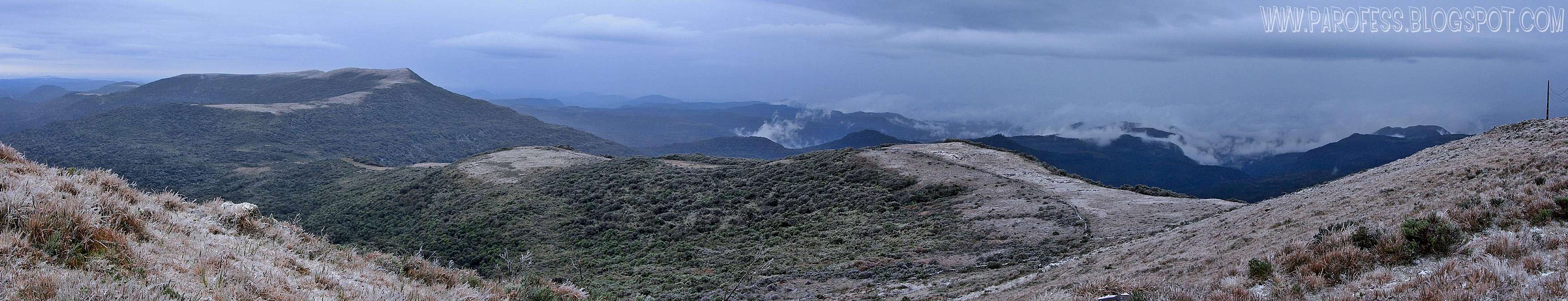
Summit panorama view
Some photos

What can I say? I was hungry!:)
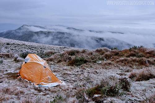
My tent atop Morro das Torres
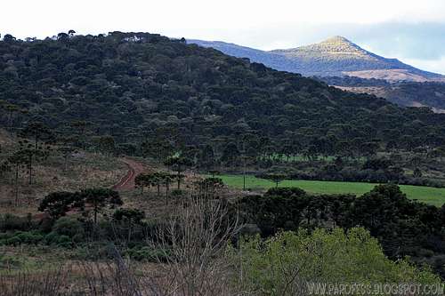
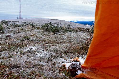
A pitouresque look of south region of Brazil.
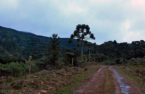
Road to the peak
Don't get lost!
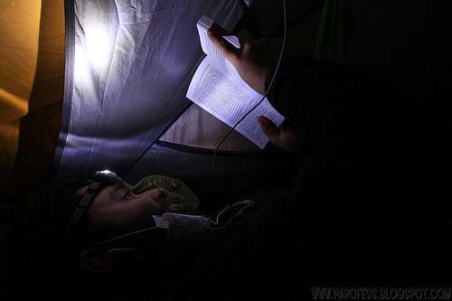
Paulo reading
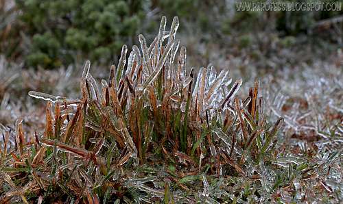
Morning rime
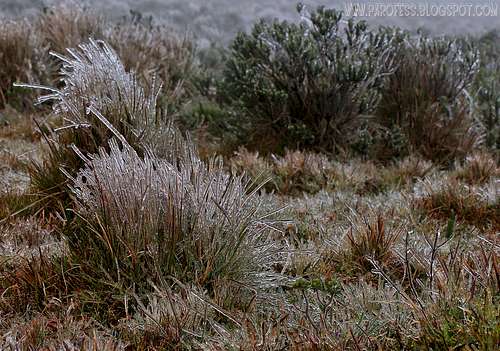
Rime all over the place
Love that!
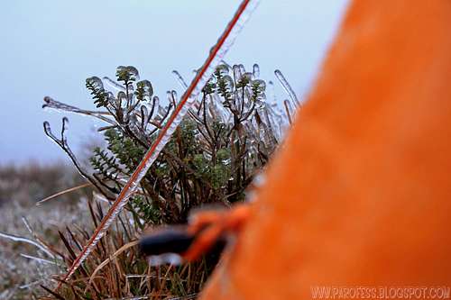
Look at that!
Weather Forecast

Click over the image to jump to the weather forecast page
To hike/ climb is a dangerous activity and requires proper equipment and clothing, the owner of this page cannot be blamed by injuries caused to anyone who read this page for its info about the mountain, and eventually got hurt by doing so with reckless behaviour or bad weather conditions.
Paulo Roberto Felipe Schmidt – AKA: PAROFES
The biggest brazilian website about climbing and mountaineering, for which I'm a columnist:

Legal Issues
To hike/ climb is a dangerous activity and requires proper equipment and clothing, the owner of this page cannot be blamed by injuries caused to anyone who read this page for its info about the mountain, and eventually got hurt by doing so with reckless behaviour or bad weather conditions.
Paulo Roberto Felipe Schmidt – AKA: PAROFES
External Links
My youtube channel: www.youtube.com/parofes - Now with 270+ videos online!The biggest brazilian website about climbing and mountaineering, for which I'm a columnist: