Mount Ann 1-26-2014
Last weekend Colin and I were working on plans to climb something in the Olympics when I received an invite through
NW Hikers to join a group of 3 who were headed for Mount Ann. The two of us had never been hiking so far North, and Mount Baker was obscured by clouds during my only trip in the area, so we changed plans with little discussion. This was our first time teaming up with someone from
NW Hikers. That and the thrill of venturing into new territory added more than the usual anticipation to the 3 hour drive from Renton.
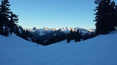
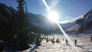
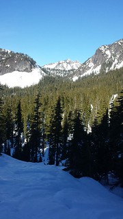
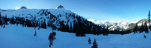
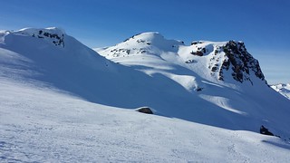
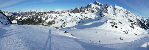
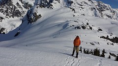
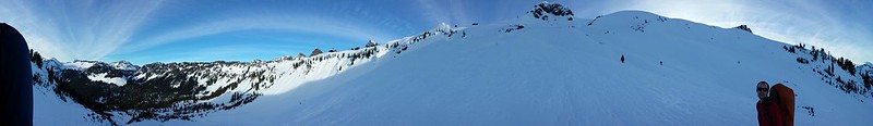
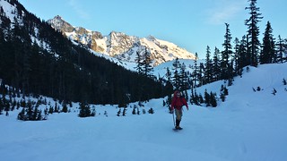
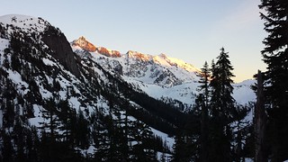
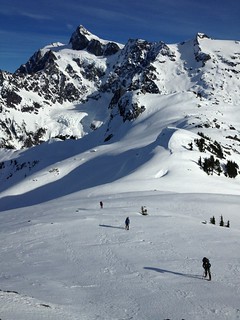
Part of the Mount Baker Wilderness, Mount Ann is situated southwest of Mount Shuksan just outside of North Cascades National Park. We arrived at the Mount Baker Ski Area just after 7 a.m. and the mountain scenery began before we left the truck. The road was closed below Artist Point so we parked in the lower lot near Bagley Creek. Introductions were made while we geared up and by 7:45 we were climbing toward Austin Pass with Table Mountain dominating the foreground and the Border Peaks rising behind us. At the pass Mount Ann and Mount Shuksan came into view.
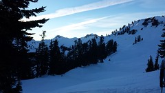
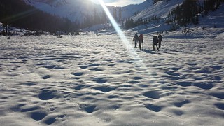
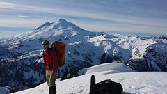
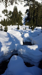
The snow surface had just begun to soften so we threw on crampons for the steep decent into Swift Creek Valley. Shortly after crossing an open snowy meadow we stopped to switch to snowshoes. Matt and I chose to hold out a bit longer but I did remove my crampons to save my new gaiters. Another half mile and a few creek crossings later we gave in when we had had enough of the post-holing. Mount Baker made a brief appearance before vanishing behind Mount Ann.
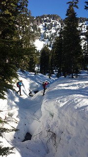
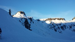
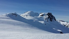
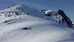
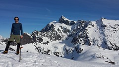
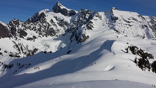
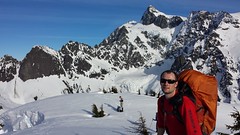
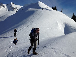
The usual winter route leaves the trail around the Lake Ann junction and ascends the ridge just west of Annette Peak. We were armed with a contour map and GPS track from to Steph Abegg, but several days of warm weather had Colin and I concerned about the steep northern slopes below Annette. We discussed a few potential routes. Colin and I liked the partially forested slopes directly north of Mount Ann's summit; above them was a mellow looking ledge that gently rose to the east meeting the ridge near the standard route. Another option was to gain the ridge near Lake Ann, but none of us knew what to expect from the south side of the ridge. We all agreed to continue along the usual winter route and further access the situation as we neared the ridge.
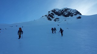
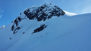
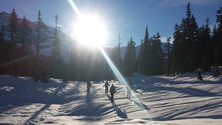
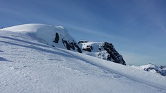
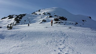
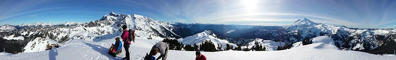
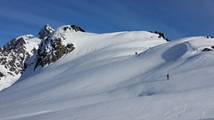
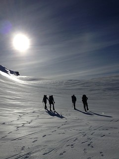
The slopes began to look more gentle as we approached them and we all switched to crampons while making the final decision. Colin and I preferred to take a short ridge of exposed rock while the rest of the group headed up the aforementioned slopes. To be extra cautious we went one-at-a-time up the short lee slopes below and above the rock. From there the steepness and exposure quickly faded away as we approached the top of the ridge. The rest of our party had a bit of trouble sinking their ice axes into the firm icy crust below Annette. I got some good pictures while they took their time safely reaching the crest, glad to have the hard part behind them.

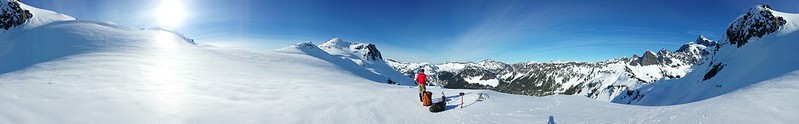
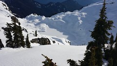
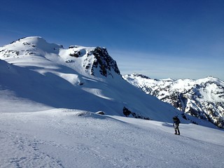
The summit was less than 500 feet above us and across much friendlier terrain. While we ate lunch two skiers descended from it and stopped to ask us about surface conditions where we had just been. They were camped on the north end of the ridge above Lake Ann and mentioned losing a few hundred feet below cliff bands on the south side of Annette on their way up in the morning. They seemed a bit hesitant at first, but had no trouble traversing above our partners tracks to the other side of Annette. We passed over a gnarly cornice on a small bump on the way to the top and celebrated our first summit together!
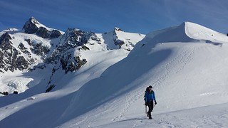
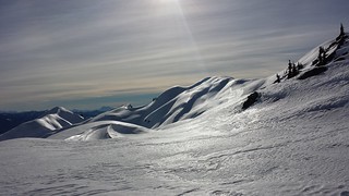
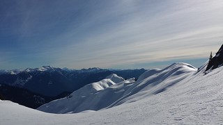
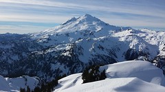
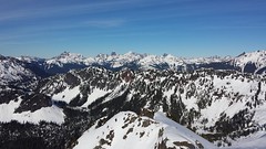
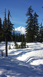
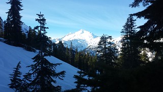
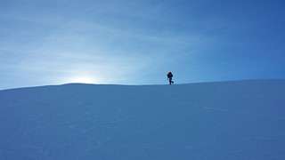
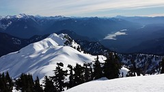
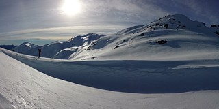
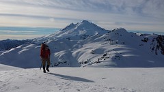
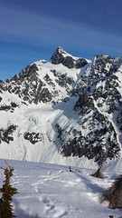
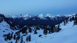
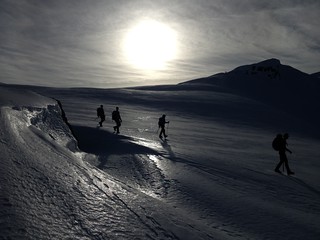
Baker was finally visible again but I was more drawn to Shuksan, the Curtis glaciers seemeing to barely hold on the the cliffs they cover. We surveyed our surroundings and tried to make sense of the distant Mountain Loop Peaks. The twisted ridge stretching out to the south was completely blanketed in snow and shadows. Getting over to Annette looked like cake, and we hoped to find a safe way down the other side so we could descend the summer route past Lake Ann. It was nice to bag another peak and get a closer look at Mount Shuksan, but it looked like we would need to lose at least 400' to safely reach the northwest ridge from Annette so we returned the way we came.
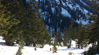
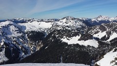
From the rocky rib Colin and I climbed on the ascent, the forested slopes below the north face of Mount Ann looked pretty mellow and we all agreed it would be nice to avoid the exposure we found below Annette. It turned out to be nearly as steep as the rest but we made it back to snowshoe territory without issue. We managed to stay higher on our way back through the valley. The final climb back to Austin Pass was highlighted by an alpenglow display on Mount Shuksan. We returned to a nearly empty lot at dusk, thoroughly satisfied with a challenging winter ascent among new friends.


10.5 miles round trip
~4000 'Elevation
10 hours car-to-car
View 2014-1-26 Mount Ann in a larger map
Comments
No comments posted yet.
