
|
|
Mountain/Rock |
|---|---|
|
|
46.96995°N / 11.30939°E |
|
|
Mountaineering |
|
|
Summer |
|
|
10663 ft / 3250 m |
|
|
Overview
Part of the Stubaier Alps (south of Innsbruck). With 3250m the highest summit of the Botzergroup (southernmost subgroup of the Stubaier Alps). Doesn't seem to be that high, but still a fairly long climb (6-8h). In good weather probably superb views towards the Stubaier Alps and the Dolomites.
Botzer and Hochwänd
Getting There
Most common accesroutes are from the Müllerhütte (3145m) or Becherhaus (3195m). Both located north of the Übeltalferner, the glacier on the northside of the Botzer.The actual climb from this side starts after one has reached the lowest point of the glacier towards the Botzer (ca. 2800m). To get there one simply needs to descent southwards from both Becherhaus or Müllerhütte for approximatly one hour.
Müllerhütte/Becherhaus-Botzer: ca. 3-4h
Other possibility: from Teplizerhütte (2586m) or the lower Grohmannhütte (2252m). From the Teplizerhütte one follows a marked path towards the Becherhaus. There's no need to hike all the way up to the Becherhaus. After reaching the Übeltalferner one can follow the route starting at the Becherhaus. Another possibility is crossing the Ebener Ferner untill one reaches the Übeltalferner. Approximately 2h1/2-3h.
The accesroute from the Grohmannhütte is the same as the one from the Teplizerhütte, apart from the fact that one has to walk first to the Teplizerhütte, some 300m higher up (marked path, ca. 1/2h).
Teplizerhütte-Botzer: ca. 5h.
Red Tape
No Red TapeRoutes
1. Übeltalferner-Hochwändscharte-SE ridge (easy)
Routes Botzer
Most recommended. After reaching the lowest point on the Übeltalferner one goes back up again. To avoid most crevasses it's best to keep to the right for the first part, the second part keeping left, and the third part one can simply go straight up.
The last part of the glacier and the rocky part to get on to the SE ridge is the most tricky part of the climb. Steep snow, followed by the rather steep Hochwändscharte, where absolutely everything is completely loose, even the larger rocks. It's best to get through as fast as possible to reduce the danger off rockfall. Best to go up one at a time (unnecessary to say that a helmet is absolutely needed).
After the Hochwändscharte one comes up the SE ridge (I), which one has to follow untill the summit. No real difficulties are encountered.
Ca. 2-3h from the lowest point of the Übeltalferner.
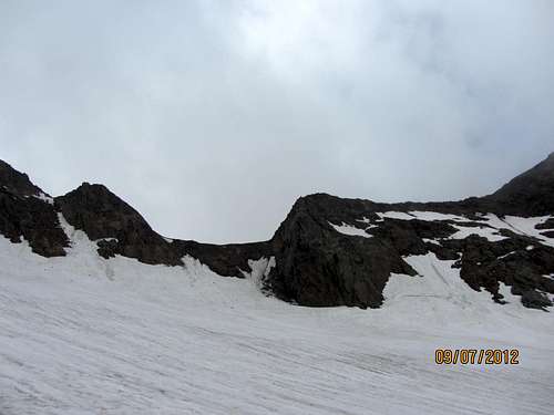
Hochwändscharte
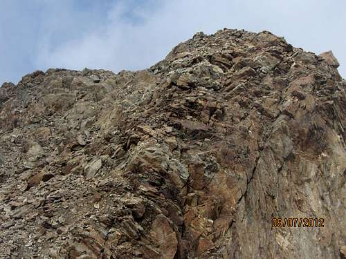
First part of the SE ridge

Descending the Hochwändscharte
To descent there is an alternative route, much faster than the SE ridge. A bit below the summit there are possibilities to leave the ridge an descent towards the glacier on your left side. From there one can descent much much faster towards the Hochwändscharte.
2. Übeltalferner-Botzerscharte- W ridge-second part of the SE ridge
Not recommended due to lots of loose stones, even worse than the Hochwändscharte.
It's important to say something about the changing snow- and glacierconditions as summer progresses. Early in summer (June and the first part of July) when there's still a reasonable amount of good snow the hochwändscharte can be climbed fairly easy. As snow is melting the Hochwändscharte becomes longer and more dangerous, as more loose rocks are comming up from beneath the retreating snow and glacier.
Accomodation
Müllerhütte: Website MüllerhütteBecherhaus: Website Becherhaus
Teplizerhütte: Website Teplizerhütte
When to climb
Summer.Best chances on good conditions: early summer.
Equipment
Rope, crampons, ice axe (glacier equipment), perhaps some basic rock climbing equipment (specially for the Hochwändscharte).Maps and Guidebooks
Map: OeAV Alpenvereinskarte 31/1 (1/25.000) Stubaier Alpen – Hochstubai.Online map of Austria and South Tyrol