
-
 8630 Hits
-
 79.78% Score
-
 11 Votes
|
|
Mountain/Rock |
|---|---|
|
|
50.01692°N / 126.22531°W |
|
|
Hiking, Mountaineering |
|
|
Spring, Summer, Fall |
|
|
5718 ft / 1743 m |
|
|
Introduction & History
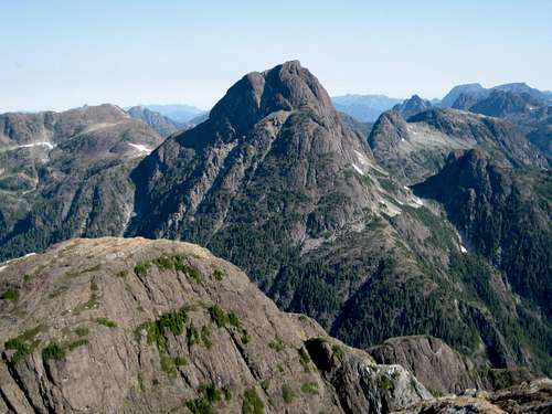
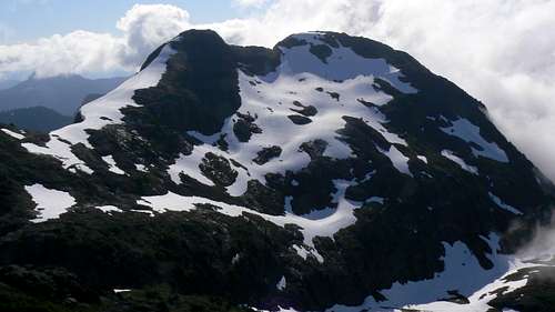 Mt Alston from Alston Fin Mt Alston from Alston Fin |
Mt Alston is no exception to this rule. After climbing the relatively gentle west side of the mountain no unprepared visitor could fail to be surprised by the precipitous east face dropping away almost vertically 400-500 metres to the bench below. Not generally as steep or challenging as its neighbour to the north, Sutton Peak, Alston also has the advantage of a much shorter, more direct approach. In addition, anyone would be hard pressed to find a lovelier place than the alpine meadows in the cirque below the west buttress of Alston and its western satellite, Alston Fin.
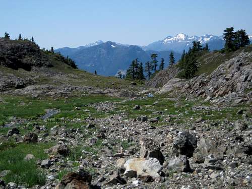
Situated above the Gold/White Rivers and the pass between them to the east and the Nimpkish Valley to the west, Alston offers wonderful views in all directions.
Industrial roads reach out of the Nimpkish Valley to an altitude of over 1,100 metres right on Alston’s SW ridge. From the top of the highest drivable road there remains no more than 200-300 metres of travel through residual logging slash to reach the old growth on the SW ridge and less than an hours travel from there on the well-defined ridge to the Alston/Fin cirque from where the summit may be reached without technical difficulty.
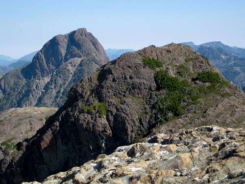
Mt Alston north aspect from Sutton Peak
Mt Alston is named for Edward Graham Alston. Alston was a member of the Legislative Council of Vancouver Island from 1861 to 1862 and was a member of the little heralded 1868 expedition which crossed Vancouver Island from Nootka Sound to the east coast.
Although Alston distinguished himself in public service on the Island, he found himself in opposition to confederation with Canada and in August 1871, shortly after British Columbia entered confederation he left the fledgling province and took up the position of Queen's Advocate in the colony of Sierra Leone, West Africa. There he served as a member of the Legislative and Executive Councils and for several months was acting governor. His career and a promising life were brought to a premature end when Alston contracted and died from "African fever” in Freetown, Sierra Leone on 12 November 1872. He was just forty-one years of age.
Getting There
Vancouver Island can be reached directly by air from Toronto, Vancouver, Seattle, Calgary, Edmonton and recently from San Francisco to either Victoria, Nanaimo, Comox or Campbell River and by ferry from Port Angeles to Victoria on The Coho and on BC Ferries from Vancouver to Victoria or Nanaimo. Public transport on the Island is notoriously poor and anyone arriving by air would be advised to rent a car.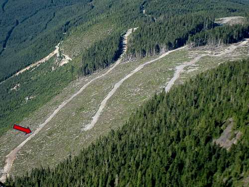
An overview of the currently accessible roads on the southwest side of Mt Alston. The southwest ridge can be accessed from any of them depending on how comfortable you feel with the driving conditions. We got this overall picture by walking 5 minutes down the southwest ridge from the south summit - the one with the tripod. Our truck is marked with the red arrow
The approach to Mt Alston requires you to negotiate steep, narrow, decommissioned industrial roads with deep water bars. Once off the main Nimpkish Road a high clearance vehicle with 4WD is absolutely mandatory. The highest drivable road that goes right onto Alston’s SW ridge is not for the faint of heart nor the vehicle-proud. Although well equipped with switch-backs, the road is very steep at times, often very narrow and exposed to huge, unprotected drops on the downhill side. If you fail to get across some of the bigger water bars, turning around could be a big problem in the narrow space available. Some may prefer to start off the hike from a lower road and, for this reason, I include that option in the description below.
There are no restrictions, such as gates, on the approach roads but it would be a good idea to check with Western Forest Products Ltd for the latest conditions.
Mt Alston can be reached off the Nimpkish Valley Road which itself can be accessed from Gold River to the south and from the inland Island Highway 19 to the north.
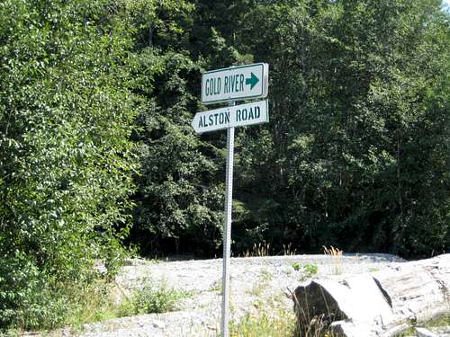
For the Gold River approach make your way to Campbell River at the end of the freeway section of the inland Island Highway 19. Take highway 28 west towards Gold River. After 40km you will enter Strathcona Park at Elk Portal. Exactly 1 km further on highway 28 makes a right turn over the bridge at Buttle Narrows. Take this turn and drive all the way to Gold River. There is no gas beyond Gold River so make sure you have enough to cover at least 150 km. From Gold River follow signs initially to Tahsis and Woss. Roughly 2-3 km from town cross the Gold River and immediately take the right fork to Woss (the left goes to Tahsis). This is the Nimpkish Valley Road and pavement ends at this point. Drive 27 km from the Gold River bridge - following signs for Woss if in doubt - and find Alston Road on the right.
For the north approach continue through Campbell River on Highway 19 following signs for Port Hardy. Pass through Sayward Junction and 11 km before the turn-off for Woss, turn left at the sign for Schoen Lake Provincial Park. All roads from this point are gravel. Almost immediately after turning onto gravel the road forks. Take the right branch signed for Gold River. This is the north part of the Nimpkish Valley Road. Drive 36 km from Highway 19 – following signs for Gold River if in doubt - and find Alston Road on the left.
 Alston Road | 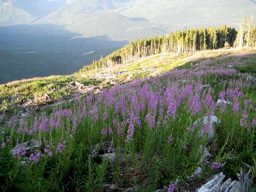 Highest Driveable Road |
The old growth is no more than 5 minutes walk above you to the north.
Approach & Routes
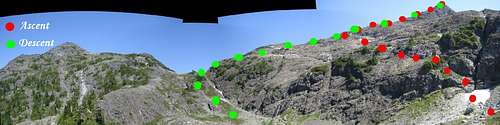 Mt Alston Routes |
Proceed steeply at first up the well defined SW ridge following a clear and flagged boot path. Since Alston sees very few ascents, we concluded that the origin of this path is probably elk hunters. We saw large numbers of Roosevelt elk on both Alston and on neighbouring Sutton Peak. Unburied garbage and toilet paper below the Fin/Alston col served to reinforce this conclusion. Elk hunting on Vancouver Island is strictly controlled. Anyone visiting Alston and able to collect any evidence of illegal hunting is urged to report all details to the RCMP.
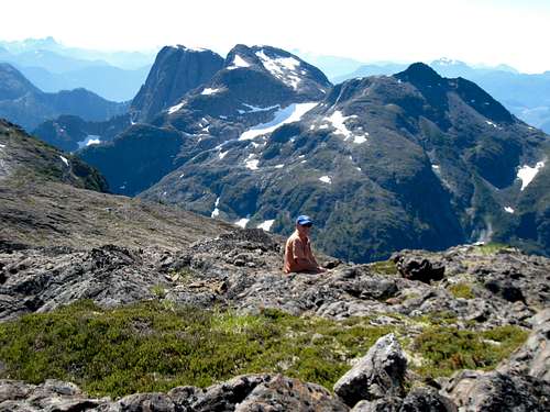
 Alston/Alston Fin Cirque | 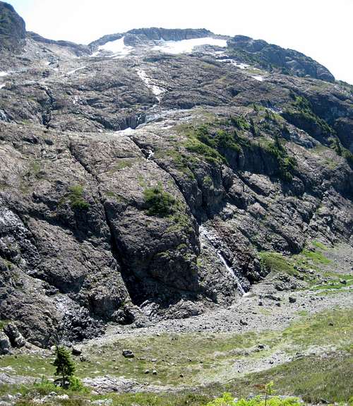 Mt Alston West Buttress | 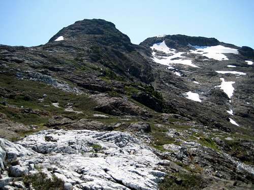 Mt Alston from the NW ridge. Main summit on left. | 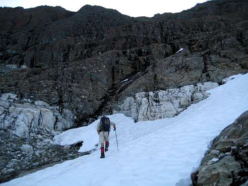 Traversing the West Buttress | 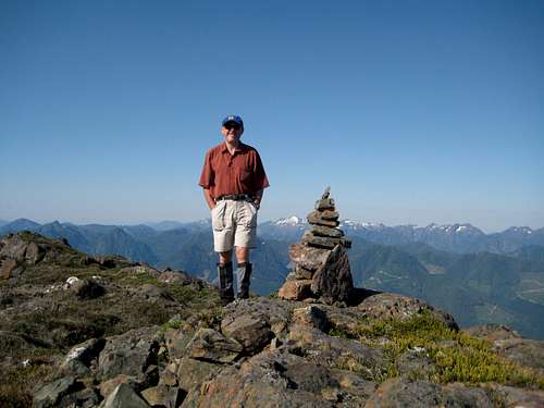 On the Summit of Mt Alston |
After 20-30 minutes of steady climbing NE the well defined ridge peters out into a lovely series of meadows and tarns below what has now become the steep SW face of Alston. Ahead to the NW is the easily recognized shape of Alston Fin with the true summit to the NE. Between the two is a col. To your immediate right is the west buttress below and between the main (north) and slightly lower south summits. A waterfall cascades down the buttress from about its half height.
The guidebook description, such as it is, advises the climber to “follow the SW ridge with no technical difficulties to the summit”. With no ridge left to follow we improvised as follows.
From the last (most northerly) tarn in the meadows in the neighbourhood of N50 00.860 W126 13.941, make a rising traverse with a little Class 3 here and there, across the face above the waterfall and with the aim to intersect the NW ridge on the right of the col at about N50 01.093 W126 13.685. You will cross several limestone bands en route if you’ve chosen the right line.
From the last (most northerly) tarn in the meadows in the neighbourhood of N50 00.860 W126 13.941, make a rising traverse with a little Class 3 here and there, across the face above the waterfall and with the aim to intersect the NW ridge on the right of the col at about N50 01.093 W126 13.685. You will cross several limestone bands en route if you’ve chosen the right line.
 Sutton Peak from Mt Alston | 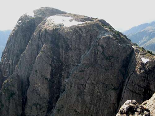 Mt Alston East Summit | 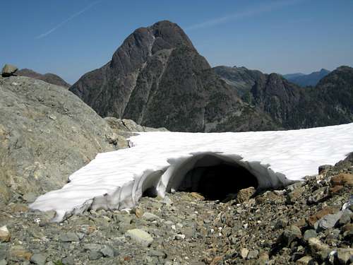 Mt Sutton from the Fin/Alston Col | 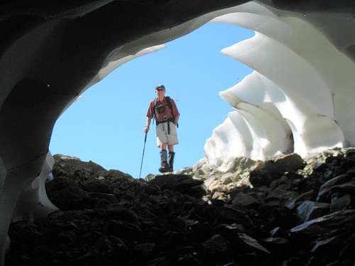 In the Mt Alston/Alston Fin Col | 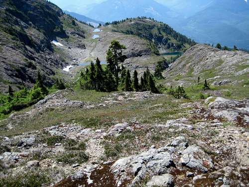 Alston South Cirque (descending) |
To descend to the meadows, continue down the NW ridge past the point you reached it and down into the Alston/Fin col with a little scrambling at the end. Turn left and walk down talus and finally grass slopes to the last tarn noted above. From this point, retrace your steps to your vehicle.
As always a MapSource/Garmin tracklog is available for the asking for the approach and summit routes. Just send me an email or PM.
Approximate route data.
Total distance: ~ 5 km
Net elevation: ~ 550 metres
Total elevation: ~ 600 metres
Ascent Time: ~ 2-2.5 hours
Descent Time: ~ 1.5-2 hours
Red Tape and Safety Considerations.
Absolutely no red tape.There’s nothing resembling a formal trailhead and an intentions system simply doesn’t exist in this neck of the woods. Make sure, therefore, that you have left a detailed trip plan with someone responsible. The RCMP and the appropriate SAR agency will respond in an emergency but it is up to you to have the mechanism in place that will initiate the call-out process if it becomes necessary.
There is no cellular service anywhere on Mt Alston. If this is a concern, equip your group with a satellite phone.
Camping
Alston is easily accomplished as a day trip. You might want to get an early start and a car camp may be called for. If so, I’d establish it right at the end of the approach road. It’s inactive and there’s unlikely to be anyone coming this way. There are also great views to the west from this side of the mountain. However there is no access to water, so haul a barrel in with you.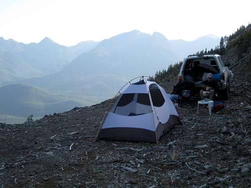 Car Camp Below Alston |
Bear and cougar frequent the mountains and forests of Vancouver Island. Proper back country methods – hanging food bags out of reach, cleaning up all cooking scraps, good toilet practice etc – are all absolutely essential.
Useful Links
For more information refer to Island Alpine – A Guide to The Mountains of Strathcona Park and Vancouver Island, Philip Stone, Wild Isle Publications, 2003, ISBN 0-9680766-5-3For general backroad information and directions get hold of a copy of Backroad Mapbook. Volume III: Vancouver Island
Weather
Nearest point current conditions and forecast.West
East
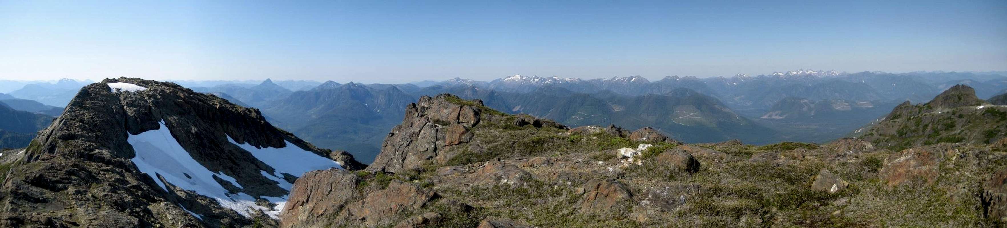
Summit Panorama
  |