
-
 8981 Hits
-
 78.27% Score
-
 9 Votes
|
|
Route |
|---|---|
|
|
47.50236°N / 120.80189°W |
|
|
Hiking, Mountaineering, Scrambling |
|
|
Spring, Summer, Fall, Winter |
|
|
A long day |
|
|
Class 3 |
|
|
III |
|
|
Overview
This route is one of the two main routes on Cannon Mountain. For the standard route see the Prussik Pass route page. This route however is much more challenging and requires much more scrambling. This route is a good choice for those climbers seeking a pristine, remote setting with more scrambling and route-finding challenges. It will also test your conditioning and provide some different perspectives on the Enchantments area.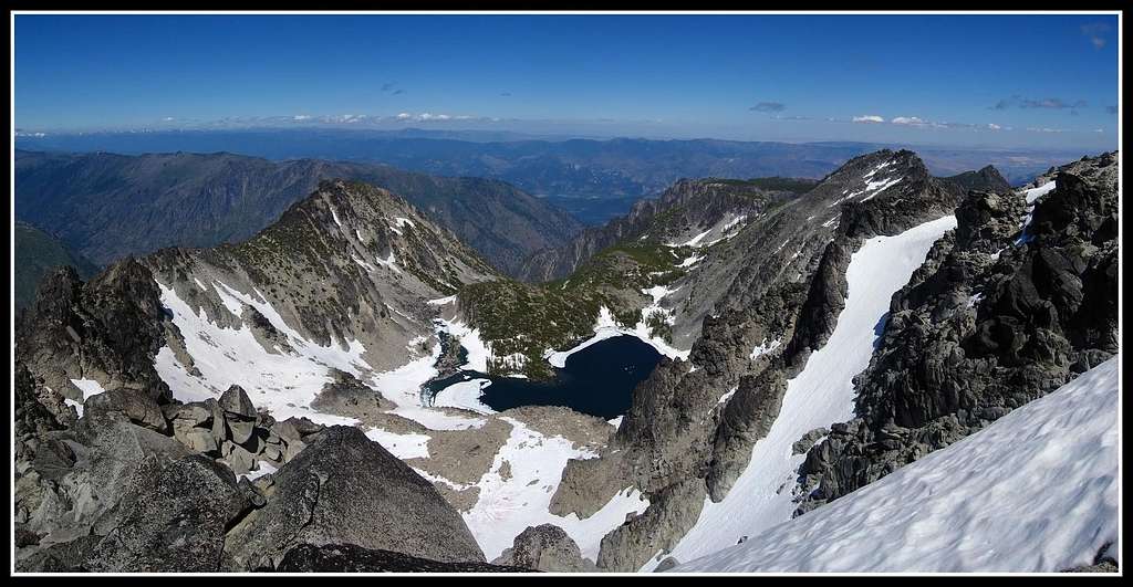
Getting There
This route starts at the popular Mountaineer Creek Trailhead which is the same trailhead for Colchuck Lake, Stuart Lake, Aasgard Pass and the upper Enchantments. From Seattle there are two ways you could go. First, you can get on I-90 and head east over Snoqualmie Pass to Cle Elum, taking the exit to Wenatchee & Blewett Pass via 970 and then US highway 97. Highway 97 takes you over Blewett pass to a junction with US Highway 2. Turn left towards Leavenworth. Go through Leavenworth and pass the Leavenworth ranger station until you come to the last road before you start to enter Tumwater canyon and turn left on Icicle road. This junction is signed and a 76 gas station is at this intersection. The second way to get to the same Icicle Creek TH from Seattle or Everett area is to take US 2 over Steven's Pass to Leavenworth. When you come out of the canyon, turn right on the Icicle Creek Road.Follow this road for just over eight miles and turn left onto the signed Eightmile Road which is gravel. Cross Icicle Creek and climb 1,100 feet to the end of the road at the large parking area. You will pass the Eightmile Creek trailhead on the way.
 Mountaineer Creek
NE Ridge Route
This route is best done later in the season when the snow around Coney Lake has melted away and the ridge is free of snow. It's more of a scramble route and it's the route I went when I climbed Cannon. This route is only advised as an ascent route.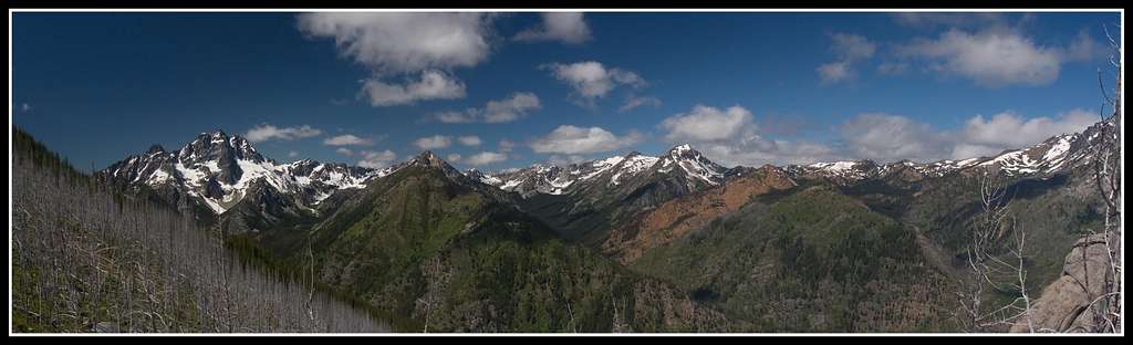
From the trailhead locate an old abandoned road heading northeastward from the parking lot. There are a few large rocks blocking the road and it has long been closed for vehicles. Follow this overgrown road as it gains little elevation until you come to a massive washout in the road at a large avalanche chute. From here you can traverse the chute over very loose dirt and debris and reach the road on the other side or start heading straight up hill. If you traverse the chute, the road continues a very short ways then switchbacks at which point you follow a small but steep rib uphill. If you decide against traversing the chute, start climbing here. Regardless of where you are on this slope, the goal is to climb with much bushwhacking and log hopping straight up the north facing slopes on lower Cannon Mountain. These slopes are mostly in a large burn area so loose dirt, big logs, underbrush and hidden traps are the norm. This isn't a pleasant ascent by any means but just keep heading south aiming for the crest of the northeast ridge. It is 3,600 feet from the old road to the crest of the main ridge so pace yourself. At about the 6,800 foot level you may pass by a steep cliffy area to the left (east). Just follow the rib south as this will take you to the main NE ridge.
 Bushwhacking the north slopes Bushwhacking the north slopes |  Hiking the old road Hiking the old road | 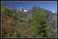 Mount Stuart from north slopes Mount Stuart from north slopes | 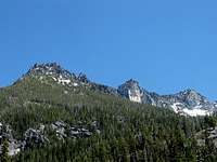 West side of Cannon Mountain West side of Cannon Mountain |
You will continue through a non-burned forested area for a bit and then top out on the ridge crest where the scrambling starts. From here start southwest, veering slightly to the right and scramble the large blocks on the crest. Coney Lake is below you to the valley on the left (east). It is one pretty sight indeed. In early season when snow fills the valley around Coney Lake, you can choose to descend 200-300 feet to the flat bench above the lake then climb the obvious couloir to the south (taking you around the NE ridge on its east side). This variation has steep snow and best avoided when dry. In summer, continue on the ridge until you come to some towers in the ridge you can't climb over at 7,980 feet a half mile from where you crested the ridge. From here you will have to drop to the right (west) and traverse the loose slope below the ridge crest at the 7,900 foot level. It is best to stay on a horizontal traverse across the many ribs and gullies that form a large steep bowl above Mountaineer Creek which you can see far below. Extreme care should be taken on this traverse since there is loose rock everywhere and at times cliffs below you. This 0.3 mile traverse can be very time consuming and you have to remain focused the entire time. There are many instances where the route looks like it will just cliff out completely but just keep traversing class 3 terrain at 7,900 feet heading towards the obvious steep slope and ridge in the distance. After the forth or fifth rib crossing, you will reach the main gully in this large bowl you have been traversing and from here it is a 500 foot talus slog back up to the ridge crest. You can't miss this gully since it's 10 times bigger than any other small gully you traversed across. This gully is very loose however so it can take quite some effort despite all the work you have done already. Once you top out of this large gully a spectacular view down to Coney Lake can be seen which is shown above in the featured photo. From here, ascend the final slopes south to the summit block which is only 100 yards away. Once at the summit block walk around to its east side and friction climb the last 5 feet where you will be able to sit one person at a time on the highest rock which is nothing more that a point.
 Cannon from NE ridge Cannon from NE ridge |  Cresting the NE ridge Cresting the NE ridge |  Traversing below the towers Traversing below the towers |  Scrambling below towers Scrambling below towers |
 Traversing below the ridge Traversing below the ridge |  Coney Lake from NE ridge Coney Lake from NE ridge |  Summit block of Cannon Summit block of Cannon |  Standing on Cannon Standing on Cannon |
 Scrambling on west side of the NE ridge Scrambling on west side of the NE ridge |  On the crest before the towers On the crest before the towers |
Descent
The best way to descend this route is to follow the standard route and head over Prussik Pass. From here you can follow the trail through the Upper Enchantment Basin, down Aasgard Pass and down the Mountaineer Creek Trail back to the trailhead. This makes for a very challenging day hike loop that is 15 miles long with lots of sustained third class scrambling and bushwhacking. Get an early start...this loop is at least a 12 hour day.Maps
Shown Below is a couple maps of the route. I believe that this route is the best route on Cannon Mountain other than the Druid Plateau/Prussik Pass route. The one on the left shows the NE ridge route in blue (with snow variation in red) while the one on the right shows other cross country route options on Cannon Mountain. NE Ridge route map NE Ridge route map | 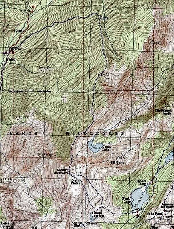 Other cross country routes Other cross country routes |
Essential Gear and Links
This route is best done in summer when the snows have all melted away at which case good boots, the ten essentials and experience on loose rock are required. If you plan to stay overnight, the Druid Plateau is a great place to bivy in good weather. Coney Lake has one nice camp spot but this will require you to descend steep terrain down the other side of the NE ridge after you have crested it. If you tackle this climb in earlier season, making this descent to the bench above Coney Lake at about 7,700 feet then ascending southward up a snow couloir to the east of the ridge up to the summit block will be more enjoyable. You will have to lose at least 200 feet however so pick your poison. In early season however, bring an axe, crampons, full snow clothing (pants, gaiters etc.) and face/eye protection.See this page for a good description of the route.
Another good report about the area
See this page for a weather forecast of the area