|
|
Route |
|---|---|
|
|
27.02916°S / 68.31609°W |
|
|
Mountaineering, Scrambling |
|
|
Summer |
|
|
Most of a day |
|
|
Class 3 |
|
|
II |
|
|
Overview
This is a simple and straightforward route to the summit from the Chilean side. With nothing more technical than 35-40 degree snow slopes and easy scrambling near the summit, this route's main challenges are the long approach, high elevation, and large elevation gain from base camp to summit if done in a single day.
Getting There
If arriving from Chile, bike or drive along Ruta 31 from Copiapo. Acclimitize as needed. Salar Maricunga, Rio Lamas, and Laguna Verde are all excellent rest-day options, and you may as well plan on climbing some other local peaks as a warm-up (e.g. Barrancas Blancas, Volcan Pena Blanca, Vicunas). Be sure to bring adequate supplies according to your mode of transportation - there are no service stations once you leave Copiapo.
Leave Ruta 31 about 5.5 km east of Laguna Verde and head onto a well-graded gravel road out to a small excavation area. If traveling by 4x4, there is a low-quality trail that continues to the vicinity of Incahuasi. Otherwise, leave your car or bike in an inconspicuous location around the gravel pit and continue on foot up the most prominent valley. Following the jeep trail and then heading towards Incahuasi will bring you to the base of the mountain after about 12.0 km.
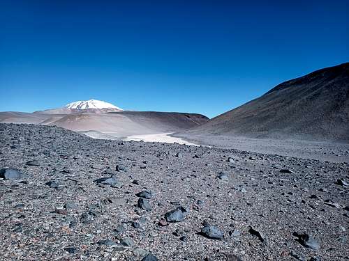
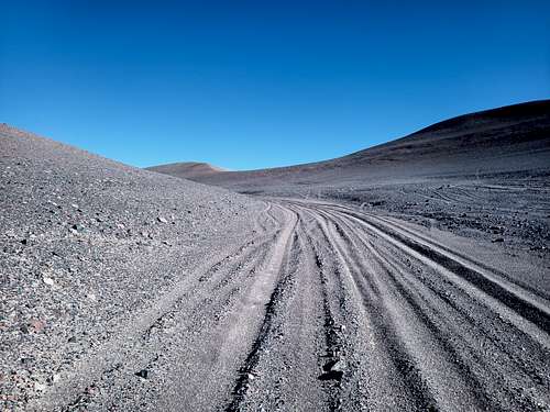
If arriving from Argentina, you should probably consider climbing the mountain from that side. Otherwise, cross the border onto Ruta 31 and drive west about 8 km to reach the trailhead described above.
It is recommended to camp at the foot of the mountain which is approximately 4900 MASL. There is little shelter from the wind on this side of the mountain, so be sure to secure your camp well to resist any wind and blowing dust. Water can be obtained by melting snow or ice, or occasionally in liquid form from the various nearby gulleys once the sun warms the ground.
Reasonable options for an upper camp exist along the route up to approximately 5600 MASL.
Route Description
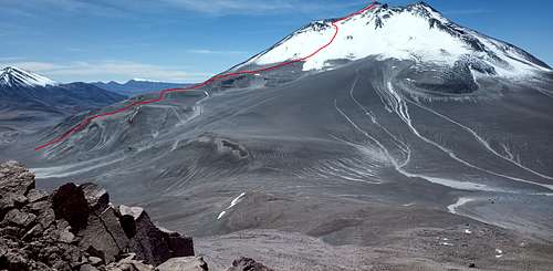
The route alternates ascending scree gulleys and crossing broad benches to reach the snowfield. Numerous variations are possible, but head towards the lower (older) caldera just northwest of the summit. There is a band of low bluffs at 5580 MASL which can be easily avoided by diverting to climbers' left.
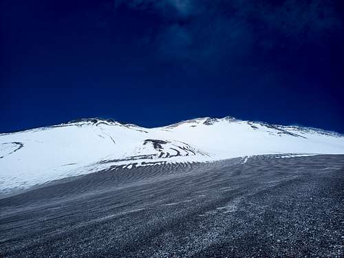
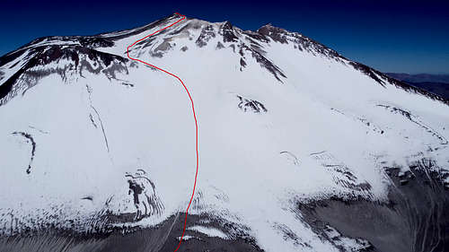
Once below the lower caldera, proceed directly up-slope. The slope angle suggests that avalanches may be possible depending on snow conditions, so use caution when approaching and passing through this area. There is no shelter from a potential avalanche on this slope, so find a different route if there is any indication of instability. The slope reaches a maximum angle of approximately 35 degrees, easing off as you approach the lower caldera.
Head slightly to climbers' left as you ascend to reach the lower caldera at approximately 6280 MASL. From here, ascend directly up-slope to the southwest. Once you reach the rim of the main caldera, continue east (climbers' left) to reach the summit after a short stretch of class 3 scrambling.
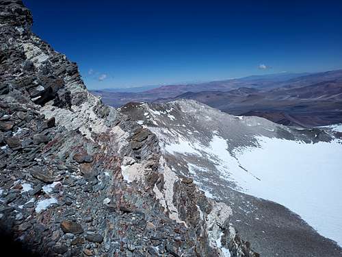
Retrace your steps to descend.
Satellite imagery indicates that this route may periodically be almost snow-free, and that the underlying slope is likely more of the same loose volcanic material that comprises the lower sections of the route. Such conditions would probably make the interval from 5800 MASL up to 6250 MASL considerably more arduous.
Essential Gear
- Cold-weather hiking gear
- Crampons or microspikes
- Ice axe

