
-
 18777 Hits
-
 95.73% Score
-
 55 Votes
|
|
Custom Object |
|---|---|
|
|
32.60600°N / 116.468°W |
|
|
Long Distance Hiking Trail |
History of the Pacific Crest Trail
 A Long Ways To Go
The Pacific Crest Trail (PCT) is one of eleven National Scenic Trails in the United States. It covers 2,663.5 miles from Mexico to Canada, passing through California, Oregon and Washington. It reveals the beauty of the desert as well as valleys and mountains, and the evidence of man's struggle to survive and prosper in his endless search for natural resources. The trail is open to hikers and equestrians, thousands of people enjoy it every year, from just a few miles, to completing every mile in one year.
The route was first explored in the late 1930s by teams from the YMCA, and was strongly promoted by Clinton Clarke and Warren Rogers. They lobbied the federal government for a border-to-border trail corridor, but had to settle for several disconnected trails along the crest of each state. In 1968 the PCT was designated one of the first National Scenic Trails, and was dedicated in 1993.
 Almost There
The Pacific Crest Trail Association (PCTA) helps maintain the trail, promote its use, and advocate for its protection, through an agreement with the Forest Service. The PCTA is a not-for-profit membership association governed by an elected board of directors to represent the whole community of trail users. They also are the central clearinghouse for information about the trail for hikers and anyone else who is interested in it. Through it's website and magazine "The PCT Communicator", the PCTA reports route changes, pending legislation, trail conditions, and other activities which affect the trail and it's users. It also provides information on trail food, equipment, re-supply points, and trailhead transportation. Another valuable service they perform for hikers is issuing a thru-hiker permit that is good for the whole trail, eliminating the need to get individual permits for the various state and national parks and wilderness areas.
PCT Map
Thru Hiker's Log Here
To read or sign the thru hiker's log, click hereSouthern California – 648 Miles
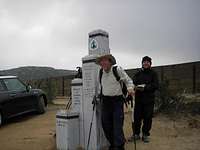 Chance and I at the Mexican Border
 Crossing the Mojave Desert
 Wind Power
 Mt. Baldy From the Climb to Baden-Powell
The PCT begins at the Mexican border near the small town of Campo. From here it is about 20 miles to Lake Morena County Park, which it passes through. Every year there is a kick off party here called ADZPCTKO, usually held around the last week in April. This is a good chance for the current year's hikers to meet each other, as well as past and future hikers, and attend many informative sessions that will help them on their hike. There are also a select group of venders that are invited to showcase their products, most of which are small companies that produce lightweight gear. Many hikers start before the KO, but then hitch a ride back to attend it.
From Lake Morena, the trail crosses under Interstate 8 and then climbs to the rim of the Laguna Mountains. It goes through the Anza-Borrego Desert State Park, around the San Felipe Hills, through the Cleveland National Forest and then climbs the backbone of the San Jacinto Mountains. Here it reaches its highest point in this section at 9,030', on the side of Mt. San Jacinto, shortly before it plunges to its lowest point, crossing beneath I-10 at 1,190', in the broad San Gorgonio Pass.
From here the PCT climbs steeply up the San Bernardino mountains, going around Mt. San Gorgonio and then passing near Big Bear Lake and Lake Arrowhead before crossing under I-15 at Cajon Pass, and then climbing up to the crest of the San Gabriel Mountains, with good views of Mt. Baldy (San Antonio), and crossing just below the summit of Mt. Baden-Powell. It then descends to Aqua Dulce, home of the famous trail angels, the Saufleys, before crossing the San Andreas Fault Zone and the western part of the Mojave Desert. Next is a hot dry climb into the Tehachapi Mountains where it enters the Sierra Nevada, ending at Walker Pass at 5,246'.
If you are doing a thru-hike, the best time to hike this section is in April and May. You should be prepared for cold, stormy weather and snow covered trails, as well as hot dry deserts and everything in between. The weather conditions can vary greatly from year to year and even day to day. Water sources can be up to 30 miles apart, although they are often supplemented by water caches supplied by trail angels, but these cannot be depended on.
Central California – 505 Miles
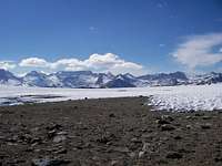 Looking Towards Forester Pass
 M&M Approaching Kearsarge Pass
 Don't Slip
 Go-Big Crossing Mono Creek
 3 Gallon Coming Down Fast
 Cross Country in the Desolation Wilderness
This section starts at its lowest point, staying near the dry crest through the Chimney Peak Wilderness, before crossing the South Fork of the Kern River near Kennedy Meadows. This is the place where most hikers receive their required bear proof food containers, and often, warmer clothes, crampons and ice axe. On an "average" year, June 15th is considered the earliest recommended starting date to enter the High Sierra, which starts just north of here. As a result, there is often a large group of hikers hanging around the store at Kennedy Meadows, waiting for the snow to melt, enjoying the camaraderie of other hikers, and building up the nerve to tackle snow covered trails and passes. It is an exciting and sometimes tense time, depending on the snow conditions and the hikers' skill levels, and a moment that will have been talked about since the beginning of the hike. The store is very hiker friendly, there is free camping, pay showers, good food and sometime free movies and BBQs put on by the local residents.
The route alternates between forests and expansive meadows, and then there is a 3,300' climb and traverse to Cottonwood Pass. In Sequoia National Park, the John Muir Trail descends from nearby Mt. Whitney to join the PCT. The trails share the same tread for most of the way to Highway 120 at Tuolumne Meadows in Yosemite National Park. Here you will need good route finding skills and may spend most of the day on snow covered slopes and passes. The trail passes through a mostly wilderness stretch, repeatedly descending into deep canyons and then ascending to high saddles. The PCT crosses eight named passes above 11,000', the first being Forester Pass, at 13,180' it is the highest point on the whole trail. Others of note are Muir, Glen, Mather and Pinchot Passes. Peak baggers should take note that the trail does not go over any of the peaks, they are side trips off the main trail, but are commonly done by thru-hikers.
More importantly, you also need to know that there are no re-supply towns in this section, and very few roads to hitchhike out from. There are three resorts, the first is Muir Trail Ranch, which for a substantial fee will pick up your re-supply bucket and pack it in by horse. Next is Red's Meadows, with a good restaurant and a small camper store, where there is also shuttle bus service to Mammoth, if the roads are open. The third one is Vermilion Valley Resort, off the trail a ways, but they have a pontoon shuttle service across the lake to the resort, with a small store and a good, but expensive, restaurant. They will also pickup your re-supply box for a fee and have it waiting for you. It is very important to check with each of these locations for opening dates if you are arriving early in the season, as well as current fees and conditions for re-supply boxes, and available lodging if desired. Some hikers choose to avoid all of these stops and carry 12 to 15 days of food with them, but this can be a risky option in a high snow year, when your daily mileage may drop down to 10 to 15 miles a day. Many hikers run low on food and are exhausted and burned from the snow and sun. An option that many chose, either beforehand or due to necessity, is to leave the PCT and exit via Kearsarge Pass, and go to Independence to re-supply. However this involves an 18-mile round trip detour hike, plus a hitchhike from and to the Onion Valley Trailhead.
Equally important considerations, along with the snow conditions, are the creek conditions. They are named creeks, but during the last half of June, most of them are raging rivers. Evolution Creek, Bear Creek and Mono Creek are some of the names you will hear talked about with fear and trembling, and rightly so. They are often impossible to cross at the normal trail crossing, you need to seek out an alternative crossing place up or down stream. Here the trade offs are to go through early, in high snow, before it starts melting and flooding the creeks, to wait until the snow melts some, but then the creeks are high, or to wait until both the snow and creeks have subsided. Another factor to consider with all of this is the need to arrive in Washington before the winter storms start.
After Yosemite there can still be some dangerous passes, notably Sonora Pass at 9,620', with the possibility of a "lethal slide" as the guidebook says, and a few others on the way to Carson Pass. However after Sonora Pass, the elevation changes diminish, with the trail passing through the Desolation and Granite Chief Wildernesses, ending the section at I-80, just north of Donner Pass.
If you are doing a thru-hike, the best time to hike this section is from the middle of June through the middle of July, otherwise through September is OK. Your chances of deep snow, and dangerous passes and creeks are greater early on, but if you wait too long you will not get to Canada before a great chance of winter storms in Washington. Of course it all depends on the weather conditions for the year, which may be different between north and south ends of the trail. One good thing about the Sierras is that there is plenty of water, so you can carry less water, to make up for the increased weight of food and equipment. However many hikers still leave Kennedy Meadows with the highest pack weight of their whole hike.
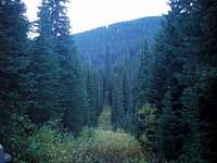
Northern California – 567 Miles
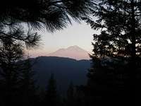 Mt. Shasta in Smoke
 Forest Fire in the Marble Wilderness
 Just Before the Oregon Border
From here north, the PCT passes through a great amount of logging country and crosses many back road, quite a change from the mostly roadless Sierra Nevada, as it also enters the southern Cascade Range. The rich volcanic soil is at the right elevation and receives sufficient rainfall to produce exceptional forests. Midway through the southern Cascade Range, the trail enters Lassen Volcanic National Park and then the dry Hat Creek Rim on the way past Mt. Shasta, which dominates the skyline for days. The trail now heads west to avoid the dry section of the Cascades, and drops down to 2,130' to cross the Sacramento River at I-5. From here is enters the Castle Crags State Park and the Trinity Alps, reaching 7,600' on its way to the Marble Mountains, before dropping back down to 1,370' to cross the Klamath River. It now climbs to the crest of the Siskiyou Mountains and traverses east, entering Oregon shortly before the section's end at I-5 near Siskiyou summit.
In spite of all the elevation changes, it is possible to start making some bigger mile days, as hikers are often eager to begin making up time, after spending more time than expected in the Sierras. It is an adjustment to need to be more careful about planning for water, as well as getting used to the heat again. It is also at this point that many people start getting tired of the trail and need to "tough it out" a bit to keep going and just put in the miles, encouraged by passing the half way mark near Chester, and the prospect of finishing California and finally getting to a new state. Of course other than a sign on a tree, one would never know that a border was crossed, it all looks the same, but it still gives a psychological boost to have California behind you.
For the thru-hiker, the best time to hike this section is in July and August. It is nice through September, but that is getting late for a thru-hike. I'm sure it is often possible to hike the trail at other times as well, but the dates given are suggested by the PCTA as to when each section is at it optimum for the average hiker.
Oregon – 430 Miles
 Lava Field in Oregon
 Crater Lake From the Hiker's PCT
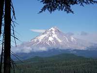 Mt. Hood
This section is not only the shortest, but is also the easiest to hike, with many hikers putting in their first 30 or even 40 mile days here. The highest point in Oregon is an unnamed saddle at 7,560' north of Mt. Thielsen. This is also volcano country, and the trail passes along the slopes of Diamond Peak, Three Finger Jack, the Three Sisters, Mt. McLoughlin, Mt. Mazama (Crater Lake), Mt. Washington, Mt. Jefferson, and Mt. Hood. The largest elevation change here is the 3,160' drop to cross the Columbia River on the Bridge of the Gods at 180', as the trail enters into Washington.
There are many clusters of lakes, like in the Sky Lakes Wilderness, with some dry patches in between, and then the PCT crosses through the Crater Lake National Park. Here there is an optional route called the Hiker PCT, that leads to the rim for a beautiful view of Crater Lake. After that, and about a 20-mile dry stretch, there are again many small lakes and ponds in the Diamond Peak Wilderness, Three Sisters Wilderness and Mt. Jefferson Wilderness areas. Northern Oregon is mostly lake free, but there are some rivers and reservoirs.
The main attraction in this stretch is Mt. Hood, Oregon's largest and most hazardous active volcano. Crossing the slopes of the mountain above Mt. Hood Lodge, it is surprising to go under an active ski lift in August. The runs are short, but skiers and snowboarders are going overhead as you hike through the area. Once off the cinder slopes of Mt. Hood, plentiful rains result in dense shady forests of Douglas, silver and noble fir, and lots of moss in some places, like Ramona Falls. There are dramatic differences between these and the lava rock areas after Obsidian Falls and other places. A popular alternate route is at the end of Oregon, the Eagle Creek Trail, which goes along an often steep and narrow gorge, and then through a tunnel under a waterfall. Another highlight is the abundance of berries along the trail, including blackberries, huckleberries, thimbleberries and salmonberries, which make for a tasty but slow hike. Finally, from Cascade Lakes, crossing the Bridge of the Gods takes you into Washington and only 507 miles to go to the Canadian border.
This is a beautiful section, although like the northern Sierra, has a lot of mosquitoes at times. The best hiking months are July through September, but most thru-hikers will want to be going through in August or early September. One of the attractions for some hikers are the Lodges, like at Crater Lake and Mt. Hood, and the resorts, where you can enjoy very nice meals in a high class rustic setting, but of course they are pricey.
Washington – 500 Miles
 Pang Leading Swiss Miss Across
 This is All That is Holding One End
 Mt. Adams
 Goat Rocks Wilderness
 Swiss Miss Just Before Chickimin Pass
 Mt. Rainier
This section begins at the Columbia River, with one last bunch of blackberries, and starts climbing from there, reaching a crest near the Indian Heaven Wilderness, with lots of huckleberries to reward you for the climb. The trail soon goes around the base of Mt. Adams, and then goes through the rugged and beautiful Goat Rocks Wilderness, and a traverse of Packwood Glacier, which is rather anti-climatic after the snowy High Sierra. It also approaches Mt. Rainier, which will be in your vision for many days. Like the High Sierra, the trail goes up over passes, only to drop down into deep canyons, and then repeats the cycle. There are also sections of clear-cuts to break up the beauty, especially between Chinook Pass and Snoqualmie Pass. This is a very green and often wet section, unless you are too late in the year, when it is white with snow.
Currently the trail through the Glacier Peak Wilderness is officially closed, due to a large storm a few years ago that wiped out seven bridges over the many rivers. However, in 2006, from all reports that I heard, most of the hikers skipped the official detour and took the more adventurous original trail, going around downed trees and washed out trail, and crossing the rivers on logs. The winter of 2006-2007 brought another huge storm to the area, and at this point it is unclear how much more damage has been done. Check with the pcta.org to get current conditions if you plan on hiking in northern Washington.
August and September are the best months to be going through this section, however be prepared for cold weather and snowstorms even in September, and especially later. The highest point in this section is Lakeview Ridge at 7,126', and then goes down to 4,240' at Monument 78 on the US/Canadian border. Don't expect a cheering crowd when you arrive there, it is a wide clear cut going up the mountains on both sides, but not a border guard in sight. There is the official "end of the Pacific Crest National Scenic Trail" marker, just like the one at the start on the Mexican border, and then a "Welcome to Canada" sign.
Bonus Section – Canada – 7 Miles
 The US/Canadian Border
 Time to Retire These Shoes
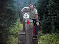 We Made It!
This trail section was added by Canada, to provide access to a through highway at Manning Provincial Park, where friends and family can meet you, and also with bus service to Vancouver, BC. (The only way to or from the border and Monument 78 is by hiking) Surprisingly the end of the trail in Canada is not marked at all, which was kind of a let down after hiking 2,663.5 miles! The trail comes out at the highway and just ends, no signs or any markers of any kind. The mileages on the sections don't add up to this because of some changes to the official trail, after the Guide was published.
This information was taken mainly from a brochure published by the Pacific Crest Trail Association, but supplemented by personal experience.
Permits and Red Tape
A permit is required for most of the state and national parks, and the wilderness areas that the trail passes through. For anyone planning on hiking more than 500 miles, the PCTA is authorized by the various agencies to issue a thru-hiker permit. This permit is good for the whole trail, and should be carried with you at all times. They can also add a Whitney permit if you plan on climbing Mt. Whitney, which is a popular side trip.A fire permit is required in California, for any fire - campfire or camp stove. In addition there are many locations where wood fires are not allowed, usually above a certain elevation in the mountains. There are also frequent fire bans during the dry season, in the various national forests and parks. Fire permits are also available at any Forest Ranger Station in California.
You are required to get a Canada Entry Permit if you want to finish in Canada, and you will need your passport to get back into the U.S.
Getting There
An important note: most of the following sections are deliberately not very detailed. All of the needed information is included in the various guidebooks and websites, there are links to them in the links section. The Wilderness Press Guide Books are essential if you want to do a thru-hike. There are also other guidebooks for day and section hikers. Most of the guidebooks are available thru the PCTA store.The majority of thru-hikers start at the Mexican border, near Campo, CA, and hike north to Manning Park Canada. A small percentage of hikers start in Canada and hike south. Depending on snow and weather conditions, some will hike north until the Sierras, and then skip up to Canada and hike south to where they left off. It is easy to get rides from trail angels, who are often other hikers, from San Diego to the Mexican border. There is also a public bus that goes near there. The bus, along with friends and family, are the best options on the Canadian end. Check the links to the PCT-L and ADZPCTKO below for information on getting rides to the Kick Off Party and to the Mexican border.
Bear Proof Food Containers
 Trying to Figure Out Where to Start, Six Days of Food - One Bear Can
Through much of the Sierra Nevada, approved bear proof food containers, or bear cans, are required for overnight camping. Currently there are about four different containers that have received official approval, and are the only legal ones to use. Some older models are no longer approved and if stopped by a ranger, you can receive a ticket for using one of these, or for not having one at all. In some campgrounds there are metal bear boxes that are available for use, but these may be full of camper's food or not spaced properly for your desired campsites. There have been endless discussions on the PCT-L, a favorite hiker email list serve, about whether or not to use bear cans, if it is possible to just use the bear boxes, and the ethics of "stealth camping" to avoid bear problems. In most of the High Sierra, hanging food is not legal, because the smarter than average bears there have learned how to get it down. Many thru-hikers will pass through this area early enough in the season that bears aren't a huge problem, but almost every year there is a least one story of a bear ripping someone's backpack apart to get the food in there.
More information on Bear Cans is in the Gear Section
Camping and Other Lodging
 A Crowded Campsite
Generally, with the thru-hiker permit, you are allowed to camp anywhere along the trail, except where specifically posted for "no camping". This may include sections where the trail passes through private land or in some parks. Most of the time you will be doing "wilderness camping", although there are a number of official campgrounds and sites, as well as many defacto sites through frequent use. Often the established campgrounds will have a special hiker section that is free, or offers a reduced rate.
The PCT passes by or near a number of resorts, most of these welcome hikers, often giving a reduced rate to thru-hikers. The same is true for many motels along the route. Most hikers take advantage of the town stops to sleep in a bed and get a hot shower, as well as do laundry, shopping and use the Internet.
Food Re-supply
 Going Through Food Send From Home
 Family Delivery - Tuolumne Meadows
 A Whole Chicken for a Hungry Billy Goat
There are three main re-supply methods that most hikers use. One is to have someone mail your prepacked food boxes to designated Post Offices, resorts or stores along the trail. The advantages of this method are being able to buy more cheaply in bulk and re-packaging the food based on daily meal needs, using prepared and self dehydrated meals that only need to be heated, and not having to spend time shopping at town stops. Disadvantages are the need for someone to mail the boxes on schedule, the expense of mailing the boxes, especially for those who don't live on the west coast, possible lost boxes or ones that don't arrive on time, getting to the Post Offices during their often limited operating hours to pick up your re-supply, and getting tired of your pre-planned meals once on the trail for a few months.
A second method is to buy your food as you go, stopping every four to seven days, or so, to buy food at nearby towns or resorts. Advantages of this are not having to plan the whole hike ahead of time, being able to vary your menu as your tastes change, as well as the quantity of food as your appetite increases, not having to worry about when you arrive at the town stops, and it is good PR to support the local trail side merchants. Disadvantages are the need to spend town stop time shopping instead of resting, high priced and limited availability of desired food in the small stores, especially at resorts, and having to buy in small quantities, which also increases the price.
A third method is a combination of the first two, which is what most hikers end up doing to some degree. Even those who recieve mailed prepackaged re-supply boxes at every stop, usually end up supplementing those with fresh foods, such as fruit and vegetables, bread, bagels and tortilla shells, and of course sweets - candy, bars, cookies, and other snacks. There are also some places where the available food is so limited that it is very hard, or impossible to re-supply near the trail. It depends on how far, or how often, you want to hitchhike to larger towns.
There is really a fourth option, usually used only as a supplement to the above, which is having someone meet you with your re-supplies at various trailheads. I was blessed to be the recipient of this many times courtesy of my hiking partner and his family.
Because of the difficulty of carrying enough food to meet the thru-hiker's requirement of 5000-6000 calories a day, almost all hikers supplement all of the above methods with pigging out at the town stops. A whole roast chicken and a half gallon of ice cream are good for this. The left overs from an extra large pizza are sometimes consumed on the trail after a town stop as well.
Water Treatment
This is another case of widely varying methods and strategies. Common water treatment methods are bleach, iodine and increasingly, Aqua Mira or other chlorine dioxide treatments, filters, Stiripen (UV) and in many places, especially in the High Sierra, no treatment at all. Again, the average hiker usually uses a combination of two or more of the above methods, depending on the source and condition of the water supply. Water sources vary from springs, rivers, lakes, ponds, tap water, water tanks and wells. The pollution dangers are wild animals, other hikers and campers, and the frequent cattle grazing areas, as well as the trail is open to horse use in addition to hikers.Guidebooks and Maps
The PCT is not a blazed trail (like the AT), often has confusing junctions, and many sections may be covered in snow during normal thru-hiking season. This makes guidebooks, maps and the ability to use them of great importance, especially if you are hiking alone. The common guidebooks explain where the trail goes, where the water sources are, available camping spots, and lots of other helpful information.The essential guidebooks are the three book series by Wilderness Press, The PCT Guide Books. They contain detailed descriptions of the trail, route and junctions, as well as much extra information such as history, flora, fauna and geological information. They also have one or two page detailed strip maps that cover the whole length of the trail. The PCT Data Book is a brief summary of these books, with mileages and elevations, very helpful (but not absolutely necessary) when used in addition to the Guide Books, but of little use by itself. These are available from the PCTA (below), Amazon and most large bookstores. Right behind these is Yogi's PCT Handbook, which is usually the most current information available, as it is updated yearly, and gives invaluable information on planning a thru-hike and detailed information about re-supply stops, such as food, lodging, Post offices, phones and Internet availability, including town maps for most re-supply towns. This includes locations and directions, operating hours and prices, recommendations from previous hikers and more current water source information.
Some hikers use larger maps, such as Tom Harrison Maps for the Sierras, AAA or other road maps, and various national park or forest maps. These, along with a GPS, are nice, but not necessary, most of the time. An exception can be in the High Sierra, early in the year or a year with high snow levels, when the trail is not visible for much of the time.
Links
Start here! The Pacific Crest Trail Association (PCTA)Hiker email list PCT-L
Hiker email list Yahoo 2007 Group (Just change the year to the year you are hiking and there should be a current group.)
Yogi's PCT Handbook
Tom Harrison Maps
The Kickoff Party ADZPCTKO
Approved Bear Containers
California Fire Permit
Canada Entry Permit
Magnets PCT website Lots of helpful information, more links and an online forum
Plan your hike My free download of valuable information
Notes and Photos
Long Distance Hikers usually use trail names, which are often descriptive of something the hiker has done, wears, or place of origin. Trail names are usually given to the hiker by other hikers, but some hikers chose their own. Trail Angels are those who provide Trail Magic (I call it Trail Blessings) to hikers, often food, drinks, rides and a place to sleep. There are a number of Trail Angels along the trail who provide full services for hikers in their homes. You will find these listed in Yogi's guidebook, and sometimes from signs along the trail. There are also many Trail Angels that offer rides to and from the trail and re-supply towns. A lot of information also travels along the trail verbally, as you meet and pass other hikers.Please see attached Pacific Crest Trail photo album for more photos
Related book reviews on Summit Post Gear
A Blistered Kind of Love One couple's account of their PCT hike
Dances With Marmots A Pacific Crest Trail Adventure
John Muir Trail A Guide, the John Muir Trail and the PCT are the same trail, for most of the JMT's route