
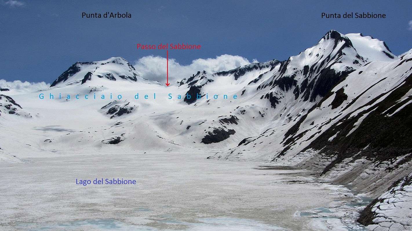
Panorama of Punta d'Arbola (3235m), Passo del Sabbione (2901m) and Punta del Sabbione (3183m)
Seen from the northeast, across Lago del Sabbione, the biggest of the many dammed lakes in the area.
These two peaks and the ridge between them are on the Swiss-Italian border. The view is from Italy, which is why I'm using the Italian names in the title.
On this side lies a small but still flowing glacier, the Ghiacciaio del Sabbione. It's already a lot smaller than what my map shows. I reckon there is still some crevasse risk. On the Swiss side is the much smaller Talligletscher, which I suspect will be gone soon.
Further right, but outside this panorama, the border continues along another ridge to Corno Cieco (3375m), the highest peak in the vicinity. This ridge never drops below 3000 m, which means that the Passo del Sabbione is the key saddle for Punta d'Arbola, giving it a prominence of 234 m.
The Swiss have German names for these peaks and the pass. In German, the title would be Ofenhorn (3235m), Hohsandjoch (2901m) and Hohsandhorn (3182m). And that last height is no mistake; this is the value on the Swiss map I saw later. Likewise, Blinnenhorn, the German name for Corno Cieco, is 3374 m according to the Swiss.
26 June 2013.


