
-
 13171 Hits
-
 87.76% Score
-
 25 Votes
|
|
Area/Range |
|---|---|
|
|
46.37820°N / 8.42274°E |
|
|
Hiking, Mountaineering, Trad Climbing, Skiing |
|
|
Spring, Summer |
|
|
11073 ft / 3375 m |
|
|
Overview
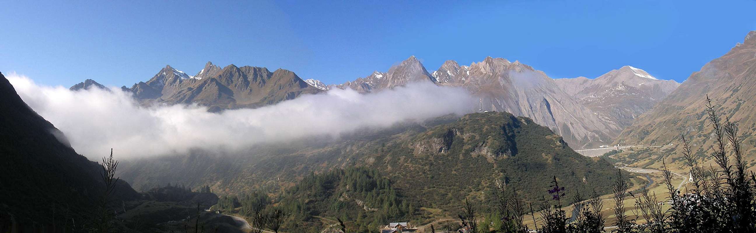
The Val Formazza is the northernmost valley of the Ossola (the first Italian area belonging to Lepontine Alps).This valley is the confluence of some very interesting valleys (clockwise)
and, on its East side, some short steep valleys coming down from the Basodino long ridge
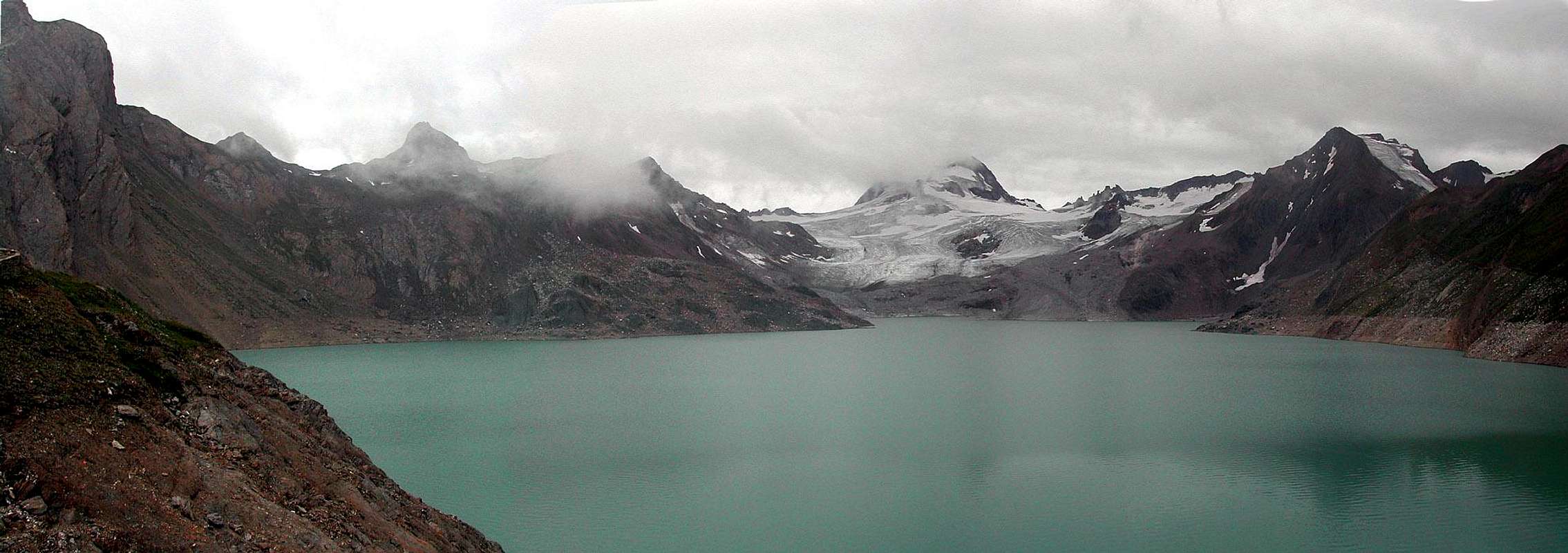
The waters coming down from these valleys give origin to the river Toce, famous for its wonderful waterfall that, unfortunately, can be seen only in the weekends : this area is perfectly fit to host power stations for the hydroelectricity so there are some dams creating wide green (spectacular) lakes.


In alpinistic environments this valley is known only for the very fine ski mountaneering routes to the 3 main summits : Arbola (Ofenhorn) - Corno Cieco (Blinnenhorn) and Basodino.
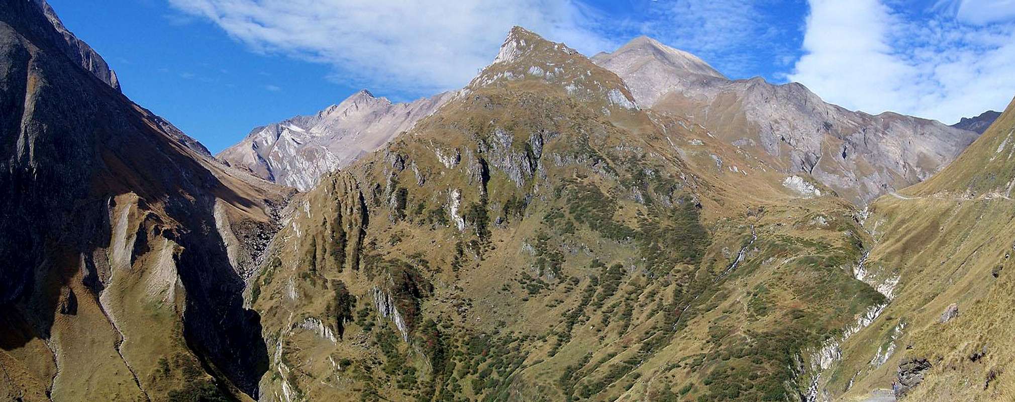
The many other summits, even if pleasant to the sight, are very rarely climbed, and only along the normal easier routes, due to the bad quality of the rocks on the ridges and the big quantity of debris in channels and on the walls.


So this site can be seen as a typical hiking area, very well provided of good accomodations (see the list below).

Getting There and Accomodations
from Switzerland (W side) : the Rhon valleyfrom Switzerland (N side) : val Bedretto (Ticino)
from Italy (E side) : valle del Toce (Formazza)
Refuges
Rifugio Margaroli al Vannino
Rifugio Claudio e Bruno al Sabbione
Rifugio Somma Lombardo" al Sabbione
Rifugio Mores" al Sabbione
Rifugio 3A" al Morasco
Rifugio Città di Busto" al Morasco
Bivacco Gries - al Passo di Gries
Rifugio Maria Luisa" in Val Toggia
advice : if you want to save time for Sabbioni and Morasco you can drive your car beyond the dam, the nothoroughfare roadsign has no legal value and is only a precaution posted by Enel (the energy company of Italy) to avoid legal problems in case of accident.
Some orographic info and Main Summits
clockwise from SW :the main ridge along the Lepontine Alps of this area starts from the Scatta Minoia that is the pass joining the Val Formazza with the Alpe Devero and grows up immediately to the Ofenhorn (Punta d'Arbola) (3285m)
from Punta d'Arbola, toward East, the ridge of Punta del Vannino (Lebendun) (2935m) and Corni di Nefelgiù (2951m)
- this ridge is the N border of the Vannino valley
- from this ridge a minor one goes toward N, hosting the Gemelli and Corno di Ban (3027m) and bordering the Nefelgiù valley
|
from Punta d'Arbola, toward N the Hohsandhorn (Punta dei Sabbioni) (3155m) and the Blinnenhorn (Corno Cieco) (3375m), the highest summit of this range
|
from Blinnenhorn, toward East the ridge goes down to Rothhorn (Corno Rosso) (3287m), Ritzhorner (3047m) and the Punta dei Camosci (3046m), ending at the Passo del Gries (Griespass (2463m)
|
East of this pass a short ridge, whose main summits are the Punta di Gries (2928m) and the Corno Brunni (2862m):
- this ridge, dividing the Bettelmat from the Val Toggia, is bordered, to the East, by the Passo San Giacomo (2313m)
From Passo San Giacomo, toward S, the short ridge of the Punta del Termine (2925m) going down to the Bocchetta di Val Maggia (2633m)
|
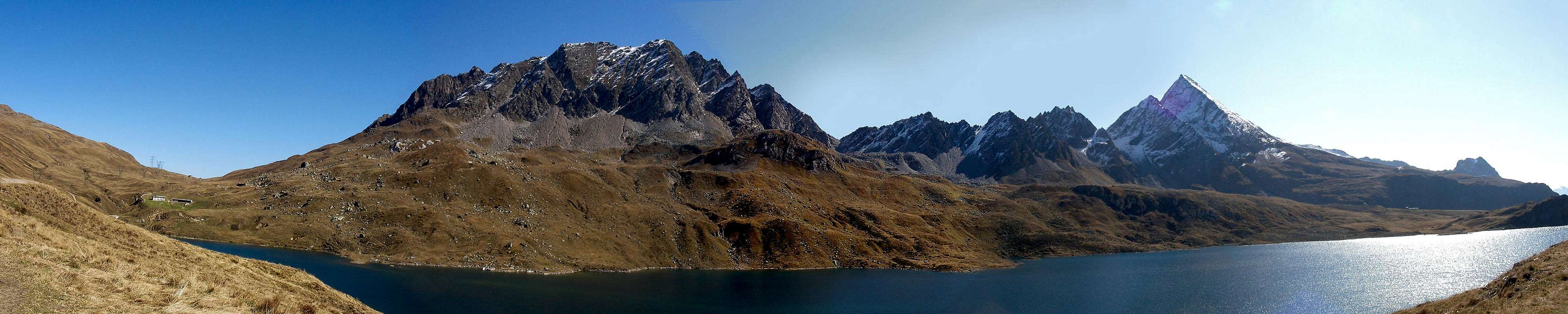
Here starts the Basodino ridge with its summit :
Punta di Castel (3128m), Pizzo Cavergno (3223m), Basodino (3273m), Punta di Tàmia (3068m), Pizzo di Mèola (2958m), Pizzo Fiorera (2918m) and the Pizzo Biela (2863m)
after this summit the ridge goes down to the Corona di Groppo, a group belonging to the Valle Antigorio
When to climb here
Mountains here, with few exceptions, are normally not sharp (almost sweet) so this area (when weather is fine) is fantastic for : | in summer and the beginning of fall (when weather is normally better): pleasant hikes and mountain bike routing : |
in spring, due to the normally heavy snowfalls here you can make some very fine ski mountaneering trips :
the 3 main summits here : Arbola (Hofenhorn), Corno Cieco (Blinnenhorn) and Basodino are among the best short ones in the whole Alps.
all year long
sport rock climbing on some rocky (excellent kind of granite) structures in the lower part of the valley and along the path to Rifugio Vannino
in winter
the granite walls of the narrow part of the valley (before arriving to the Toce waterfall) normally have very steep ice walls and iced waterfalls
Camping
many good places for Campersthe best one is just beneath the Morasco dam
Meteo
Weather in Val Formazza is a little strange (...) the many wide lakes create normally, in the hot season, a big quantity of dampness that, coming in contact with the iced parts of the range (glaciers are not so small) create local fogs and cloudsSo from june to august here a blue sky is difficult to be seen apart in the windy days.
| Weather Formazza - Free service by Weather Webcam |