Toggle navigation
Mountains
Routes
Images
Trip Reports
Forum
What's New
People
Areas & Ranges
Articles
Trailheads
Canyons
Huts & Campgrounds
Albums
Logistical Centers
Fact Sheets
Lists
Custom Objects
Gear
Plans & Partners
WELCOME TO SUMMITPOST
SIGN IN
REGISTER
Sonora Pass Area
Additional Parents
Relief Peak
Image
Panoramic view of Relief Peak...
View High-Resolution Image
Panoramic view of Relief Peak...
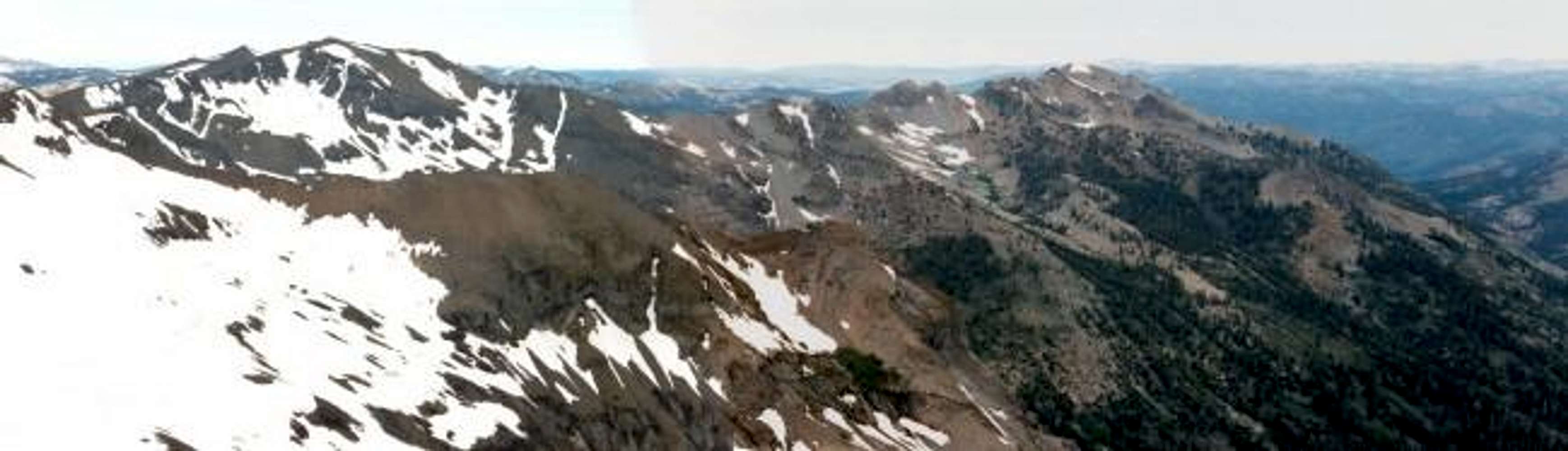
Panoramic view of Relief Peak from Molo Mountain, July 1996. Relief Peak is on the left hand side of the photo. Soda Canyon is on the bottom right hand side.
« PREV
NEXT »
Alpinist
on
Jan 3, 2004 11:28 pm
Comments & voting
Other parents
Lat/Lon:
38.23700°N / 119.695°W
Image ID:
37409
3418 Hits
72.23
% Score
3
Votes
Log in to vote
Comments
No comments posted yet.
to post!
Don't have an account?
Sonora Pass Area
(Area/Range)
You are at
the First
Image
Viewing
#1 of 1
GALLERY
You are at
the Last
Image
Alpinist's Image Gallery
« PREV
Viewing
#442 of 664
GALLERY
NEXT »
Relief Peak
(Mountain/Rock)
Loading....
×
You need to login in order to vote!
User Name
Password
Remember me
Forgot your password?
Log me out when I close my browser.
Keep me logged in all the time.
sign in as a user
Don't have an account?
Register now for FREE
Rating available
Suggested routes for you
People who climb the same things as you
Comments Available
Create Albums
Register Here


