
|
|
Mountain/Rock |
|---|---|
|
|
34.32897°N / 114.26615°W |
|
|
Download GPX » View Route on Map |
|
|
Hiking, Mountaineering |
|
|
Winter |
|
|
2833 ft / 863 m |
|
|
Overview
Note About Elevation: The USGS Map puts contour lines of 2840-2880 ft for the elevation of the highest point of this peak and writes an exact value of 2833 ft a short distance to the southeast. Caltopo Maps gives an exact value of 2720 ft where the USGS says 2840-2880.
Rank: Peak 2860 ft is California' s 7679th highest ranked peak
Prominenece: 1400 ft
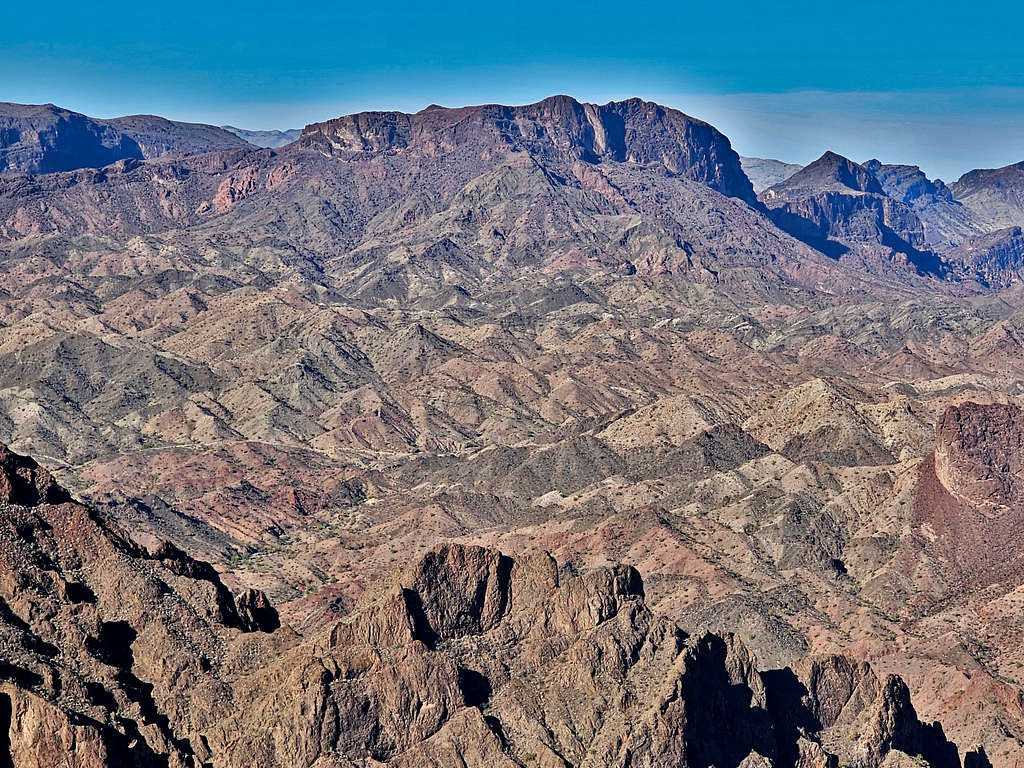
Peak 2833 ft sits in the Whipple Mountains of southeastern California near Lake Havasu. Rising higher than many of its surrounding mountains, the top of Peak 2833 ft can provide you with fantastic views of Lake Havasu and other nearby desert peaks.
The northeastern face of Peak 2833 ft is made of sheer cliffs that are more than 500 feet tall. No trail goes to or near Peak 2833 ft. Despite that, I was able to reach the summit via a class II walkup hike. The hike, however, required route finding through a meandering maze of small canyons.
Getting There
From Parker, Arizona, cross the bridge over Colorado River into California. Get on Parker Dam Road and drive 15.5 miles north to just south of Parker Dam (From Lake Havasu City, Arizona, you could drive south on Route 95 and cross the river into California over Parker Dam. The dam is closed from 11 PM to 5 AM, check hours online since it might change).
Get on Trail End Camp Road and drive 6.2 miles to a split in the road. Right remains paved and goes to Black Meadow Landing. Left becomes dirt and is the continuation of Trail End Camp Road. Turn left and drive 1.9 miles to a nonspecific area at the bottom of a dry desert wash, GPS Coordinates: 34 deg, 20.066 min North, 114 deg, 14.768 min West. There is no place to park at that spot, I was however able to squeeze my rental Jeep into a safe spot at the turn. The dirt road surface appeared smooth and passable by most high clearance vehicles under dry conditions.
Route/Trip Report
Elevation at starting Point: 1195 ft
Summit Elevation: 2833 ft
Roundtrip Distance: 5.39 miles.
Total Ascent per my GPS: 1804 ft
February 11, 2024
Left the vacation rental house in Big River, California at 6:05 AM (sunrise around 6:30). Drove to near Parker Dam and got on Trail End Camp Road and then the dirt road that went to Havasu Palms. By looking at satellite photos, topo maps and Google Earth, I had entered my chosen hiking path into my GPS. The hike started at a nonspecific dry desert wash. Once I reached my starting point, I noted that there was no place to park. Fortunately, the road was wide, and I was able to squeeze my rental Jeep into a safe spot at a 90 degree turn in the road. No one was there and I did not see anyone all day long. Temperature was in the mid-40s degrees F and the high later reached low 60s.
Started my hike at 7:05 AM. Elevation was 1195 ft. Peak 2833 ft was well visible to the southwest.
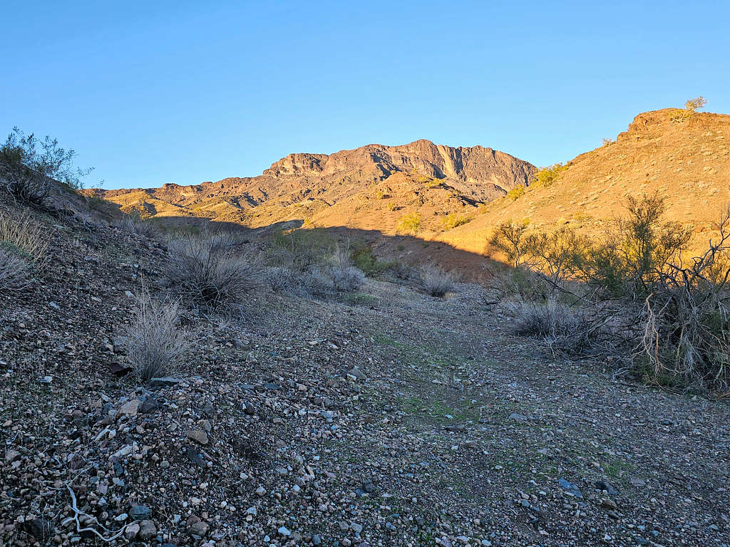
Began hiking the bottom of a dry desert wash that formed a mini canyon. My peak soon went out of view. I knew that I would eventually need to exit the canyon. Reached what looked like a well-established beaten path that exited the canyon, so I followed it a short distance getting out of the canyon onto an open area where the peak came into view again. The path faded away.
GPS showed that I was off my chosen path, so I found a way down to the bottom of the canyon.
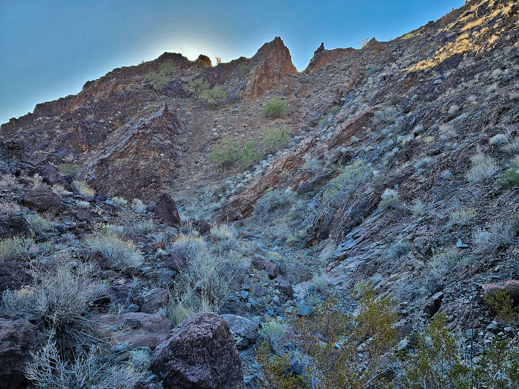
Losing site of the peak again, I relied on my GPS to guide me the right way where the canyon branched. Fortunately, did not come across any obstacles. There were a couple of dry waterfalls that I could easily walk up.
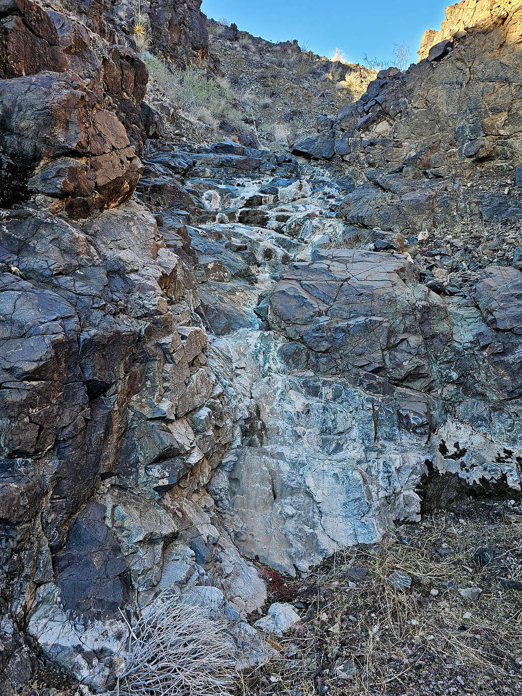
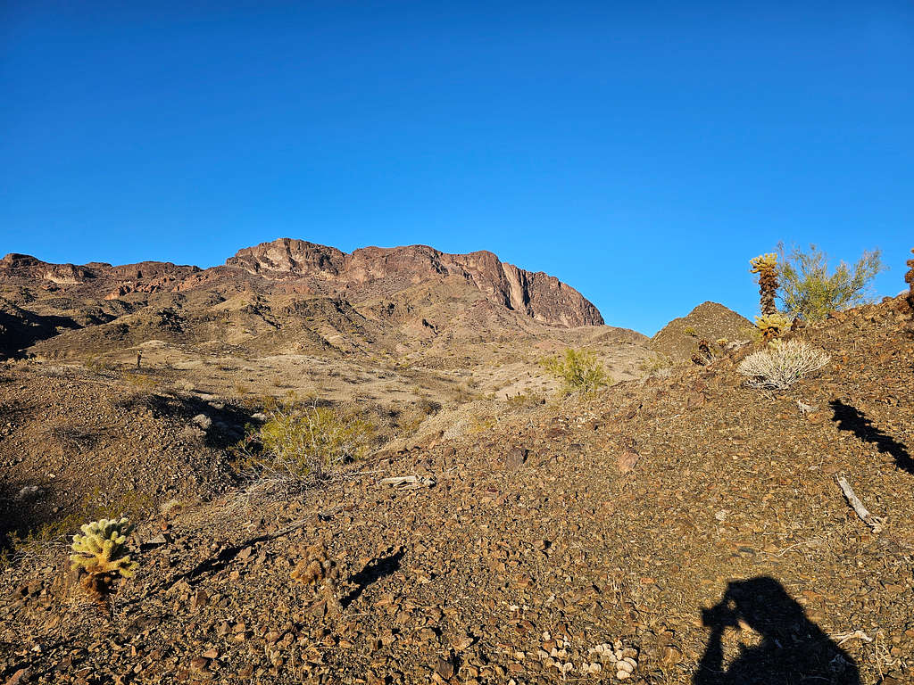
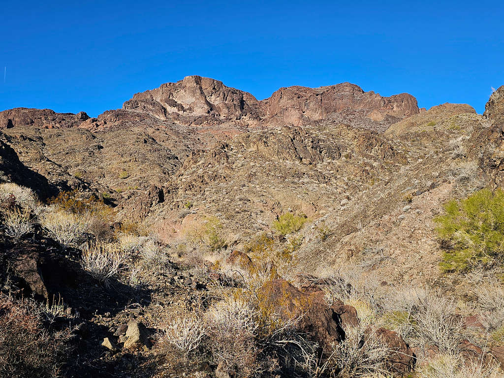
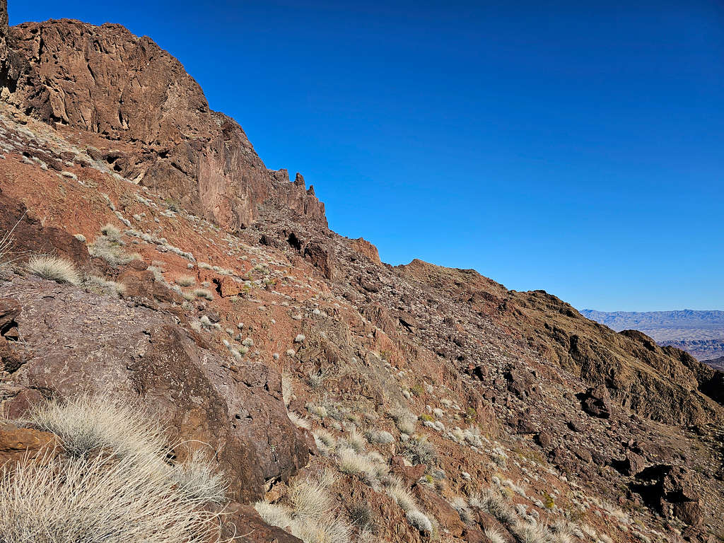
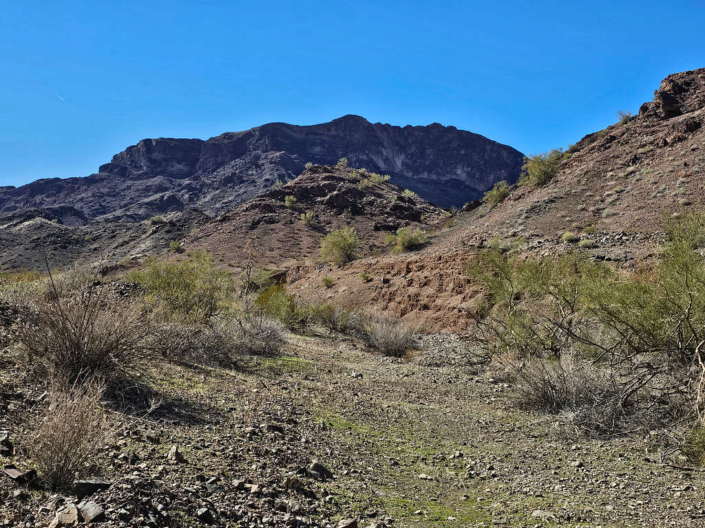
The canyon opened and I was then hiking up the slopes toward a series of cliffs. I knew that there would be a walkway below the cliffs that would allow me to go to the back side of the mountain, but I could not see it and was hoping that it would not turn out to be a nasty slope.
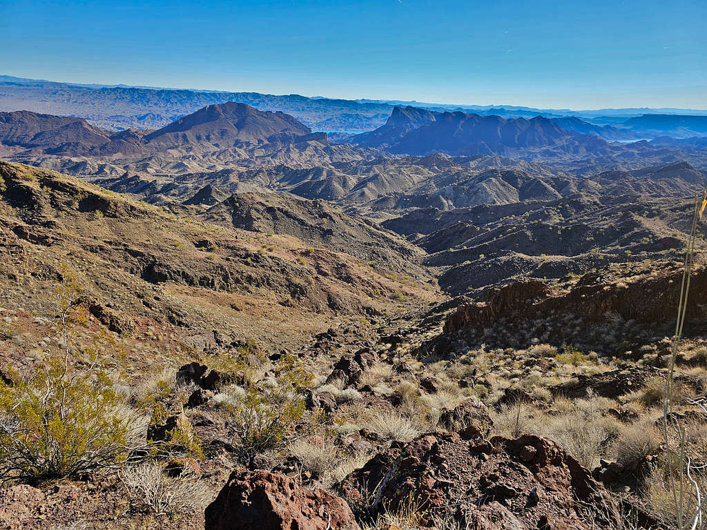
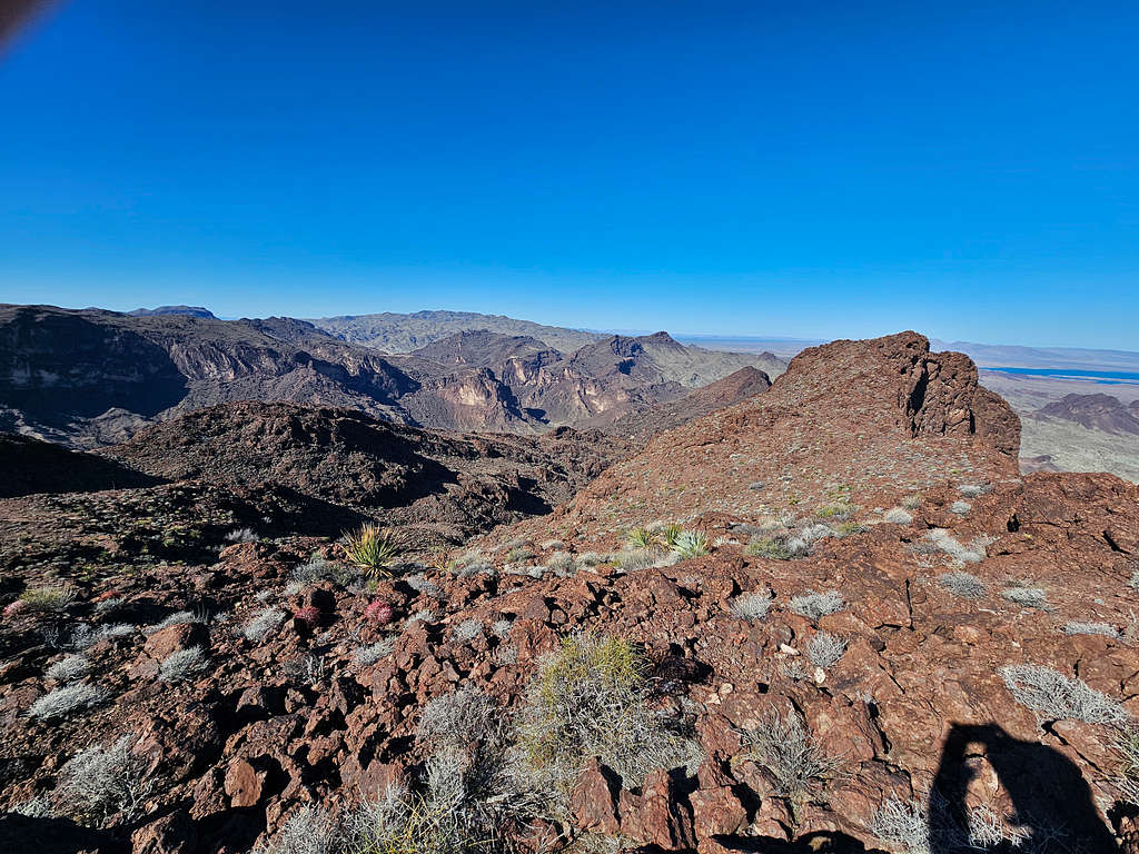
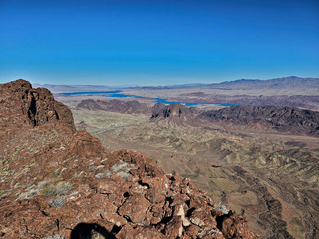
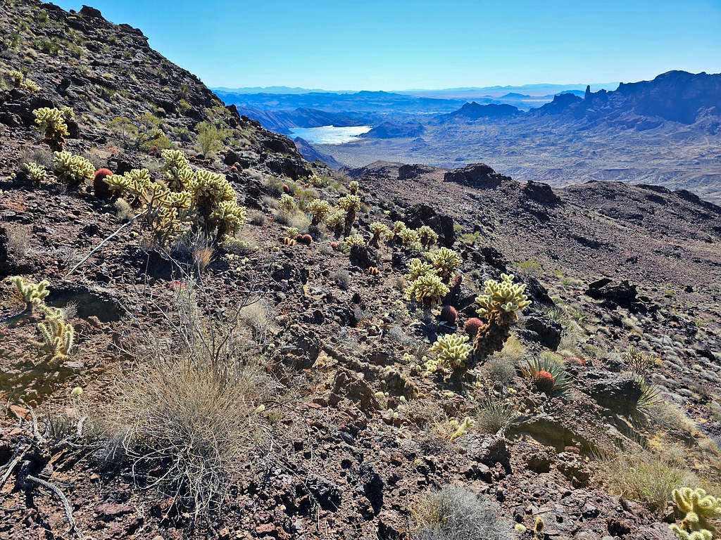
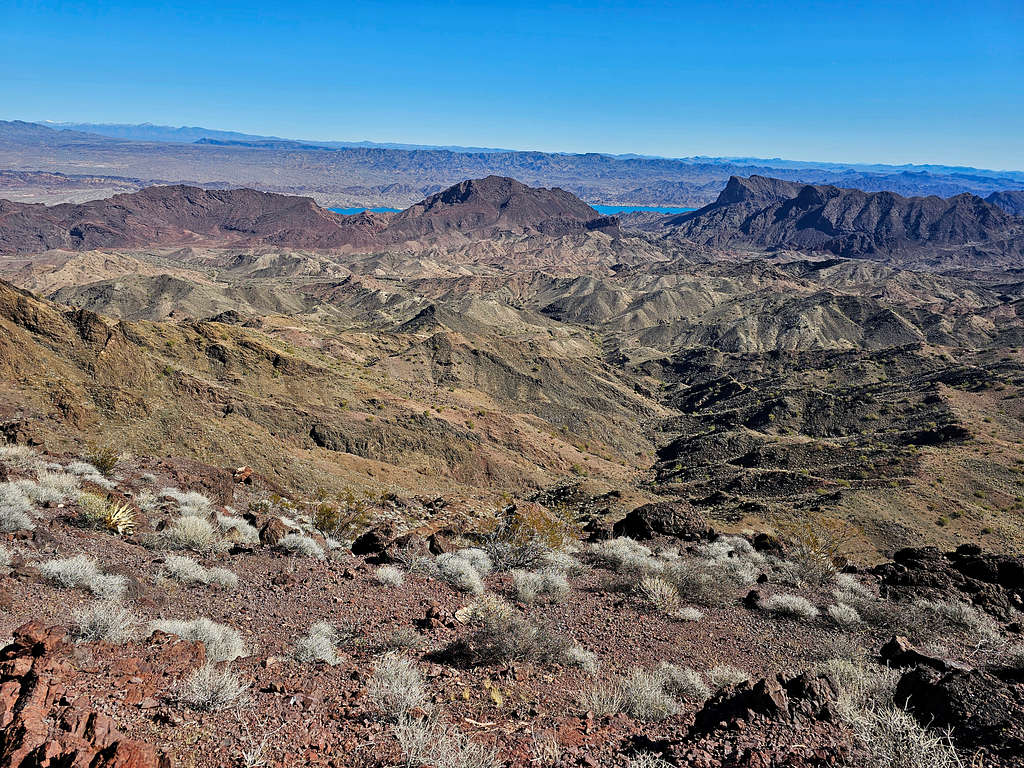
Looking back at the drainage that I had climbed. A glimpse of Lake Havasu had appeared, and I could also see Peaks 2056 ft, 1990 ft and 2037 ft.
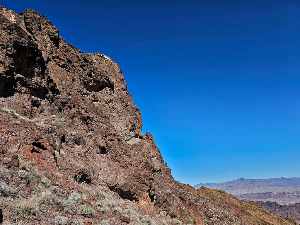
I was relieved to finally see an easy slope below the cliffs that allowed me to head south and then west to go behind (the west face of) the mountain. Looking at the cliffs behind me (this is not the easy slope).
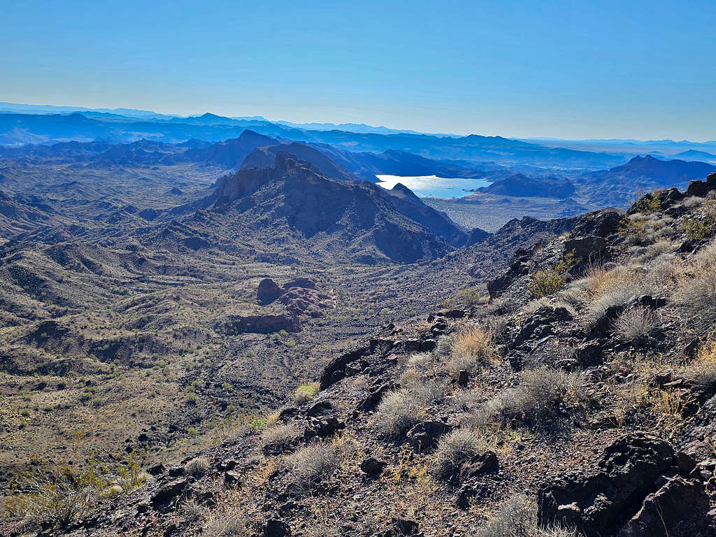
Copper Basin reservoir from the walkway below the cliffs.
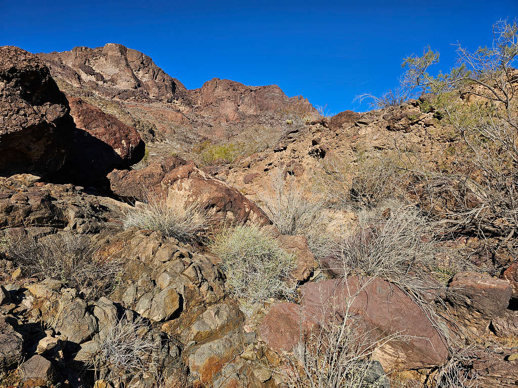
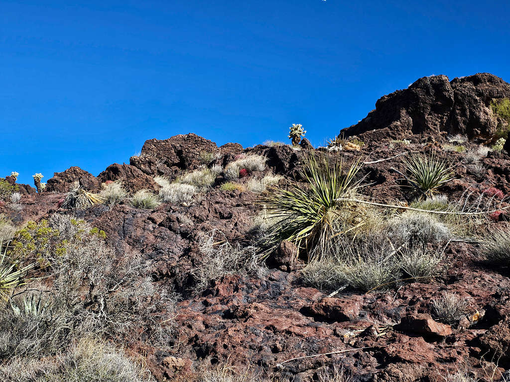
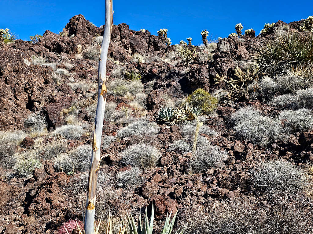
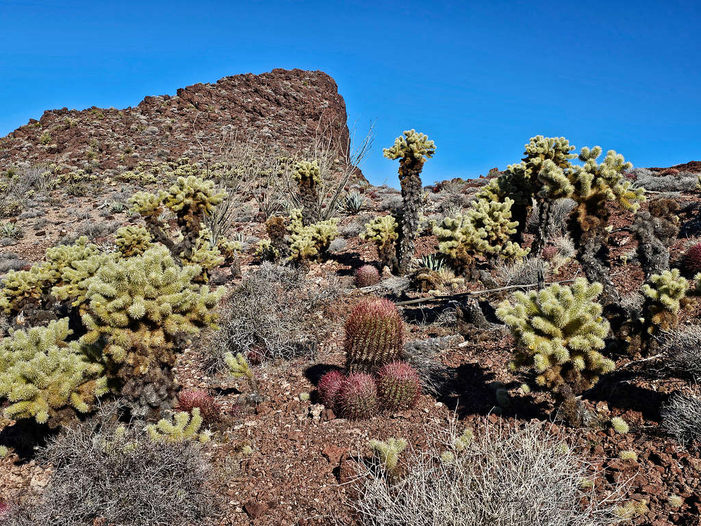
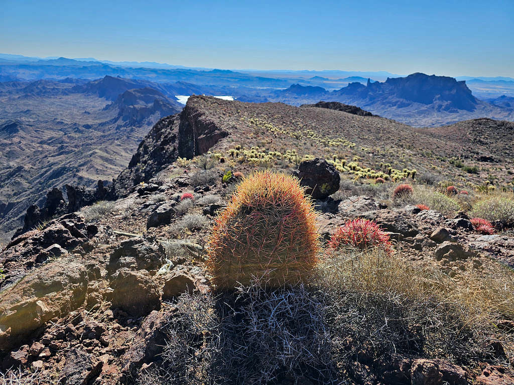
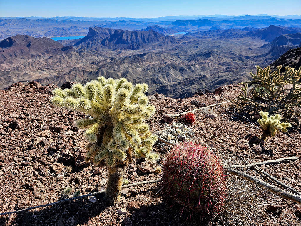
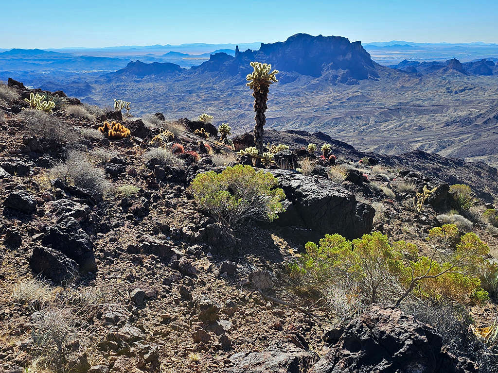
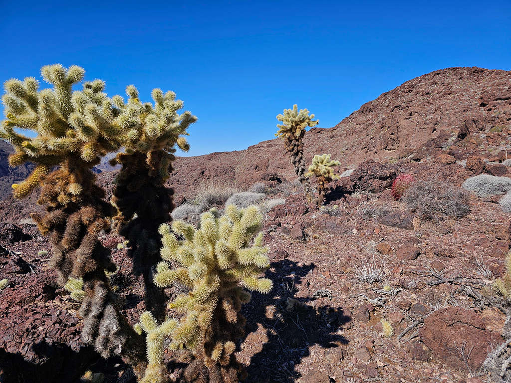
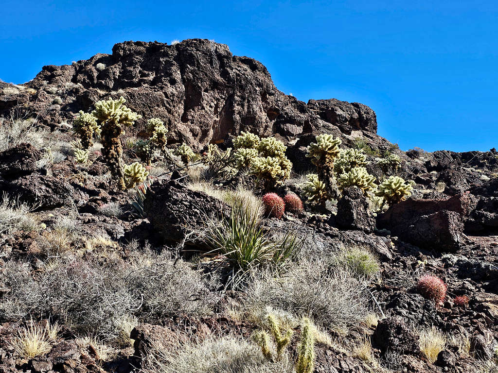
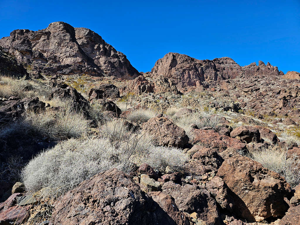
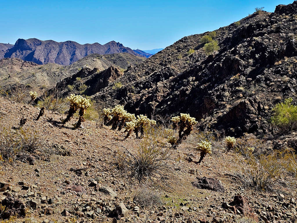
On the west face of the mountain, I remained below the ridgetop and avoided all difficulties. Found myself in a beautiful cactus garden.
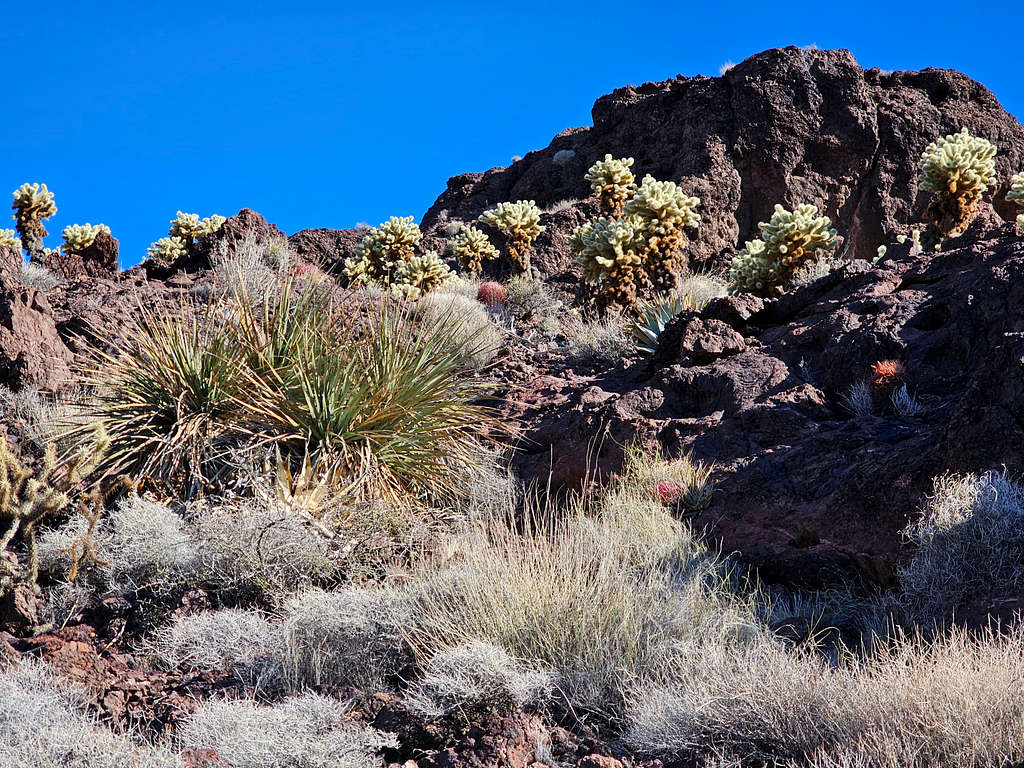
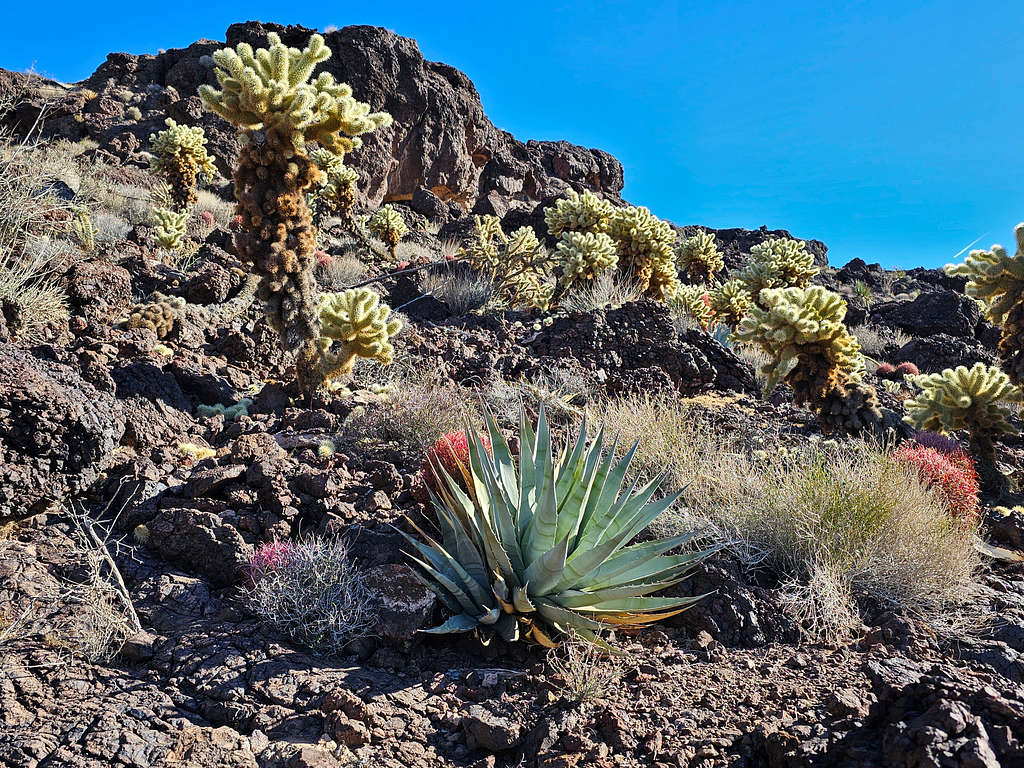
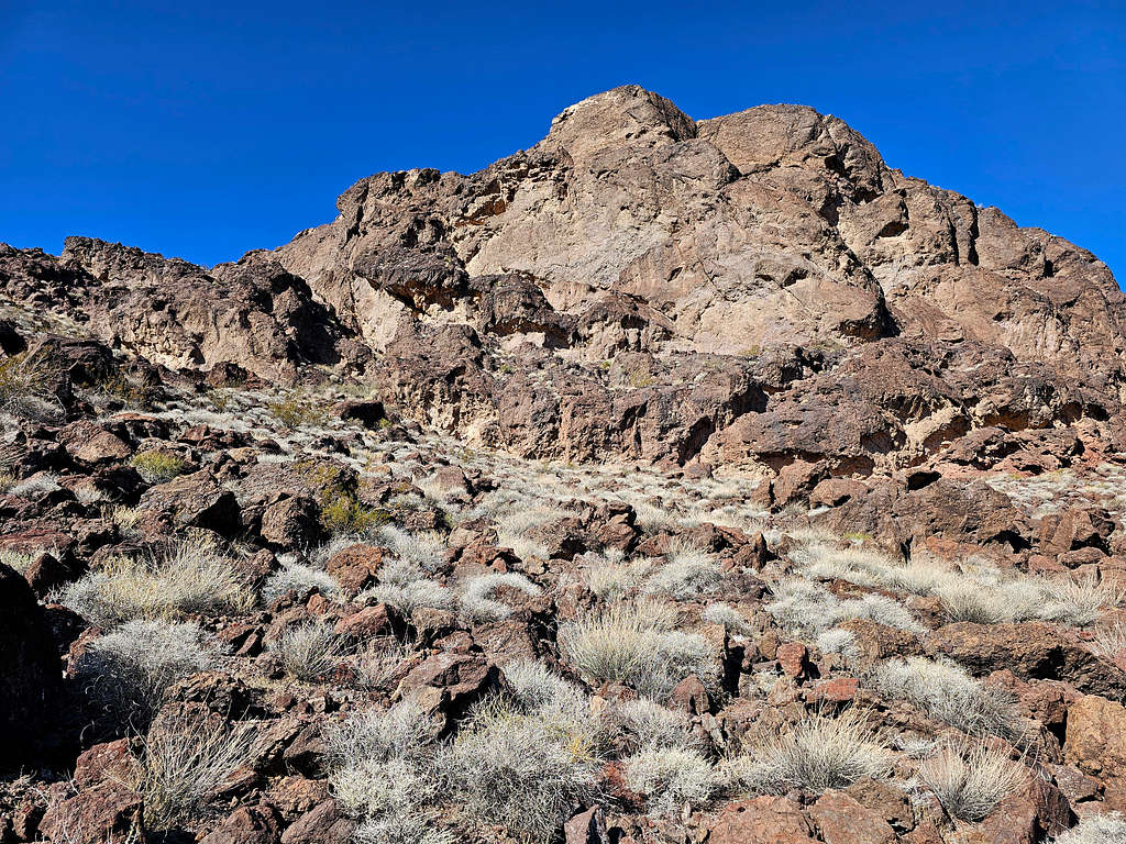
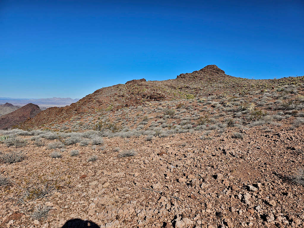
Near the summit, the color of the rock turned from black to red. At first, I mistook this spot for the summit.
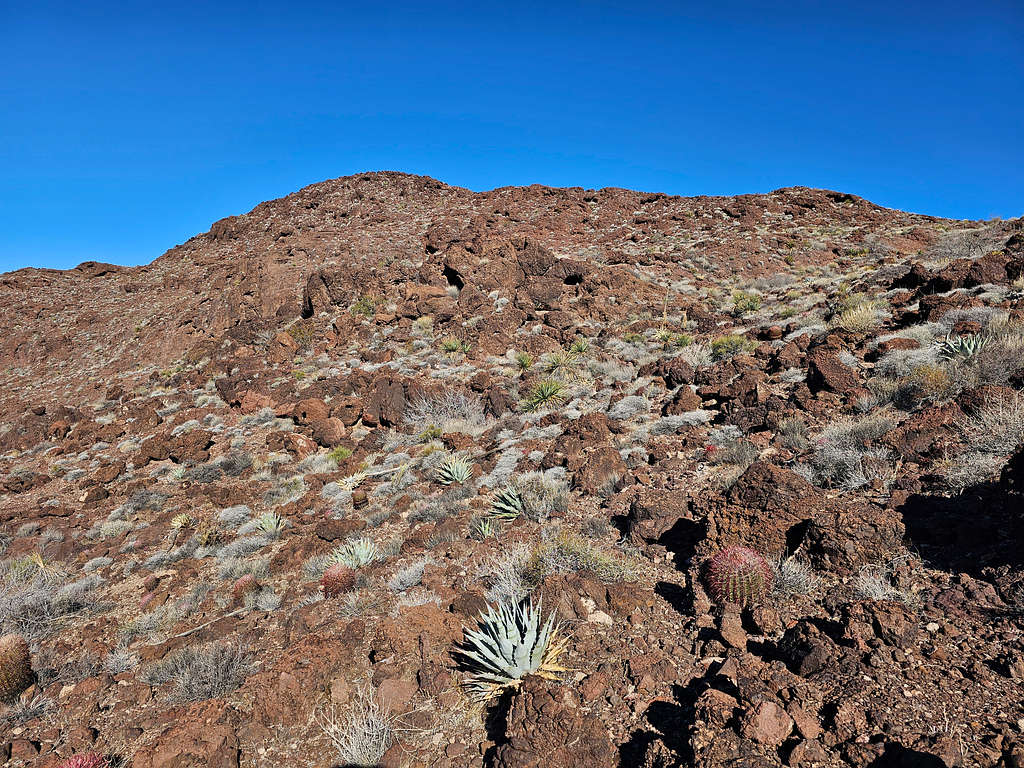
Then I reached what looked like a plateau with the true summit rising above it as a rocky hill.
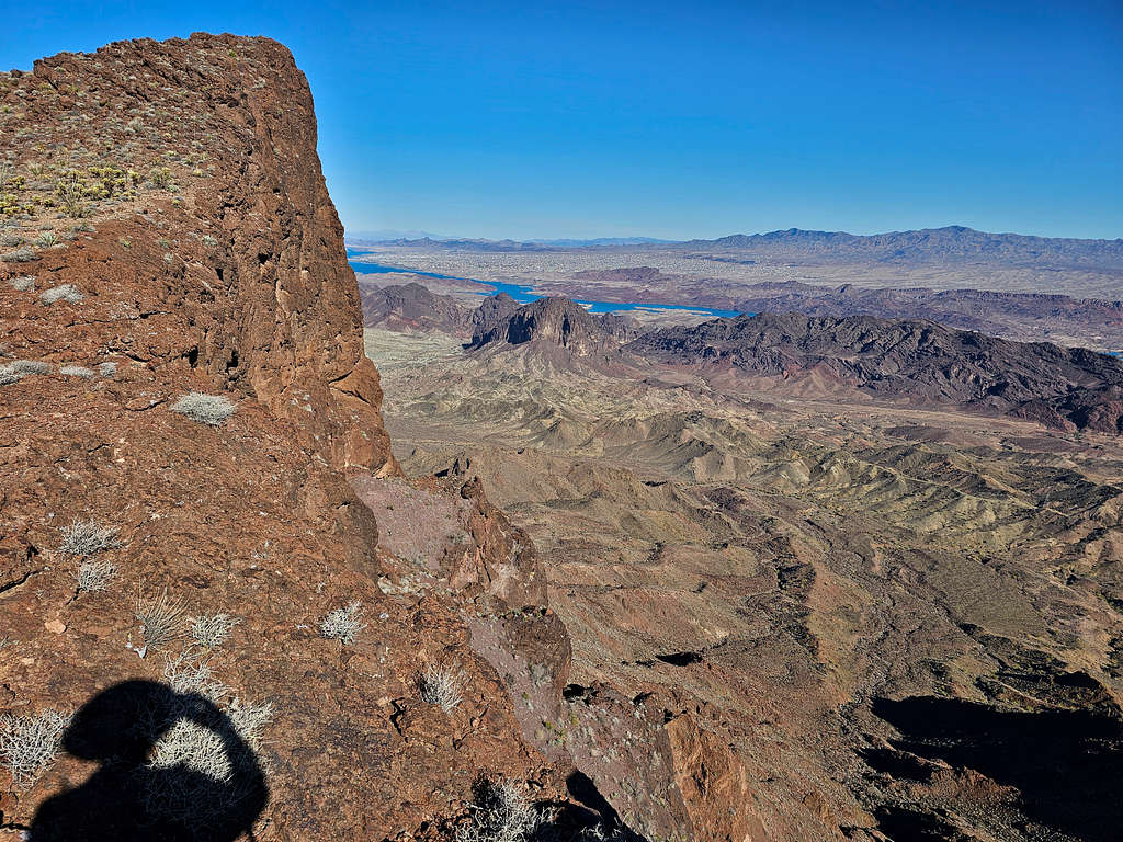
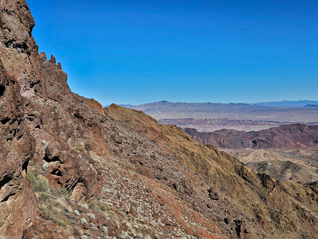
Reaching the edge of the plateau, I was blown away by the spectacular view of the northeastern wall of the summit.
Reached the summit at 9:41 AM and 2.63 miles of hiking.
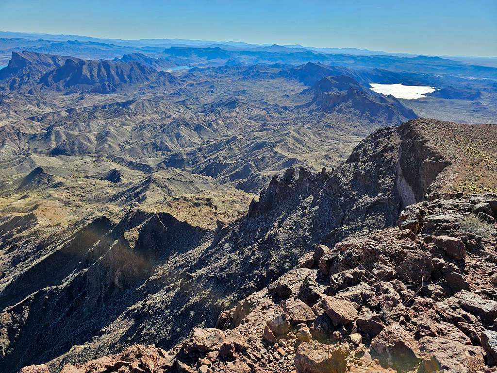
Looking east/northeast at Lake Havasu. Peaks 2037 ft, 1713 ft and 1715 ft seen.
Looking southeast at Gene Wash and Copper Basin Reservoirs. Peak 2056 ft on the extreme left of the picture.
Looking south at Monument Peak and Gene wash Reservoir.
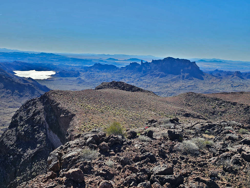
Peak 2922 ft to the southwest.
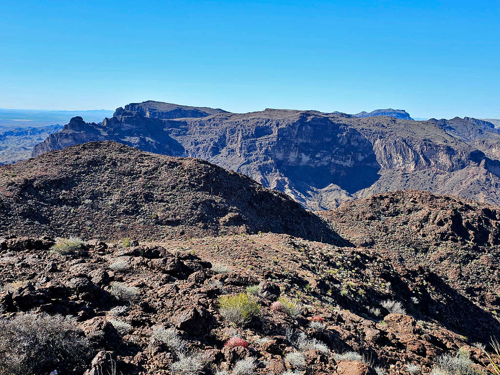
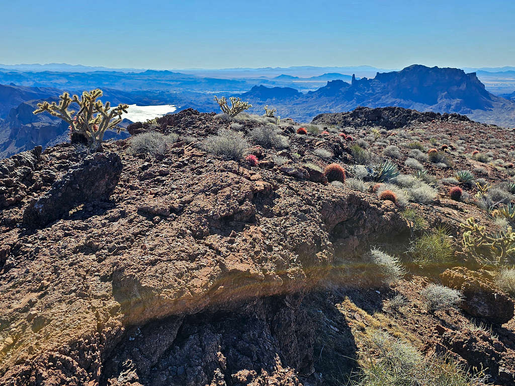
Looking northwest at the 2720 ft subpeak.
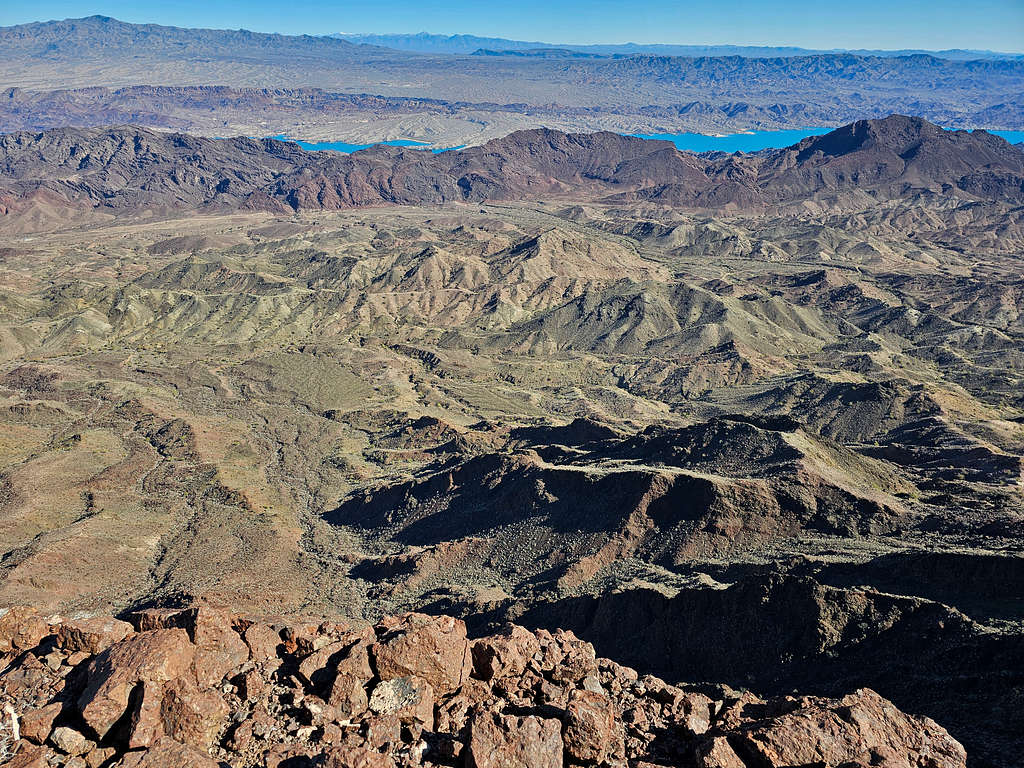
Lake Havasu and Crossman Peak in the far distance to the northeast.
Ate, enjoyed the views, called my wife and left around 10 AM retracing the path I had climbed. The area was just so beautiful.
A little lower.
From the walkway below the cliffs.
View of the cliffs again.
Continuing down the slopes.
Reached my Jeep at 12:21 PM. Looking back at Peak 2833 ft.
Red Tape
No fees or permits.
When to Climb
Winter is the best time to climb. Summer is dangerously hot. Even fall and spring can get hot.