1) - in fact, you can start from the last sector by taking advantage of the many existing roadways and, even, numerous interpoderal or dirt roads
Begin with a median stretch by entering a path from the farther away.
Alternatively, you can continue the whole path, which reaches the highest possible point from the valley floor. In this itinerary, which we propose just below, there are all three of these possibilities and the variables can be made with exclusive personal choice.
infatti si può partire in alto dallo ultimo settore approfittando delle molte strade interpoderali poderali esistenti.
Iniziare da un tratto mediano inserendosi su di un percorso che parte da più lontano.
Oppure ed ancora si può percorrere integralmente l'intero sentiero che, salendo dal fondovalle, raggiunge il punto più elevato possibile. In questo itinerario, che proponiamo appena al di sotto, sono contenute tutte e tre queste possibilità e le variabili possono essere effettuate con scelta esclusivamente personale.
Inside the Pieiller small Valley, the Old Road to the Saint Julien Hermitage/Shrine certainly would not start from Le Coteau, but directly by the
Fund Valley or Bottom with walking paths and trails now gone almost entirely into disuse, and the progressive construction of Roads Regional, Municipal and finally Intercrofting (sometimes reach up to
2500 meters them) have in practice caused him to abandon these ancient means of communication and transport livestock within individual vallons or in connection different.
Returning Topic, said the chance to return to the Old along the entire route
from Fénis to the Mount Saint Julien or towards
La Torrasse (1854m), even to
Prapremier or
Praz-Premier Alp (2011m). In this case, the start may be made by the
Village Le Perron (582m), also from that adjacent of
Le Pommier (614 m), going through the route
n° 10 which gradually approaches the Torrent de Bioley reaching the road at an altitude of
around 820 metres, here comes, but with a larger circle to the West, also the path
n° 10A with the same starting point. In addition comes the route
n° 11 from
Tillier Hamlet (550m) and connecting to
Réan Village (898m) in the Municipality of Saint Marcel. From this triple crossing of the trail goes up as
n° 11A toward Southeast and reaches the farm at the Torrent de Bioley inserting the primitive
n° 10 starting Le Perron.
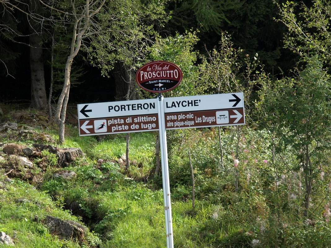
NOTE Wherever you go, howsoever you must know that you will pass by the small Village of
Boit du Chat (695m, "The Cat Box"), with the trail
number 10 and following
Champlan, Crou-de-Ban (926m). Just after leaving the deviation
n° 10A for
Marcellat (1207m; under Maison Longue and with short distance by Seissogne/Sazailland (1066m, 1220m), now into the adjacent St. Marcel Municipality) to the right (West), the itinerary continues unified along the left (West) riverbed of the
Pieiller Torrent. Or with longer, but also more panoramic, follow the Regional Road in asphalt with six hairpin bends returned to the West, until you reach
Le Pieiller-de-Sermoz (1075m).
Also and with parallel path along the stream of the river basin arrive always at
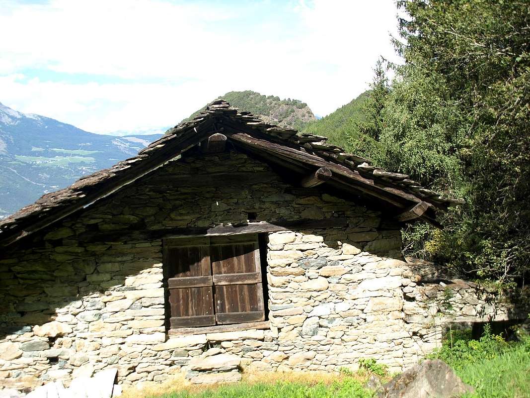
Le Pieiller-de-Sermoz Village, "hanging" into the meadows, and, bypassing those of
Maison Longue (1112m; brief diagonal deviation to the right or North) and of
Le Plany (1174m; wooded fountain topped by the heads of two "vispi" (lively) small cocks), the branching
n° 10B reaches
Le Coteau (1234m) out halfway between the fountain and the village (1h 30s / 2h '00, in total for the
Mont Saint Julien (2h '00/2h '30). From Le Coteau old Village hemi abandoned
(1234m; fountain), as already mentioned above, you can go to the bottom of the valley, abandonaning to the right (West) the little Village of
Le Pieiller (1230/5m; fountain in the meadow in front of three alpages), until you reach
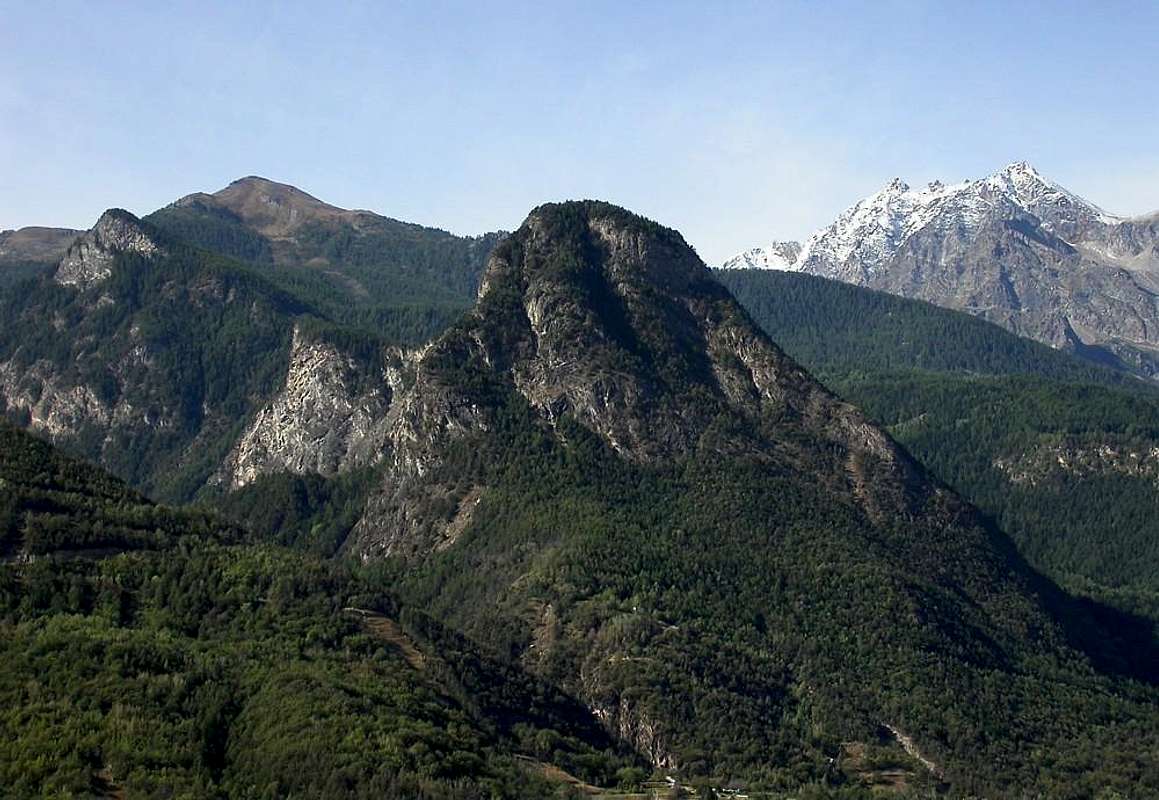
Le Plan-de-Meyes (1875m), at the foot of
Mont La Torrasse or Touriasse (1854m), and from there in a short time the
Alpe Bren (1961m) at the confluence of the road which reaches both
Les Druges "Basse" or Low (1567m) and the
"Alte" or High (1610m). Continue halfway through path
n° 14 in a short time you reach the
Prapremier or Praz-Premier Alp (2011m), located at the head of the valley.
This route allows, in addition to logically a harder workout, the discovery of many specific feature of the
"Half Hillock" with a trip more rewarding.
Factors not indifferent ...
The St.Julien above the "Half Hillock" by Fénis Commune, by SalVal
Antica ed integrale Via iniziando dalla Frazione di Le Perron (582 m) o dal vicino Villaggetto di Le Pommier (614 m)
Utilizzando il Valloncello del Pieiller, la Vecchia Strada per il Saint Julien Santuario/Eremo non partiva certamente da
Le Coteau, bensì direttamente dal
Fondovalle con sentieri e mulattiere ormai andati quasi completamente in disuso; la costruzione progressiva di Strade Regionali, Comunali ed infine Interpoderali (a volte raggiungono anche i
2500 metri!) hanno in pratica fatto si che s'abbandonasero questi antichi mezzi di comunicazione e di trasporto pel bestiame all'interno dei singoli valloni o nel collegamento di diversi di loro. Dicevam della possibilità di tornare all'Antico percorrendo l'intero itinerario
da Fénis al Monte Saint Julien; ed anche oltre fino al
Le Plan-de-Meyes (1875 m), posto ai pedi del
Mont Torrasse o La Touriasse (1854 m), raggiungendo presso l'
Alpe di Bren (1961 m) la strada poderale che proviene da Les Druges
(1610 m). In simil caso la partenza può avvenire dalla
Frazione Le Perron (582 m), oppure da quella adiacente di
Le Pommier (614 m), risalendo tramite il sentiero
n° 10 che s'avvicina progressivamente al Torrent de Bioley raggiungendo la carrozzabile in quota
820 metri circa; quivi giunge, ma con giro più largo ad Occidente, anche il sentiero
n° 10A sempre col medesimo punto di partenza. Inoltre arriva il sentiero
n° 11 dalla
Frazione Tillier (550 m) e pur quello di collegamento da
Réan (898 m) nel Comune di Saint Marcel. Da questo triplice incrocio il sentiero risale come
n° 11A verso Sudest e raggiunge la poderale presso il Torrent de Bioley inserendosi sul primitivo
n° 10 sempre di
Le Perron.
NOTA. Dovunque voi partiate dovete sapere che, sia con
n° 10 che tramite la strada poderale, comunque passerete presso il piccolo Villaggio di
Boit du Chat (695 m; "La Scatola del Gatto") che dai due successivi di
Champlan, Crou-de-Ban (926 m). Subito dopo, lasciando a destra (Ovest) la deviazione
n° 10A per
Marcellat (1207 m), l'itinerario prosegue unificato sempre lungo la sponda idrografica sinistra (sempre Ovest) del
Torrent de Pieiller. Oppure con percorso più lungo, ma anche più panoramico, seguire la Strada Regionale con sei tornati sempre ad Ovest. Questo tratto si trova appena al di sotto delle pendici roccioso-boschive Occidentali del
Mont St. Julien (1384 m).
Ed ancora, con percorso parallelo lungo il rivo idrografico del torrente, si arriva sempre a
Le Pieiller-de-Sermoz (1075 m) ed, oltrepassando quelli di
Maison Longue (1112 m) e di
Le Plany (1174 m; caratteristica fontana in legno sormontata dalle teste di due "vispi" galletti), con la ramificazione
n° 10B raggiunge infine le baite di
Le Coteau (1234 m) uscendone a metà strada tra la fontana ed il villaggio
(1h '30/2h '00; in totale per il Saint Julien 2h '00/2h '30). Dal Villaggio semiabbandonato di Le Coteau
(1234 m; fontana in pietra appena prima), come già sovraccennato, si può proseguire sul fondo del vallone, abbandonando sulla destra (Ovest) il Villaggetto di
Le Pieiller (1230/5 m; fontana nel prato davanti alle tre baite), fino a raggiungere
Le Plan-de-Meyes (1875 m), posto ai piedi del
Mont La Torrasse o Touriasse (1854 m), posto sul margine Orientale del vallone. Da qui in breve tempo l'
Alpe di Bren (1961 m) alla confluenza con la strada poderale che arriva sia da
Les Druges "Basse" (1567 m) che da quelle
"Alte" (1610 m). Continuando a mezza costa tramite il sentiero
n° 14 in breve si raggiunge l'
Alpe di Prapremier o Praz-Premier (2011 m), posta al colmo del vallone.
Questo percorso integralmente dal basso permette, oltre a logicamente ottenere un allenamento più duro, la scoperta di molte peculiarietà della
"Mezza Collinetta" con gita più remunerativa, nonché naturalistica ed anche culturale.
Fattori non indifferenti, da permettere una miglior conoscenza di questo ambiente ancora ben conservato.
La Morgettaz (1370m) in the middle of Pieiller's Vallon, by Osw
Now into the green forest towards Les Druges "Alte" under the Rouèses Range, by Osw
Comments
No comments posted yet.