


-
 4373 Hits
-
 79.04% Score
-
 10 Votes
|
|
Area/Range |
|---|---|
|
|
45.73370°N / 7.50433°E |
|
|
Hiking, Mountaineering, Trad Climbing |
|
|
Spring, Summer, Fall, Winter |
|
|
11532 ft / 3515 m |
|
|
Note
La montagna chiama i suoi figli, ed essi rispondono fedelmente al suo appello… Osvaldo Cardellina, Diario alpinistico, 1964-65 Page texts: @ OsvaldoCardellina "Osva", passed away on May 2, 2022. Page owners: Christian Cardellina e Osvaldo Cardellina. Any updates from September 12, 2022: Antonio Giani, page administrator, friend and climbing companion. Testi della pagina: @ OsvaldoCardellina "Osva", scomparso il 2 maggio 2022. Proprietari pagina: Christian Cardellina e Osvaldo Cardellina. Eventuali aggiornamenti dal 12 settembre 2022: Antonio Giani, amministratore della pagina, amico e compagno di salite. |
Overview
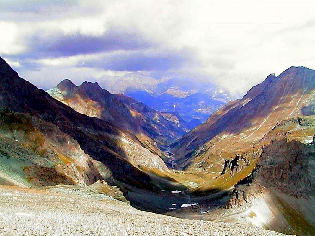
This long vallon that, similarly to the neighbors of Champdepraz, Ponton (in the East) and Saint Marcel, stretches covering an area can be considered a remarkable valley in effect both for its size and width, reaching its end in the Champorcher Valley and confining in its last part also with that of Cogne. The development of numerous side walloons ago that you need to practice it divide arbitrarily into four main branches:
1) - the central that the fraction of boats, just beyond Fènis, you lengthens itself on the axis North/South, forming the vallon floor of Clavalité Tableland towards Grand-Alpe Alpages at the beginning of the terminal part or High Comba Tersiva, at the foot of East Slopes of Punta Tersiva (3.515m).
2) - the stretch higher than at the Eastern foot of Tersiva, reaches the Fénis and Pontonnet Hills, nearby the Champorcher Valley and Urtier Vallon (into the Cogne Valley).
3) - the Southeast side or Vallon Savoney also called Margheron with the eponymous lake that reaches the North-northwestern Wall Mont Glacier, passing below Mont Rafray. The same ends at Col Mezove or Medzove Medzove, right on the border with the Vallon Champdepraz also called Valley of the Lakes, with which it is connected through the Alta Via n° 2. On the same passes also the Inter-valley trail n° 102 that, starting from Voella above Champdepraz Common and at the entrance of Park Nature of Monte Avìc, reaches the Pont Suaz at Aosta. A wonderful Trekking-Tour, which bisects the Clavalité then head to the Hill Lavodiléc, whence the adjacent Valley of St. Marcel.
4) - the vallon to the West side that is directed to Lavodiléc at the foot of the P. Tessonet and Pt. Avert, that through the preceding path leads to the Valley St. Marcel. So a bid "varied" that opens like a large fan in the two parts middle-upper, while in the initial steep valleys that we are directed towards the more Eastern Bellalana Vallon, or that you "go off" against the steep walls Mont Saint Julien, Punta Plan Rué, also known as Tita de la Rossa, and Gr. Avert wild on the opposite more narrow and rough side.
 |
Questo lungo vallone che, parimenti ai vicini di Champdepraz, Ponton (ad Oriente) e Saint Marcel, si allunga coprendo un'area notevole può essere considerata una valle a tutti gli effetti sia per la sua estensione che per la larghezza, raggiungendo al suo culmine la Valle di Champorcher e confinando nella sua ultima parte anche con quella di Cogne. Lo sviluppo di numerosi valloni collaterali fà si che per esigenza pratica lo si suddivida arbitrariamente per scelta personale in quattro rami principali:
1) - la parte centrale che dalla Frazione di Barche, appena oltre Fènis, si allunga sull'asse Nord/Sud formando il Piano della Clavalité, che raggiunge l'Alpeggio di Grand-Alpe.
2) - il tratto più elevato che, alle pendici Orientali della Punta Tersiva, raggiunge il Colle di Fénis, presso quello del Pontonnet entrambi presso le Valli di Champorcher e Cogne.
3) - il vallone laterale a Sudest di Savoney o Margheron con l'omonimo lago, che raggiunge la parete Nord-nordovest del Mont Glacier, passando al di sotto del Mont Rafray. Lo stesso s'esaurisce al Col Mezove oppure di Medzove, proprio al confine con la Valle di Champdepraz chiamato anche Vallone dei Laghi, al quale é collegato con l'Alta Via n° 2 della Val d'Aosta transitante proprio per quest'ultimo. Sullo stesso passa anche il sentiero Intervallivo n° 102 che, partendo da Voella, sopra Champdepraz ed all'ingresso del Parco Naturale del Monte Avìc, raggiunge il Pont-Suaz presso la Città d'Aosta. Uno splendido Trekking-Tour, intersecante la Clavalité per poi dirigersi al Colle di Lavodiléc.
4) - il vallone laterale ad Occidente risalente al Lago di Lavodiléc ai piedi della Punta del Tessonet e del Petit Avert, che tramite il sentiero di prima conduce al Vallone di St. Marcel. Quindi un'offerta "variegata" che s'apre a guisa di gran ventaglio nelle due parti medio-superiori, mentre in quella iniziale troviamo ripidi valloni indirizzantisi verso la Bellalana ad Est, oppure che si "spengono" contro le ripide pareti del Saint Julien, Punta Plan Rué, detta anche Tita de la Rossa, e Grand Avert sul selvaggio e ristretto opposto versante.
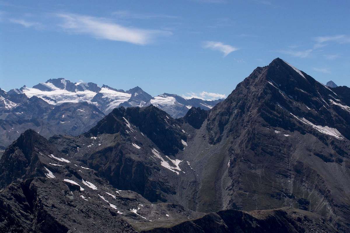
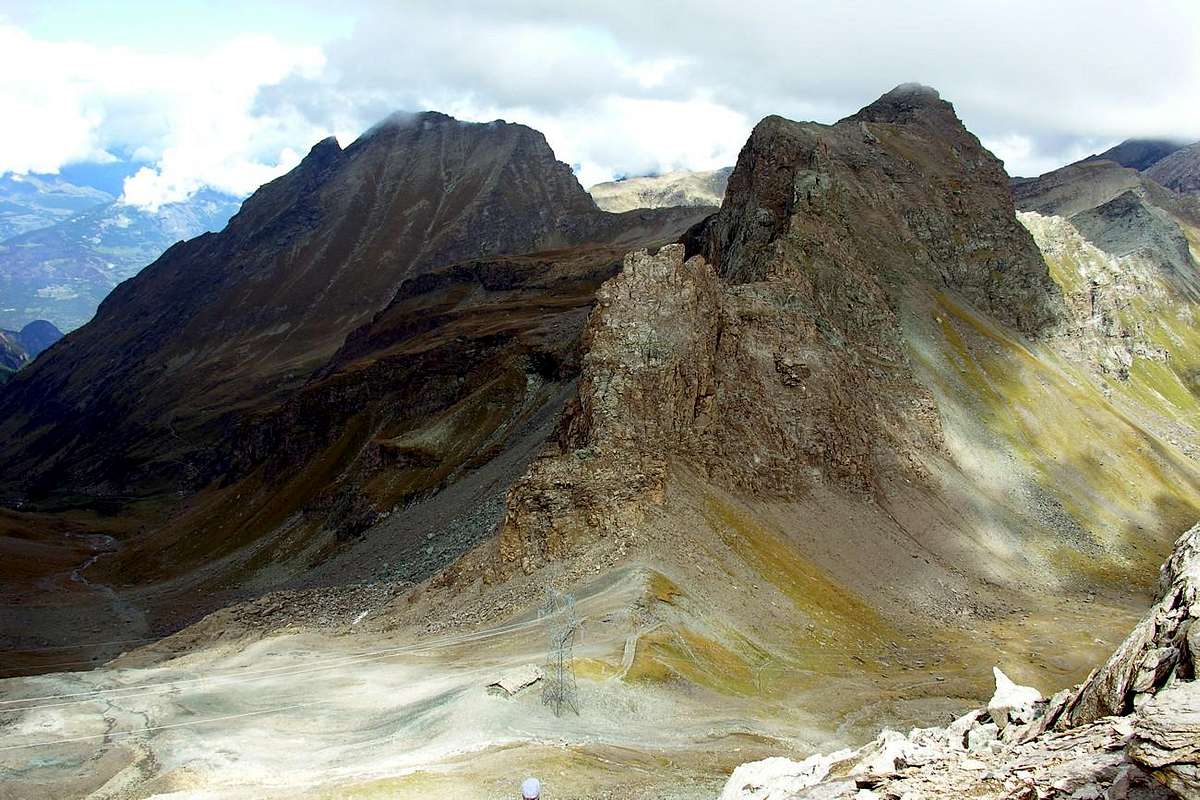
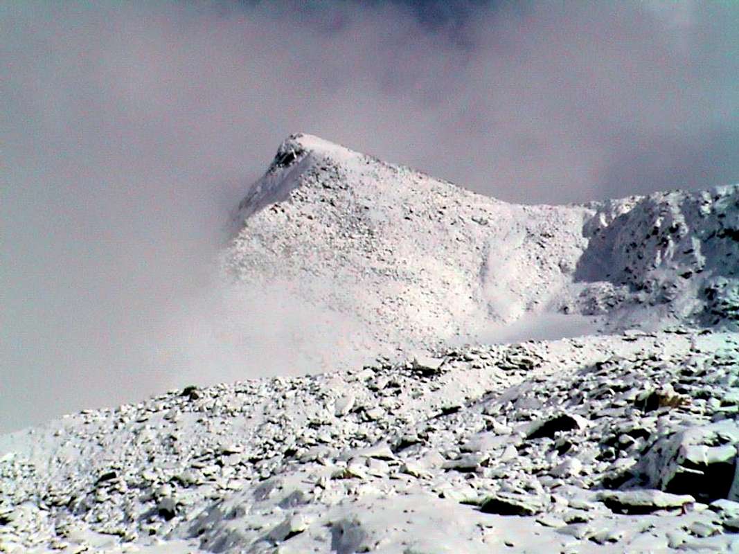
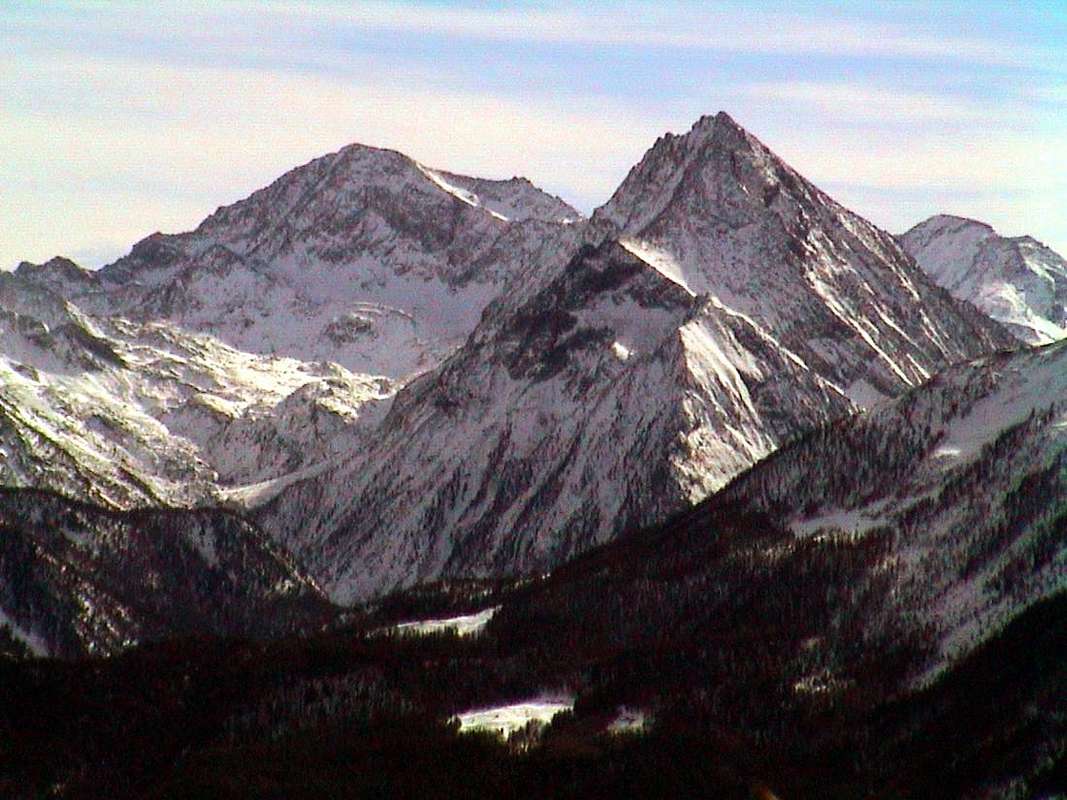
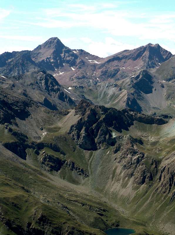
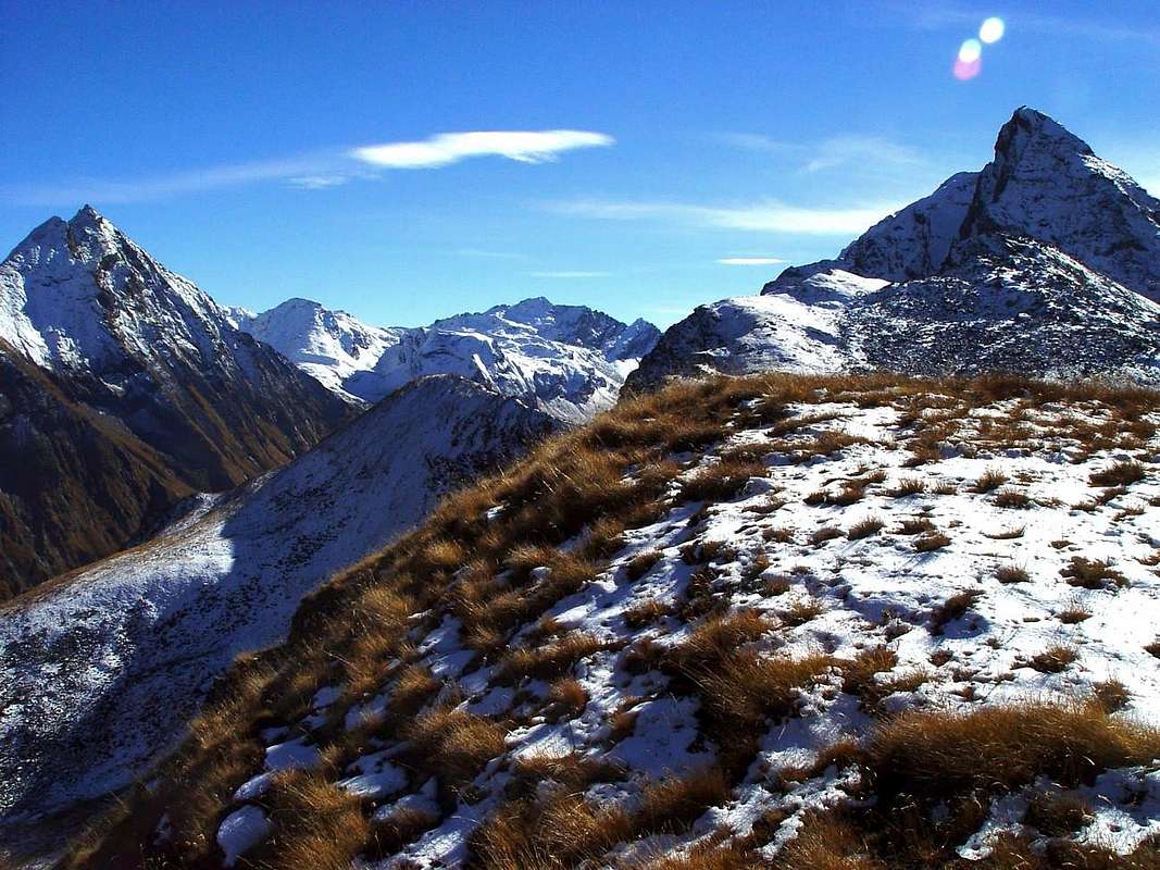
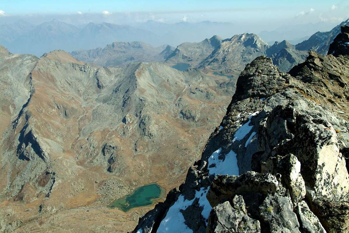
Not found, nor was interested in finding them, ibex and chamois even, which in the meantime had become very clever and the steinbock had learned to hide without making too fine display of trophies shine on the head. Most were smartly, with intelligence and cunning, "expatriates" in the adjacent Valley of Saint Marcel, where Gamekeepers Baron Beck Peckoz Gressoney observed that more careful surveillance. Specially we have not talked about this remarkable and slender pyramid, located on a buttress secondary Mont Glacier, descends to separate the Valley Fènis-Clavalité from that "most hidden" by Savoney: after the Colle di Eyelè or dell'Etsely the watershed stands up to Rafray or Raffrey and also Refrey then fall, like the prow of a large vessel, above the Bec de Viot and Bec d'Ause or d'Ansey (2.325m), flagpole extreme. This branch bisects the entire valley dividing it into two distinct and almost parallel valleys, before it reaches the Pastures of Grand-Alpe (2.116m) to finally reach the High Comba Tersiva at the foot of the great pyramid. The other lake or Lavodiléc, that for a turn of phrase makes improper name (as it would mean he washed Lavò or Lake and Léc always and again Loch), is positioned on the opposite side, surrounded by the ridges Punta Tessonet and Petit Avert, which are joined to Lavodiléc Hill (2.870m), wide door of passage to the adjacent St. Marcel Valley and on which passes the Alta Via n° 2 & Intervalleys n° 102 of the Aosta Valley. This too is wonderful but the appearance of color of its water is completely different from the first. There were green-grayish, here are blue, almost cobalt. But for both worth the essential concept of solitude and peace unopposed. And if you are a real Hunter Lakes, we find a third tiny almost a frozen pond, the Lac Glacier (2.935m), "perched" in the Northwestern slopes of Glacier; many go under to him to go to Col Fussì or Fussy (2.912m) and then cross in Champorcher Valley or climb next on "Normal Via" to the West Slope of Mont Glacier by Fénis-Clavalité, but almost nobody reaches the same. "He died" for solitude, but in Holy Peace, including its Mount Glacier and Etsely below Rafray. The mountains surrounding have an average of about 3.000 meters, except for Tersiva (3.515m), Queen and unquestioned, unchallenged Symbol of the same. The list, at least the most important, clockwise starting from the North-northeast to get again in this direction, but on the opposite side: Bec Tolomon or Tolomont, Bec Courbo, Mont Charmontane (2.680m), Tête de Plan Fret, Raye Chevrères, Mont Glacier (3.186m), Mont Delà (3.139m), Mont or Tour Moussaillon (3.073m) and Tour Pontonnet before Tersiva. Then on the watershed with the Valley St. Marcel bordering the Hunting Reserve Marquis Turati: Punta del Tessonet (3.264m), Pt. and Gr. Avert (2.946m, 2.991m), the Gran Cresta also "Evil Crest", Punta Plan Rué (2.877/81) or Tita de la Rossa, Mont Corquet (2.530m) and, finally, the two small hilltop La Torasse, or for the inhabitants Touriasse, and Saint Julien (1.377m), with his namesake and renowned Hermitage & Chapel of San Grato, places the first over a tremendous precipice on the underlying Val Clavalité and the second on the wooded round promontory at the end of the watershed with the small Walloon of the Pieiller, also belonging to the Common Fénis.
Le montagne circostanti la valle hanno una media di circa 3.000 metri, eccezione fatta per la Tersiva (3.515 m), Regina, incontrastato ed indiscusso Simbolo. Le elenchiamo, evidenziando almeno le più importanti, in senso orario partendo da Nord-nordest per arrivare ancora in questa direzione, ma sul versante opposto: Bec Tolomon oppure Tolomont, Bec Courbo, Mont Charmontane (2.680 m), Tête de Plan Fret, Raye Chevrères, Mont Glacier (3.186 m), Mont Delà (3.139 m), Mont o Tour Moussaillon o Moutsaillon (3.073 m) e le due Tour Pontonnet, prima d'arrivar alla Punta Tersiva. Poi sullo spartiacque con la Valle di Saint Marcel al confine con la Riserva di Caccia del Marchese Turati: Punta del Tessonet (3.264 m), Petit e Grand Avert (2.946 m, 2.991 m), la Gran Cresta o cosiddetta "Cresta del Diavolo", Punta di Plan Rué (2.877/81 m) od in loco Tita de la Rossa dal nome della sottostante Alpe, Mont Corquet (2.530 m) e, per finire, le due piccole Sommità della Torasse in loco chiamata Mont Touriasse e del Saint Julien (1.377 m), coll'omonimo nonché famoso Eremitaggio e Cappella di San Grato, posti il primo sopra d'un tremendo strapiombo di roccia sulla sottostante Clavalité e la seconda sul tondeggiante promontorio boschivo al termine dello spartiacque col Valloncello del Pieiller, sempre appartenente ed all'inizio del Comune di Fénis.
 |
 |
 |
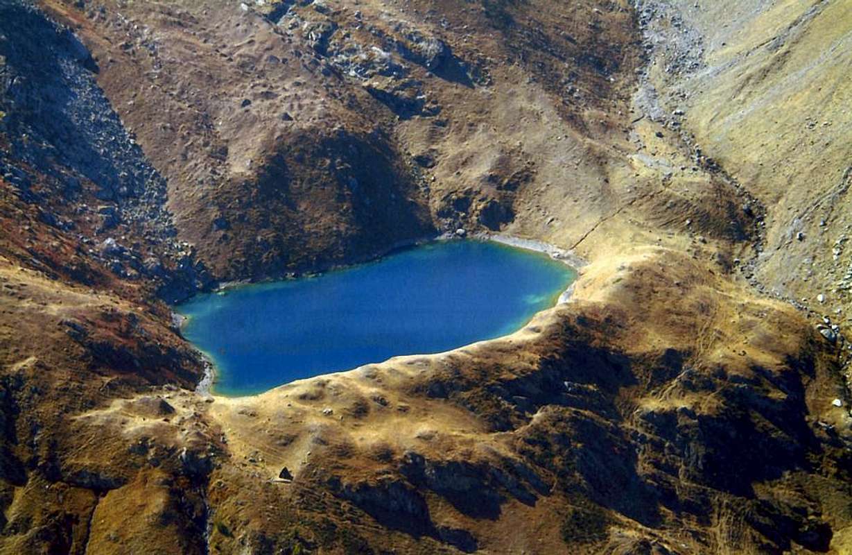 |
It is not a valley that has many lakes, but the two who, Margheron and Lavodilèc, are really beautiful. Seem, secluded as they are, living in another planet, but not forgotten neither by God nor men. A trip to the same, although a very long voyage since you have to start over from Lovignana Pasture above Barche, is already an objective in its own right and reward the effort made. Two corners of Paradise that are still less known to the masses and not too familiar with even fewer visits; more a meeting place for lovers of nature or for local fishermen. The first "take refuge" at the foot of Mont Rafray (3.146m),repulsive rocky couloirs and gullies Oriental, from which, if you tend well the ear, yet to come hear the ringing of the horn hunting Huntsman of "King Toio" engaged in their hunting ibexes, even though he had to settle for the chamois, so much so that he was known as "The Mountain of Chamoises". The steinbocks? Are all fled from the Top, all escaping from the Summit, or gave themselves down to the horrid gullies that surround the mountain in the number of over twenty. When August 21th, 1900, down from Mont Glacier and crossing the Col Fussì that of Eyelè arrived Nicola Vigna, Carlo Ratti and Giulio Toesca by Castellazzo thought they had made the first ascent. Awaited their bitter surprise, however, as the third of the three Summit or Summit North, they found the signal left by Military Topographers of His Majesty King of two Sardegne or Gamekeepers of the King who had also drawn a line of ascent that a careful eye knows yet find: on the edge of the steep wall that divides the Southern Wall from more "docile & malleable" Southwest Slope, above the Alp de l'Etsely Damon. They were instead climbed through the steep opposite Edge or Southeast, which separates this from the dizzying canyons of the East Face, just above Lake Margheron (2.377m).
 |
 |
 |
 |
Non é una valle che possegga molti laghi, ma i due che ha, Margheron e Lavodilèc, son veramente stupendi. Sembran, appartati come sono, vivan in altro pianeta, ma non dimenticati né da Dio, né dagli uomini. Una gita ai medesimi, anche se lunga poiché bisogna partire dall'Alpe Lovignana sopra la Frazione di Barche, é già un obiettivo a se stante e gratifica dello sforzo effettuato. Due angoli di Paradiso che ancora la massa non troppo conosce ed ancor meno frequenta; più un ritrovo per amatori della Natura locali o per i pescatori. Il primo "si rifugia" ai piedi dei repulsivi canaloni Orientali del Mont Rafray (3.146 m), dal quale, se tendete bene l'orecchio, sentirete ancora arrivare gli squilli del corno di caccia dei Guardiacaccia di Re Toio" impegnati nelle loro battute allo stambecco, anche se poi dovevan magari accontentarsi del camoscio, tant'é ch'era conosciuto come "La Montagna dei Camosci". Gli stambecchi? Scappavan tutti sulla Sommità o si davan giù per gli orridi canaloni che circondano la montagna in numero d'oltre venti. Quando il 21 di Agosto del 1900, scendendo dal Mont Glacier ed attraversando dal Col Fussì a quello di Eyelè, arrivarono Nicola Vigna, Carlo Ratti e Giulio Toesca di Castellazzo pensaron d'averne compiuto la prima salita. Attendeva loro però amara sorpresa, poiché sulla terza delle tre Sommità, o Vertice Settentrionale, trovarono il segnale lasciato dai Topografi Militari di Sua Maestà Re delle due Sardegne o dai Guardiacaccia del Re che altresì avean tracciato una via di salita che occhio attento sà ancor oggigiorno individuare: su quello spigolo che divide la ripida Parete Sud dal più "docile" Versante Sudovest, sopra l'Alpe dell'Etsely Damon. Loro eran invece saliti tramite il ripido spigolo opposto o Sudest, che separa questa dai vertiginosi canaloni del Versante Est, proprio sopra il Lago Margheron. Non trovaron, e neppur interessava lor trovarne, stambecchi e nemmen camosci, che nel frattempo eran divenuti scaltri ed avean ben imparato a nascondersi senza far troppo bella mostra degli splendidi trofei. I più furbi intelligentemente eran "espatriati" nell'attiguo di St. Marcel, ove i Guardiacaccia del Barone Beck Peckoz di Gressoney osservavano più che attenta sorveglianza. Appositamente non v'abbiam parlato di questa notevole e slanciata piramide che, situata su d'un contrafforte secondario del Mont Glacier, scende a separare la Valle di Fènis-Clavalité da quella "più nascosta" di Savoney: dopo il Colle d'Eyelè o dell'Etsely lo spartiacque si rialza al Rafray o Raffrey ed anche Refrey per poi precipitare, come la prua d'un grande vascello, sopra il Bec de Viot (3.051 m) ed il Bec d'Ause o d'Ansey (2.325 m), pennone estremo. Questo ramo taglia l'intera vallata dividendola in due netti e quasi paralleli valloni, prima che la medesima raggiunga gli Alpeggi di Grand-Alpe (2.116 m) per infine distendersi nell'Alta Comba Tersiva ai piedi della grande piramide. L'altro lago o di Lavòdilèc (2.357 m), che per un giro di parole rende il toponimo improprio (poiché vorrebbe significare Lago o Lavò del Lago o Léc, quindi inutile ripetizione), é posizionato sul fronte opposto, racchiuso tra le creste della Punta del Tessonet e del Pt. Avert, congiungentesi al Colle di Lavodiléc (2.870 m), ampia porta di passaggio verso l'attigua Valle di St. Marcel e sulla quale passa l'Alta Via n° 2 e l'Intervallivo n° 102 della Valle d'Aosta. Anche questo é di sembianze meravigliose, ma il colore delle sue acque é completamente diverso. Là eran verdi-grigiastre, qui son d'azzurro, quasi cobalto. Ma per entrambi vale il concetto essenziale di solitudine e d'incontrastata pace. Se poi siete vero Cacciatore di Laghi, ne trovate un terzo minuscolo, il Lac Glacier (2.935 m), "appollaiato" sotto alle pendici Nordovest del Glacier; molti gli passan sotto per andar al Col Fussì o Fussy (2.912 m) e poi scavalcare in Valle di Champorcher oppure affianco per salire la "Normale" del Mont Glacier da Fénis, ma quasi nessun purtroppo lo raggiunge. "Muore" per solitudine, ma in Santa Pace, tra il suo Glacier e l'Etsely sott'al Rafray.
VALLEYS & VALLONS In order to deploy clockwise from Fénis to Saint Marcel Municipalities
Little Histories & tiny Amenities
Brevi tratti Istorici & qualche Curiosità
Getting There
BY CAR:
- From TORINO, MILANO, etc: Motorway A5. Exit at IVREA or Quincinetto (PIEDMONT) From IVREA Town: in West (Southern side) to Pont Saint Martin, Donnas, Bard, Champdepraz, Pontey, Fénis, Saint Marcel. From Fénis (537m) to Clavalité-Grand'Alpe Pastures (2.129m; through dirt road), just below E. Borroz/Rotary-Clavalité Refuge (2.156m) at Cuneu Alp. From Saint Marcel (630m) to Saint Marcel Valley and Turati Reserve up to the Mulac & Grande Chaux Hunting Houses & Alp (1.937m, 2.370m).
- From FRANCE: through the Mont Blanc Tunnel to Entrèves-crossroads to Vény/Ferret Valleys - Mountain Guides of Courmayeur - La Saxe Rock Gym - Courmayeur. By Little Saint Bernard Pass, closed since November until half May to La Thuile Valley - Pré Saint Didier - Courmayeur. It is not necessary to take Motorway A5: you can drive on SS.26, in the direction of AOSTA - IVREA - TURIN.
BY PLANE:
- Aeroporto "Corrado Gex" Saint Christophe (Aosta).
 |
 |
 |
All its Vallons
Fénis-Clavalité-High Comba Tersiva Valley Fénis-Clavalité-Savoney Valleys: from Fénis-Barche (607m), Arbussayes, La Cerise, Le Plan-Mayen (989m), Le Leffrey (1.074m), La Servettaz (1.107m), Lovignanaz (1.169m), by dirt road without permession; from this Les Fontaines (1.281m), in Southeast Petite Bella Lana Alp (2.256m) to Ballalanaz Pass (2.501m) to Point Charmontane (2.683m), through and under easy South Crest. From Les Fontaines in South Margheron or Marqueron (1.442m), Robbio also Robiaz (1.512m), Chez-Boz (1.508m), les Maisonnasses (1.534m) Pastures; from this in Southeast La Grande Ballalanaz Alp (2.334m) to Raye Chevrère Hill (2.703m), with path. From Maisonnasses in South Maison Blanche (1.526m), Bioley (1.527m), Chardonney (1.531m) Pastures; from this in Southeast Le Crin (1.587m), Les Bayettes (1.642m), L'Orgère (1.747m), Savoney (2.138m) Alps to Marguerite and Mé(d)zove or Margueron Lochs (2.376m), with path. From Lake in Southeast Medzove Hill (2.613m) to Lakes-Champdepraz Vallon, with various paths. Clavalité-High Comba Tersiva Valley: from Chardonney in South La Coutà, Celey (1.570m), Coujeic, Beneyte (1.733m), Le Bayet (1.918m), Meney (1.949m) to Grand Alpe (2.129m) Pastures, with dirt road-path. From fork, immediately before in East, Etsely or Echellier Low (2.097m), Upper also Tramouaille (2.437m) to Etsely Pass (2.812m) and descent to Savoney Valley, with path. From Grand Alpe:
1) - in East-southeast Tramouaille de Cuneux (2.509m) to Fussy Pass (2.911m), between Mounts Glacier (3.186m) and Delà (3.139m), with path;
2) - in South-southeast Moussaillon Loch, Pass (2.847m) to Dondena Valley in Champorcher Valley, with paths.
3) - In South on High Comba Tersiva Fénis Hill (2.833m) to Pontonnet Vallon, with paths. Connection in West with Pontonnet Hill (2.898m), descent in Urtier Valley-Cogne Valley, with paths.
Pieiller Vallon: from Fénis-Le Perron (582m) Hamlet, Champlan, Crou de Ban (926m), Le Pieiller de Sermoz (1.075m), Maison Longue (1.112m), Le Plany (1.174m), Le Pieiller (1.230m) little Villages, alternative on hairpin road (about 1.200m) to Le Coteau (1.234m) Village, with municipal road or path from valley floor; from this:
1) - in Northeast Mount Saint Julien (1.384m), Saint Grat Sanctuary and, through short descent, Saint Julien Hermitage, with path.
2) - From Le Pieiller road continuation in Southeast to La Morgnettaz (1.245m), Champremier (1.833m) Villages and connection with Les Druges Comba, at the entrance of Saint Marcel Valley;
3) - or the same connection but with path, starting from The Morgnettaz, passes through the small Villages of Porteron (1.368m; sledge run Combasse), Malplanet (1.495m), Les Druges Low and High (1.567m).
Historical and some small notes Inquisitiveness
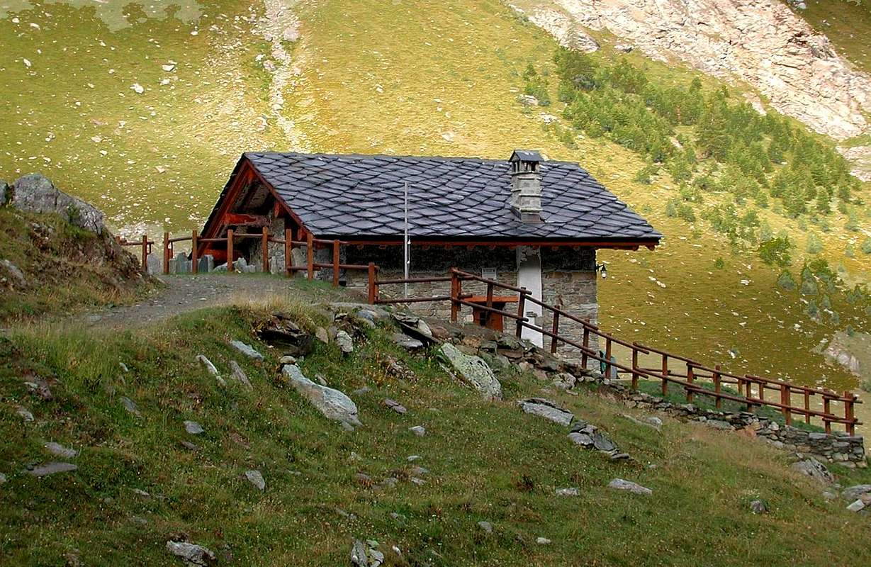
This long valley opens behind the Municipality of Fénis (537m), sited with its beautiful Medieval Castle of 1330, between the Cities of Saint Vincent to the East and Aosta. The same lies on the Southern side of the Central Valley of Baltea and at the slopes of Chermontane and St. Julien, who constitute the last bastion of the same that had originated at the foot of the pyramid of Tersiva. This castle, completely built with local stone and certainly one of the most magnificent of all Italy, with its towers and lacy walls was built by the Family Challant and more precisely by Aimone, who served first as Tutor to the Duke Amedeo VII° Savoy House and later by General Commander of the Troops of Savoy in the first half of that century. Sold to local farmers in 1716 by Count Francesco Giorgio to fulfill the legal costs incurred by the father and then to save the noble title of Challants with their privileges, is of great value both for the exterior architecture and for its interior, unfortunately worn and habited by commoners who used it improperly to their home for over 80 years. In 1895 the providential intervention of Architect Alfredo of Andrate saved him from complete ruin; the same, after partial restoration, gave it as a gift to the Italian State, while his feudal courtyard was faithfully copied in 1884 in the Medieval Castle Turin. This feud stretched from the small Municipality of Chambave, beyond the Baltea with its famous vineyards, up to above the wide Clavalité Plan (by Latin Clava), whence the name that prevailed even on the most current toponym of Val Fénis. This resulted favorite area in past centuries, as the most suitable for growing (the famous chestnut Fénis) and farming, while the higher areas were exploited for the pastures in summer and for water control (well showed the largest Tersiva Glacier at the foot of Wall North-northeast and now gradually being recession). But this area was already known and used by the Romans as it is here that they built two roads there and exploited widely Mineral Resources, today completely abandoned. The phasing out of the same, certainly less competitive than those of iron, copper and manganese in the adjacent Valley of Saint Marcel, led to more and more apparent oblivion of the same, reduced almost exclusively to Hunting Reserve by the Counts of Challant. Over 15 Kilometres long and varies in width between 3 and 5 Km., the Clavalité possesses, as we go along is elevated in the panoramic prerogative to offer the two pyramids of the Matterhorn, downstream, and of Tersiva, upstream, that give the impression of rivaling with one another, almost facing each in an epic duel. At about 15 Kilometres from Aosta Fénis ranks near the exit of Highway 5 near Aosta East, while it is 1.5 Kilometers; from the National Road n° 26, where, after a roundabout, past the Dora Baltea on a large stone bridge. Is composed of seven villages and its inhabitants (1427 in 1964) Nowadays exceed two thousand. There are post office, public telephone, shops, Tourism Committee, Pro-site and various sports facilities, while the nearby International Luge Track of Combasse (on the border with Saint Marcel) has now been closed almost since nearly two decades. Also worth visiting are the Church with the Bell-shaped spire, the "Cross Ramoliva" of 1500 and the small Chapel of San Giuliano (1.372m) at the beginning of Clavalité wide Plain. While crossing the dense Forest of Ban, you can come to Southeast in the very wild Ponton Vallon, interposed between those of Champdepraz or of the Lakes, Bellecombe (famous for the presence of minerals with garnets and vesuvius), Valmeriana (ancient mine became to Plan of Lovo) and Val Fénis. Find also many pastures, but only two bivouacs: the E. Borroz Rotary Club (2.156m), just above the Grande-Alpe (2.120m) and on the way to the Etsely and Marquis Turati (2.342m), the latter private and always closed just below the promontory where lies the Lavòdilèc. Oh, I forgot. If you go upwards in Grande-Alpe, find a Professor of Mathematics Albanian with Family. The same in 2005 won the First Prize for the best "Fontina" Val d'Aosta. Selling milk, butter, brossa and fontina and, if you go to my name, will you also to the discount. But remember to him that he is the past few years ... Finally: be careful because in the offing he lives the "Marassus berus", which is the only viper that attacks humans. As from experience in 1994 with the "Peppino" ...
 |
 |
 |
 |
Questa lunga valle s'apre alle spalle del Comune di Fénis (537 m), sito con il suo splendido Castello Medioevale del 1330, tra le Cittadine di Saint Vincent ad Oriente e di Aosta. Lo stesso s'adagia sul lato Meridionale della Valle Centrale della Dora Baltea ed alle pendici dei Monti Chermontane e St. Julien, costituenti l'ultimo baluardo della medesima che s'era originata ai piedi della piramide della Tersiva. Questo castello, completamente edificato con pietra locale e sicuramente uno dei più belli di tutta l'Italia, con le sue torri e le mura merlettate venne costruito dalla Famiglia dei Challant e più precisamente da Aimone, che fungeva dapprima da Precettore del Duca Amedeo VII° di Casa Savoia e poi da Comandante Generale delle Truppe Sabaude nella prima metà di quel Secolo. Venduto ai contadini locali nel 1716 da parte del Conte Giorgio Francesco per assolvere alle spese giudiziarie incontrate dal padre e quindi per salvare il titolo nobiliare dei Challant con relativi privilegi, risulta di notevole valore sia per quanto concerne l'architettura esterna che per i suoi interni, purtroppo usurati dai popolani che lo sfruttarono impropriamente a propria abitazione per oltre 80 anni. Nel 1895 l'intervento provvidenziale dell'Architetto Alfredo d'Andrate lo salvò da completa rovina; il medesimo, dopo il parziale restauro, lo diede in dono allo Stato Italiano, mentre il suo cortile feudale venne riprodotto fedelmente nel 1884 nel Castello Medioevale di Torino. Questo feudo s'estendeva dal Comune di Chambave, al di là della Dora Baltea coi suoi rinomati vigneti, fino al soprastante Pianoro della Clavalité (dal latino Clava), donde il nome predominante anche su quello più attuale di Val Fénis. Questa risultava l'area prediletta nei secoli passati, poiché la più adatta alla coltivazione (famosa la castagna di Fénis) ed alla pastorizia, mentre le zone più elevate venivano sfruttate per gli alpeggi estivi e per il controllo delle acque (ben più esteso risultava il Ghiacciaio della Tersiva ai piedi della Parete Nord-nordest ed oggi in fase di progressiva recessione). Ma questa area era di già conosciuta e sfruttata dai Romani tanto ne é che qui costruirono due loro strade e ne sfruttarono ampiamente le Risorse Minerarie, oggi del tutto abbandonate. L'abbandono progressivo delle medesime, sicuramente meno concorrenziali di quelle di ferro, rame e manganese dell'adiacente Valle di St. Marcel, portarono al sempre più evidente dimenticatoio della medesima, ridotta quasi esclusivamente a Riserva di Caccia da parte dei Conti di Challant. Lunga oltre 15 Kilometri e con una larghezza che varia tra i 3 e 5, la Clavalité possiede, man mano che ci si innalzi nel percorrerla, la prerogativa panoramica d'offrire le due piramidi del Cervino, a valle, e della Tersiva, a monte, che danno la impressione di rivaleggiar tra loro, quasi affrontandosi in epico duello. A circa 15 Km. da Aosta, Fénis si colloca nei pressi dell'uscita della Autostrada 5 nei pressi di Aosta Est, mentre risulta ad 1,5 Km. dalla SS.26, dove, dopo una rotonda, s'oltrepassa la Dora su d'un largo ponte in pietra. Risulta composta da sette frazioni ed i suoi abitanti (1427 nel 1964) ora superano le due migliaia. Esistono posta, telefono pubblico, negozi, Comitato per il Turismo, Pro loco ed impianti sportivi varii, mentre la vicina Pista internazionale di Slittino di Combasse (ai confini con St. Marcel) é ormai stata chiusa da quasi un ventennio. Inoltre son degni di visita la Chiesa con il Campanile a forma di cuspide, la "Croce di Ramoliva" del 1500 e la Cappella di San Giuliano (1.372 m) in Clavalité, mentre, attraversando la fitta Foresta del Ban, si può entrare verso Sudest nel selvaggio Vallone del Ponton, interposto tra Champdepraz, Bellecombe, Valmeriana e Val di Fénis. Trovate molti alpeggi, ma due soli Bivacchi: il E. Borroz Rotary Club (2.156 m), appena sopra Grande-Alpe (2.120 m) e sulla strada dell'Etsely, ed il Marchese Attilio Turati, quest'ultimo privato e sempre chiuso, appena al di sotto del promontorio ove giace lo splendido Lago di Lavòdilèc. Ah, dimenticavo. Se andate sù a Grande-Alpe, trovate un Professore di Matematica Albanese con la sua Famiglia. Lo stesso nel 2005 ha vinto il Primo Premio per la miglior Fontina della Valle d'Aosta. Vende latte, burro, brossa e fontina e, se andate a mio nome, vi farà anche lo sconto. Però ricordategli che é passato più di qualche anno ... Un'ultima: state attenti, perché nei paraggi vive il "Marassus Irascibilis", l'unica vipera che aggredisce l'uomo. Come da personale esperienza nel 1994 col "Peppino" ...
Campings
Remember that free camping is forbidden (except for emergency reasons, over 2.500m, from darkness until dawn).Mountain Conditions
- You can get meteo information at the official site of the Regione Valle d'Aosta:
- Valle d'Aosta Meteo
Books and Maps
BOOKS- "Guida delle Alpi Occidentali" di Giovanni Bobba e Luigi Vaccarone C.A.I. Sezione di Torino Volume II (parte II), 25 Maggio 1896.
- "Guida dei Monti d'Italia – Emilius Rosa dei Banchi-Parco del Mont Avic" di Giulio Berutto e Lino Fornelli - Club Alpino Italiano/Touring Club Italiano, Marzo 2005.
- "Guida della Regione Autonoma Valle d'Aosta" di Mario Aldrovandi; Ed. S.P.E. di Carlo Fanton, Torino 1964.
 |
 |
 |
MAPS:
- Kompass "Gran Paradiso Valle d'Aosta Sentieri e Rifugi" Carta Turistica 1:50.000.
- L'Escursionista "Parco Naturale del Mont Avic" Carta dei sentieri 1:25.000.
- L'Escursionista "Tour de la Vallée de Cogne Grand Paradis" Carta dei sentieri 1:25.000.
- Hapax "Les Sentiers" Comunità Montana Monte Emilius, Luglio 2000 1:25.000.
- Meridiani Montagne "Gran Paradiso" 1:25.000.
- I.G.C. Istituto Geografico Centrale Torino "Il Parco Nazionale del Gran Paradiso" 1:50.000.
- Studio F.M.B. "Gran Paradiso" Bologna 1:50.000.
- Enrico Editore Ivrea-Aosta "Gruppo del Gran Paradiso" 1:50.000.
- L'Escursionista "Valle di Cogne" Carta dei sentieri (n° 10) 1:25.000.
Important Information
- REGIONE AUTONOMA VALLE D'AOSTA the official site.
- FONDAZIONE MONTAGNA SICURA Villa Cameron, località Villard de la Palud n° 1 Courmayeur (AO) Tel: 39 0165 897602 - Fax: 39 0165 897647.
- A.I.NE.VA. (Associazione Interregionale Neve e Valanghe).
Useful numbers
- Protezione Civile Valdostana località Aeroporto n° 7/A Saint Christophe (Ao) Tel. 0165-238222.
- Bollettino Meteo (weather info) Tel. 0165-44113.
- Unità Operativa di Soccorso Sanitario Tel. 118.