
-
 8400 Hits
-
 83.69% Score
-
 17 Votes
|
|
Mountain/Rock |
|---|---|
|
|
37.94670°N / 13.97924°E |
|
|
Hiking, Scrambling |
|
|
Spring, Summer, Fall, Winter |
|
|
4544 ft / 1385 m |
|
|
Overview
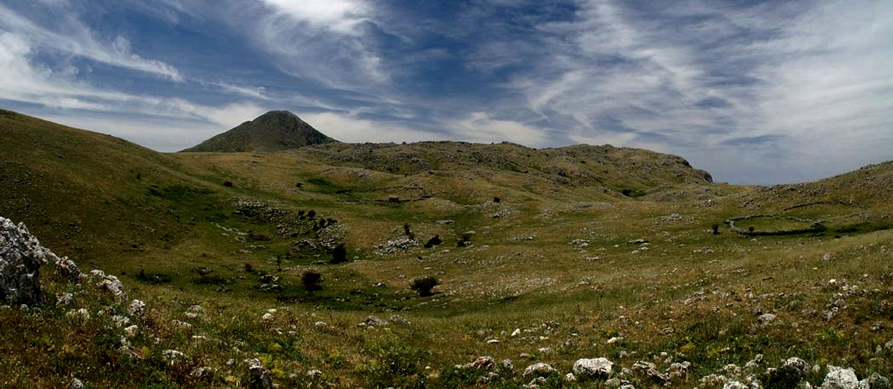
 Pizzo Dipilo Pizzo Dipilo |
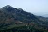
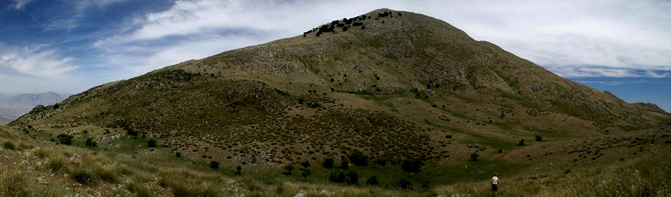
Pizzo Dipilo is the highest summit of its little group, a subgroup of the Madonie mountain range in Sicily. The group is a hilly high plateau, out of which several notable summits rise, among them Monte Macabubbo, Monte Grotta Grande and Pizzo Dipilo. The subgroup is located in the northwest of Le Madonie, far away from the higher mountains of the group so that any of its summits offer fine views to the coast and into the Madonie range itself.
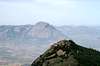
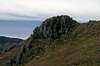
The mountain, Pizzo Dipilo, itself has a round-topped summit, dropping off to all sides with the same type of steep grass covered slopes out of which several rocky ramparts peep out. The highest of these, Pizzo dell'Occhio is located to the east of Pizzo Dipilo and reaches almost 1200m in height. Its faces, like all of the faces of the Dipilo Group, are made up from broken, karst like limestone, a sight to look at but horrible to climb.
The routes to Pizzo Dipilo are much easier, from Isnello a dirt road leads up to the plateau and from there on a scramble along the south ridge of the mountain is the sensible way up. The same is true for the route from Munciarrati, though here you have to be contented with paths. The route from I Pianetti in the north is probably the most beautiful though it is the steepest and most rocky one.
|


Getting There
  |
Sicily can be reached from all Italian and the major European airports by plane. There are two large international airports, one at Catania in the east and one at Palermo. Since Palermo is much closer to the mountain than Catania my itinerary starts here. Also, Palermo is the main ferry port in the area.
From Palermo airport
- Take motorway A29 direction Palermo
- In Palermo the motorway turns into a four laned city highway which circles the city to its south
- The city highway turns into motorway A20 direction Messina
- Turn off at the exit Cefalù and head for the town centre
- Shortly before you reach the town centre take SP28 south towards Isnello and Gratteri
- A couple of 100m behind the Sanctuario di Gibilmanna turn right (still SP28) towards Gratteri and park in the saddle I Pianetti
- Alternatively drive straight on to Isnello (SP84)) or even on to Munciarati in the south of the mountain.
|


Red Tape
The Dipilo Group belongs to the Parco delle Madonie, which was established in 1989 and covers an area of approximately 40000ha. In the Sicilian parks you can climb and hike almost everywhere. Obstacles are the many barbed wire fences, which however can be crossed. They serve only for the pastures and to keep cattle sheep and horses from getting lost in the vast terrain.Camping is not tolerated in the parks, better look for accommodation in the nearby villages. The northern coast is close by and there you will be able to find all kinds of accommodation (see below).
Accommodation
 |
You can quite easily find hotel rooms and apartments everywhere on the coasts. All European travel companies offer accommodation so a visit to your nearest travel office will find you some. In the mountains themselves accommodation is much harder to come by. Since camping is not allowed (see red tape) you have to ask at the local inns. Moreover there are some farms which offer “agriturismo” though on Sicily this often means only food and no rooms.
Weather Conditions
Sicily is located very close to northern Africa (Marsala on the west coast is closer to Tunis than to any place on the Italian mainland), thus temperatures can get very high. March, April and early May are the best months if you plan to hike the mountains, the winter can be wet, the summer scorchingly hot. Here the nearest weatherunderground link for Palermo:Maps & Books
Maps
Unfortunately there are no current topographic maps of Sicily. The best are reported to be more than 50 years old and probably are the same as the basis for the digital maps of atlanteitaliano.it.
As a workaround you can use street maps for general orientation together with a good guidebook (see below). The most accurate maps are scaled 1:200000, sometimes detailing everything down to forest and dirt roads through the mountains. I settled for
- Sizilien
Shell Generalkarte
1:200000
Mairs Geographischer Verlag
ISBN: 3-8297-2080-7
Books
Since there are no good topographical maps of Sicily you should take care to get a good guidebook. The one I used is in general excellent. Pizzo Dipilo in not described in the book but a route getting to the base of it is. From there the final 300m are a scramble across steep rock covered meadows. The book is available in German and English.
- Sizilien / Sicily
M. Omidvar
Rother Verlag
ISBN:
3-7633-4266-4 (German)
3-7633-4813-1 (English)