
-
 3911 Hits
-
 79.78% Score
-
 11 Votes
|
|
Mountain/Rock |
|---|---|
|
|
35.04480°N / 106.4637°W |
|
|
Bernalillo |
|
|
Hiking, Bouldering |
|
|
Spring, Summer, Fall, Winter |
|
|
6860 ft / 2091 m |
|
|
Overview
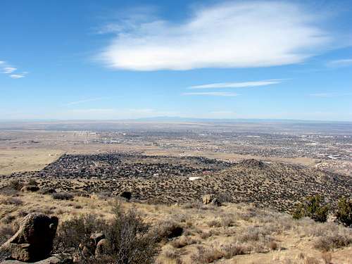
Point 6860 is located within the Manzano open space but is actually a part of the Manzanito Mountain range. This range is a bridge between the Sandia and Manzano ranges. Its proximity to the city of Albuquerque makes it and ideal after work hike. Along the way there are many opportunities for rock scrambling or bouldering. This area is not well known about so you are not likely to encounter other people along your way. However, there is a lot of wildlife in this area. Point 6860 and bouldering area with moon
New Mexico Rank: 1930
Prominence: 553'
Quadrangle: Tijeras
Rank and Prominence information from
Lists of John
Getting There
From Albuquerque head east on I-40 to exit 167 (Tramway Blvd). Take a right off the exit then take an immediate left onto Central Ave. Get into the right lane on Central Ave because at the first light you will turn right onto Four Hills Rd. Continue on Four Hills Rd until it forks, then take the left fork. Stay on this road; it will make a 90 degree turn back to the south and the road will now be called Stagecoach Rd. This road wil dead end at some gate. Park here but do not block the gates. You will see signs for the Manzano Open Space.Route Overview
 Point 6860 route
There is one main route to the summit of Point 6860 although there are plenty of minor variations of the route. Whichever way you decide to go you will have a short, fun, Class 3 scramble on the summit boulder.
West Slope: This is the standard route for Point 6860 although many variations exist. The route follows a dirt road up to a saddle between Point 6860 and it's northern sub-peak. From there it traverses back to the west face and swithbacks up to a flat summit area. At this point all that is left is a short class 3 scramble up a few boulders to the true summit.
Views from the summit:
 Looking East
 Looking North
 Looking South
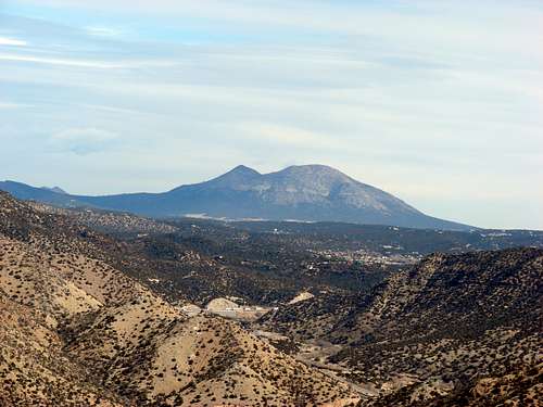 Looking Northeast
Red Tape
Since the Manzano Open Space borders Kirtland Air Force Base the fence line is closely monitored. You SHOULD NOT attempt to cross this fence. The open space prohibits firearms, fires, littering, glass containers, and alcoholic beverages. Dogs should be kept on a leash and cleaned up after.Camping
There is no camping in the immediate area however there is camping very close by. Camping can be found at the base of Cedro Peak at the Cedro Peak Campground. Check the following Forest Service website for prices and more information on this campground.External Links
Local weather: AlbuquerqueLocal Search and Resuce Team: Cibola SAR
Cibola National Forest - Sandia Ranger District