-
 15826 Hits
-
 85.87% Score
-
 21 Votes
|
|
Mountain/Rock |
|---|---|
|
|
47.91660°N / 24.32500°E |
|
|
Hiking |
|
|
Spring, Summer, Fall, Winter |
|
|
6358 ft / 1938 m |
|
|
Overview
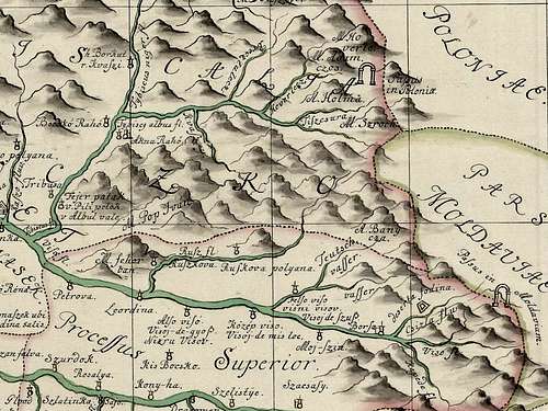
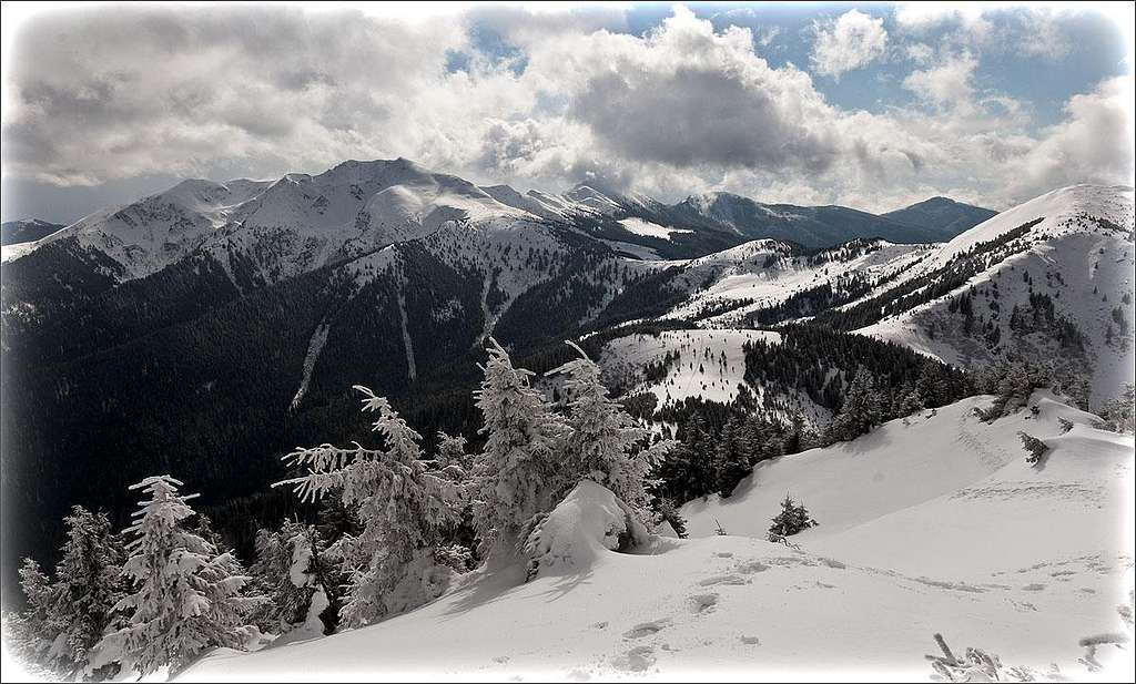
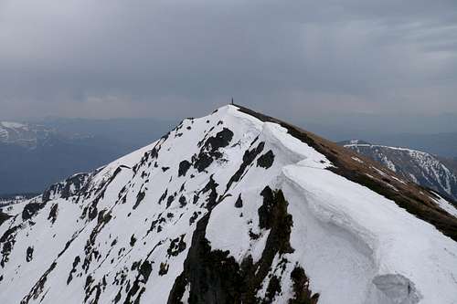
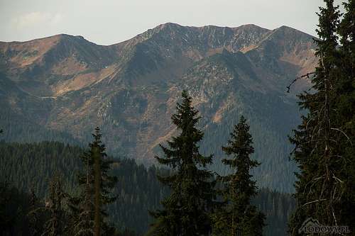
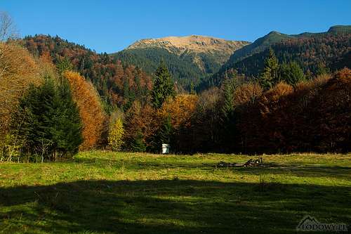
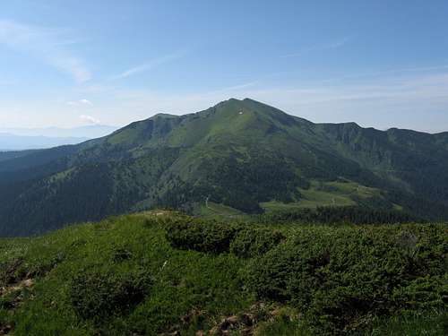
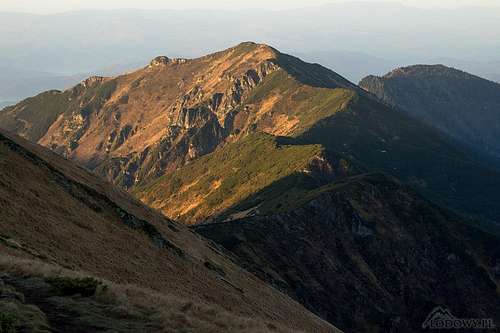
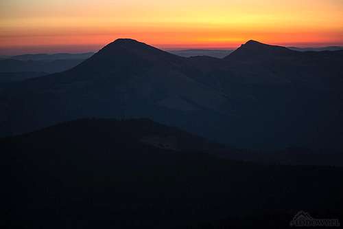
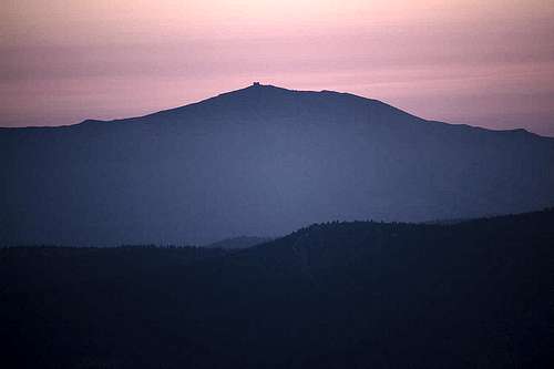
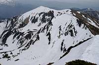
Straddling the border between Ukraine and Romania, Pop Ivan (Pip Ivan in Ukrainian) at 1938 m is the highest mountain on the main ridge of the Marmarosh Mountains as well as being the highest Ukrainian peak in these mountains. What is more, the massif of Pop Ivan, with its three summits and several postglacial corries on its northeast side is the most spectacular of all in the Ukrainian Carpathians. This is due to the fact that Pop Ivan - unlike nearly all of the mountains in the Ukrainian Carpathians - is formed of gneiss, an ancient, relatively hard Precambrian rock. The jagged northeast face of Pop Ivan is the most attractive, but the bulky massif, rising well above the treeline, is impressive regardless of the direction it is viewed from. 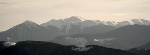
The name of the mountain, which is at least three hundred years old, is a mystery. The word pop/pip means priest, but according to Wojciech Włoskowicz (Słowa na niewysokiej połoninie, Magazyn PAN 1/45/2016) the local people known as Hutsuls call the mountain Popivan and maintain that the name comes from the fact that the wind sings ('popivaye') on the summit. The linguist is positive that the toponym was originally one word which had nothing to do with 'priest'. 'Popivan' could have been easily converted into 'Pop Ivan' by an Austrian or Hungarian cartographer. Perhaps it would be more romantic if it all had started with a Rusyn (Hutsul)/Romanian 'Pop', as in Romanian ‘pop’ also translates as king, and Pop Ivan does reign in the Hutsul Alps as the western part of the Marmarosh Mountains is often called …
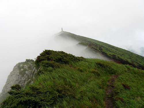
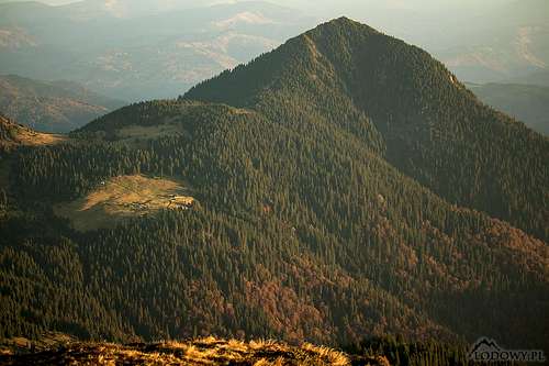
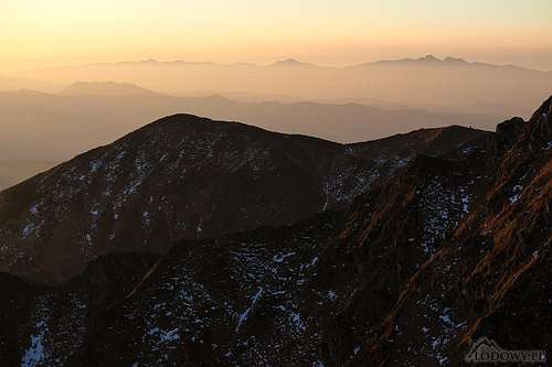
Apart from standing on the main ridge, Pop Ivan sends a massive ridge to the north, which reaches a peak in Petros at 1781 m, around five kilometers away from Pop Ivan. Views from the summit area are excellent. Most of the Marmarosh Mountains can be seen, the highest, good-looking nearby peaks being Sherban/Zherban at 1793 m to the southwest (on the main ridge) and Petros to the north. The highest summit in the Marmarosh Mountains, Farcău at 1957 m, stands nine kilometers east. Further away, the Chornohora range dominates the northeastern horizon while the Rodna looms in the southeast. The main summit of Pop Ivan is marked with a rather ugly, fortunately not very big, concrete pylon. The mountain should not be mistaken for Pip Ivan Chornohirskyi, a conspicuous summit at the southeast end of the Chornohora.
The Marmarosh Pop Ivan was a very popular destination for the passionate hiker of the interwar time (1920-1938). Now it is hard to believe that in July the top of Pop Ivan was covered in carpets of white narcissi and red alpine roses (Rhododendron kotschyi). Still, much of that romantic climate has been preserved. You may feel like you have been transferred to a lost world, surrounded by mountain ridges, submerged by the divine tranquility of undisturbed nature. 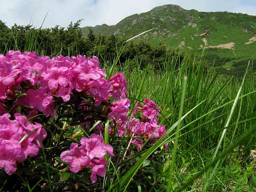
|
Maramaroskyi Massif Nature Reserve
This piece of the Carpathian Biosphere Reserve was established in 1992 on the Ukrainian side of the Marmarosh Mountains, in the part of the mountains known in Ukraine as the Rakhiv Mountains (often called the Hutsul Alps by the locals). The reserve is part of UNESCO's Man and Biosphere project. The protected territory, encompassing 8990 ha, is located at elevations ranging from 750 to 1940 m. The main mountain unit is Pip Ivan Maramoroskyi. The massif is formed of gneisses, micaceous and quartz slates, and marmoreal limestones of the Jurassic period. The relief is characterized by deep valleys, rugged crests and peaks. Traces of Pleistocene glaciation occur on the eastern side of Pop Ivan. The nature reserve called Lysychyi Strunzhen, set up in 1912 is one of the oldest protected territories in the Ukrainian Carpathians. The Maramoroskyi protected massif has peculiar vegetable cover stipulated by its geologic structure. The mixed and deciduous forests are usually formed by beech, fir and spruce. The beech virgin forests are widely spread on the southern slopes and soils, which are rich in calcium. In June 2007 clusters of virgin forests in the Maramoroskyi massif were inscribed on the UNESCO's World Heritage List together with other sites in Ukraine and Slovakia as Primeval Beech Forests of the Carpathians.
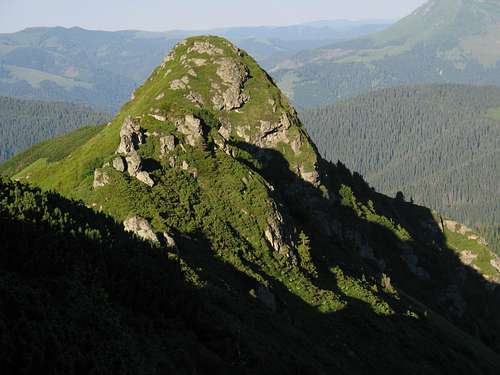
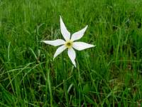
The mixed phytocenosises are found in most of the massif’s territory. The pure climax fir-groves are found at elevations 1600-1700 m, where the upper forest line runs, and the climate is cold. Subalpine and alpine meadows, with patches of elfine wood, mainly formed by dwarf pine, are found at a higher altitude. A number of rare plants, such as Anemonastrum narcissiflorum, Anthemis carpatica, Gentiana acaulis, Narcissus angustifolius, Poa deylii, Pulsatilla alba, Sempervivum montanum grow in the subalpine and alpine zones, and in the forest zone - also Campanula carpatica, Scopolia carniolica and others. Visitors are attracted by 'alpine roses', i.e. the Rhododendron Kotschyi. The red flowers of this Carpathian endemic plant enhance the beauty of the mountain scenery. 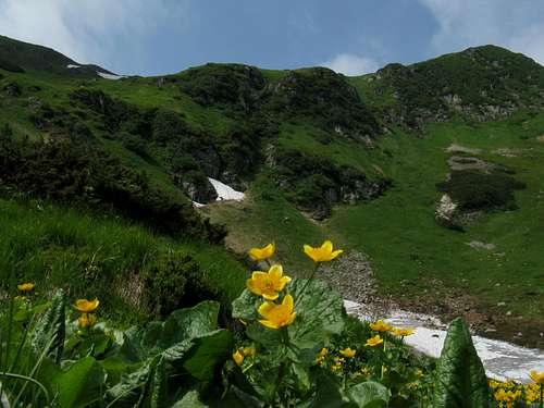 Caltha palustris with Pop Ivan's cliffs Caltha palustris with Pop Ivan's cliffsThe heart of the Marmarosh massif is dominated by three distinct mountains of diverse character. Petros (1780m) is covered by coniferous trees, Berlebashka (1733m) looks like a grassy pasture and Pip Ivan (1938m) is characterized by craggy postglacial cirques. The Hutsul Alps are the most picturesque part of the Ukrainian Carpathians. |


Getting There
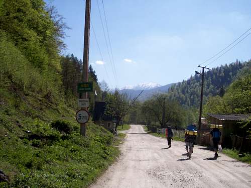
Pop Ivan massif is remote and it is hard to reach its summit in a single day. Therefore a tent is highly advisable. According to my Romanian sources, only about a few dozen hikers a year climb the mountain. No wonder Pop Ivan is a symbol of tranquility and solitude. The table below gives information about the access routes.
Please see here for information how to get to the trailhead. |
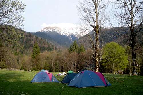
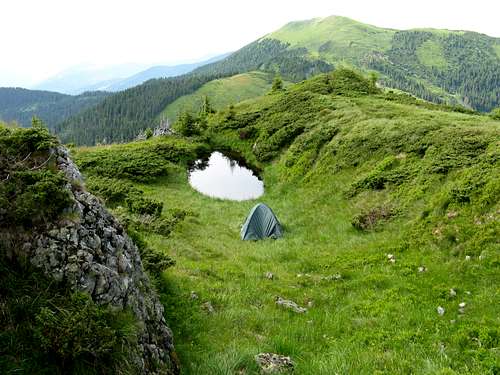
Camping
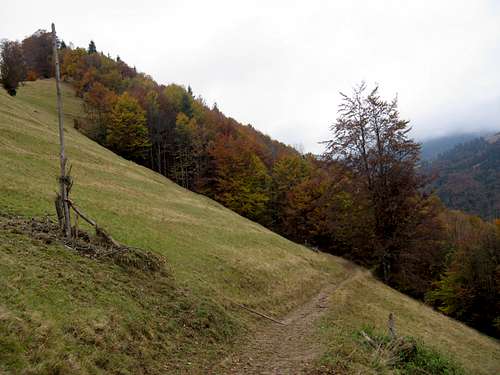
You can bivouac virtually anywhere. In the Ukrainian territory, there are convenient, designated camping grounds less than an hour's walk from Pop Ivan: SE of the summit just north of the border and W of the summit on Polonyna Strungy.
|
|
Red Tape
Pop Ivan massif is located directly on the border between Ukraine and Romania. Ukraine is not part of the EU, which means access to the border line is very difficult. NB Ukrainian laws are kind of bothersome bureaucracy and you will need permission even to enter within 3-5 km off the border. Moreover, the negotiations with Ukraine's border police can be very frustrating, because they don't usually speak English.
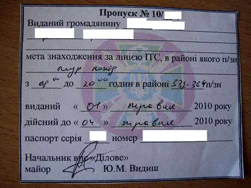
If you want to hike the Ukrainian part of the Pip Ivan, please fill in an appropriate form and send it, with a copy of your passport, to the following address. If you need help with translation, please PM LukZem
Мукачивський прикордонний загин, вул. Недецей 45, Мукачeвo 896 00, Закарпаття, УКРАЇНА
e-mail: mukachivskiy_zagon@pvu.gov.ua
Permit Number ................... Issued to a citizen of ……………………(full name) …………………………………….. The objective of the trip into the border area is …………………………………………………. Hiking is permitted from …hours to …hours Issued on…………………… Valid until…………………… Passport number…………………Date of issue.........
A story of getting a permit to climb Pip Ivan is available here.